Bennan

Coastal Marsh, Saltings in Wigtownshire

Scotland

Bennan

Southbound on the Rhins of Galloway Rockhopping on the way into the mouth of Clanyard bay
Southbound on the Rhins of Galloway Credit: Tony Page

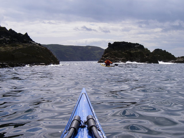
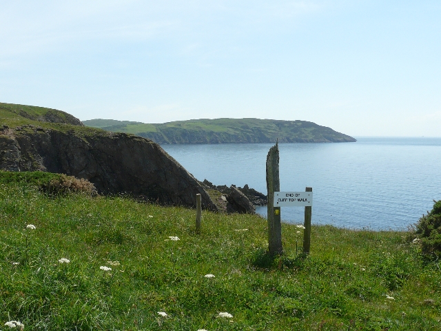
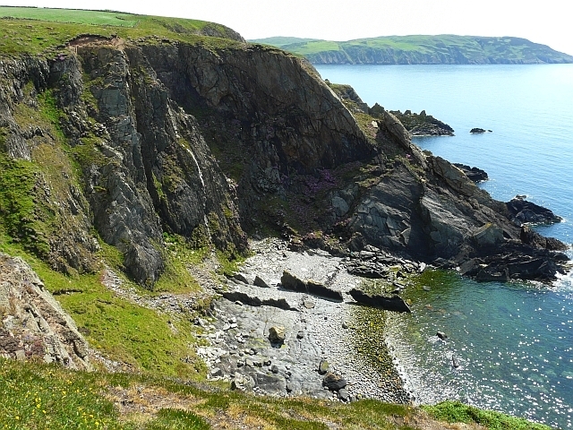
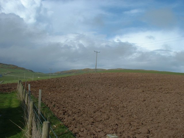
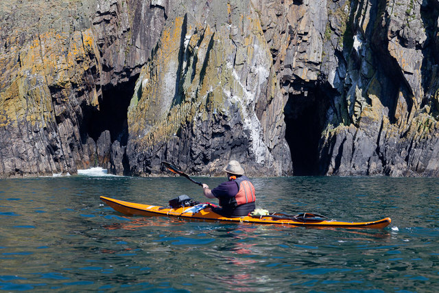
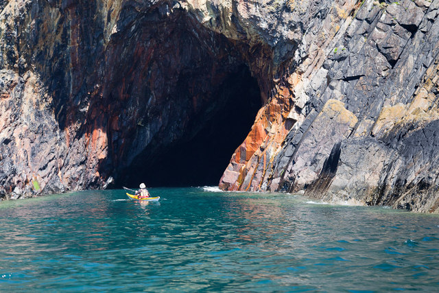
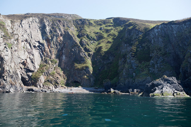
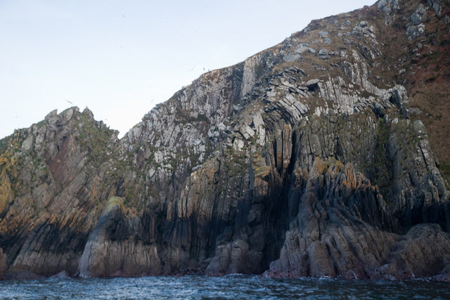
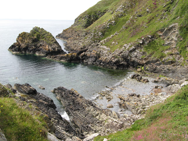
Bennan, located in Wigtownshire, is a small coastal marsh area that is commonly referred to as the "Saltings." Situated on the western coast of Scotland, this stunning natural formation stretches across approximately 2 square kilometers. Known for its unique ecological features, Bennan boasts an array of diverse flora and fauna, making it a significant site for nature enthusiasts and wildlife conservationists.

The marshland is characterized by its muddy and sandy terrain, which is rich in nutrients and ideal for supporting a variety of plant species. Visitors to Bennan can expect to find an assortment of salt-tolerant plants like samphire, sea lavender, and cordgrass. These plants play a crucial role in stabilizing the marshland and providing habitat for various bird species.

Speaking of birds, Bennan is home to an impressive avian population. Birdwatchers can spot an assortment of wading birds, including herons, oystercatchers, and curlews, all of which are attracted to the marsh's abundant food sources. During the breeding season, the area becomes particularly vibrant, as the marsh serves as a nesting ground for many bird species.

Bennan's coastal location also means that it experiences the ebb and flow of tides, resulting in a constantly changing landscape. This tidal influence creates a dynamic environment, with pools and channels forming and disappearing with each tide cycle. It is advisable for visitors to be cautious and aware of tidal movements when exploring the area.

Overall, Bennan, Wigtownshire, is a captivating coastal marshland that offers a unique blend of natural beauty and biodiversity. Its rich ecosystem and stunning scenery make it an ideal destination for nature lovers and those seeking tranquility amidst the wonders of Scotland's coastline.

If you have any feedback on the listing, please let us know in the comments section below.

Bennan Images

Images are sourced within 2km of 54.698639/-4.9524568 or Grid Reference NX0937. Thanks to Geograph Open Source API. All images are credited.

Southbound on the Rhins of Galloway Rockhopping on the way into the mouth of Clanyard bay
Southbound on the Rhins of Galloway
Rockhopping on the way into the mouth of Clanyard bay
End of Clifftop Walk from Port Logan It is rare to see a yellow waymarker pointing straight down.  This one means 'turn back'.
There is no easy way beyond this point.
End of Clifftop Walk from Port Logan
It is rare to see a yellow waymarker pointing straight down. This one means 'turn back'. There is no easy way beyond this point.
Cliffs overlooking Slate Heugh Bay The rock is greywacke of Early Silurian age.
Cliffs overlooking Slate Heugh Bay
The rock is greywacke of Early Silurian age.
Slate Heugh Bay The cliffs here are composed of greywacke, a sedimentary rock, laid down in the Early Silurian period. In the bay a jagged line of upstanding rock crosses the shore from the sea, and appears to continue as a white line all the way up the cliff. This is a later intrusion of hard igneous rock, and is mentioned in the British Geological Survey's excursion guide to the area <span class="nowrap"><a title="http://shop.bgs.ac.uk/Bookshop/product.cfm?p_id=GSWS" rel="nofollow ugc noopener" href="http://shop.bgs.ac.uk/Bookshop/product.cfm?p_id=GSWS">Link</a><img style="margin-left:2px;" alt="External link" title="External link - shift click to open in new window" src="https://s1.geograph.org.uk/img/external.png" width="10" height="10"/></span> as "a cross-cutting, Tertiary dolerite dyke".
Slate Heugh Bay
The cliffs here are composed of greywacke, a sedimentary rock, laid down in the Early Silurian period. In the bay a jagged line of upstanding rock crosses the shore from the sea, and appears to continue as a white line all the way up the cliff. This is a later intrusion of hard igneous rock, and is mentioned in the British Geological Survey's excursion guide to the area LinkExternal link as "a cross-cutting, Tertiary dolerite dyke".
Fields towards Cairn Fell With Barncorkrie Moor to left.
Fields towards Cairn Fell
With Barncorkrie Moor to left.
Yellow Horse caves, Laggantalluch Head Yellow Horse caves, Laggantalluch Head, taken on a sea kayaking trip from East Tarbet to Port Logan.
Yellow Horse caves, Laggantalluch Head
Yellow Horse caves, Laggantalluch Head, taken on a sea kayaking trip from East Tarbet to Port Logan.
Cave of the Saddle, Gounie Head Cave of the Saddle, Gounie Head, taken on a sea kayaking trip from East Tarbet to Port Logan.
Cave of the Saddle, Gounie Head
Cave of the Saddle, Gounie Head, taken on a sea kayaking trip from East Tarbet to Port Logan.
Breddock Bay Breddock Bay taken on a sea kayak trip from East Tarbet to port Logan
Breddock Bay
Breddock Bay taken on a sea kayak trip from East Tarbet to port Logan
Craig of Dolt Craig of Dolt is composed of vertical and folded strata of greywacke, a sedimentary rock. The photo was taken in the vicinity of a delightfully named Gobawhilkin, while on a sea kayaking trip from East Tarbet to Port Logan.
Craig of Dolt
Craig of Dolt is composed of vertical and folded strata of greywacke, a sedimentary rock. The photo was taken in the vicinity of a delightfully named Gobawhilkin, while on a sea kayaking trip from East Tarbet to Port Logan.
Cairn, Barncorkrie Moor A rather neat cairn on the summit of the moor overlooking Barncorkrie. Another, nearby, is named the Cairn of Dolt, but I didn't go there.
Cairn, Barncorkrie Moor
A rather neat cairn on the summit of the moor overlooking Barncorkrie. Another, nearby, is named the Cairn of Dolt, but I didn't go there.
Carlin House Bay A small bay eroded along the strike of the rather deformed rocks of the turbiditic greywackes of the Clanyard Bay Formation (Gala Group, Silurian). Much interest attaches to the deformation style and stratigraphy of this area, but I did not climb down from the grassy col between the larger and smaller bays.
Carlin House Bay
A small bay eroded along the strike of the rather deformed rocks of the turbiditic greywackes of the Clanyard Bay Formation (Gala Group, Silurian). Much interest attaches to the deformation style and stratigraphy of this area, but I did not climb down from the grassy col between the larger and smaller bays.
Farm track Looking up the farm track towards the col of Balloch, with Cairn fell in the right background.
Farm track
Looking up the farm track towards the col of Balloch, with Cairn fell in the right background.
Sheep fanks Looking down onto the sheep fanks at Balloch, with Cairn Fell in the background.
Sheep fanks
Looking down onto the sheep fanks at Balloch, with Cairn Fell in the background.
Granite outcrop Heading west on Barncorkrie Moor the geology changes to granite and quite quickly the heather begins to dominate the moorland pasture.
Granite outcrop
Heading west on Barncorkrie Moor the geology changes to granite and quite quickly the heather begins to dominate the moorland pasture.
Farm quarry A convenient source of easily-worked stone. This band of slatey rock, part of the Silurian Gala Group of greywackes, runs across the Rhins and is worked in several places. See <a href="https://www.geograph.org.uk/photo/3141425">NX1139 : Quarry lakes</a> for another. In this image the bedding of the rocks is very clear, steep and northerly, and that is a regional trend reflecting the collision of continents in the Caledonian orogeny.
Farm quarry
A convenient source of easily-worked stone. This band of slatey rock, part of the Silurian Gala Group of greywackes, runs across the Rhins and is worked in several places. See NX1139 : Quarry lakes for another. In this image the bedding of the rocks is very clear, steep and northerly, and that is a regional trend reflecting the collision of continents in the Caledonian orogeny.
Junction of the tracks The way-marked track from Port Logan comes in from the left here, and is signposted towards Cowans. Behind the camera stretches the route to Clanyard and Inshanks, which is the old road.
Junction of the tracks
The way-marked track from Port Logan comes in from the left here, and is signposted towards Cowans. Behind the camera stretches the route to Clanyard and Inshanks, which is the old road.
Track to Clanyard Beyond the limit of fields belonging to Cowans, the track sees little use, but it is a fine walking route. Barncorkrie Moor and Cairn Fell make the far horizon.
Track to Clanyard
Beyond the limit of fields belonging to Cowans, the track sees little use, but it is a fine walking route. Barncorkrie Moor and Cairn Fell make the far horizon.
Track to Port Logan Looking towards Port Logan on the waymarked track that is the old road from Inshanks and Clanyard. Here it just clips the corner of another square as it makes its lonely way through the fields.
Track to Port Logan
Looking towards Port Logan on the waymarked track that is the old road from Inshanks and Clanyard. Here it just clips the corner of another square as it makes its lonely way through the fields.
Show me another place!

Bennan is located at Grid Ref: NX0937 (Lat: 54.698639, Lng: -4.9524568)

Unitary Authority: Dumfries and Galloway

Police Authority: Dumfries and Galloway

What 3 Words

///paves.emulating.laptop. Near Drummore, Dumfries & Galloway

Related Wikis

Kirkmaiden (village)

Kirkmaiden (sometimes Maidenkirk; Scottish Gaelic: Cill M'Eudan) is a small settlement in Galloway, Scotland, located approximately 17 miles (27 km) south...

Kirkmaiden

Kirkmaiden is a parish in the Rhins of Galloway, the most southerly in Scotland; the present Church of Scotland parish has the same name as and is approximately...

Port Logan

Port Logan, formerly Port Nessock, is a small village in the parish of Kirkmaiden in the Rhins of Galloway in Wigtownshire. The Gaelic name is Port Neasaig...

Drummore

Drummore (drum-ORE; (from Gaelic An Druim Mòr meaning "the great ridge") is the southernmost village in Scotland, located at the southern end of the Rhins...

Nearby Amenities

Located within 500m of 54.698639,-4.9524568
Source: PGS
Lat/Long: 54.7029389/-4.9519971
Source: PGS
Lat/Long: 54.7027908/-4.9524106
Source: PGS
Lat/Long: 54.7026668/-4.9520436
Source: PGS
Lat/Long: 54.7026326/-4.9504543
Source: PGS
Lat/Long: 54.7024211/-4.9492642
Source: PGS
Lat/Long: 54.7019413/-4.9482115
Source: PGS
Lat/Long: 54.7015295/-4.9479531
Source: PGS
Lat/Long: 54.7010135/-4.9478284
Source: PGS
Lat/Long: 54.7004763/-4.9478303
Source: PGS
Lat/Long: 54.6996553/-4.9480204
Source: PGS
Lat/Long: 54.6989204/-4.9485506
Source: PGS
Lat/Long: 54.6987056/-4.9490918
Source: PGS
Lat/Long: 54.6988312/-4.9497863
Source: PGS
Lat/Long: 54.6987916/-4.9505402
Source: PGS
Lat/Long: 54.6985687/-4.9512962
Source: PGS
Lat/Long: 54.6983169/-4.952231
Source: PGS
Lat/Long: 54.6982467/-4.9530781
Source: PGS
Lat/Long: 54.6979446/-4.954406
Source: PGS
Lat/Long: 54.6974566/-4.9548489
Source: PGS
Lat/Long: 54.6973082/-4.9560238
Source: PGS
Lat/Long: 54.6971989/-4.9565473
Source: PGS
Lat/Long: 54.6967913/-4.9566408
Source: PGS
Lat/Long: 54.6965283/-4.9579744
Clanyard Bay
Natural: bay
Lat/Long: 54.7001812/-4.9529862
The data included in this document is from www.openstreetmap.org. The data is made available under ODbL.

Have you been to Bennan?

Leave your review of Bennan below (or comments, questions and feedback).