Clanyard Moor

Downs, Moorland in Wigtownshire

Scotland

Clanyard Moor

Southbound on the Rhins of Galloway Rockhopping on the way into the mouth of Clanyard bay
Southbound on the Rhins of Galloway Credit: Tony Page

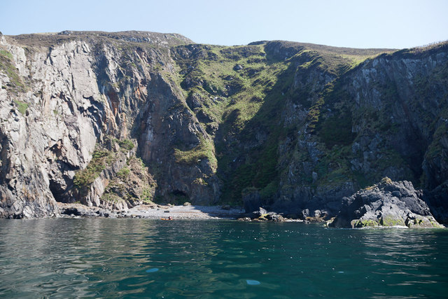
Clanyard Moor is a picturesque area located in Wigtownshire, Scotland. Situated in the southern part of the country, it is known for its stunning downs and moorland landscapes. The moor covers a vast expanse of approximately 10 square miles, providing a haven for nature enthusiasts and wildlife alike.

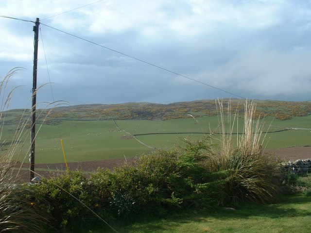
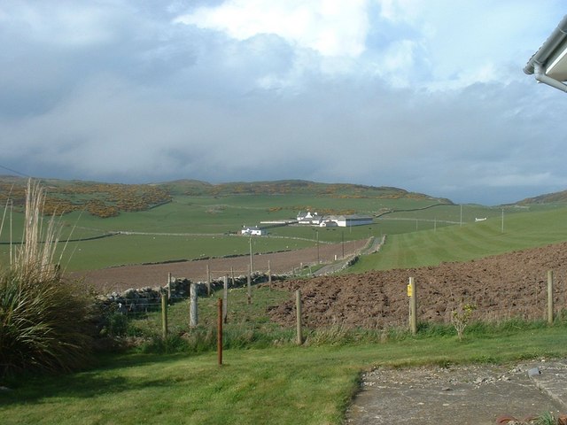
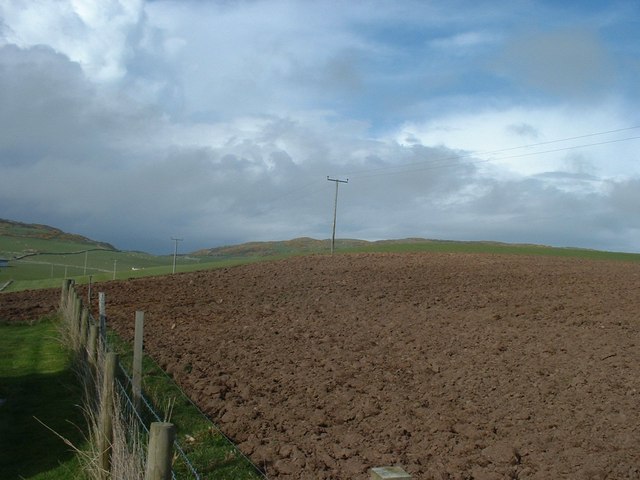
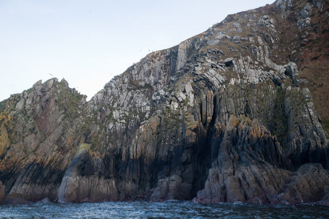
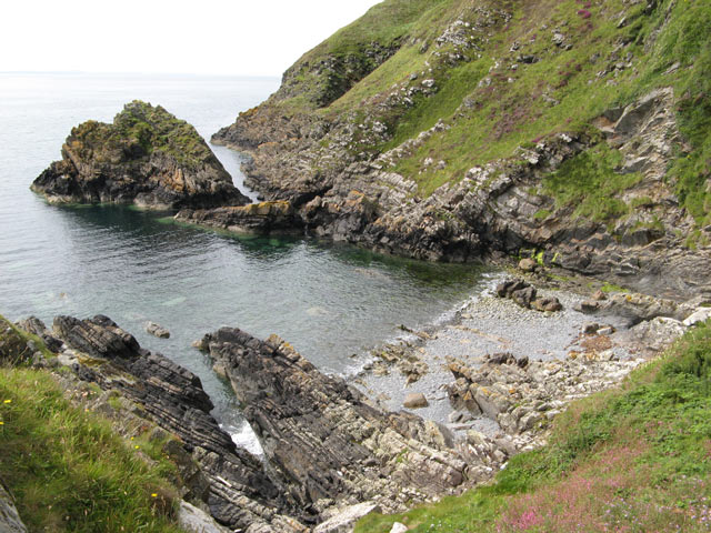
The moorland terrain of Clanyard Moor is characterized by undulating hills, heather-covered slopes, and scattered patches of woodland. The area is predominantly made up of rough grasses and heather, creating a rich tapestry of colors throughout the year. During the summer months, the moorland blooms with vibrant wildflowers, attracting a variety of insects and butterflies.

The downs of Clanyard Moor offer panoramic views of the surrounding countryside. From its elevated position, visitors are treated to vistas of rolling hills, distant mountains, and the sparkling waters of the nearby lochs. The moorland is crisscrossed by a network of footpaths and trails, allowing hikers and walkers to explore the area at their leisure.

Clanyard Moor is not only visually appealing but also serves as an important habitat for various bird species. The moorland provides nesting grounds for birds such as curlews, lapwings, and red grouse. Birdwatchers can spot these and other avian species throughout the year, making it a popular destination for ornithologists.

In summary, Clanyard Moor offers a stunning natural landscape with its downs and moorland. It provides a tranquil retreat for those seeking to immerse themselves in the beauty of nature and offers a diverse range of flora and fauna for visitors to enjoy.

If you have any feedback on the listing, please let us know in the comments section below.

Clanyard Moor Images

Images are sourced within 2km of 54.696085/-4.9547081 or Grid Reference NX0937. Thanks to Geograph Open Source API. All images are credited.

Southbound on the Rhins of Galloway Rockhopping on the way into the mouth of Clanyard bay
Southbound on the Rhins of Galloway
Rockhopping on the way into the mouth of Clanyard bay
Towards Barncorkrie Moor The gorse on the hillside glows brightly against the new spring grass in the sheep pasture.
Towards Barncorkrie Moor
The gorse on the hillside glows brightly against the new spring grass in the sheep pasture.
Barncorkrie Farm With Barncorkrie Moor behind and the minor road to Inshanks Fell in front.
Barncorkrie Farm
With Barncorkrie Moor behind and the minor road to Inshanks Fell in front.
Fields towards Cairn Fell With Barncorkrie Moor to left.
Fields towards Cairn Fell
With Barncorkrie Moor to left.
Laggantalluch Head Laggantalluch Head from the south, taken on a sea kayak trip from East Tarbet to Port Logan round the Mull of Galloway.
Laggantalluch Head
Laggantalluch Head from the south, taken on a sea kayak trip from East Tarbet to Port Logan round the Mull of Galloway.
Yellow Horse caves, Laggantalluch Head Yellow Horse caves, Laggantalluch Head, taken on a sea kayaking trip from East Tarbet to Port Logan.
Yellow Horse caves, Laggantalluch Head
Yellow Horse caves, Laggantalluch Head, taken on a sea kayaking trip from East Tarbet to Port Logan.
Cave of the Saddle, Gounie Head Cave of the Saddle, Gounie Head, taken on a sea kayaking trip from East Tarbet to Port Logan.
Cave of the Saddle, Gounie Head
Cave of the Saddle, Gounie Head, taken on a sea kayaking trip from East Tarbet to Port Logan.
Breddock Bay Breddock Bay taken on a sea kayak trip from East Tarbet to port Logan
Breddock Bay
Breddock Bay taken on a sea kayak trip from East Tarbet to port Logan
Craig of Dolt Craig of Dolt is composed of vertical and folded strata of greywacke, a sedimentary rock. The photo was taken in the vicinity of a delightfully named Gobawhilkin, while on a sea kayaking trip from East Tarbet to Port Logan.
Craig of Dolt
Craig of Dolt is composed of vertical and folded strata of greywacke, a sedimentary rock. The photo was taken in the vicinity of a delightfully named Gobawhilkin, while on a sea kayaking trip from East Tarbet to Port Logan.
Cairn, Barncorkrie Moor A rather neat cairn on the summit of the moor overlooking Barncorkrie. Another, nearby, is named the Cairn of Dolt, but I didn't go there.
Cairn, Barncorkrie Moor
A rather neat cairn on the summit of the moor overlooking Barncorkrie. Another, nearby, is named the Cairn of Dolt, but I didn't go there.
Carlin House Bay A small bay eroded along the strike of the rather deformed rocks of the turbiditic greywackes of the Clanyard Bay Formation (Gala Group, Silurian). Much interest attaches to the deformation style and stratigraphy of this area, but I did not climb down from the grassy col between the larger and smaller bays.
Carlin House Bay
A small bay eroded along the strike of the rather deformed rocks of the turbiditic greywackes of the Clanyard Bay Formation (Gala Group, Silurian). Much interest attaches to the deformation style and stratigraphy of this area, but I did not climb down from the grassy col between the larger and smaller bays.
Barncorkrie sheds and house Looking up the farm road past the sheds.
Barncorkrie sheds and house
Looking up the farm road past the sheds.
Farm track Looking up the farm track towards the col of Balloch, with Cairn fell in the right background.
Farm track
Looking up the farm track towards the col of Balloch, with Cairn fell in the right background.
Sheep fanks Looking down onto the sheep fanks at Balloch, with Cairn Fell in the background.
Sheep fanks
Looking down onto the sheep fanks at Balloch, with Cairn Fell in the background.
Grazing divide This fence obviously marks a farm boundary on Barncorkrie Moor, with grazed moor to the right and undisturbed heather to the left.
Grazing divide
This fence obviously marks a farm boundary on Barncorkrie Moor, with grazed moor to the right and undisturbed heather to the left.
Granite outcrop Heading west on Barncorkrie Moor the geology changes to granite and quite quickly the heather begins to dominate the moorland pasture.
Granite outcrop
Heading west on Barncorkrie Moor the geology changes to granite and quite quickly the heather begins to dominate the moorland pasture.
Track to Clanyard Beyond the limit of fields belonging to Cowans, the track sees little use, but it is a fine walking route. Barncorkrie Moor and Cairn Fell make the far horizon.
Track to Clanyard
Beyond the limit of fields belonging to Cowans, the track sees little use, but it is a fine walking route. Barncorkrie Moor and Cairn Fell make the far horizon.
Track to Port Logan Looking towards Port Logan on the waymarked track that is the old road from Inshanks and Clanyard. Here it just clips the corner of another square as it makes its lonely way through the fields.
Track to Port Logan
Looking towards Port Logan on the waymarked track that is the old road from Inshanks and Clanyard. Here it just clips the corner of another square as it makes its lonely way through the fields.
Show me another place!

Clanyard Moor is located at Grid Ref: NX0937 (Lat: 54.696085, Lng: -4.9547081)

Unitary Authority: Dumfries and Galloway

Police Authority: Dumfries and Galloway

What 3 Words

///parading.scowls.doors. Near Drummore, Dumfries & Galloway

Related Wikis

Nearby Amenities

Located within 500m of 54.696085,-4.9547081
Source: PGS
Lat/Long: 54.6987056/-4.9490918
Source: PGS
Lat/Long: 54.6988312/-4.9497863
Source: PGS
Lat/Long: 54.6987916/-4.9505402
Source: PGS
Lat/Long: 54.6985687/-4.9512962
Source: PGS
Lat/Long: 54.6983169/-4.952231
Source: PGS
Lat/Long: 54.6982467/-4.9530781
Source: PGS
Lat/Long: 54.6979446/-4.954406
Source: PGS
Lat/Long: 54.6974566/-4.9548489
Source: PGS
Lat/Long: 54.6973082/-4.9560238
Source: PGS
Lat/Long: 54.6971989/-4.9565473
Source: PGS
Lat/Long: 54.6967913/-4.9566408
Source: PGS
Lat/Long: 54.6965283/-4.9579744
Source: PGS
Lat/Long: 54.6962332/-4.9590568
Source: PGS
Lat/Long: 54.6960425/-4.9594729
Source: PGS
Lat/Long: 54.6961651/-4.9600975
Source: PGS
Lat/Long: 54.6959996/-4.9598008
Source: PGS
Lat/Long: 54.6954634/-4.960644
Source: PGS
Lat/Long: 54.6953198/-4.961642
Source: PGS
Lat/Long: 54.6950215/-4.9618497
Source: PGS
Lat/Long: 54.6946297/-4.9615938
Source: PGS
Lat/Long: 54.6942996/-4.9618186
Clanyard Bay
Natural: bay
Lat/Long: 54.7001812/-4.9529862
The data included in this document is from www.openstreetmap.org. The data is made available under ODbL.

Have you been to Clanyard Moor?

Leave your review of Clanyard Moor below (or comments, questions and feedback).