Breddock Bay

Bay in Wigtownshire

Scotland

Breddock Bay

The west shore of The Rhins Bay House in view, just right of centre.
The west shore of The Rhins Credit: David Purchase

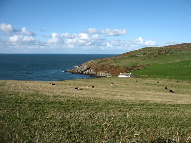
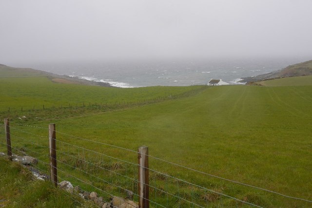
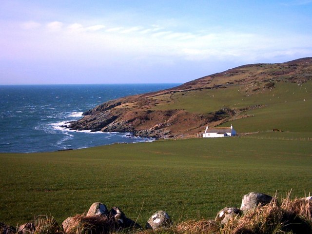
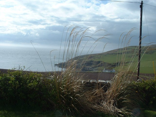
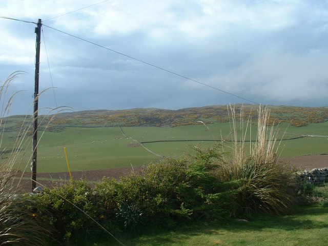
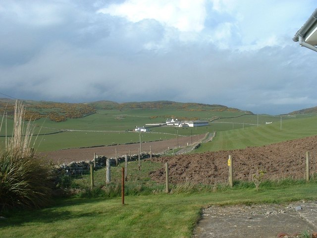
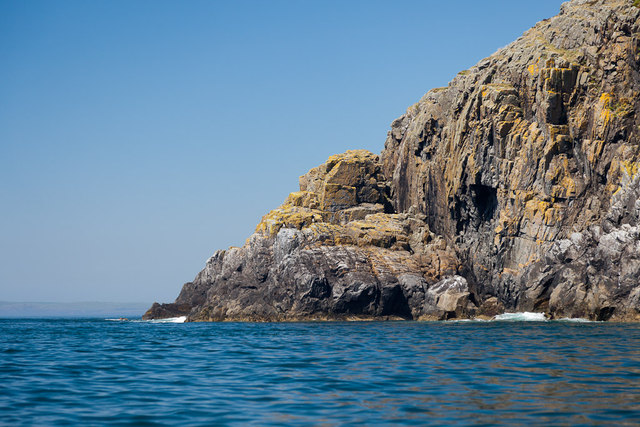
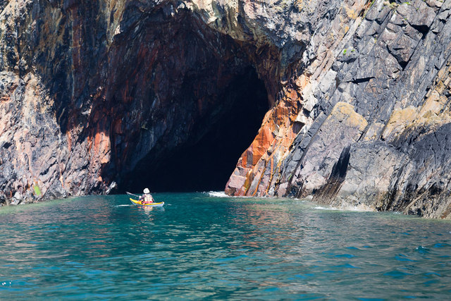
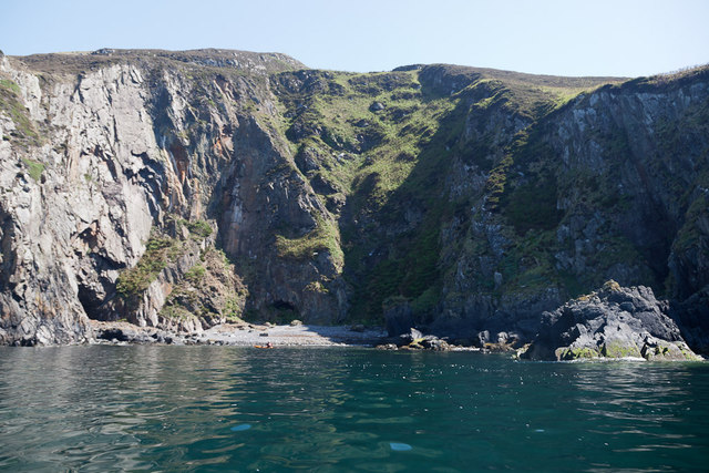
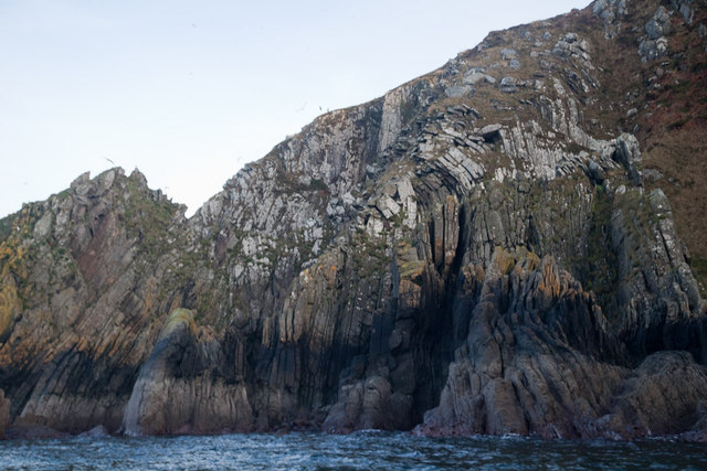
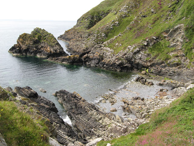
Breddock Bay is a picturesque bay located in Wigtownshire, Scotland. Situated on the western coast of the country, it offers stunning views of the Irish Sea and is known for its natural beauty and tranquility. The bay is nestled between rolling hills and cliffs, creating a dramatic backdrop for visitors and locals alike.

The bay itself is a small inlet, with a curved sandy beach that stretches for approximately half a mile. The sand is soft and golden, perfect for long walks or relaxing picnics. At low tide, the bay reveals numerous rock pools, which are teeming with marine life, making it a popular spot for children and nature enthusiasts.

Breddock Bay is also home to a diverse range of wildlife. Birdwatchers will find a haven here, as the bay attracts a variety of seabirds, including gulls, cormorants, and even the occasional puffin. The surrounding cliffs provide nesting sites for these birds, making it an ideal location for bird watching.

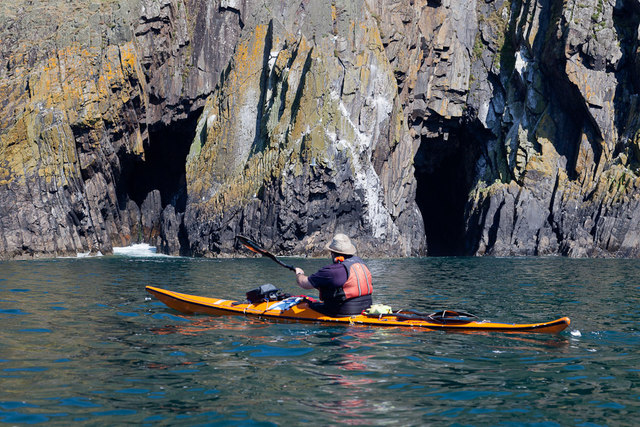
The bay is easily accessible by car, with a small parking area located nearby. There are also public transport options available, with regular buses running to and from Wigtownshire. Visitors can enjoy a leisurely stroll along the beach, take a dip in the clear waters, or simply soak up the peaceful atmosphere.

Overall, Breddock Bay is a hidden gem on Scotland's western coast, offering visitors a chance to escape the hustle and bustle of everyday life and immerse themselves in the beauty of nature. Whether it's a family day out or a quiet retreat, this bay has something to offer for everyone.

If you have any feedback on the listing, please let us know in the comments section below.

Breddock Bay Images

Images are sourced within 2km of 54.693688/-4.9637379 or Grid Reference NX0937. Thanks to Geograph Open Source API. All images are credited.

The west shore of The Rhins Bay House in view, just right of centre.
The west shore of The Rhins
Bay House in view, just right of centre.
Bay House The bay is Portencorkrie. The west side of the Rhins is wild and there is a gale blowing out to sea.
Bay House
The bay is Portencorkrie. The west side of the Rhins is wild and there is a gale blowing out to sea.
Bay House, Portencorkrie An idyllic traditional Galloway cottage above Portencorkrie Bay.
Bay House, Portencorkrie
An idyllic traditional Galloway cottage above Portencorkrie Bay.
Southbound on the Rhins of Galloway Rockhopping on the way into the mouth of Clanyard bay
Southbound on the Rhins of Galloway
Rockhopping on the way into the mouth of Clanyard bay
North End Portencorkrie Bay The beach side house is now boarded up and abandoned.
North End Portencorkrie Bay
The beach side house is now boarded up and abandoned.
Towards Barncorkrie Moor The gorse on the hillside glows brightly against the new spring grass in the sheep pasture.
Towards Barncorkrie Moor
The gorse on the hillside glows brightly against the new spring grass in the sheep pasture.
Barncorkrie Farm With Barncorkrie Moor behind and the minor road to Inshanks Fell in front.
Barncorkrie Farm
With Barncorkrie Moor behind and the minor road to Inshanks Fell in front.
Fields towards Cairn Fell With Barncorkrie Moor to left.
Fields towards Cairn Fell
With Barncorkrie Moor to left.
Laggantalluch Head Laggantalluch Head from the south, taken on a sea kayak trip from East Tarbet to Port Logan round the Mull of Galloway.
Laggantalluch Head
Laggantalluch Head from the south, taken on a sea kayak trip from East Tarbet to Port Logan round the Mull of Galloway.
Yellow Horse caves, Laggantalluch Head Yellow Horse caves, Laggantalluch Head, taken on a sea kayaking trip from East Tarbet to Port Logan.
Yellow Horse caves, Laggantalluch Head
Yellow Horse caves, Laggantalluch Head, taken on a sea kayaking trip from East Tarbet to Port Logan.
Cave of the Saddle, Gounie Head Cave of the Saddle, Gounie Head, taken on a sea kayaking trip from East Tarbet to Port Logan.
Cave of the Saddle, Gounie Head
Cave of the Saddle, Gounie Head, taken on a sea kayaking trip from East Tarbet to Port Logan.
Breddock Bay Breddock Bay taken on a sea kayak trip from East Tarbet to port Logan
Breddock Bay
Breddock Bay taken on a sea kayak trip from East Tarbet to port Logan
Craig of Dolt Craig of Dolt is composed of vertical and folded strata of greywacke, a sedimentary rock. The photo was taken in the vicinity of a delightfully named Gobawhilkin, while on a sea kayaking trip from East Tarbet to Port Logan.
Craig of Dolt
Craig of Dolt is composed of vertical and folded strata of greywacke, a sedimentary rock. The photo was taken in the vicinity of a delightfully named Gobawhilkin, while on a sea kayaking trip from East Tarbet to Port Logan.
Cairn, Barncorkrie Moor A rather neat cairn on the summit of the moor overlooking Barncorkrie. Another, nearby, is named the Cairn of Dolt, but I didn't go there.
Cairn, Barncorkrie Moor
A rather neat cairn on the summit of the moor overlooking Barncorkrie. Another, nearby, is named the Cairn of Dolt, but I didn't go there.
Granite scenery Portencorkrie gives its name to the intrusion of granodiorite whose outcrops are centred on the bay and nearby headlands. The weathering profile of the granitic rock which is highly jointed and fractured makes a very different local topography. In the background are Bay House and Knockencule.
Granite scenery
Portencorkrie gives its name to the intrusion of granodiorite whose outcrops are centred on the bay and nearby headlands. The weathering profile of the granitic rock which is highly jointed and fractured makes a very different local topography. In the background are Bay House and Knockencule.
Carlin House Bay A small bay eroded along the strike of the rather deformed rocks of the turbiditic greywackes of the Clanyard Bay Formation (Gala Group, Silurian). Much interest attaches to the deformation style and stratigraphy of this area, but I did not climb down from the grassy col between the larger and smaller bays.
Carlin House Bay
A small bay eroded along the strike of the rather deformed rocks of the turbiditic greywackes of the Clanyard Bay Formation (Gala Group, Silurian). Much interest attaches to the deformation style and stratigraphy of this area, but I did not climb down from the grassy col between the larger and smaller bays.
Barncorkrie sheds and house Looking up the farm road past the sheds.
Barncorkrie sheds and house
Looking up the farm road past the sheds.
Farm track Looking up the farm track towards the col of Balloch, with Cairn fell in the right background.
Farm track
Looking up the farm track towards the col of Balloch, with Cairn fell in the right background.
Show me another place!

Breddock Bay is located at Grid Ref: NX0937 (Lat: 54.693688, Lng: -4.9637379)

Unitary Authority: Dumfries and Galloway

Police Authority: Dumfries and Galloway

What 3 Words

///chats.issue.strumming. Near Drummore, Dumfries & Galloway

Related Wikis

Port Logan

Port Logan, formerly Port Nessock, is a small village in the parish of Kirkmaiden in the Rhins of Galloway in Wigtownshire. The Gaelic name is Port Neasaig...

Kirkmaiden (village)

Kirkmaiden (sometimes Maidenkirk; Scottish Gaelic: Cill M'Eudan) is a small settlement in Galloway, Scotland, located approximately 17 miles (27 km) south...

Kirkmaiden

Kirkmaiden is a parish in the Rhins of Galloway, the most southerly in Scotland; the present Church of Scotland parish has the same name as and is approximately...

Drummore

Drummore (drum-ORE; (from Gaelic An Druim Mòr meaning "the great ridge") is the southernmost village in Scotland, located at the southern end of the Rhins...

Logan Botanic Garden

Logan Botanic Garden is a botanical garden near Port Logan on the Rhins of Galloway, at the south-western tip of Scotland. The Botanic Garden was established...

Cairngaan

Cairngaan, Wigtownshire, is the southmost settlement in Scotland. The hamlet of Cairngaan lies just north of the Mull of Galloway (which contains Scotland...

Doon Castle Broch

Doon Castle Broch is an iron-age broch located in Dumfries and Galloway, Scotland (grid reference NX 06702 44683). == Location == The Broch is located...

Ardwell

Ardwell (from Gaelic Àrd Bhaile meaning "high town", pronounced as "Ardwell") is a village in the Scottish unitary council area of Dumfries and Galloway...

Nearby Amenities

Located within 500m of 54.693688,-4.9637379
Source: PGS
Lat/Long: 54.6965283/-4.9579744
Source: PGS
Lat/Long: 54.6962332/-4.9590568
Source: PGS
Lat/Long: 54.6960425/-4.9594729
Source: PGS
Lat/Long: 54.6961651/-4.9600975
Source: PGS
Lat/Long: 54.6959996/-4.9598008
Source: PGS
Lat/Long: 54.6954634/-4.960644
Source: PGS
Lat/Long: 54.6953198/-4.961642
Source: PGS
Lat/Long: 54.6950215/-4.9618497
Source: PGS
Lat/Long: 54.6946297/-4.9615938
Source: PGS
Lat/Long: 54.6942996/-4.9618186
Source: PGS
Lat/Long: 54.6930916/-4.9647486
Source: PGS
Lat/Long: 54.6926605/-4.9650431
Source: PGS
Lat/Long: 54.692661/-4.9654797
Source: PGS
Lat/Long: 54.6922277/-4.9659498
Source: PGS
Lat/Long: 54.6921396/-4.9671955
Source: PGS
Lat/Long: 54.6918153/-4.9682459
Source: PGS
Lat/Long: 54.6916249/-4.9687853
Source: PGS
Lat/Long: 54.6914686/-4.9691935
Source: PGS
Lat/Long: 54.6912866/-4.9696336
Source: PGS
Lat/Long: 54.6911901/-4.9698257
The data included in this document is from www.openstreetmap.org. The data is made available under ODbL.

Have you been to Breddock Bay?

Leave your review of Breddock Bay below (or comments, questions and feedback).