Cidhe Miabhaig

Coastal Marsh, Saltings in Ross-shire

Scotland

Cidhe Miabhaig

Lazy Beds at Tràigh na Beirigh Ridges formed by hand digging of fields.  These one are unusual in that some of the ridges are lined with small stones.
Lazy Beds at Tràigh na Beirigh Credit: Sandy Gerrard

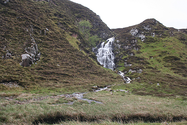
Cidhe Miabhaig, located in Ross-shire, Scotland, is a stunning coastal marshland characterized by its unique saltings. This enchanting area is known for its exceptional natural beauty and diverse ecosystem.

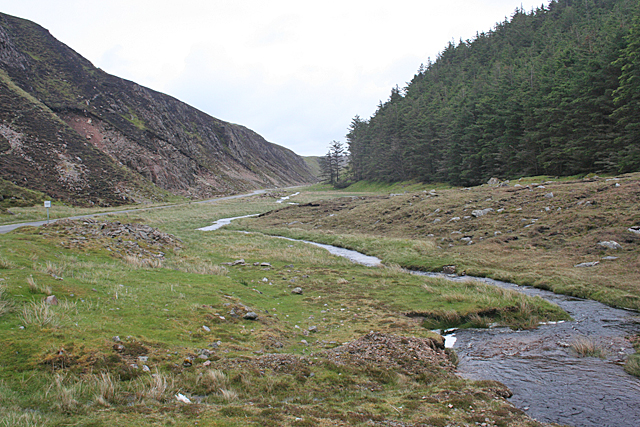
The marshland stretches along the coast, covering a considerable area with its lush green vegetation and tranquil water channels. The saltings, or salt marshes, are a distinctive feature of Cidhe Miabhaig. These marshes are formed by the deposition of saltwater, creating a dynamic environment that is home to a variety of plants and animals.

The marshland boasts a rich biodiversity, with numerous species of plants and wildlife thriving in this unique habitat. Tall grasses, reeds, and sedges dominate the landscape, creating a picturesque scenery. In the summer, the marshes burst into a vibrant display of colors with wildflowers blooming all around.

Birdwatchers flock to Cidhe Miabhaig for its incredible avian population. The marshes serve as a vital nesting and feeding ground for numerous bird species, including waders, waterfowl, and seabirds. Visitors can spot elegant herons, graceful swans, and even elusive migratory birds during their seasonal journeys.

The marshland offers a peaceful and serene escape for nature enthusiasts. Walking trails wind through the area, allowing visitors to explore the marshes and observe the fascinating wildlife up close. The tranquil atmosphere, coupled with the breathtaking coastal views, makes Cidhe Miabhaig a popular destination for photographers and artists seeking inspiration.

Cidhe Miabhaig, with its coastal marshes and saltings, is a hidden gem in Ross-shire, offering a captivating blend of natural beauty and ecological significance.

If you have any feedback on the listing, please let us know in the comments section below.

Cidhe Miabhaig Images

Images are sourced within 2km of 58.202212/-6.9545266 or Grid Reference NB0934. Thanks to Geograph Open Source API. All images are credited.

Lazy Beds at Tràigh na Beirigh Ridges formed by hand digging of fields.  These one are unusual in that some of the ridges are lined with small stones.
Lazy Beds at Tràigh na Beirigh
Ridges formed by hand digging of fields. These one are unusual in that some of the ridges are lined with small stones.
An Sùileachan Monument A monument to the Lewis land clearances <span class="nowrap"><a title="https://bhaltostrust.co.uk/suileachan-project/" rel="nofollow ugc noopener" href="https://bhaltostrust.co.uk/suileachan-project/">Link</a><img style="margin-left:2px;" alt="External link" title="External link - shift click to open in new window" src="https://s1.geograph.org.uk/img/external.png" width="10" height="10"/></span>
An Sùileachan Monument
A monument to the Lewis land clearances LinkExternal link
A slipway in Loch Miabhaig
Berie Sands Caravan Park Busy site at Traigh na Beirigh with many caravans parked on the machair above the extensive sands.
Berie Sands Caravan Park
Busy site at Traigh na Beirigh with many caravans parked on the machair above the extensive sands.
A' Bheirigh from Suaineabhal
Lochan at Cragavig An old boundary wall snakes across the moorland
Lochan at Cragavig
An old boundary wall snakes across the moorland
Cerishader: postbox № HS2 158 A small postbox on the B8011, with its back to Loch Ròg. It is emptied at 9 o'clock each morning, except Sunday.
Cerishader: postbox № HS2 158
A small postbox on the B8011, with its back to Loch Ròg. It is emptied at 9 o'clock each morning, except Sunday.
A' Bheirigh
A' Bheirigh
Carishader postbox The sea inlet is part of Loch Ròg.
Carishader postbox
The sea inlet is part of Loch Ròg.
Gleann Bhaltois (Glen Valtos) 5 Gleann Bhaltois is a spectacular example of a glacial meltwater channel. At the end of the last Ice Age, about 10,000 years ago, there is thought to have been a lake where Uig Bay now lies, dammed by ice to the west. The outlet from the lake was at the head of what is now Gleann Bhaltois, and carved a deep steep-sided glen, exploiting a fault line in the rocks. Following several wet days, a waterfall is draining the moor above.
Gleann Bhaltois (Glen Valtos) 5
Gleann Bhaltois is a spectacular example of a glacial meltwater channel. At the end of the last Ice Age, about 10,000 years ago, there is thought to have been a lake where Uig Bay now lies, dammed by ice to the west. The outlet from the lake was at the head of what is now Gleann Bhaltois, and carved a deep steep-sided glen, exploiting a fault line in the rocks. Following several wet days, a waterfall is draining the moor above.
Gleann Bhaltois (Glen Valtos) 6 Gleann Bhaltois is a spectacular example of a glacial meltwater channel. At the end of the last Ice Age, about 10,000 years ago, there is thought to have been a lake where Uig Bay now lies, dammed by ice to the west. The outlet from the lake was at the head of what is now Gleann Bhaltois, and carved a deep steep-sided glen, exploiting a fault line in the rocks. At this point, the glen steps down from its winding upper course through a rock fall to the much straighter lower course.
Gleann Bhaltois (Glen Valtos) 6
Gleann Bhaltois is a spectacular example of a glacial meltwater channel. At the end of the last Ice Age, about 10,000 years ago, there is thought to have been a lake where Uig Bay now lies, dammed by ice to the west. The outlet from the lake was at the head of what is now Gleann Bhaltois, and carved a deep steep-sided glen, exploiting a fault line in the rocks. At this point, the glen steps down from its winding upper course through a rock fall to the much straighter lower course.
Gleann Bhaltois (Glen Valtos) 7 Gleann Bhaltois is a spectacular example of a glacial meltwater channel. At the end of the last Ice Age, about 10,000 years ago, there is thought to have been a lake where Uig Bay now lies, dammed by ice to the west. The outlet from the lake was at the head of what is now Gleann Bhaltois, and carved a deep steep-sided glen, exploiting a fault line in the rocks. From this point, the glen follows the straight line of the fault. The classic and diagnostic feature of a meltwater channel, well seen in this view, is that the stream it contains is too small to have carved it in the first place.
Gleann Bhaltois (Glen Valtos) 7
Gleann Bhaltois is a spectacular example of a glacial meltwater channel. At the end of the last Ice Age, about 10,000 years ago, there is thought to have been a lake where Uig Bay now lies, dammed by ice to the west. The outlet from the lake was at the head of what is now Gleann Bhaltois, and carved a deep steep-sided glen, exploiting a fault line in the rocks. From this point, the glen follows the straight line of the fault. The classic and diagnostic feature of a meltwater channel, well seen in this view, is that the stream it contains is too small to have carved it in the first place.
Gleann Bhaltois (Glen Valtos) 7 Gleann Bhaltois is a spectacular example of a glacial meltwater channel. At the end of the last Ice Age, about 10,000 years ago, there is thought to have been a lake where Uig Bay now lies, dammed by ice to the west. The outlet from the lake was at the head of what is now Gleann Bhaltois, and carved a deep steep-sided glen, exploiting a fault line in the rocks.
Gleann Bhaltois (Glen Valtos) 7
Gleann Bhaltois is a spectacular example of a glacial meltwater channel. At the end of the last Ice Age, about 10,000 years ago, there is thought to have been a lake where Uig Bay now lies, dammed by ice to the west. The outlet from the lake was at the head of what is now Gleann Bhaltois, and carved a deep steep-sided glen, exploiting a fault line in the rocks.
Name That Tune This cheerful accordionist stands just inside a field by the cattle grid on the B8011 north of Cairisiadar. The label at his feet reads 'Name That Tune'.
Name That Tune
This cheerful accordionist stands just inside a field by the cattle grid on the B8011 north of Cairisiadar. The label at his feet reads 'Name That Tune'.
Cairisiadar (Carishader) Though the B8011 has been much improved, there are still some single-track stretches, notably where it crosses narrow bridges which have not been rebuilt, as here at Cairisiadar.
Cairisiadar (Carishader)
Though the B8011 has been much improved, there are still some single-track stretches, notably where it crosses narrow bridges which have not been rebuilt, as here at Cairisiadar.
Miabhaig harbour pontoon View from RIB afloat to pontoon at Miabhaig, Ceann A Tuath Na Hearadh (North Harris).  Compare to <a href="https://www.geograph.org.uk/photo/575251">NB0934 : Miabhaig Jetty</a> taken by Dave Fergusson on 1 Oct 2007.
Miabhaig harbour pontoon
View from RIB afloat to pontoon at Miabhaig, Ceann A Tuath Na Hearadh (North Harris). Compare to NB0934 : Miabhaig Jetty taken by Dave Fergusson on 1 Oct 2007.
Show me another place!

Cidhe Miabhaig is located at Grid Ref: NB0934 (Lat: 58.202212, Lng: -6.9545266)

Unitary Authority: Na h-Eileanan an Iar

Police Authority: Highlands and Islands

What 3 Words

///flexed.flitting.founders. Near Carloway, Na h-Eileanan Siar

Related Wikis

Loch na Berie

Loch Na Berie is a broch in the Outer Hebrides of Scotland, located approximately 400 yards from the shore, and is thought to have been located on an island...

Cliff, Lewis

Cliff (Scottish Gaelic: Cliobh) is a small settlement on the Isle of Lewis, in the Outer Hebrides, Scotland. Cliff is within the parish of Uig. The settlement...

Flodaigh, Lewis

Flodaigh is a small island in Loch Roag on the west coast of Lewis in the Outer Hebrides of Scotland. It is about 33 hectares (82 acres) in extent and...

Kneep

Kneep (Scottish Gaelic: Cnìp) is a village on the Isle of Lewis, in the Outer Hebrides, Scotland. Kneep is within the parish of Uig.Various archaeological...

Nearby Amenities

Located within 500m of 58.202212,-6.9545266
Passing Place
Lat/Long: 58.1985659/-6.952369
Barrier: cattle_grid
Lat/Long: 58.2045289/-6.9616805
Passing Place
Lat/Long: 58.2036172/-6.9536011
Bus Stop
Miavaig Turn
Naptan AtcoCode: 6010731868
Naptan Bearing: NW
Naptan CommonName: Miavaig Turn
Naptan Indicator: Miavaig Turn
Naptan Landmark: Miavaig Turn
Naptan NaptanCode: 94723945
Naptan Street: Miavaig Turn
Naptan Verified: no
Source: naptan_import
Lat/Long: 58.2032589/-6.9627141
Barrier: cattle_grid
Lat/Long: 58.2013388/-6.9546299
Leisure: slipway
Lat/Long: 58.2020107/-6.953176
Leisure: slipway
Lat/Long: 58.2034502/-6.9543832
Restaurant
Scallop
Lat/Long: 58.2017993/-6.9530219
Miabhaig
Name En: Miavaig
Name Gd: Miabhaig
Place: village
Lat/Long: 58.2029652/-6.9596178
Ùigean
Name En: Uigen
Name Gd: Ùigean
Place: hamlet
Lat/Long: 58.2026825/-6.9469578
Passing Place
Lat/Long: 58.1996054/-6.9530129
Passing Place
Lat/Long: 58.2013676/-6.9572234
Barrier: cattle_grid
Lat/Long: 58.2017522/-6.9466971
Power: pole
Lat/Long: 58.1981776/-6.9514386
Power: pole
Lat/Long: 58.1986777/-6.9518375
Power: pole
Lat/Long: 58.199407/-6.9524133
Power: pole
Lat/Long: 58.2000418/-6.9531922
Power: pole
Lat/Long: 58.2007166/-6.9539865
Power: pole
Lat/Long: 58.2010722/-6.956996
Power: pole
Lat/Long: 58.2017695/-6.9539218
Power: pole
Lat/Long: 58.2011631/-6.9582835
Power: pole
Lat/Long: 58.2012137/-6.9590604
Power: pole
Lat/Long: 58.2013231/-6.9603582
Power: pole
Lat/Long: 58.2016505/-6.9607994
Power: pole
Lat/Long: 58.2021642/-6.9614727
Power: pole
Lat/Long: 58.2029096/-6.9624099
Power: pole
Lat/Long: 58.2031059/-6.9626604
Power: pole
Lat/Long: 58.2063167/-6.9569103
Power: pole
Lat/Long: 58.2060398/-6.9564833
Power: pole
Lat/Long: 58.2054097/-6.9555191
Power: pole
Lat/Long: 58.2050127/-6.9539989
Power: pole
Lat/Long: 58.2046651/-6.9526775
Power: pole
Lat/Long: 58.2042204/-6.9515696
Power: pole
Lat/Long: 58.2037116/-6.950312
Power: pole
Lat/Long: 58.2036499/-6.9492602
Power: pole
Lat/Long: 58.2035615/-6.9479426
Power: pole
Lat/Long: 58.2037623/-6.9471562
Power: pole
Lat/Long: 58.2020319/-6.9472198
Power: pole
Lat/Long: 58.2024506/-6.9467594
Power: pole
Lat/Long: 58.2029037/-6.9467706
Power: pole
Lat/Long: 58.2033384/-6.946844
Power: pole
Lat/Long: 58.2036072/-6.9468157
Power: pole
Lat/Long: 58.2035724/-6.9469987
Power: pole
Lat/Long: 58.203111/-6.950273
Power: pole
Lat/Long: 58.2031656/-6.9494458
Power: pole
Lat/Long: 58.2032185/-6.9487095
Power: pole
Lat/Long: 58.2035026/-6.947377
Generator Method: wind_turbine
Generator Source: wind
Generator Type: horizontal_axis
Power: generator
Lat/Long: 58.2039254/-6.9474938
Passing Place
Lat/Long: 58.2041045/-6.9543398
Passing Place
Lat/Long: 58.2045401/-6.9549891
Passing Place
Lat/Long: 58.2058038/-6.9569789
Passing Place
Lat/Long: 58.2052424/-6.9560949
Barrier: cattle_grid
Lat/Long: 58.2014886/-6.9560943
Power: pole
Lat/Long: 58.2013561/-6.954735
Power: pole
Lat/Long: 58.2009226/-6.9556832
Power: pole
Lat/Long: 58.2012302/-6.9555702
Power: pole
Lat/Long: 58.2011515/-6.9561351
Power: pole
Lat/Long: 58.2011093/-6.9569539
Power: pole
Lat/Long: 58.200842/-6.9550196
Power: pole
Lat/Long: 58.2012624/-6.9576926
Power: pole
Lat/Long: 58.2014127/-6.9583933
Power: pole
Lat/Long: 58.2016481/-6.9586921
The data included in this document is from www.openstreetmap.org. The data is made available under ODbL.

Have you been to Cidhe Miabhaig?

Leave your review of Cidhe Miabhaig below (or comments, questions and feedback).