An Caolas

Coastal Marsh, Saltings in Ross-shire

Scotland

An Caolas

Sheepfold at Tobha Mòr
Sheepfold at Tobha Mòr Credit: Sandy Gerrard

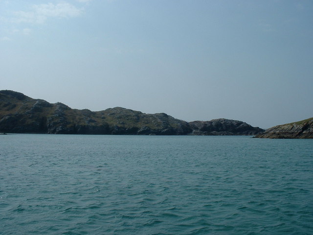
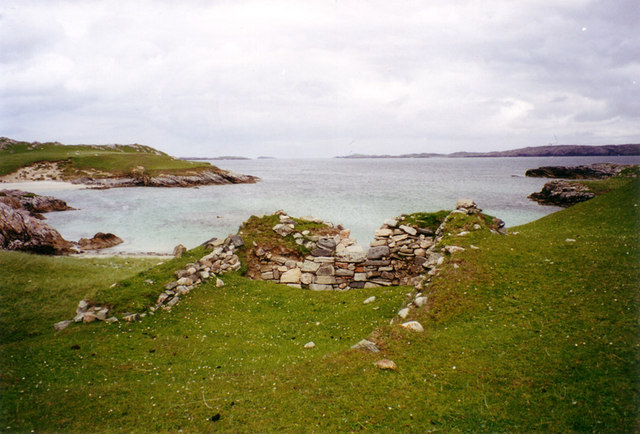
An Caolas, located in Ross-shire, Scotland, is a picturesque coastal marshland that is commonly referred to as the "Coastal Marsh" or "Saltings." Spanning approximately one square kilometer, An Caolas is known for its diverse range of flora and fauna, making it a popular destination for nature enthusiasts and birdwatchers.

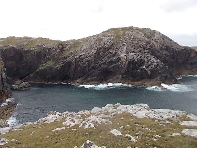
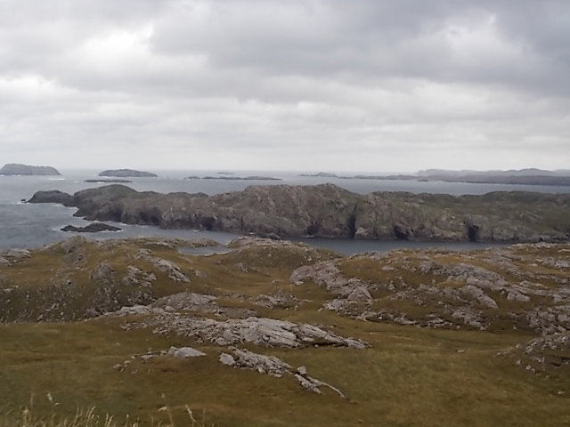
The marshland is situated between two bodies of water, the North Sea and the Dornoch Firth, creating a unique ecosystem that supports a wide variety of plant and animal species. The area is characterized by its vast stretches of salt marshes, mudflats, and sand dunes, providing a rich habitat for various bird species, including waders, ducks, and geese.

The marshland is home to several rare and endangered plant species, such as sea lavender, sea aster, and sea purslane, which thrive in the brackish waters of the marshes. The dunes within An Caolas also provide a habitat for a range of grasses and wildflowers, adding to the natural beauty of the area.

Visitors to An Caolas can explore the marshland via a network of walking trails and observation points, allowing them to observe the abundant wildlife in their natural habitat. The area is a designated Special Protection Area and a Site of Special Scientific Interest, emphasizing its importance for conservation and preservation.

Overall, An Caolas, with its stunning coastal landscape, diverse plant and animal life, and its significance for conservation, offers a unique and enriching experience for those seeking to explore and appreciate the natural wonders of Ross-shire.

If you have any feedback on the listing, please let us know in the comments section below.

An Caolas Images

Images are sourced within 2km of 58.245529/-6.9561792 or Grid Reference NB0939. Thanks to Geograph Open Source API. All images are credited.

Sheepfold at Tobha Mòr
Sheepfold and boundary wall near Tobha Mòr
Rocky surface at Eala Sheadha
Eastern side of the Eala Sheadha Headland
Crystal clear seas off North West coast of Na h-Eileanan an Iar View to about 3 metres depth from RIB floating in lagoon between Pabaigh Mor and Pabaigh Beag.  See also <a href="https://www.geograph.org.uk/photo/1120209">NB1038 : Lagoon on Pabbay Mor</a>
Crystal clear seas off North West coast of Na h-Eileanan an Iar
View to about 3 metres depth from RIB floating in lagoon between Pabaigh Mor and Pabaigh Beag. See also NB1038 : Lagoon on Pabbay Mor
Geodh'an Tuill penetrates Pabaigh Mor Pabaigh More has a tidally flooded low-lying area in the middle of the island (at one time used for buffering lobsters) which connects to the open sea over a reef to the northwest, and through a couple of rocky channels heading northeast. It's clear that those channels must have started the same way as this cave, which has penetrated right to the lagoon (from which it is separated only by a storm beach thrown up by waves entering the cave) and, on a geological timescale, is just about at the end of its life. Although one of our group walked over the arch, and once we'd paddled round the island several of us entered the cave from the sea, it is not the most confidence-inspiring roof, especially at this landward end.
Geodh'an Tuill penetrates Pabaigh Mor
Pabaigh More has a tidally flooded low-lying area in the middle of the island (at one time used for buffering lobsters) which connects to the open sea over a reef to the northwest, and through a couple of rocky channels heading northeast. It's clear that those channels must have started the same way as this cave, which has penetrated right to the lagoon (from which it is separated only by a storm beach thrown up by waves entering the cave) and, on a geological timescale, is just about at the end of its life. Although one of our group walked over the arch, and once we'd paddled round the island several of us entered the cave from the sea, it is not the most confidence-inspiring roof, especially at this landward end.
Lagoon between Pabaigh Mor and Pabaigh Beag View to west showing narrows between these two islands off the northwest coast off Na h-Eileanan an Iar (Outer Hebrides).
Lagoon between Pabaigh Mor and Pabaigh Beag
View to west showing narrows between these two islands off the northwest coast off Na h-Eileanan an Iar (Outer Hebrides).
View from near Bhaltos towards Pabaigh Mor
Tobha Mor with Senna Chnoc island in distance
Geodha Maladail
Geodha Maladail
Pabaigh Mor Numerous caves on the south west side of the island
Pabaigh Mor
Numerous caves on the south west side of the island
Summit cairn, Seuchaval
Eala Sheadha
Eala Sheadha
High point, Eala Sheadha
Cave at Pabaigh Mor
Cave at Pabaigh Mor
Sgeir Mhinig a Muigh Locally known as Sikh Island, as it was bought by a Sikh, sight unseen, for £20K, to build a house on. The winter waves sweep over it! Buyer beware...
Sgeir Mhinig a Muigh
Locally known as Sikh Island, as it was bought by a Sikh, sight unseen, for £20K, to build a house on. The winter waves sweep over it! Buyer beware...
Natural Arch at Eala Sheadha Big swell running through after heavy weather.
Natural Arch at Eala Sheadha
Big swell running through after heavy weather.
St Peter’s Church, Pabaigh Mor The ruin of St Peter’s Church stands above Traigh na Cille on the isle of Pabaigh Mor in Loch Rog.
St Peter’s Church, Pabaigh Mor
The ruin of St Peter’s Church stands above Traigh na Cille on the isle of Pabaigh Mor in Loch Rog.
Show me another place!

An Caolas is located at Grid Ref: NB0939 (Lat: 58.245529, Lng: -6.9561792)

Unitary Authority: Na h-Eileanan an Iar

Police Authority: Highlands and Islands

What 3 Words

///oldest.neckline.enthused. Near Carloway, Na h-Eileanan Siar

Nearby Locations

An Caolas Màs Sgeir

Related Wikis

Pabaigh Mòr

Pabay Mòr or Pabaigh Mòr is an uninhabited island in the Outer Hebrides of Scotland. == History == The island's name comes from papey, an Old Norse name...

Kneep

Kneep (Scottish Gaelic: Cnìp) is a village on the Isle of Lewis, in the Outer Hebrides, Scotland. Kneep is within the parish of Uig.Various archaeological...

Vacsay

Vacsay (Scottish Gaelic: Bhacsaigh from Old Norse "bakkiey" meaning "peat bank island") is one of the Outer Hebrides. It is off the west coast of Lewis...

Cliff, Lewis

Cliff (Scottish Gaelic: Cliobh) is a small settlement on the Isle of Lewis, in the Outer Hebrides, Scotland. Cliff is within the parish of Uig. The settlement...

Have you been to An Caolas?

Leave your review of An Caolas below (or comments, questions and feedback).