Uigean

Settlement in Ross-shire

Scotland

Uigean
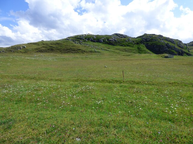
Lazy Beds at Tràigh na Beirigh Ridges formed by hand digging of fields.  These one are unusual in that some of the ridges are lined with small stones.
Lazy Beds at Tràigh na Beirigh Credit: Sandy Gerrard

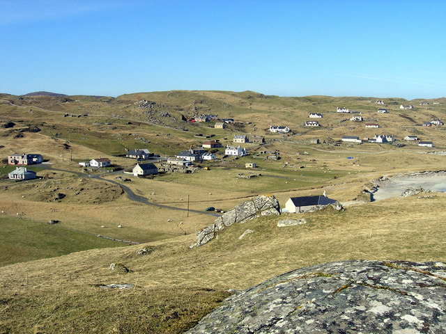
Uigean, located in Ross-shire, Scotland, is a small village known for its picturesque beauty and rich historical heritage. Situated on the northwest coast of Scotland, it is nestled between the towns of Gairloch and Poolewe, offering stunning views of the surrounding mountains and the pristine waters of Loch Ewe.

With a population of around 300 residents, Uigean is a tranquil and close-knit community. The village boasts a charming mix of traditional stone cottages and modern houses, blending seamlessly with the natural landscape. The area is a popular destination for nature lovers, hikers, and outdoor enthusiasts, as it offers numerous walking trails and opportunities for wildlife spotting.

Uigean is steeped in history, with notable landmarks such as the Uigean Standing Stones, a collection of ancient stones believed to date back to the Bronze Age. These mysterious monuments provide a glimpse into the area's past and attract visitors from near and far.

The village is also known for its connection to World War II, as Loch Ewe served as a vital naval base during the conflict. Today, the Russian Arctic Convoy Museum located in Uigean commemorates the bravery and sacrifice of those who served in the convoys, helping to keep the memory alive for future generations.

Uigean offers a tranquil escape from the hustle and bustle of city life, with its stunning natural surroundings and rich history. Whether exploring the rugged coastline, immersing oneself in local folklore, or simply enjoying the peace and quiet, Uigean is a hidden gem waiting to be discovered.

If you have any feedback on the listing, please let us know in the comments section below.

Uigean Images

Images are sourced within 2km of 58.202923/-6.9471103 or Grid Reference NB0934. Thanks to Geograph Open Source API. All images are credited.

Lazy Beds at Tràigh na Beirigh Ridges formed by hand digging of fields.  These one are unusual in that some of the ridges are lined with small stones.
Lazy Beds at Tràigh na Beirigh
Ridges formed by hand digging of fields. These one are unusual in that some of the ridges are lined with small stones.
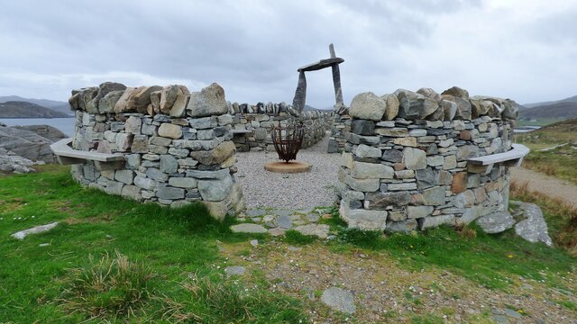
An Sùileachan Monument A monument to the Lewis land clearances <span class="nowrap"><a title="https://bhaltostrust.co.uk/suileachan-project/" rel="nofollow ugc noopener" href="https://bhaltostrust.co.uk/suileachan-project/">Link</a><img style="margin-left:2px;" alt="External link" title="External link - shift click to open in new window" src="https://s1.geograph.org.uk/img/external.png" width="10" height="10"/></span>
An Sùileachan Monument
A monument to the Lewis land clearances LinkExternal link
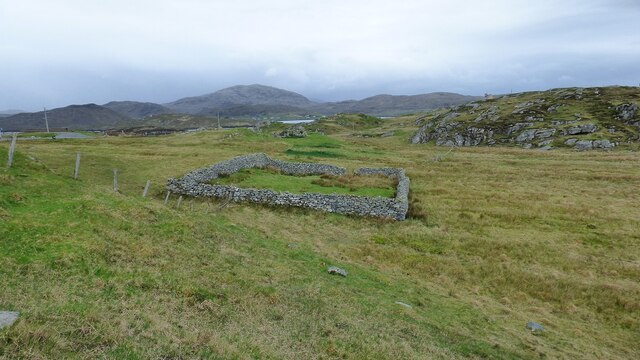
Sheepfold at Riof
Sheepfold at Riof
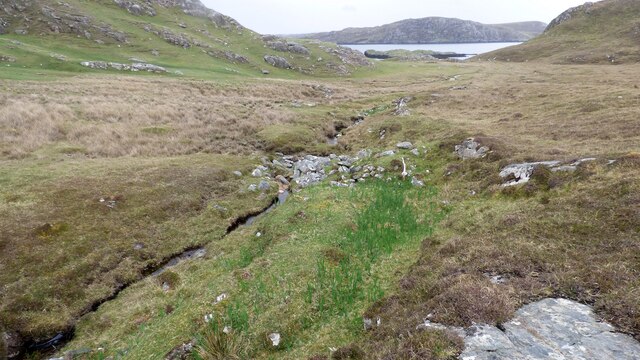
Norse Mill on burn leading from Loch Lionais The mill is very ruinous and survives as a spread of rubble overlying the lower courses of the building.  The leat serving the mill is represented by the bright green stripe.
Norse Mill on burn leading from Loch Lionais
The mill is very ruinous and survives as a spread of rubble overlying the lower courses of the building. The leat serving the mill is represented by the bright green stripe.
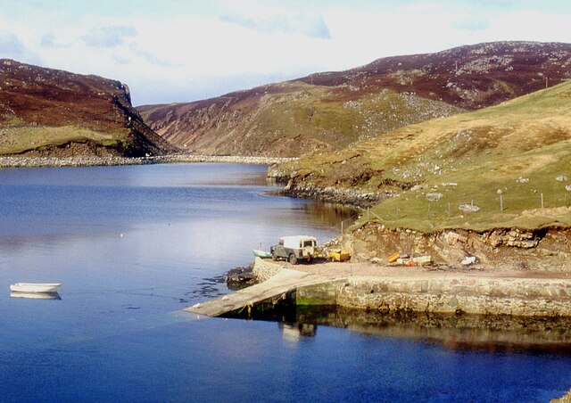
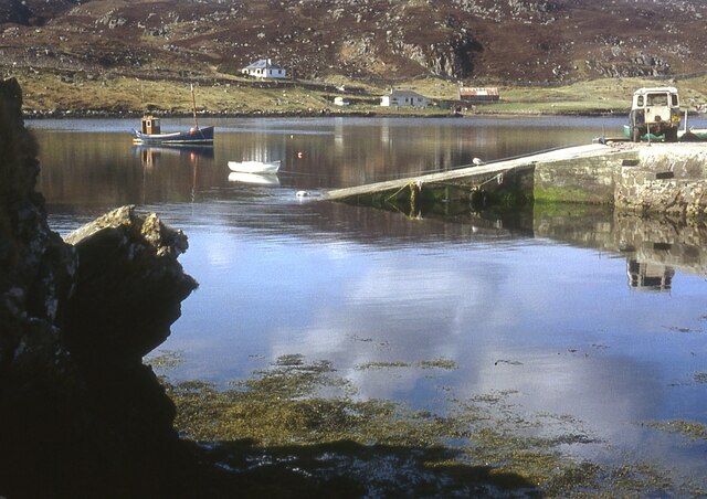
A slipway in Loch Miabhaig
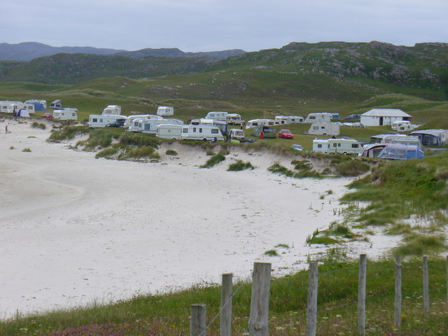
Berie Sands Caravan Park Busy site at Traigh na Beirigh with many caravans parked on the machair above the extensive sands.
Berie Sands Caravan Park
Busy site at Traigh na Beirigh with many caravans parked on the machair above the extensive sands.
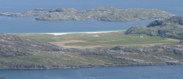
A' Bheirigh from Suaineabhal
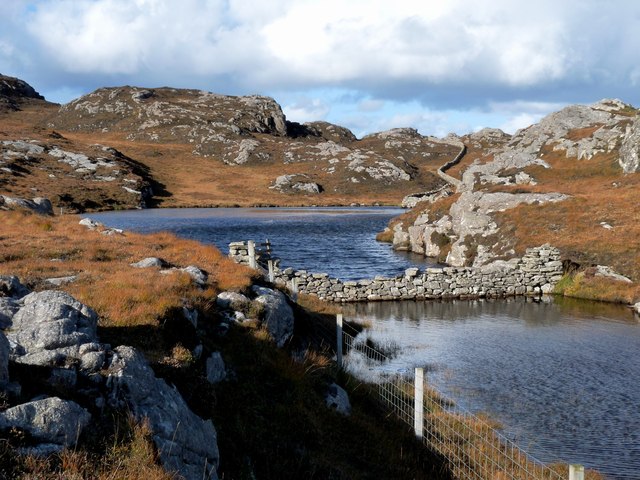
Lochan at Cragavig An old boundary wall snakes across the moorland
Lochan at Cragavig
An old boundary wall snakes across the moorland
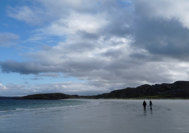
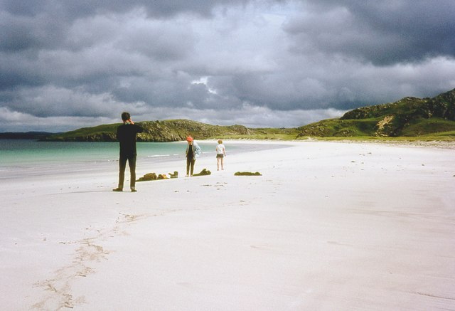
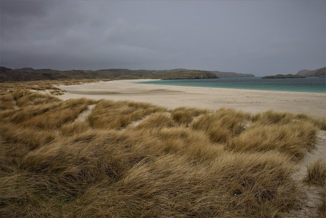
Tràigh na Beirigh In the 1960's this was a deserted beach.  Now it has to be shared with caravanners.
Tràigh na Beirigh
In the 1960's this was a deserted beach. Now it has to be shared with caravanners.
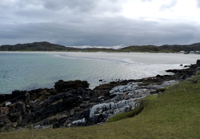
Tràigh na Beirigh A perfect crescent beach
Tràigh na Beirigh
A perfect crescent beach
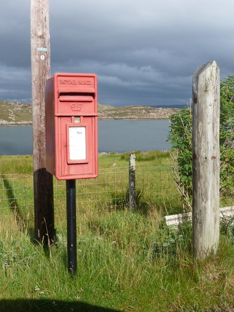
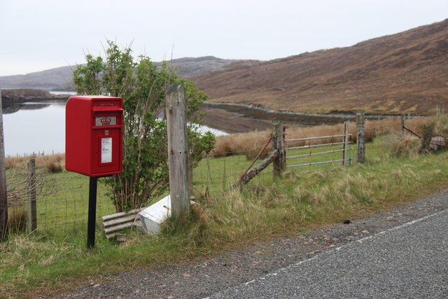
Cerishader: postbox № HS2 158 A small postbox on the B8011, with its back to Loch Ròg. It is emptied at 9 o'clock each morning, except Sunday.
Cerishader: postbox № HS2 158
A small postbox on the B8011, with its back to Loch Ròg. It is emptied at 9 o'clock each morning, except Sunday.
Traigh na Berie
Traigh na Berie
A' Bheirigh
A' Bheirigh
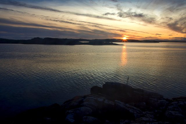
Sunrise, Gridig
Sunrise, Gridig
Traigh na Berie
Traigh na Berie
Carishader postbox The sea inlet is part of Loch Ròg.
Carishader postbox
The sea inlet is part of Loch Ròg.
Show me another place!

Uigean is located at Grid Ref: NB0934 (Lat: 58.202923, Lng: -6.9471103)

Unitary Authority: Na h-Eileanan an Iar

Police Authority: Highlands and Islands

Also known as: Uigen

What 3 Words

///pizzeria.stung.shipwreck. Near Carloway, Na h-Eileanan Siar

Related Wikis

Loch na Berie

Loch Na Berie is a broch in the Outer Hebrides of Scotland, located approximately 400 yards from the shore, and is thought to have been located on an island...

Flodaigh, Lewis

Flodaigh is a small island in Loch Roag on the west coast of Lewis in the Outer Hebrides of Scotland. It is about 33 hectares (82 acres) in extent and...

Cliff, Lewis

Cliff (Scottish Gaelic: Cliobh) is a small settlement on the Isle of Lewis, in the Outer Hebrides, Scotland. Cliff is within the parish of Uig. The settlement...

Kneep

Kneep (Scottish Gaelic: Cnìp) is a village on the Isle of Lewis, in the Outer Hebrides, Scotland. Kneep is within the parish of Uig.Various archaeological...

Nearby Amenities

Located within 500m of 58.202923,-6.9471103
Passing Place
Lat/Long: 58.2044034/-6.9419838
Passing Place
Lat/Long: 58.2048206/-6.9437523
Passing Place
Lat/Long: 58.2036172/-6.9536011
Barrier: cattle_grid
Lat/Long: 58.2013388/-6.9546299
Leisure: slipway
Lat/Long: 58.2020107/-6.953176
Leisure: slipway
Lat/Long: 58.2034502/-6.9543832
Restaurant
Scallop
Lat/Long: 58.2017993/-6.9530219
Ùigean
Name En: Uigen
Name Gd: Ùigean
Place: hamlet
Lat/Long: 58.2026825/-6.9469578
Barrier: cattle_grid
Lat/Long: 58.2017522/-6.9466971
Passing Place
Lat/Long: 58.2043488/-6.9408406
Barrier: cattle_grid
Lat/Long: 58.2049442/-6.9436662
Power: pole
Lat/Long: 58.199407/-6.9524133
Power: pole
Lat/Long: 58.2000418/-6.9531922
Power: pole
Lat/Long: 58.2007166/-6.9539865
Power: pole
Lat/Long: 58.2017695/-6.9539218
Power: pole
Lat/Long: 58.2050127/-6.9539989
Power: pole
Lat/Long: 58.2046651/-6.9526775
Power: pole
Lat/Long: 58.2042204/-6.9515696
Power: pole
Lat/Long: 58.2037116/-6.950312
Power: pole
Lat/Long: 58.2036499/-6.9492602
Power: pole
Lat/Long: 58.2035615/-6.9479426
Power: pole
Lat/Long: 58.2037623/-6.9471562
Power: pole
Lat/Long: 58.2038992/-6.9465325
Power: pole
Lat/Long: 58.2040116/-6.9460417
Power: pole
Lat/Long: 58.204331/-6.9446626
Power: pole
Lat/Long: 58.2044479/-6.9433424
Power: pole
Lat/Long: 58.2041376/-6.9420422
Power: pole
Lat/Long: 58.2040788/-6.9406467
Power: pole
Lat/Long: 58.2041937/-6.9394243
Power: pole
Lat/Long: 58.2020319/-6.9472198
Power: pole
Lat/Long: 58.2024506/-6.9467594
Power: pole
Lat/Long: 58.2029037/-6.9467706
Power: pole
Lat/Long: 58.2033384/-6.946844
Power: pole
Lat/Long: 58.2036072/-6.9468157
Power: pole
Lat/Long: 58.2035724/-6.9469987
Power: pole
Lat/Long: 58.203111/-6.950273
Power: pole
Lat/Long: 58.2031656/-6.9494458
Power: pole
Lat/Long: 58.2032185/-6.9487095
Power: pole
Lat/Long: 58.2035026/-6.947377
Generator Method: wind_turbine
Generator Source: wind
Generator Type: horizontal_axis
Power: generator
Lat/Long: 58.2039254/-6.9474938
Passing Place
Lat/Long: 58.2041045/-6.9543398
Passing Place
Lat/Long: 58.2045401/-6.9549891
Power: pole
Lat/Long: 58.2013561/-6.954735
The data included in this document is from www.openstreetmap.org. The data is made available under ODbL.

Have you been to Uigean?

Leave your review of Uigean below (or comments, questions and feedback).