Uigshader

Settlement in Inverness-shire

Scotland

Uigshader

Structure near Carbost Described in a geocache description as a four poster bed from memory
Structure near Carbost Credit: thejackrustles

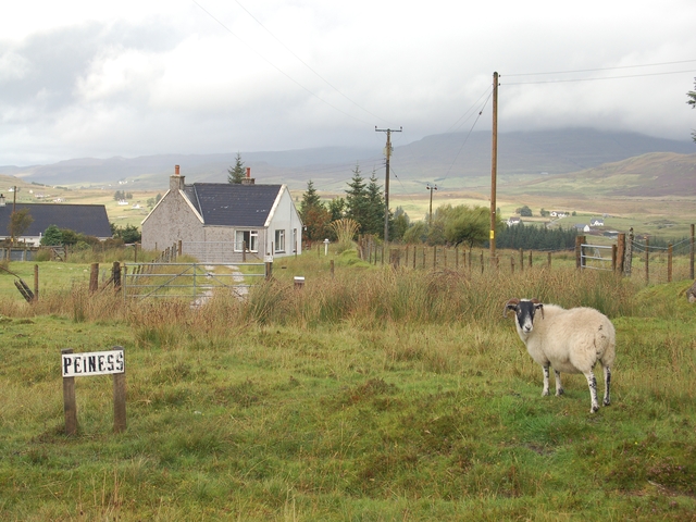
Uigshader is a small hamlet located in the Inverness-shire region of Scotland. Situated in the north-western part of the country, Uigshader is surrounded by picturesque landscapes and offers a tranquil setting for its residents and visitors.

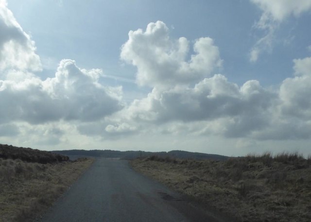
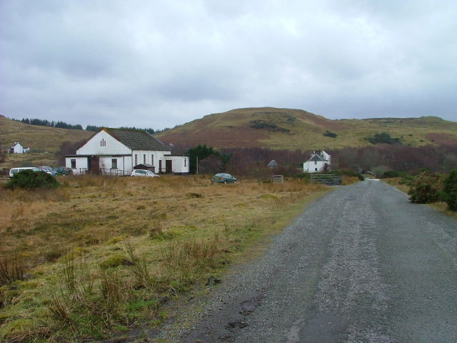
The hamlet is characterized by its rural charm and natural beauty, with rolling hills, lush green meadows, and sparkling lochs dotting the landscape. Uigshader is nestled near the Uig River, which adds to its idyllic setting and provides opportunities for fishing and other water activities.

Despite its small size, Uigshader has a rich history that can be explored through its various landmarks and historical sites. Nearby, there is the Uig Parish Church, a quaint stone building dating back to the 19th century, and the Uig Lodge, an impressive Victorian mansion that has been converted into a luxury hotel.

For nature enthusiasts, Uigshader offers ample opportunities for outdoor activities such as hiking, cycling, and wildlife spotting. The surrounding area is home to a diverse range of flora and fauna, including red deer, golden eagles, and otters, making it a haven for nature lovers.

Though Uigshader may not have extensive amenities, it is located in close proximity to larger towns and cities such as Inverness, providing easy access to a wider range of services, shopping centers, and cultural attractions.

Overall, Uigshader is a charming and peaceful hamlet that offers a perfect retreat for those seeking a tranquil escape amidst the stunning Scottish countryside.

If you have any feedback on the listing, please let us know in the comments section below.

Uigshader Images

Images are sourced within 2km of 57.435914/-6.2876153 or Grid Reference NG4246. Thanks to Geograph Open Source API. All images are credited.

Structure near Carbost Described in a geocache description as a four poster bed from memory
Structure near Carbost
Described in a geocache description as a four poster bed from memory
Car on the C1233 A Daihatsu Sirion heading towards Uigshader on the minor road near Macdiarmid Primary School.
Car on the C1233
A Daihatsu Sirion heading towards Uigshader on the minor road near Macdiarmid Primary School.
Peiness and Uigshader Minor settlements close to the River Snizort.
Peiness and Uigshader
Minor settlements close to the River Snizort.
Afternoon nap A highland cow enjoying a rest near the old Skeabost road.
Afternoon nap
A highland cow enjoying a rest near the old Skeabost road.
Bun-Sgoil Mhic Dhiarmaid Macdiarmid Primary School serves pupils from around the Skeabost, Bernisdale, Borve and Kensaleyre areas.
Bun-Sgoil Mhic Dhiarmaid
Macdiarmid Primary School serves pupils from around the Skeabost, Bernisdale, Borve and Kensaleyre areas.
MacDiarmid Primary School Bun-Sgoil Mhic Dhiarmaid at Carbost. For earlier views see <a href="https://www.geograph.org.uk/photo/2370585">NG4347 : Mac Diarmid Primary School and Nursery</a> and <a href="https://www.geograph.org.uk/photo/101009">NG4347 : Macdiarmid Primary School and Nursery</a>.
MacDiarmid Primary School
Bun-Sgoil Mhic Dhiarmaid at Carbost. For earlier views see NG4347 : Mac Diarmid Primary School and Nursery and NG4347 : Macdiarmid Primary School and Nursery.
Agricultural shed at Peiness A concrete and corrugated iron structure beside a cattle grid on the C1233.
Agricultural shed at Peiness
A concrete and corrugated iron structure beside a cattle grid on the C1233.
B885 crossing moorland below Ben Grasco
B885 north of Ben Grasco
The A850 heading for Portree Part of the old road can be seen on the left.
The A850 heading for Portree
Part of the old road can be seen on the left.
Lòn an Eireannaich A main tributary to the River Snizort, which it joins just beyond the visible trees.
Lòn an Eireannaich
A main tributary to the River Snizort, which it joins just beyond the visible trees.
Bridge over the Lòn an Eireannaich The trees here, seen in <a href="https://www.geograph.org.uk/photo/100977">NG4346 : Woodland at Uigshadder</a> in 2006 were felled around 2017.
Bridge over the Lòn an Eireannaich
The trees here, seen in NG4346 : Woodland at Uigshadder in 2006 were felled around 2017.
Cleared forest by the Lòn an Eireannaich The trees here, seen 14 years earlier in <a href="https://www.geograph.org.uk/photo/100977">NG4346 : Woodland at Uigshadder</a>, were felled in around 2017.
Cleared forest by the Lòn an Eireannaich
The trees here, seen 14 years earlier in NG4346 : Woodland at Uigshadder, were felled in around 2017.
Lòn an Eireannaich In English, the burn of the Irishman. It is so called from a story of an Irish pedlar who drowned in it while escaping in the night from his nearby lodging in Garlapin. He had overheard a conversation about killing a goat, which he took to be about killing him. The Gaelic for a wedder is eibhrionnach, which sounds similar to Eireannaich.
Lòn an Eireannaich
In English, the burn of the Irishman. It is so called from a story of an Irish pedlar who drowned in it while escaping in the night from his nearby lodging in Garlapin. He had overheard a conversation about killing a goat, which he took to be about killing him. The Gaelic for a wedder is eibhrionnach, which sounds similar to Eireannaich.
Meander in the Lòn an Eireannaich The burn of the Irishman, a tributary of the River Snizort, near Garlapin.
The hill on the central horizon is Beinn Tianabhaig, near Portree.
Meander in the Lòn an Eireannaich
The burn of the Irishman, a tributary of the River Snizort, near Garlapin. The hill on the central horizon is Beinn Tianabhaig, near Portree.
Ice on the River Snizort Skye's longest river flowing under a sheet of ice after prolonged cold and dry weather.
Ice on the River Snizort
Skye's longest river flowing under a sheet of ice after prolonged cold and dry weather.
Grazings by the River Snizort Sheep on good quality grassland south of the meandering River Snizort.
Grazings by the River Snizort
Sheep on good quality grassland south of the meandering River Snizort.
Mac Diarmid Primary School and Nursery
Show me another place!

Uigshader is located at Grid Ref: NG4246 (Lat: 57.435914, Lng: -6.2876153)

Unitary Authority: Highland

Police Authority: Highlands and Islands

What 3 Words

///cleansed.terminology.waltz. Near Portree, Highland

Nearby Locations

Uigshader Peiness

Related Wikis

Uigshader

Uigshader (from Old Norse Vík-sœtr 'dwelling at the riverbend', Scottish Gaelic: Ùigseadar) is a settlement on the Isle of Skye in Scotland.The settlement...

Carbost, Trotternish

Carbost (Scottish Gaelic: Càrrabost) is a crofting settlement at the southern end of the Trotternish peninsula on the Isle of Skye in the Highlands of...

Skeabost

Skeabost (Scottish Gaelic: Sgeitheabost) is a township, at the head of the sea loch, Loch Snizort Beag in the southern end of the Trotternish peninsula...

Snizort Cathedral

Snizort Cathedral (Gaelic: Snìosort) was a small cathedral church located on an island (St Columba's Isle, Gaelic: Eilean Chaluim Chille) in the River...

Nearby Amenities

Located within 500m of 57.435914,-6.2876153
Uigshader
Name En: Uigshader
Name Gd: Ùigseadar
Name Non: Vík-sœtr
Place: hamlet
Wikidata: Q1967976
Wikipedia: en:Uigshader
Lat/Long: 57.4346777/-6.2845591
Barrier: cattle_grid
Source: survey
Lat/Long: 57.4386242/-6.2892439
Passing Place
Lat/Long: 57.4376137/-6.2893619
Barrier: cattle_grid
Source: survey
Lat/Long: 57.4346715/-6.2882783
Power: pole
Lat/Long: 57.4365974/-6.29585
Power: pole
Lat/Long: 57.4362466/-6.2949863
Power: pole
Lat/Long: 57.4358958/-6.294128
Power: pole
Lat/Long: 57.4355464/-6.2932616
Power: pole
Lat/Long: 57.4351552/-6.2922934
Power: pole
Lat/Long: 57.4347437/-6.2913063
Power: pole
Lat/Long: 57.4331484/-6.2863389
Power: pole
Lat/Long: 57.4326994/-6.2846115
Power: pole
Lat/Long: 57.4342918/-6.289874
Power: pole
Lat/Long: 57.4340262/-6.2890238
Power: pole
Lat/Long: 57.4337533/-6.2879884
Power: pole
Lat/Long: 57.4334891/-6.2870309
Power: pole
Lat/Long: 57.4332206/-6.286017
Power: pole
Lat/Long: 57.4329434/-6.2849173
Power: pole
Lat/Long: 57.4326315/-6.2837935
Power: pole
Lat/Long: 57.4322792/-6.2830398
Power: pole
Lat/Long: 57.4323297/-6.2826347
Peiness
Name En: Peiness
Name Gd: Peighinn an Easa
Place: hamlet
Lat/Long: 57.4359865/-6.2887111
The data included in this document is from www.openstreetmap.org. The data is made available under ODbL.

Have you been to Uigshader?

Leave your review of Uigshader below (or comments, questions and feedback).