Crakavagh

Coastal Marsh, Saltings in Inverness-shire

Scotland

Crakavagh

Houses at Samhla
Houses at Samhla Credit: Sandy Gerrard

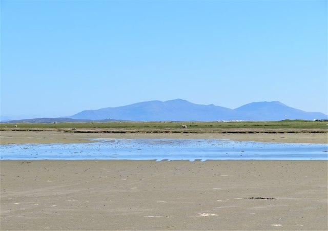
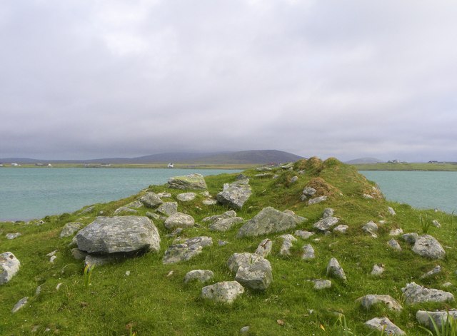
Crakavagh is a coastal marsh located in Inverness-shire, Scotland. Situated in the northern part of the country, it is a part of the larger region known as the Scottish Highlands. The marsh is specifically located in the area known as the Saltings, which is characterized by its low-lying, marshy terrain.

Crakavagh is known for its unique ecosystem, which is predominantly made up of salt marsh plants and grasses. These plants are adapted to survive in the brackish water of the marsh, which is a mixture of saltwater and freshwater. The marsh provides an important habitat for a variety of bird species, including waders and waterfowl, which are attracted to the rich feeding grounds found here.

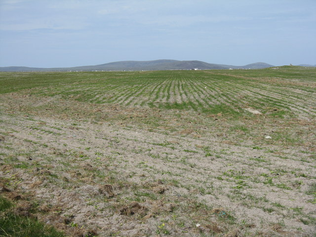
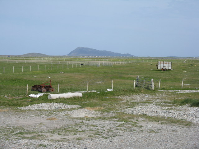
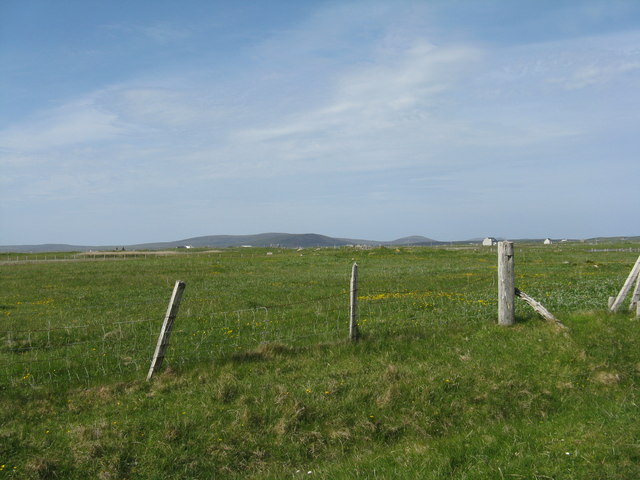
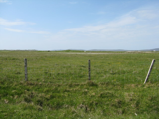
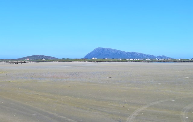
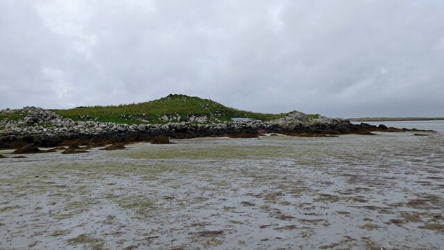
The landscape of Crakavagh is characterized by its vast expanses of open marshland, interspersed with small pools of water. The marsh is prone to tidal flooding, with the water levels rising and falling with the tides. This creates a dynamic environment that is constantly changing with the ebb and flow of the sea.

Crakavagh is a popular destination for nature enthusiasts and birdwatchers, who come to observe the diverse range of bird species that frequent the marsh. The area is also of scientific interest, with ongoing research and monitoring efforts to study the unique ecology of the salt marsh.

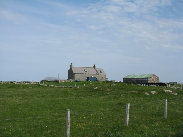
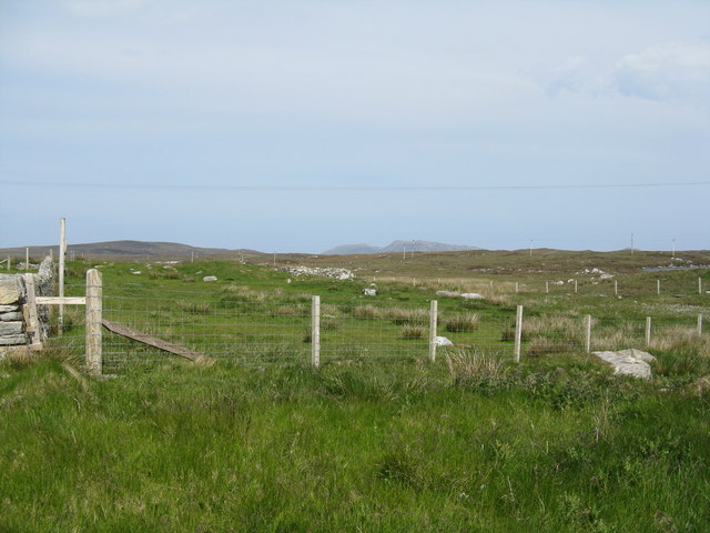
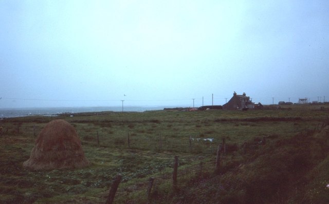
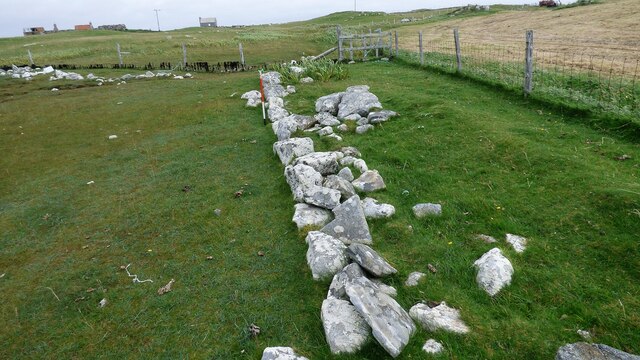
Access to Crakavagh is relatively limited, with a few designated walking trails that allow visitors to explore the marshland. The surrounding coastal area offers stunning views of the rugged Scottish coastline, making it a picturesque location for nature lovers and photographers alike.

If you have any feedback on the listing, please let us know in the comments section below.

Crakavagh Images

Images are sourced within 2km of 57.540155/-7.360012 or Grid Reference NF7962. Thanks to Geograph Open Source API. All images are credited.

Houses at Samhla
Houses at Samhla
Baleshare - North Uist Causeway Looking east from Samhla to North Uist. Interestingly, although both sides are open to the sea, there is water to the south but it was dry on the north.
Baleshare - North Uist Causeway
Looking east from Samhla to North Uist. Interestingly, although both sides are open to the sea, there is water to the south but it was dry on the north.
Shore at Samhla Looking south from the west end of the causeway.
Shore at Samhla
Looking south from the west end of the causeway.
Reseeded machair  Looking northeast across flat sandy machair land.
Reseeded machair
Looking northeast across flat sandy machair land.
Farmhouse on Baleshare The peak in the distance, to the left, is Eaval on North Uist.
Farmhouse on Baleshare
The peak in the distance, to the left, is Eaval on North Uist.
Fence at Ceardach Ruadh Looking inland from the west coast of Baleshare.
Fence at Ceardach Ruadh
Looking inland from the west coast of Baleshare.
Looking inland from Sloc Sabhaidh Machair pasture on Baleshare, looking east to Eaval, about 15km away.
Looking inland from Sloc Sabhaidh
Machair pasture on Baleshare, looking east to Eaval, about 15km away.
Pasture on Baleshare/Baile Sear Looking northeast from the road to Teanna Mhachair on the west side of the island. The high land beyond will be on North Uist.
Pasture on Baleshare/Baile Sear
Looking northeast from the road to Teanna Mhachair on the west side of the island. The high land beyond will be on North Uist.
Machair on Baleshare/Baile Sear Looking northwest to a slight rise in the ground, on which there are the remains of a Dun.
Machair on Baleshare/Baile Sear
Looking northwest to a slight rise in the ground, on which there are the remains of a Dun.
A sandy island surrounded by sand This is the part of the extensive area of tidal sand on the east side of Baile Sear island. The sand must be firm due to the number of vehicle tyre tracks across it. Looking due east towards the profile of Eabhal.
A sandy island surrounded by sand
This is the part of the extensive area of tidal sand on the east side of Baile Sear island. The sand must be firm due to the number of vehicle tyre tracks across it. Looking due east towards the profile of Eabhal.
Vehicle graveyard Baile Sear Vehicles are rather like dwellings on the Western Isles. When no longer wanted, they are simply left to rot out in the elements.
Vehicle graveyard Baile Sear
Vehicles are rather like dwellings on the Western Isles. When no longer wanted, they are simply left to rot out in the elements.
Sand and land, Baile Sear Looking south along the beach on the east side of Baile Sear island. The view is south across the low lying Benbecula towards the big hills of South Uist.
Sand and land, Baile Sear
Looking south along the beach on the east side of Baile Sear island. The view is south across the low lying Benbecula towards the big hills of South Uist.
Cladach Iolaraigh West side of North Uist
Cladach Iolaraigh
West side of North Uist
Carnan Nan Long chambered cairn Neolithic chambered cairn on the coastline. <span class="nowrap"><a title="https://canmore.org.uk/site/10005/north-uist-baleshare-carnan-nan-long" rel="nofollow ugc noopener" href="https://canmore.org.uk/site/10005/north-uist-baleshare-carnan-nan-long">Link</a><img style="margin-left:2px;" alt="External link" title="External link - shift click to open in new window" src="https://s1.geograph.org.uk/img/external.png" width="10" height="10"/></span>
Carnan Nan Long chambered cairn
Neolithic chambered cairn on the coastline. LinkExternal link
Field wall next to beach on Baile Sear Walls were often erected to prevent stock on beaches getting onto adjacent arable ground (Scale 1m).
Field wall next to beach on Baile Sear
Walls were often erected to prevent stock on beaches getting onto adjacent arable ground (Scale 1m).
Harvest in at Teanna Mhachair Old methods are still in favour here
Harvest in at Teanna Mhachair
Old methods are still in favour here
Baile Sear, crops drying old style The sand blown west coast of Uist is very fertile.
Baile Sear, crops drying old style
The sand blown west coast of Uist is very fertile.
Chambered cairn on Baleshare Neolithic chambered tomb on the northern coast of Baleshare island.
Chambered cairn on Baleshare
Neolithic chambered tomb on the northern coast of Baleshare island.
Show me another place!

Crakavagh is located at Grid Ref: NF7962 (Lat: 57.540155, Lng: -7.360012)

Unitary Authority: Na h-Eileanan an Iar

Police Authority: Highlands and Islands

What 3 Words

///thrusters.state.deluded. Near Balivanich, Na h-Eileanan Siar

Related Wikis

Baleshare

Baleshare (Scottish Gaelic: Baile Sear) is a flat tidal island in the Outer Hebrides of Scotland. Baleshare lies to the south-west of North Uist. Its economics...

Teampull na Trionaid

Teampull na Trionaid ("trinity church") is a ruined 13th-century Augustinian nunnery at Carinish, on North Uist, in the Outer Hebrides of Scotland. �...

Battle of Carinish

The Battle of Carinish was a Scottish clan battle fought in North Uist in 1601. It was part of a year of feuding between Clan MacLeod of Dunvegan and the...

Carinish

Carinish (Scottish Gaelic: Càirinis), is a hamlet on North Uist, in the Outer Hebrides, Scotland. It is in the south of the island, about two miles (three...

Nearby Amenities

Located within 500m of 57.540155,-7.360012
Samhla
Place: hamlet
Lat/Long: 57.5387373/-7.3535443
Passing Place
Lat/Long: 57.5386196/-7.3527011
Turning Circle
Lat/Long: 57.5377061/-7.365968
Power: pole
Lat/Long: 57.5409601/-7.3526222
Power: pole
Lat/Long: 57.5408205/-7.3533035
Power: pole
Lat/Long: 57.5407485/-7.3537192
Power: pole
Lat/Long: 57.5405585/-7.3547572
Power: pole
Lat/Long: 57.5404721/-7.3553071
Power: pole
Lat/Long: 57.5402706/-7.3563612
Power: pole
Lat/Long: 57.5400676/-7.3575307
Power: pole
Lat/Long: 57.5398099/-7.3589683
Power: pole
Lat/Long: 57.5395853/-7.3601699
Power: pole
Lat/Long: 57.5393363/-7.3615888
Power: pole
Lat/Long: 57.5391304/-7.3626617
Power: pole
Lat/Long: 57.5390498/-7.3638875
Power: pole
Lat/Long: 57.5389462/-7.3654003
Power: pole
Lat/Long: 57.5387259/-7.3646224
Power: pole
Lat/Long: 57.5386266/-7.3641423
Power: pole
Lat/Long: 57.5384236/-7.3631955
Power: pole
Lat/Long: 57.5387617/-7.3679455
Power: pole
Lat/Long: 57.5388495/-7.366701
Power: pole
Lat/Long: 57.5388414/-7.3651597
Power: pole
Lat/Long: 57.5375884/-7.353829
Power: pole
Lat/Long: 57.5379857/-7.3540114
Power: pole
Lat/Long: 57.5383413/-7.3534213
Power: pole
Lat/Long: 57.539909/-7.3550038
Power: pole
Lat/Long: 57.5392252/-7.3546766
Power: pole
Lat/Long: 57.5386062/-7.3543387
Post Box
Collection Times: Mo-Fr 09:30; Sa 09:00
Operator: Royal Mail
Post Box Mounting: pole
Post Box Type: lamp
Ref: HS6 31
Royal Cypher: scottish_crown
Lat/Long: 57.540698/-7.3525411
The data included in this document is from www.openstreetmap.org. The data is made available under ODbL.

Have you been to Crakavagh?

Leave your review of Crakavagh below (or comments, questions and feedback).