Hope Point

Coastal Feature, Headland, Point in Kent Thanet

England

Hope Point

Chalk and Flint The cliff is not all that stable and bits are continually dropping off to add to the pile of boulders at the base.
Chalk and Flint Credit: Des Blenkinsopp

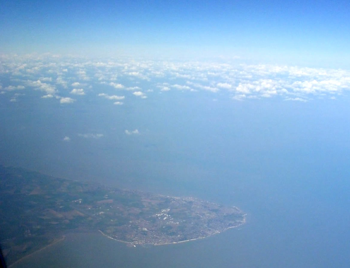
Hope Point, located in Kent, is a prominent coastal feature that stands as a majestic headland and point. Situated on the southeastern coast of England, this striking natural formation offers breathtaking views and a rich historical significance.

Rising proudly from the rugged coastline, Hope Point commands attention with its imposing cliffs and dramatic landscapes. The headland stretches out into the English Channel, providing an ideal vantage point to observe the surrounding coastal scenery. Visitors to Hope Point are treated to panoramic vistas of the sparkling blue waters, sandy beaches, and charming coastal villages that dot the area.

Aside from its remarkable natural beauty, Hope Point holds historical significance. The headland was named after the HMS Hope, a British naval ship that famously sailed along the Kent coast during the 19th century. The ship played a vital role in protecting the shores and ensuring the safety of coastal communities.

Nature enthusiasts flock to Hope Point to explore its diverse ecosystem. The headland is home to a variety of plant and animal species, including seabirds, wildflowers, and unique coastal vegetation. The rugged cliffs and rocky outcrops provide a sanctuary for nesting birds and other wildlife, making it a haven for birdwatchers and nature lovers.

In addition to its natural wonders, Hope Point offers various recreational activities. Hiking trails wind through the headland, allowing visitors to immerse themselves in the stunning coastal scenery. The nearby beaches provide opportunities for sunbathing, swimming, and water sports, attracting both locals and tourists.

Overall, Hope Point in Kent is a captivating coastal feature that seamlessly combines natural beauty, historical significance, and recreational opportunities.

If you have any feedback on the listing, please let us know in the comments section below.

Hope Point Images

Images are sourced within 2km of 51.370603/1.4495088 or Grid Reference TR4069. Thanks to Geograph Open Source API. All images are credited.

Chalk and Flint The cliff is not all that stable and bits are continually dropping off to add to the pile of boulders at the base.
Chalk and Flint
The cliff is not all that stable and bits are continually dropping off to add to the pile of boulders at the base.
Beware of Tidal Cut Off This is at the southern end of the popular beach at Joss Bay. At low tide you can explore along the shoreline but there isn't a way up the steep cliffs and there is a risk of being stranded.
Beware of Tidal Cut Off
This is at the southern end of the popular beach at Joss Bay. At low tide you can explore along the shoreline but there isn't a way up the steep cliffs and there is a risk of being stranded.
Below East Cliff, Broadstairs This whole bay and the wave-cut platform are all submerged at high tide.
Below East Cliff, Broadstairs
This whole bay and the wave-cut platform are all submerged at high tide.
Foreshore at Stone Bay The sandy beach transforms into a rock platform at low tide.
Foreshore at Stone Bay
The sandy beach transforms into a rock platform at low tide.
Stone Bay, Broadstairs Looking along the full length from the harbour jetty with Hope Point and North Foreland in the distance. Note the sewage discharge pipe at the beginning of the rocks, hopefully no longer in use!
Stone Bay, Broadstairs
Looking along the full length from the harbour jetty with Hope Point and North Foreland in the distance. Note the sewage discharge pipe at the beginning of the rocks, hopefully no longer in use!
Turnstone on the landing slip, Broadstairs Taking refuge after being chased along the beach by a dog.
Turnstone on the landing slip, Broadstairs
Taking refuge after being chased along the beach by a dog.
Broadstairs Sailing Club A decent wind without too much sea running. Mainly Laser class one-man dinghies with a Contender far right.
Broadstairs Sailing Club
A decent wind without too much sea running. Mainly Laser class one-man dinghies with a Contender far right.
North Foreland, looking towards Kingsgate Bay At high tide, this square is almost completely all at sea.  At low tide, a series of rock pools is revealed.
North Foreland, looking towards Kingsgate Bay
At high tide, this square is almost completely all at sea. At low tide, a series of rock pools is revealed.
Wave Cut Platform, North Foreland
Joss Bay from North Foreland cliff
Beach and Rocks at Joss Bay
RNLI lifeboat, Joss Bay Sadly it was too far away for me to be able to identify it.
RNLI lifeboat, Joss Bay
Sadly it was too far away for me to be able to identify it.
Joss Bay III, Broadstairs Looking towards the cliffs at North Foreland, in part of Joss Bay, 
said to be named after a local smuggler.
Joss Bay III, Broadstairs
Looking towards the cliffs at North Foreland, in part of Joss Bay, said to be named after a local smuggler.
Joss Bay  Beach This sandy beach is between Hackmedown Point (in the background) and North Foreland.
Joss Bay Beach
This sandy beach is between Hackmedown Point (in the background) and North Foreland.
Rocks near Joss Bay As seen from the beach near Joss Gap.
These rocks can only be seen at low tide.
Rocks near Joss Bay
As seen from the beach near Joss Gap. These rocks can only be seen at low tide.
Beach, Joss Bay Lumps of chalk from the chalk cliffs sprinkle the extremities of the beach, but most is fine sand.
Beach, Joss Bay
Lumps of chalk from the chalk cliffs sprinkle the extremities of the beach, but most is fine sand.
Beach, Joss Bay A sandy bay with a distant view of passing shipping.
Beach, Joss Bay
A sandy bay with a distant view of passing shipping.
The beach in Joss Bay
Show me another place!

Hope Point is located at Grid Ref: TR4069 (Lat: 51.370603, Lng: 1.4495088)

Administrative County: Kent

District: Thanet

Police Authority: Kent

What 3 Words

///smart.toned.reason. Near Broadstairs, Kent

Related Wikis

St Stephen's College, Broadstairs

Sts Stephen's College was an educational establishment for girls run by the Community of St John Baptist, an Anglican convent of Augustinian nuns in Clewer...

North Foreland

North Foreland is a chalk headland on the Kent coast of southeast England, specifically in Broadstairs. With the rest of Broadstairs and part of Ramsgate...

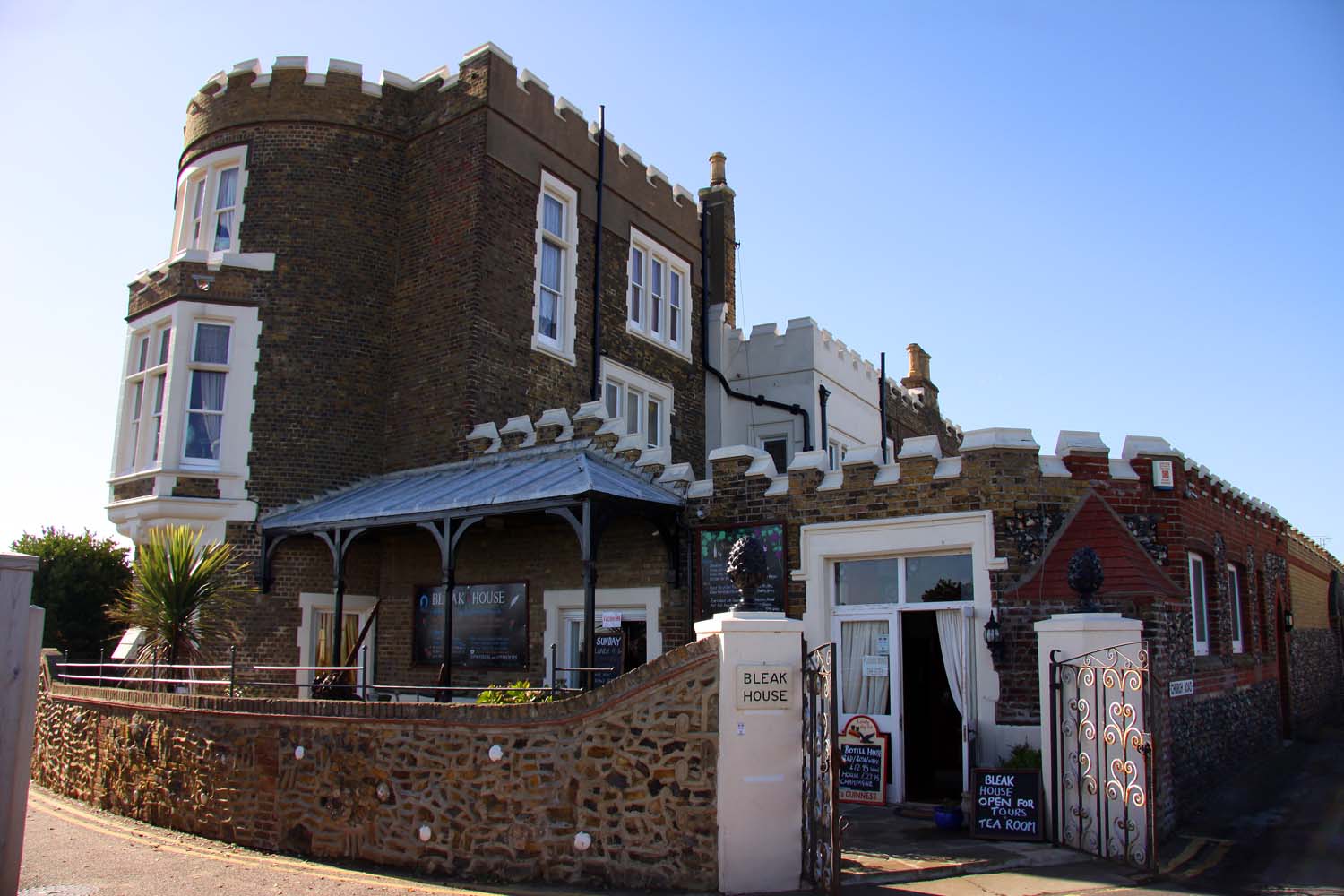
Bleak House, Broadstairs

Bleak House (originally known as Fort House) is a prominent house on the cliff overlooking the North Foreland and Viking Bay in Broadstairs, Kent. It was...

Palace Cinema, Broadstairs

The Palace Cinema is an independent single-screen cinema in Broadstairs, Kent, England. Housed in a converted commercial building, it opened in 1965 as...

Nearby Amenities

Located within 500m of 51.370603,1.4495088
Traffic Calming: hump
Lat/Long: 51.3715184/1.4430973
Traffic Calming: hump
Lat/Long: 51.3717824/1.4433428
Post Box
Collection Times: Mo-Fr 09:00; Sa 07:00
Operator: Royal Mail
Operator Wikidata: Q638098
Post Box Type: pillar
Ref: CT10 95D
Royal Cypher: VR
Royal Cypher Wikidata: Q33102356
Lat/Long: 51.374197/1.4453543
Traffic Calming: bump
Lat/Long: 51.3719459/1.446188
Post Box
Check Date: 2022-06-10
Collection Times: Mo-Fr 09:00; Sa 07:00
Operator: Royal Mail
Operator Type: private
Operator Wikidata: Q638098
Post Box Type: pillar
Ref: CT10 81D
Royal Cypher: GR
Royal Cypher Wikidata: Q33102273
Lat/Long: 51.3688002/1.4430101
Bus Stop
Lanthorne Road
Bench: no
Bin: no
Bus: yes
Flag: yes
Lit: no
Naptan AtcoCode: 2400A047010A
Naptan Bearing: S
Naptan CommonName: Lanthorne Road
Naptan Indicator: opp
Naptan Landmark: Lanthorne Road
Naptan NaptanCode: kntdwptd
Naptan Street: Stone Road
Naptan Verified: no
Public Transport: platform
Ref: kntdwptd
Shelter: no
Source: naptan_import
Source Date: 2018-02-02T13:45:00
Tactile Paving: no
Lat/Long: 51.3685061/1.4431717
Post Box
Postal Code: CT10
Ref: CT10 103
Source: survey
Lat/Long: 51.3724086/1.4463985
Traffic Calming: bump
Lat/Long: 51.3699484/1.4469086
Traffic Calming: bump
Lat/Long: 51.3704582/1.4452428
Check Date: 2022-02-06
Traffic Calming: bump
Lat/Long: 51.3707382/1.4450177
Traffic Calming: bump
Lat/Long: 51.373498/1.4465614
Check Date: 2022-02-06
Traffic Calming: hump
Lat/Long: 51.3709967/1.4434745
Check Date: 2022-02-06
Traffic Calming: hump
Lat/Long: 51.3711433/1.4431287
Generator Method: photovoltaic
Generator Output Electricity: yes
Generator Source: solar
Generator Type: solar_photovoltaic_panel
Location: roof
Power: generator
Lat/Long: 51.3719763/1.4465019
Generator Method: photovoltaic
Generator Output Electricity: yes
Generator Source: solar
Generator Type: solar_photovoltaic_panel
Location: roof
Power: generator
Lat/Long: 51.3741178/1.4455792
Generator Method: photovoltaic
Generator Output Electricity: yes
Generator Source: solar
Generator Type: solar_photovoltaic_panel
Location: roof
Power: generator
Lat/Long: 51.3746368/1.4464885
Generator Method: photovoltaic
Generator Output Electricity: yes
Generator Source: solar
Generator Type: solar_photovoltaic_panel
Location: roof
Power: generator
Lat/Long: 51.3736155/1.4479034
The data included in this document is from www.openstreetmap.org. The data is made available under ODbL.

Have you been to Hope Point?

Leave your review of Hope Point below (or comments, questions and feedback).