Hackemdown Point
Coastal Feature, Headland, Point in Kent Thanet
England
Hackemdown Point

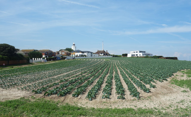
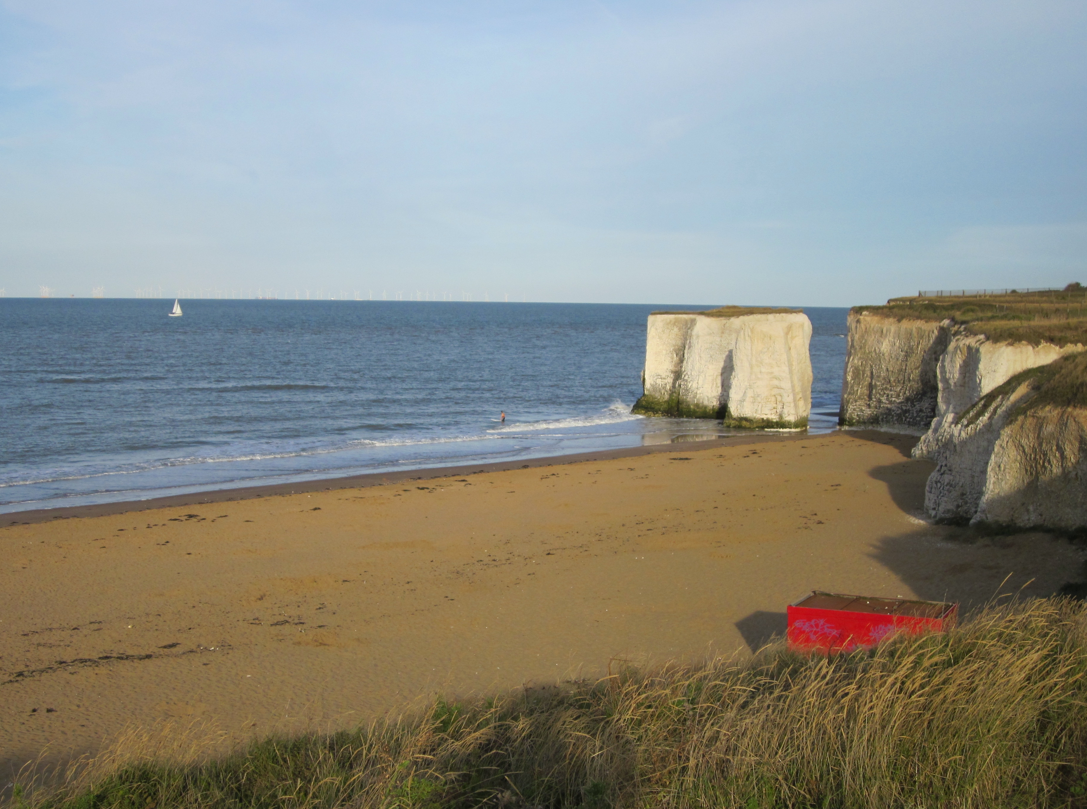
Hackemdown Point is a prominent coastal feature located in the county of Kent, England. Situated on the southeastern coast of the country, it is a headland that juts out into the English Channel. The point is named after its dramatic cliffs, which are renowned for their steepness and ruggedness.
The cliffs at Hackemdown Point are composed of chalk and form an impressive backdrop against the blue waters of the Channel. They reach heights of up to 100 meters, providing breathtaking views of the surrounding area. The point itself is a narrow strip of land that extends outward from the mainland, forming a distinct geographical feature.
The area around Hackemdown Point is known for its diverse wildlife and natural beauty. The cliffs provide nesting sites for numerous seabirds, including gulls, razorbills, and fulmars. The surrounding waters are also home to a variety of marine life, making it a popular spot for fishing and birdwatching enthusiasts.
Visitors to Hackemdown Point can enjoy a range of outdoor activities, such as hiking, nature walks, and photography. The headland is part of a larger nature reserve, offering opportunities for exploration and discovery. Additionally, there are several walking trails that allow visitors to fully appreciate the unique landscape and stunning vistas.
Hackemdown Point is easily accessible by road, with parking facilities available nearby. The area is also served by public transportation, making it a convenient destination for both locals and tourists. Whether it's for its natural beauty, wildlife, or recreational activities, Hackemdown Point is a must-visit location for anyone seeking a true coastal experience in Kent.
If you have any feedback on the listing, please let us know in the comments section below.
Hackemdown Point Images
Images are sourced within 2km of 51.381946/1.4470705 or Grid Reference TR3970. Thanks to Geograph Open Source API. All images are credited.


Hackemdown Point is located at Grid Ref: TR3970 (Lat: 51.381946, Lng: 1.4470705)
Administrative County: Kent
District: Thanet
Police Authority: Kent
What 3 Words
///reader.bids.glitz. Near Broadstairs, Kent
Nearby Locations
Related Wikis
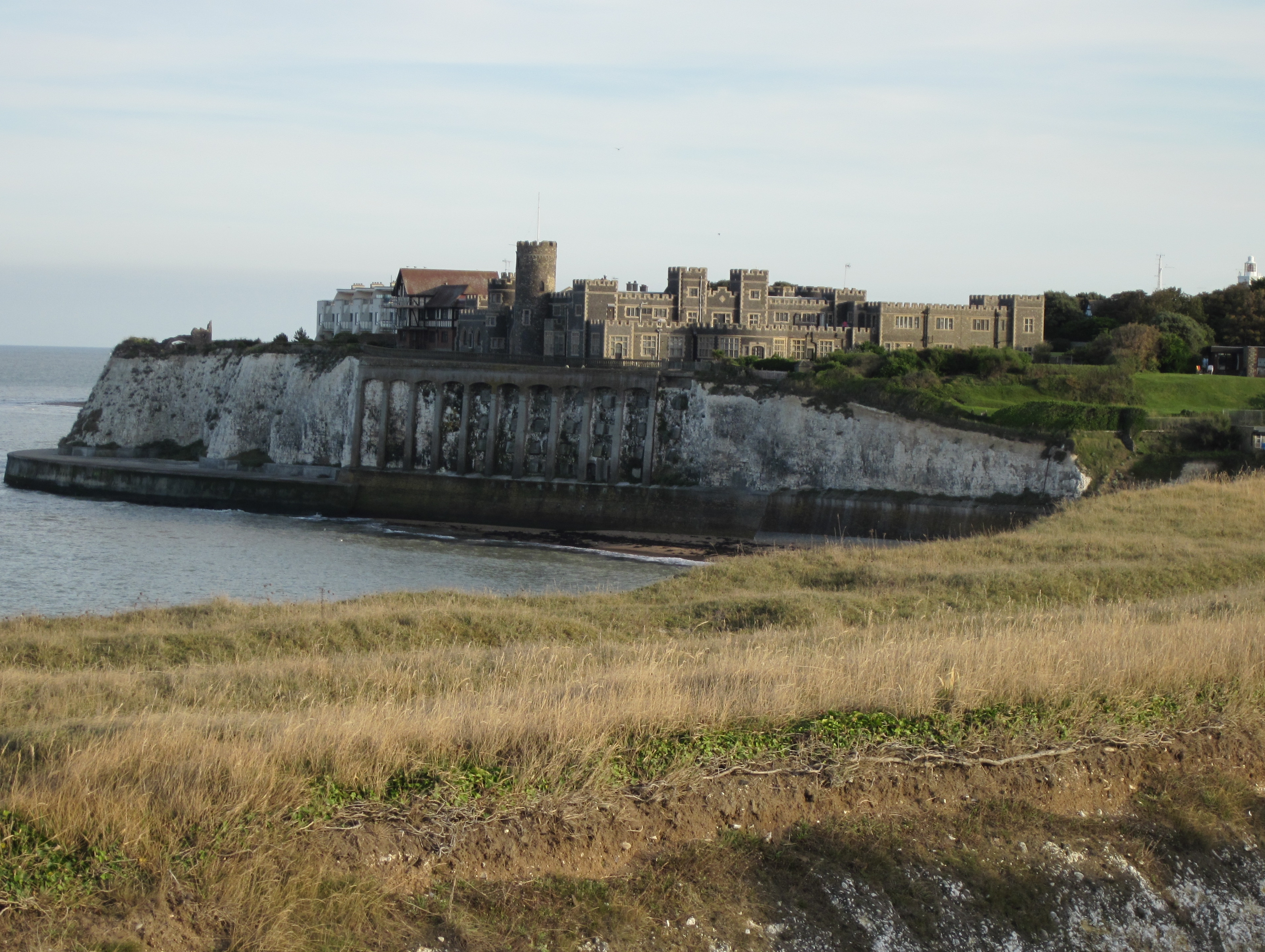
Kingsgate Castle
Kingsgate Castle on the cliffs above Kingsgate Bay, Broadstairs, Kent, was built for Lord Holland (Henry Fox, 1st Baron Holland) in the 1760s as the stable...
Kingsgate, Kent
Kingsgate is a hamlet in St Peter's parish, Broadstairs, Kent. The name Kingsgate is related to an incidental landing of Charles II on 30 June 1683 (‘gate...
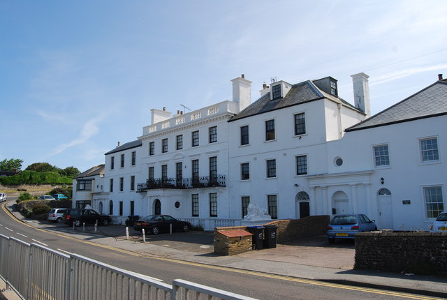
Holland House, Kingsgate
Holland House, Kingsgate, in Kent, is a Georgian country house built between 1762 and 1768 as his retirement home by the politician Henry Fox, 1st Baron...
North Foreland
North Foreland is a chalk headland on the Kent coast of southeast England, specifically in Broadstairs. With the rest of Broadstairs and part of Ramsgate...

St Stephen's College, Broadstairs
Sts Stephen's College was an educational establishment for girls run by the Community of St John Baptist, an Anglican convent of Augustinian nuns in Clewer...
Botany Bay, Kent
Botany Bay is a bay in Broadstairs facing the north sea, Kent, England. Botany Bay is the northernmost of seven bays in Broadstairs. It features chalk...

Foreness Point
Foreness Point is a low headland on the coast of Kent in England. It extends a short distance into the entrance of the Thames Estuary, on the north coast...

Northern Belle
The Northern Belle was an American transatlantic ship which ran aground near Thanet, England, on 5 January 1857. No lives on her were lost, thanks to...
Nearby Amenities
Located within 500m of 51.381946,1.4470705Have you been to Hackemdown Point?
Leave your review of Hackemdown Point below (or comments, questions and feedback).