Crowlink
Coastal Feature, Headland, Point in Sussex Wealden
England
Crowlink

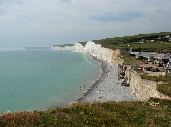
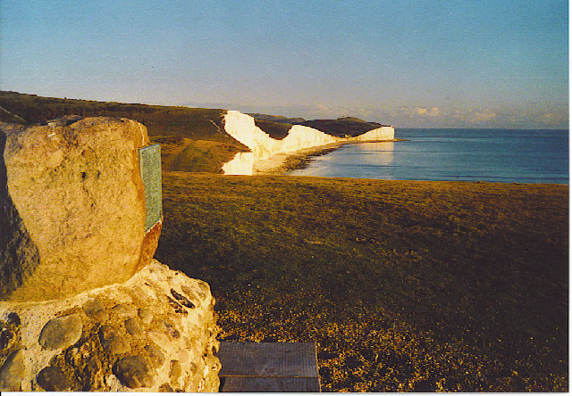
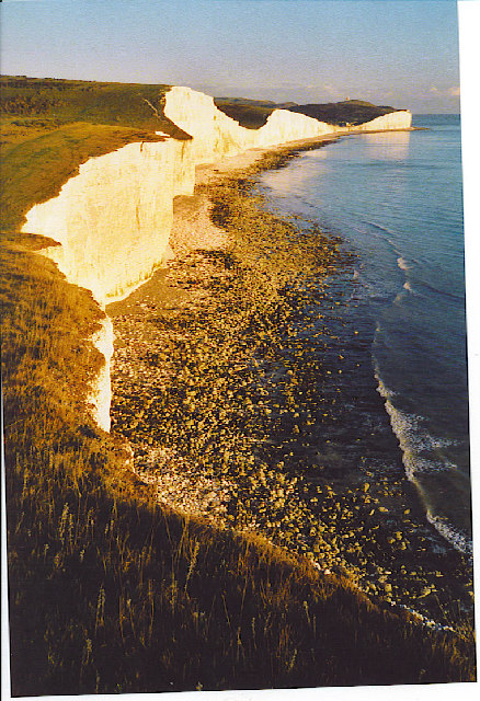
Crowlink is a picturesque headland located in Sussex, England, along the stunning coastline of the South Downs National Park. Situated between the towns of Eastbourne and Seaford, it offers panoramic views of the English Channel and the surrounding countryside.
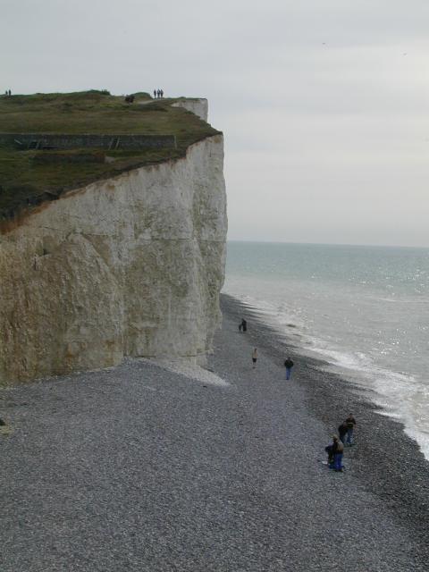
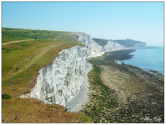
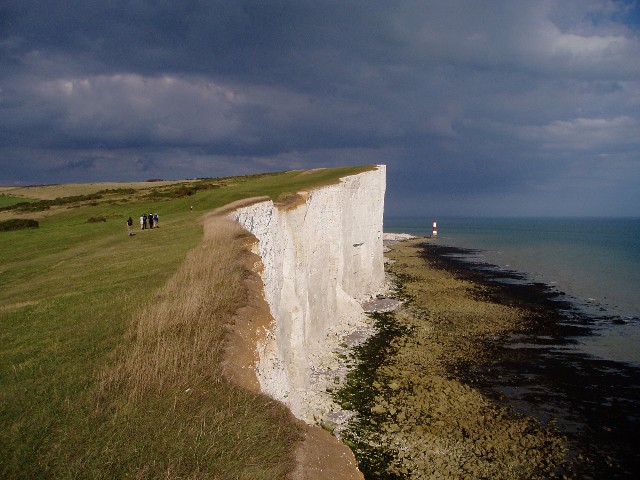
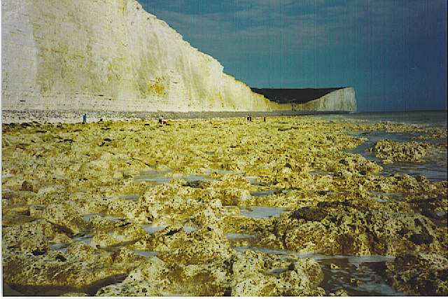
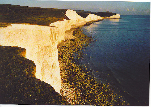
The headland is characterized by its rugged cliffs, which rise up to approximately 200 feet above sea level, providing a dramatic backdrop to the coastal scenery. These cliffs are composed mainly of chalk, a characteristic geological feature of this area. Crowlink is also home to a diverse range of flora and fauna, including rare plants such as orchids, as well as numerous bird species that nest in the cliffs.
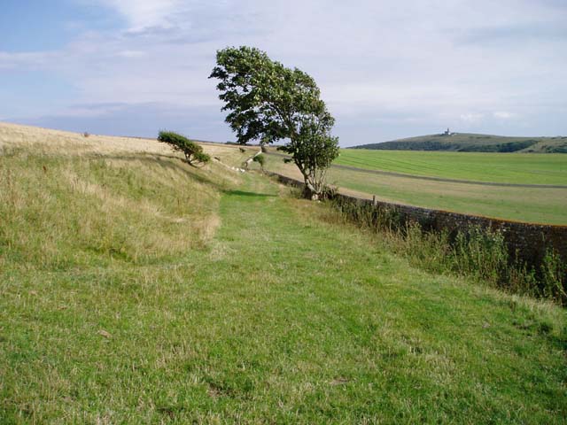
Visitors to Crowlink can enjoy a variety of activities in this natural paradise. There are several walking trails that crisscross the headland, offering breathtaking views of the coastline and the opportunity to observe the local wildlife. The area is also popular among birdwatchers, who come to spot migratory birds and seabirds that frequent the cliffs and surrounding areas.
The headland is easily accessible by foot or by car, with a small parking area available for visitors. However, it is important to note that the cliffs can be steep and slippery, so caution is advised when exploring the area.
Overall, Crowlink is a must-visit destination for nature lovers and outdoor enthusiasts seeking the beauty and tranquility of the Sussex coastline. Its stunning cliffs, diverse wildlife, and breathtaking views make it a truly remarkable coastal feature.
If you have any feedback on the listing, please let us know in the comments section below.
Crowlink Images
Images are sourced within 2km of 50.743683/0.19727267 or Grid Reference TV5596. Thanks to Geograph Open Source API. All images are credited.


Crowlink is located at Grid Ref: TV5596 (Lat: 50.743683, Lng: 0.19727267)
Administrative County: East Sussex
District: Wealden
Police Authority: Sussex
What 3 Words
///towns.scoop.notes. Near Friston, East Sussex
Nearby Locations
Related Wikis

SM UB-121
SM UB-121 was a German Type UB III submarine or U-boat in the German Imperial Navy (German: Kaiserliche Marine) during World War I. She was commissioned...

Seven Sisters Sheep Centre
The Seven Sisters Sheep Centre was a farm near East Dean, in the Seven Sisters Country Park of the South Downs. It held a large collection of about 50...
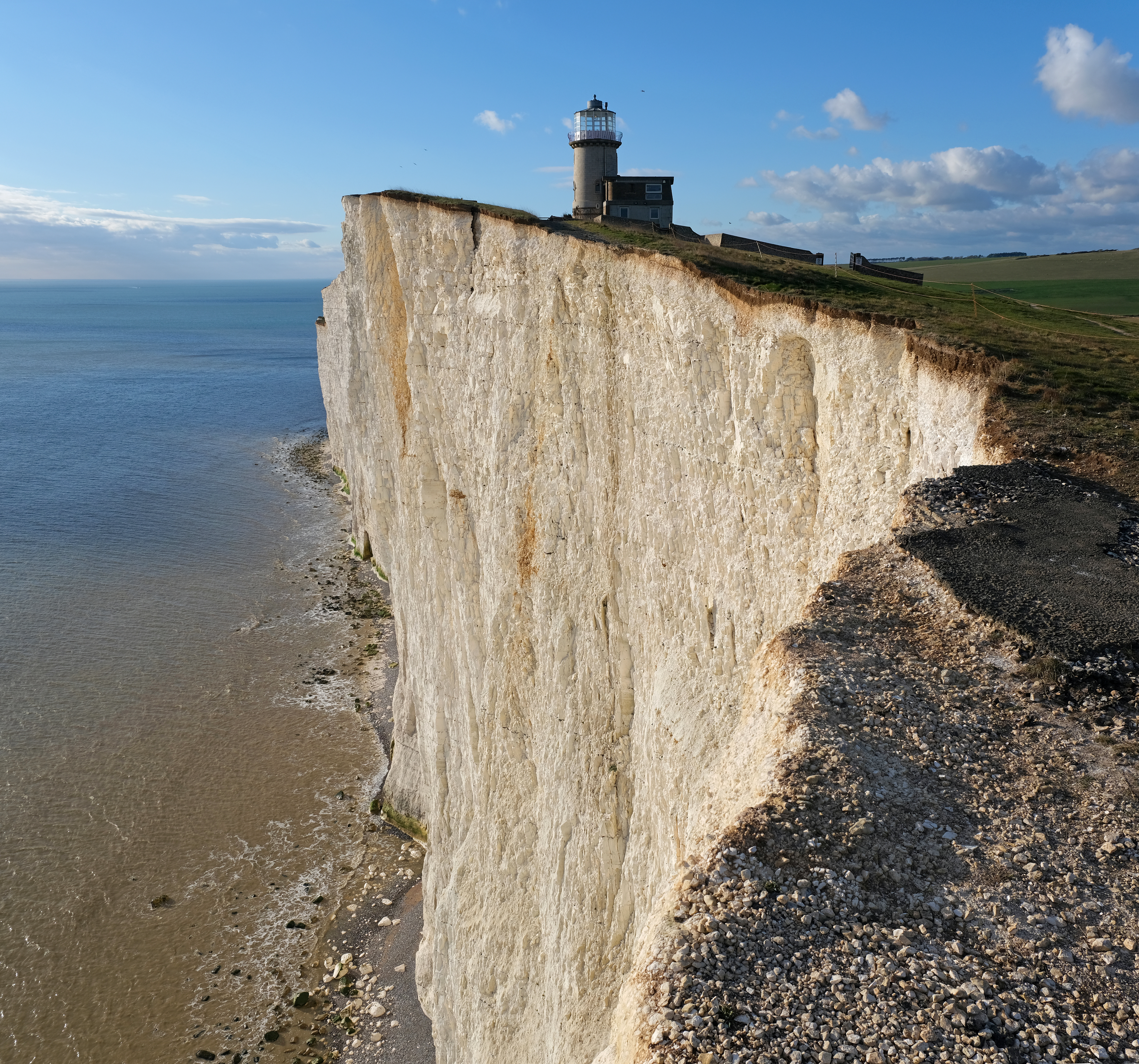
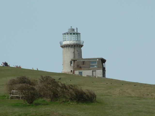
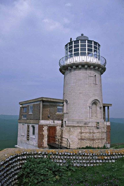
Belle Tout Lighthouse
The Belle Tout Lighthouse (also spelled Belle Toute) is a decommissioned lighthouse and British landmark located at Beachy Head, East Sussex, close to...

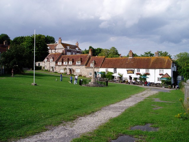
East Dean and Friston
East Dean and Friston is a civil parish in the Wealden District of East Sussex, England.The two villages in the parish are in a dry valley on the South...

Seaford to Beachy Head
Seaford to Beachy Head is a 1,108.7-hectare (2,740-acre) biological and geological Site of Special Scientific Interest which stretches from Seaford to...

RAF Friston
Royal Air Force Friston or more simply RAF Friston is a former Royal Air Force satellite station and Emergency Landing Ground located in East Sussex, England...

Seven Sisters, East Sussex
The Seven Sisters are a series of chalk sea cliffs on the English Channel coast, and are a stretch of the sea-eroded section of the South Downs range of...

Action of 2 May 1707
The action of 2 May 1707, also known as Beachy Head, was a naval battle of the War of the Spanish Succession in which a French squadron under Claude de...
Nearby Amenities
Located within 500m of 50.743683,0.19727267Have you been to Crowlink?
Leave your review of Crowlink below (or comments, questions and feedback).