Birling Gap
Settlement in Sussex Wealdon
England
Birling Gap

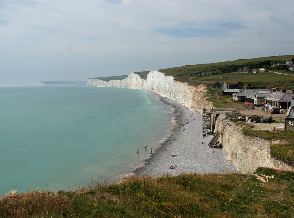
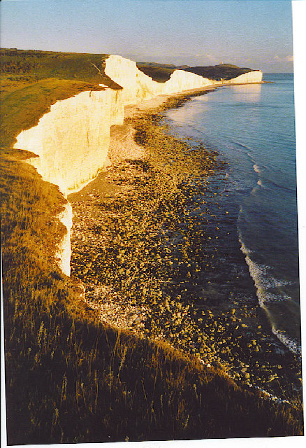
Birling Gap is a picturesque coastal village located in the county of Sussex, England. Situated on the South Downs National Park, this stunning destination is known for its breathtaking scenery and rugged cliffs that overlook the English Channel.
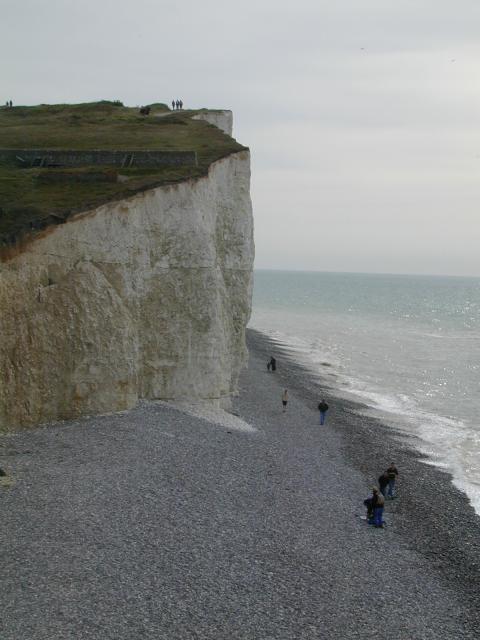
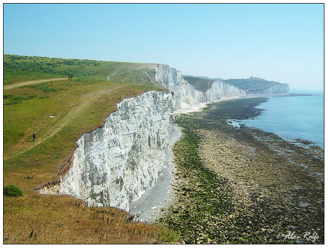
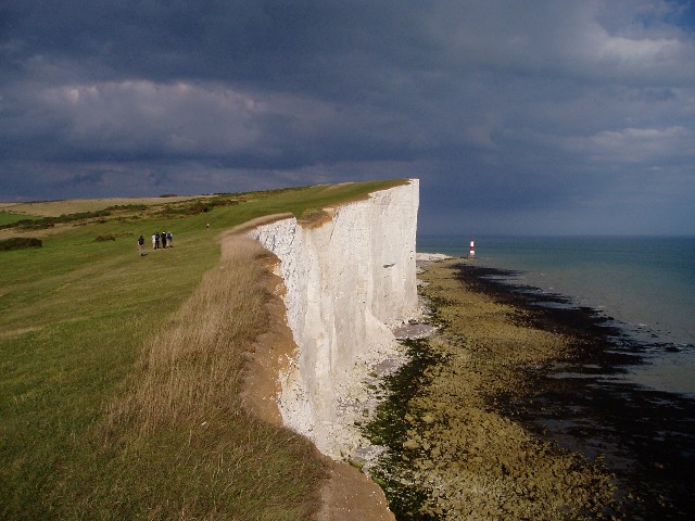
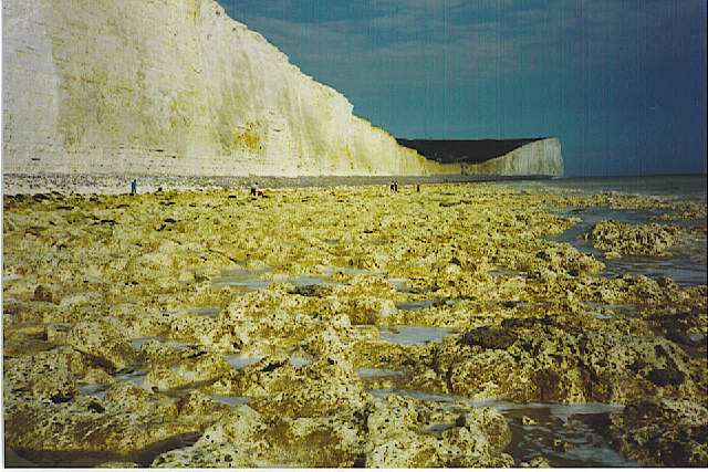
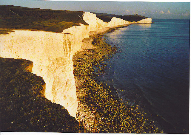
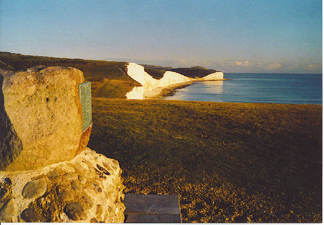
Nestled between the towns of Eastbourne and Seaford, Birling Gap is a popular spot for outdoor enthusiasts and nature lovers alike. The area is renowned for its dramatic chalk cliffs, which have been eroded over centuries by the relentless power of the sea. These cliffs provide visitors with awe-inspiring views and are particularly striking at sunset, casting a warm glow over the surrounding landscape.
One of the main attractions at Birling Gap is its beautiful pebble beach, which stretches for miles along the coast. This beach is a haven for fossil hunters, as it is rich in ancient artifacts and prehistoric remains. Visitors can spend hours exploring the shoreline, combing through the stones in search of hidden treasures.
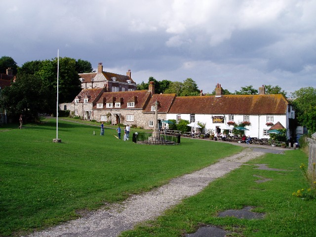
The village itself is small but charming, with a handful of cottages and a quaint café that offers refreshments and homemade treats. There is also a National Trust visitor center, where visitors can learn about the local wildlife and the history of the area.
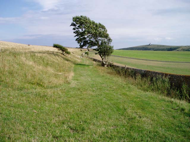
For those looking to immerse themselves in nature, Birling Gap offers a variety of walking trails that wind through the surrounding countryside. These trails provide an opportunity to spot rare wildlife, such as peregrine falcons and fulmars, as well as a chance to enjoy the tranquility of the natural surroundings.
Overall, Birling Gap is a captivating destination that combines natural beauty with a rich history, making it a must-visit place for anyone seeking a peaceful and enriching experience in Sussex.
If you have any feedback on the listing, please let us know in the comments section below.
Birling Gap Images
Images are sourced within 2km of 50.74382/0.20097874 or Grid Reference TV5596. Thanks to Geograph Open Source API. All images are credited.


Birling Gap is located at Grid Ref: TV5596 (Lat: 50.74382, Lng: 0.20097874)
Administrative County: East Sussex
District: Wealdon
Police Authority: Sussex
What 3 Words
///gave.spots.releasing. Near Friston, East Sussex
Nearby Locations
Related Wikis

SM UB-121
SM UB-121 was a German Type UB III submarine or U-boat in the German Imperial Navy (German: Kaiserliche Marine) during World War I. She was commissioned...

Seven Sisters Sheep Centre
The Seven Sisters Sheep Centre was a farm near East Dean, in the Seven Sisters Country Park of the South Downs. It held a large collection of about 50...
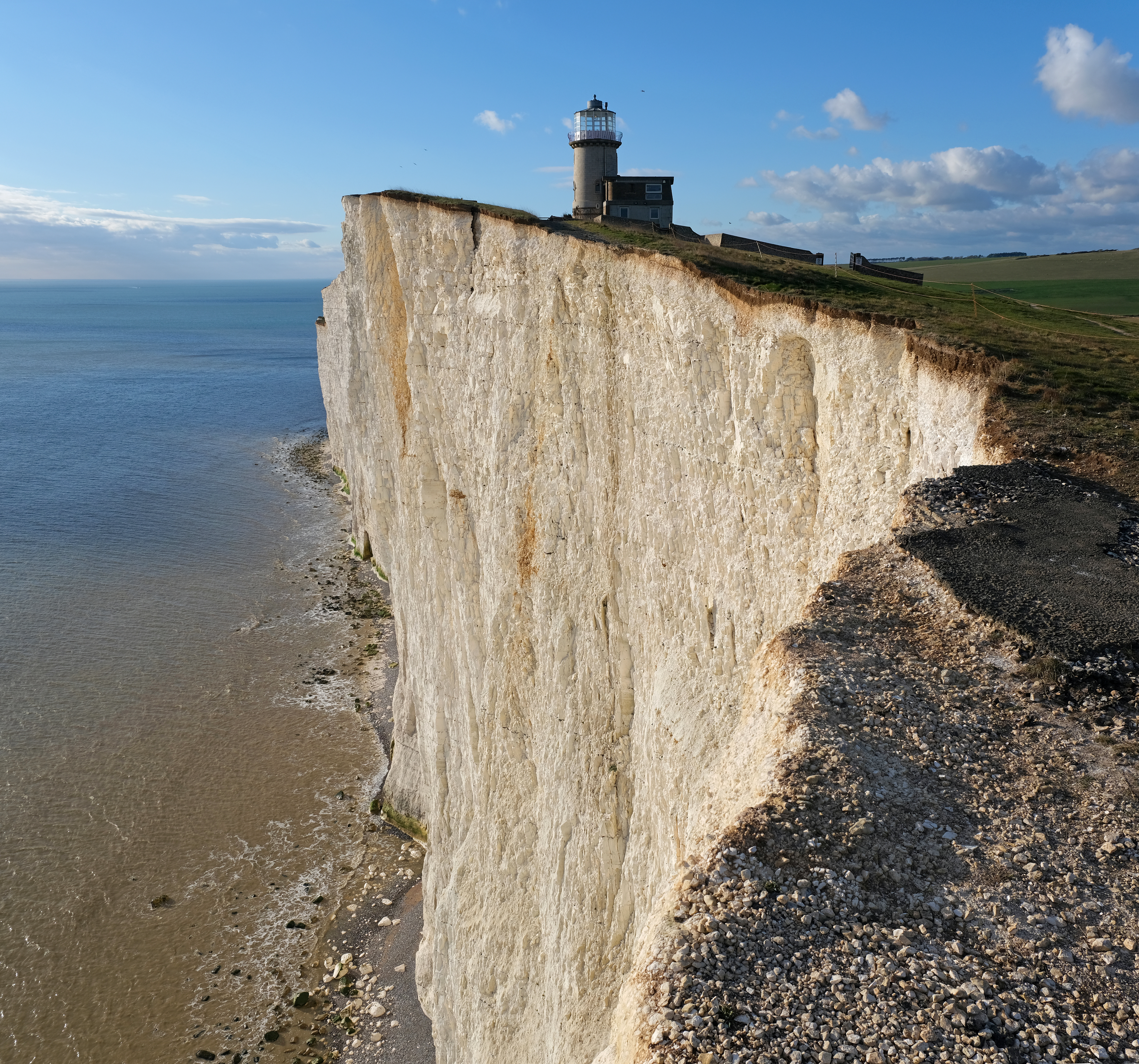
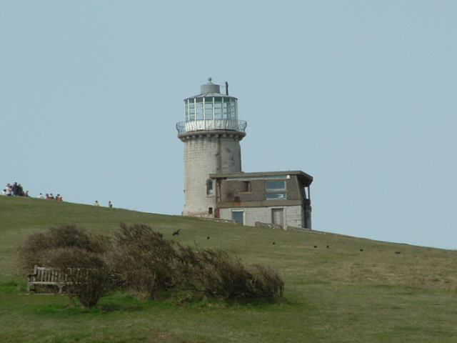
Belle Tout Lighthouse
The Belle Tout Lighthouse (also spelled Belle Toute) is a decommissioned lighthouse and British landmark located at Beachy Head, East Sussex, close to...

East Dean and Friston
East Dean and Friston is a civil parish in the Wealden District of East Sussex, England.The two villages in the parish are in a dry valley on the South...

Seaford to Beachy Head
Seaford to Beachy Head is a 1,108.7-hectare (2,740-acre) biological and geological Site of Special Scientific Interest which stretches from Seaford to...

Action of 2 May 1707
The action of 2 May 1707, also known as Beachy Head, was a naval battle of the War of the Spanish Succession in which a French squadron under Claude de...

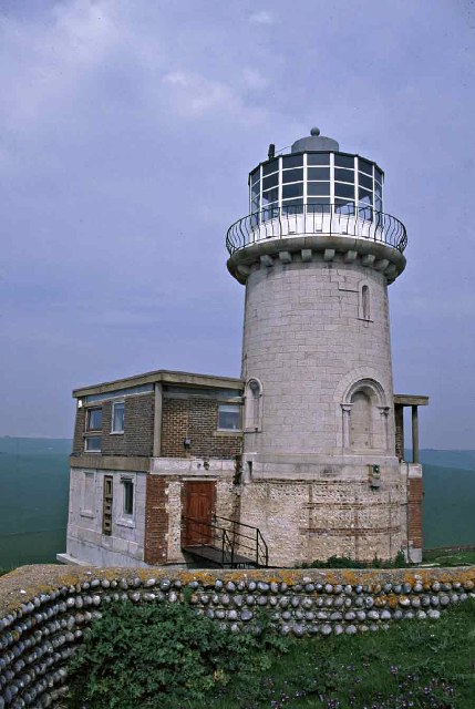
Beachy Head Lighthouse
Beachy Head Lighthouse is a lighthouse located in the English Channel below the cliffs of Beachy Head in East Sussex. It is 33 m (108 ft) in height and...

RAF Friston
Royal Air Force Friston or more simply RAF Friston is a former Royal Air Force satellite station and Emergency Landing Ground located in East Sussex, England...
Nearby Amenities
Located within 500m of 50.74382,0.20097874Have you been to Birling Gap?
Leave your review of Birling Gap below (or comments, questions and feedback).