Wottri

Coastal Feature, Headland, Point in Shetland

Scotland

Wottri

The end of the road at Queyfirth Three tracks continue, two heading to houses.
The end of the road at Queyfirth Credit: Mike Pennington

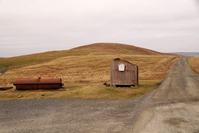
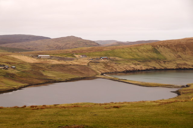
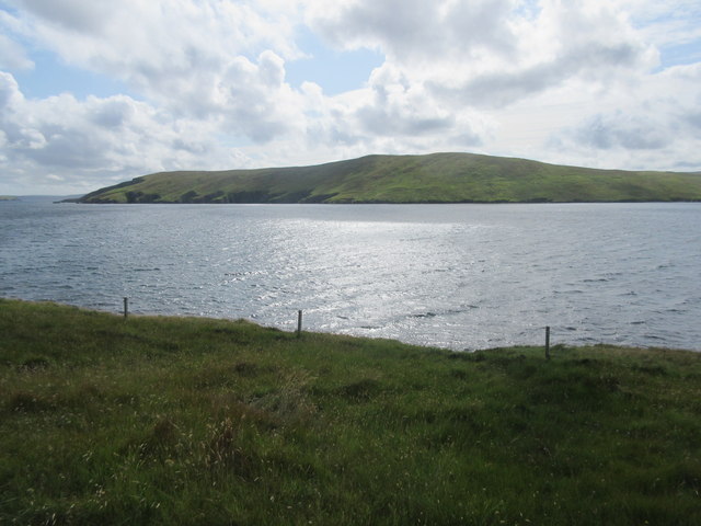
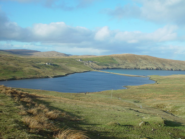
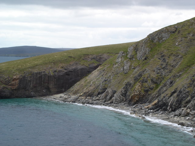
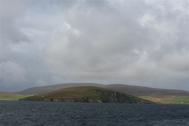
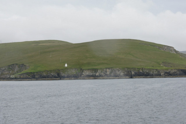
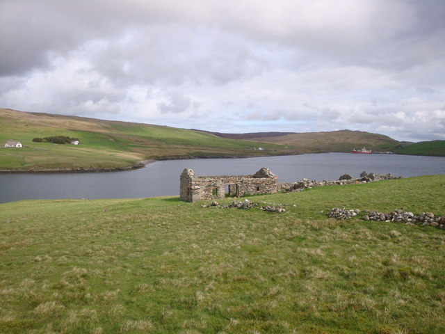
Wottri is a prominent coastal feature located in Shetland, an archipelago in Scotland. It is classified as a headland or point due to its unique geographical characteristics. Situated on the eastern coast of Shetland, Wottri extends into the North Sea, jutting out into the water and creating a distinctive shape that is easily identifiable from both land and sea.

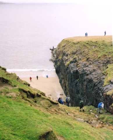
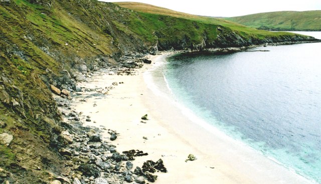
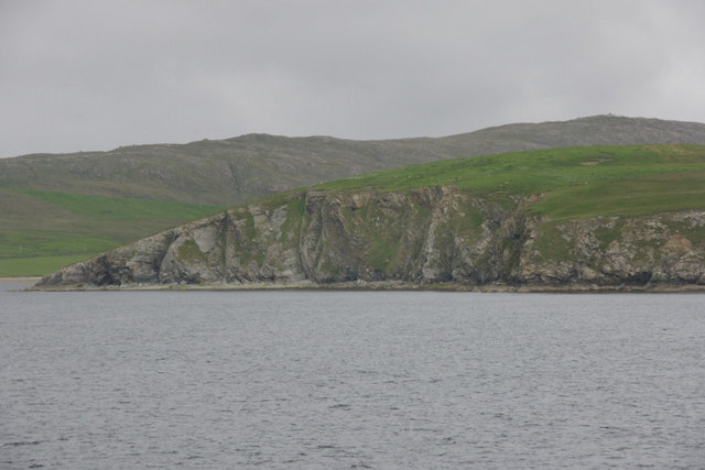
The headland is known for its rugged and rocky terrain, formed by the natural erosion of the coastal cliffs over centuries. The cliffs at Wottri reach impressive heights, providing a dramatic backdrop to the surrounding landscape. The exposed rocks, shaped by the relentless pounding of the waves, add to the charm and character of the area.

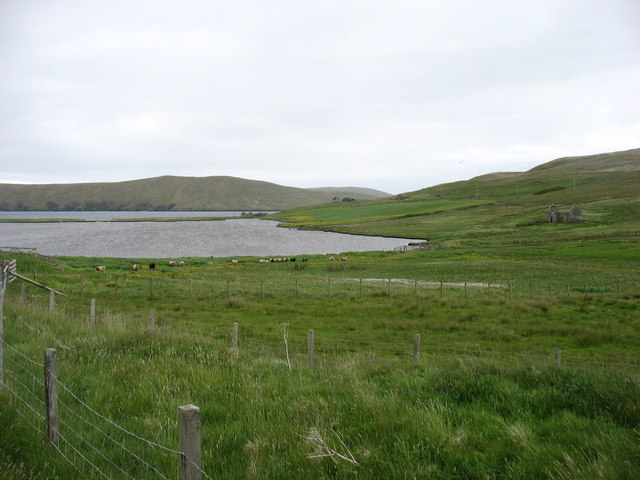
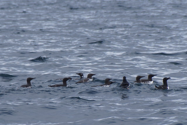
Wottri is also renowned for its rich biodiversity. The headland supports a variety of plant and animal species, making it an important habitat for wildlife. Seabirds, in particular, flock to the cliffs to nest, including puffins, guillemots, and kittiwakes. Visitors can often witness these magnificent creatures soaring through the skies or perched on the cliff edges.

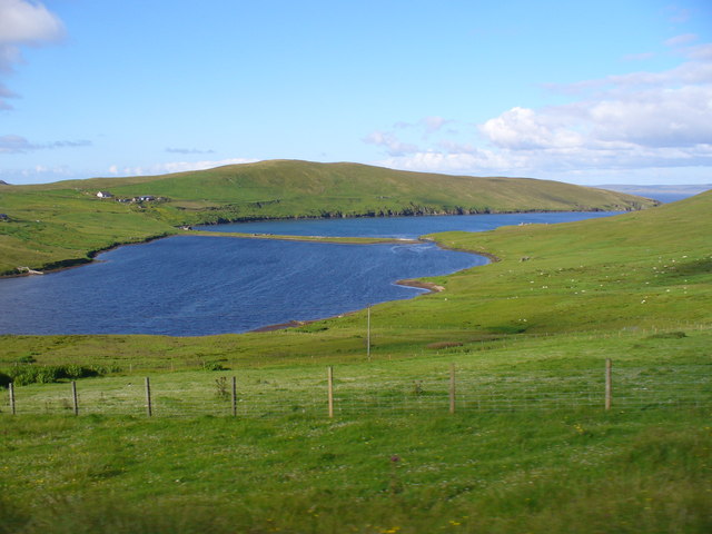
For nature enthusiasts and photographers, Wottri offers stunning panoramic views of the North Sea. The ever-changing colors of the water, ranging from deep blues to vibrant greens, create a mesmerizing sight. The headland is also an excellent vantage point for observing marine life, such as seals and dolphins, which can occasionally be spotted swimming in the surrounding waters.

Wottri, with its striking beauty and diverse ecosystem, serves as a popular attraction for tourists and locals alike. Whether one seeks solitude and tranquility or wants to explore the wonders of Shetland's coastal landscape, Wottri is a must-visit destination.

If you have any feedback on the listing, please let us know in the comments section below.

Wottri Images

Images are sourced within 2km of 60.525087/-1.3242489 or Grid Reference HU3782. Thanks to Geograph Open Source API. All images are credited.

The end of the road at Queyfirth Three tracks continue, two heading to houses.
The end of the road at Queyfirth
Three tracks continue, two heading to houses.
Loch of Queyfirth from Hill of Ollaberry The loch is really an arm of the sea, with an outflow at low tide and the sea encroaching at high tide.
Loch of Queyfirth from Hill of Ollaberry
The loch is really an arm of the sea, with an outflow at low tide and the sea encroaching at high tide.
Housetter and Colla Firth
Auks off Lamba, Yell Sound All Guillemots, apart from one Razorbill on the far right and a Puffin fourth from the right.
Auks off Lamba, Yell Sound
All Guillemots, apart from one Razorbill on the far right and a Puffin fourth from the right.
Colla Firth Looking across Colla Firth, which is just under 1km across so both sides are in the square, to Ness of Queyfirth.
Colla Firth
Looking across Colla Firth, which is just under 1km across so both sides are in the square, to Ness of Queyfirth.
Loch of Queyfirth, Shetland If you take the road from Upper Ollaberry signposted Leon you come over the ridge to the west the Hill of Ollaberry and are greeted with this view of the Loch of Queyfirth and Quey Firth.
Loch of Queyfirth, Shetland
If you take the road from Upper Ollaberry signposted Leon you come over the ridge to the west the Hill of Ollaberry and are greeted with this view of the Loch of Queyfirth and Quey Firth.
Saberstone This spectacular cliff is part of the Walls Boundary Fault, which cuts Shetland from north to south and may be the continuation of the Great Glen Fault in Scotland.
Saberstone
This spectacular cliff is part of the Walls Boundary Fault, which cuts Shetland from north to south and may be the continuation of the Great Glen Fault in Scotland.
Looking towards the Taing of Norwick The Taing is the headland beyond this fine but rather inaccessible beach.
Looking towards the Taing of Norwick
The Taing is the headland beyond this fine but rather inaccessible beach.
Ollaberry Fault An extension of the Great Glen Fault of Scotland, outcropping in Shetland. A must for all geologists.The cliff on the far side is granite; that on the nearside is schist.
Ollaberry Fault
An extension of the Great Glen Fault of Scotland, outcropping in Shetland. A must for all geologists.The cliff on the far side is granite; that on the nearside is schist.
Loch of Queyfirth
Loch of Queyfirth
Neap of skea  with pilot boat inbound
Neap of skea with pilot boat inbound
Back of Ollaberry
Back of Ollaberry
Stream Taing and Wottri, Ness of Queyfirth The white blob is one of many beacons guarding the entrance to Sullom Voe.
Stream Taing and Wottri, Ness of Queyfirth
The white blob is one of many beacons guarding the entrance to Sullom Voe.
Cliffs below Height of Neap, Lochend The Beorgs of Housetter are in the background.
Cliffs below Height of Neap, Lochend
The Beorgs of Housetter are in the background.
Loch of Queyfirth View from the minor road above Leon. In the valley are the loch, an ayre and Quey Firth in the distance. Grassy moorland surrounds the loch.
Loch of Queyfirth
View from the minor road above Leon. In the valley are the loch, an ayre and Quey Firth in the distance. Grassy moorland surrounds the loch.
Abandoned croft house on the Ness of Queyfirth Once a settlement of crofts with access by land or boat, the area is now rough grazing for sheep.
Abandoned croft house on the Ness of Queyfirth
Once a settlement of crofts with access by land or boat, the area is now rough grazing for sheep.
Back Sands Beach Back of Ollaberry & The Walls Boundary Fault.  The scramble from the beach is alongside the rock.
Back Sands Beach
Back of Ollaberry & The Walls Boundary Fault. The scramble from the beach is alongside the rock.
Show me another place!

Wottri is located at Grid Ref: HU3782 (Lat: 60.525087, Lng: -1.3242489)

Unitary Authority: Shetland Islands

Police Authority: Highlands and Islands

What 3 Words

///duplicity.roosters.shining. Near Toft, Shetland Islands

Related Wikis

Lamba, Shetland

Lamba is an uninhabited island in Yell Sound in Shetland. It lies 1.5 km (0.93 mi) north of the entrance to the Sullom Voe inlet and 1.4 kilometres (0...

Ollaberry

Ollaberry (Old Norse: Olafrsberg, meaning Olaf's Hill) is a village on Mainland, Shetland, Scotland on the west shore of Yell Sound, 10.9 miles (17.5 km...

Voe, Northmavine

Voe is a settlement on the Northmavine peninsula of Mainland, Shetland, Scotland. It is at the head of Ronas Voe and just off the A970 road. == Whaling... ==

Little Roe

Little Roe is an island in Yell Sound in the Shetland Islands == History == The island's name is Norse in origin, from Rauðey Litla, meaning "small red...

Little Holm, Yell Sound

Little Holm is a small island in Yell Sound, in Shetland, Scotland. It lies between Northmavine and the island of Yell. There is a lighthouse here. In...

Northmavine

Northmavine or Northmaven (Old Norse: Norðan Mæfeið, meaning ‘the land north of the Mavis Grind’) is a peninsula in northwest Mainland Shetland in Scotland...

Brother Isle

Brother Isle (Old Norse: breiðare øy meaning broad beach island) is a small, uninhabited island in Shetland, Scotland. It lies between the islands of Yell...

Eela Water

Eela Water is a freshwater loch (lake) in Northmavine, part of the mainland of Shetland in Scotland. Besides being a freshwater fishing location, the site...

Nearby Amenities

Located within 500m of 60.525087,-1.3242489
Seamark Light 1 Character: Oc
Seamark Light 1 Colour: white
Seamark Light 1 Height: 22
Seamark Light 1 Period: 6
Seamark Light 1 Range: 12
Seamark Light 1 Sector End: 290
Seamark Light 1 Sector Start: 150
Seamark Light 1 Sequence: 4+(2)
Seamark Light 2 Character: Oc
Seamark Light 2 Colour: green
Seamark Light 2 Height: 22
Seamark Light 2 Period: 6
Seamark Light 2 Range: 8
Seamark Light 2 Sector End: 327
Seamark Light 2 Sector Start: 290
Seamark Light 2 Sequence: 4+(2)
Seamark Light 3 Character: Oc
Seamark Light 3 Colour: white
Seamark Light 3 Height: 22
Seamark Light 3 Period: 6
Seamark Light 3 Range: 12
Seamark Light 3 Sector End: 334
Seamark Light 3 Sector Start: 327
Seamark Light 3 Sequence: 4+(2)
Seamark Light 4 Character: Oc
Seamark Light 4 Colour: red
Seamark Light 4 Height: 22
Seamark Light 4 Period: 6
Seamark Light 4 Range: 8
Seamark Light 4 Sector End: 80
Seamark Light 4 Sector Start: 334
Seamark Light 4 Sequence: 4+(2)
Seamark Light Reference: A 3820.5
Seamark Name: Quey Firth
Seamark Type: light_major
Source: US NGA Pub. 114. 2011-05-26.
Lat/Long: 60.5240372/-1.3259835
The data included in this document is from www.openstreetmap.org. The data is made available under ODbL.

Have you been to Wottri?

Leave your review of Wottri below (or comments, questions and feedback).