Silli Geo

Coastal Feature, Headland, Point in Shetland

Scotland

Silli Geo

Loose Head, St Ninian's Isle, from the air
Loose Head, St Ninian's Isle, from the air Credit: Mike Pennington

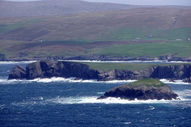
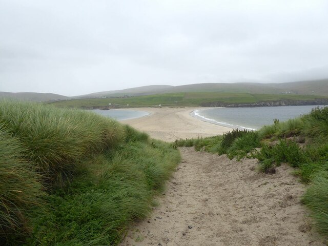
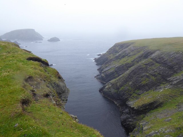
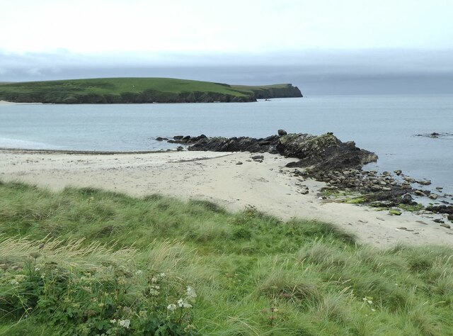
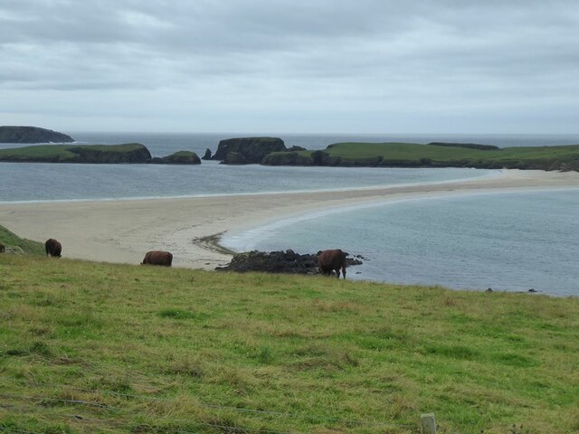
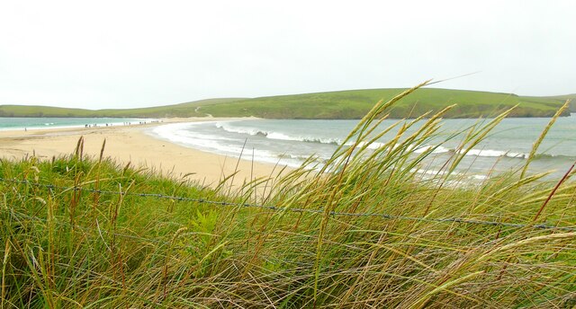
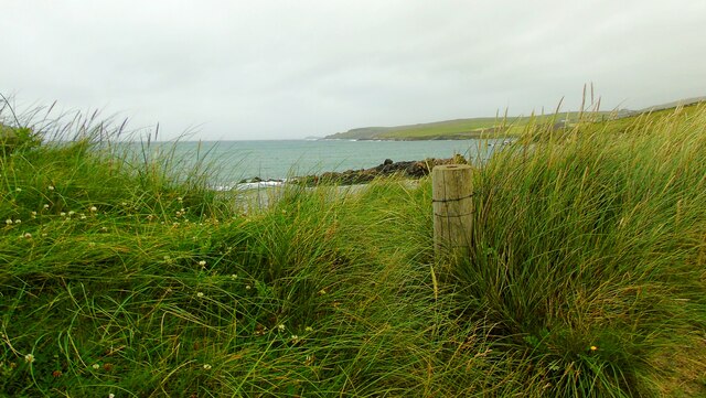
Silli Geo is a coastal feature located in the Shetland Islands, off the northeastern coast of Scotland. It is a prominent headland that juts out into the North Sea, forming a distinct point along the rugged coastline. The name "Silli Geo" is derived from the Old Norse language and translates to "seal inlet," which is fitting as the area is known for its diverse wildlife, including seals.

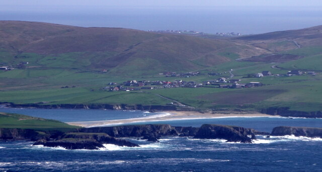
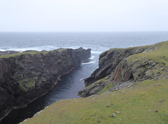
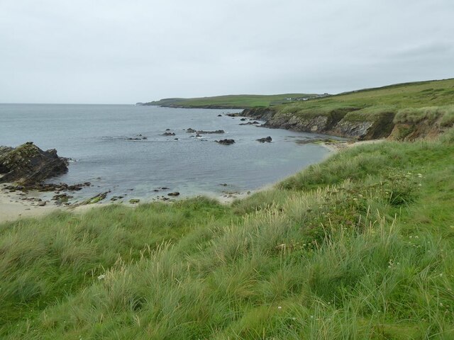
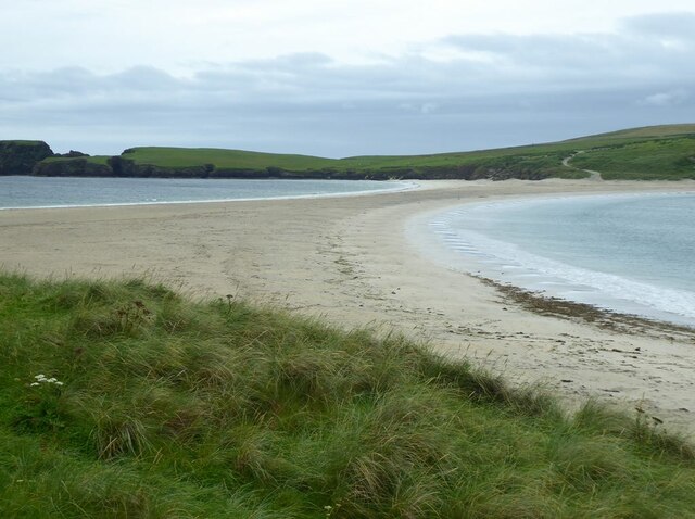
Situated in an area of natural beauty, Silli Geo boasts stunning panoramic views of the surrounding seascape. The headland is characterized by its towering cliffs, which are formed from layers of sedimentary rock that have been eroded by the relentless forces of wind and waves over time. These cliffs provide a nesting site for various seabirds, such as puffins and gannets, making it a popular spot for birdwatching enthusiasts.

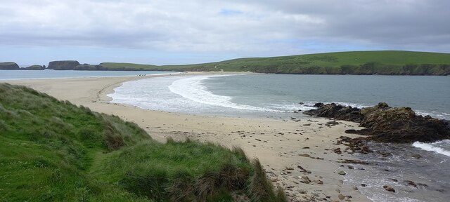
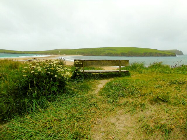
Access to Silli Geo is relatively easy, with a well-maintained footpath leading visitors from the nearby village to the headland. Along the way, hikers can enjoy the picturesque coastal scenery, with opportunities to spot other wildlife species, including otters and dolphins. The path culminates at the tip of the headland, where visitors can take in breathtaking views of the open sea and the surrounding rugged coastline.

Silli Geo offers a tranquil and scenic escape, allowing visitors to immerse themselves in the raw beauty of the Shetland Islands' coastal landscape. Whether it's for a peaceful walk, birdwatching, or simply taking in the natural wonders, this coastal feature is a must-visit for nature enthusiasts and those seeking a connection with the untamed beauty of the Scottish coastline.

If you have any feedback on the listing, please let us know in the comments section below.

Silli Geo Images

Images are sourced within 2km of 59.980529/-1.3362866 or Grid Reference HU3721. Thanks to Geograph Open Source API. All images are credited.

Loose Head, St Ninian's Isle, from the air
Hich Holm, St Ninian's Isle, from the air
St Ninian's Ayre from the air
St Ninian's Ayre
St Ninian's Ayre
St Ninian's Ayre
St Ninian's Ayre
Inlet on the south-west corner of St Ninian's Isle Channel separating Sweyn Holm (to the left) from St Ninian's Isle.
Inlet on the south-west corner of St Ninian's Isle
Channel separating Sweyn Holm (to the left) from St Ninian's Isle.
Track on St Ninian's Isle Leading down to the tombolo which ties the island to the mainland.
Track on St Ninian's Isle
Leading down to the tombolo which ties the island to the mainland.
Ruins of St Ninian's Chapel In the middle distance, the tombolo which ties St Ninian's Isle to the mainland.
Ruins of St Ninian's Chapel
In the middle distance, the tombolo which ties St Ninian's Isle to the mainland.
Inlet on the west coast of St Ninian's Isle Out to sea is the island of Hich Holm <a href="https://www.geograph.org.uk/gridref/HU3521">HU3521</a> and to the right, Fora Stack.
Inlet on the west coast of St Ninian's Isle
Out to sea is the island of Hich Holm HU3521 and to the right, Fora Stack.
Rocky shore at Bigton
Tombolo linking Mainland to St Ninian's Isle A textbook example of a tombolo. Bigton Wick to the right, St Ninian's Bay to the left.
Tombolo linking Mainland to St Ninian's Isle
A textbook example of a tombolo. Bigton Wick to the right, St Ninian's Bay to the left.
Bigton Wick Looking across the bay to St Ninian's Isle.
Bigton Wick
Looking across the bay to St Ninian's Isle.
View from Bigton Looking over the tombolo towards St Ninian's Bay and the southern end of St Ninian's Isle.
View from Bigton
Looking over the tombolo towards St Ninian's Bay and the southern end of St Ninian's Isle.
View north from Bigton Ireland Wick and the hamlet of Ireland on the far hillside.
View north from Bigton
Ireland Wick and the hamlet of Ireland on the far hillside.
Tombolo at St Ninian's Isle Taken on St Ninian's beach at Bigton, Shetland, I am looking along the tombolo linking the mainland to St Ninian's Isle, site of the remains of St Ninian's Chapel.
Tombolo at St Ninian's Isle
Taken on St Ninian's beach at Bigton, Shetland, I am looking along the tombolo linking the mainland to St Ninian's Isle, site of the remains of St Ninian's Chapel.
St Ninian's Bay I am standing at the mainland end of the tombolo leading to St Ninian's Isle and looking south down St Ninian's Bay towards Inns Holm with Colsay off to the right. Northern Ness, Fora Ness and Noss Hill can be gilmpsed in the clouded distance.
St Ninian's Bay
I am standing at the mainland end of the tombolo leading to St Ninian's Isle and looking south down St Ninian's Bay towards Inns Holm with Colsay off to the right. Northern Ness, Fora Ness and Noss Hill can be gilmpsed in the clouded distance.
St Ninian's Isle I am just above the beach at Bigton Wick and looking across to the north end of St Ninian's Isle where the ruins of St Ninian's Chapel are to be found. The cliffs of Scarfi Taing are discernible to the right.
St Ninian's Isle
I am just above the beach at Bigton Wick and looking across to the north end of St Ninian's Isle where the ruins of St Ninian's Chapel are to be found. The cliffs of Scarfi Taing are discernible to the right.
Ireland Wick to Griskerry I am on St Ninian's beach, Bigton, Shetland, and looking north west along the coast past the Wick of Ireland (and the settlement of Ireland behind it) towards Griskerry, the summit of which can be glimpsed on the horizon (centre of shot).
Ireland Wick to Griskerry
I am on St Ninian's beach, Bigton, Shetland, and looking north west along the coast past the Wick of Ireland (and the settlement of Ireland behind it) towards Griskerry, the summit of which can be glimpsed on the horizon (centre of shot).
Show me another place!

Silli Geo is located at Grid Ref: HU3721 (Lat: 59.980529, Lng: -1.3362866)

Unitary Authority: Shetland Islands

Police Authority: Highlands and Islands

What 3 Words

///initiated.plotter.exotic. Near Sandwick, Shetland Islands

Related Wikis

Bigton

Bigton is a small settlement on South Mainland, Shetland, UK. Bigton is within the civil parish of Dunrossness.Bigton lies on the Atlantic coast of the...

St Ninian's Isle

St Ninian's Isle is a small tied island connected by the largest tombolo in the UK to the south-western coast of the Mainland, Shetland, in Scotland. It...

Colsay

Colsay is an uninhabited island off the South West coast of Mainland, Shetland. Fora Ness lies to the south, across the Muckle Sound. The highest elevation...

Levenwick

Levenwick is a small village about 17 miles (27 km) south of Lerwick, on the east side of the South Mainland of Shetland, Scotland. It is part of the parish...

Scousburgh

Scousburgh is a small community in the parish of Dunrossness, in the South Mainland of Shetland, Scotland, overlooking the picturesque Scousburgh Sand...

Little Havra

Little Havra is a small island off the west of South Mainland in Shetland. It is 35 metres (115 ft) at its highest point, upon which there is a cairn....

Hoswick

Hoswick is a settlement in Sandwick in the south mainland of Shetland, Scotland, on the eastern part of the Dunrossness civil parish. It is separated from...

Clumlie Broch

Clumlie Broch is an Iron Age broch located on Mainland, Shetland, in Scotland (grid reference HU40451811). == Location == Clumlie Broch is located in Dunrossness...

Nearby Amenities

Located within 500m of 59.980529,-1.3362866
Ireland Wick
Natural: bay
Lat/Long: 59.9769411/-1.3314271
The data included in this document is from www.openstreetmap.org. The data is made available under ODbL.

Have you been to Silli Geo?

Leave your review of Silli Geo below (or comments, questions and feedback).