The Tongues

Coastal Feature, Headland, Point in Shetland

Scotland

The Tongues

Loose Head, St Ninian's Isle, from the air
Loose Head, St Ninian's Isle, from the air Credit: Mike Pennington

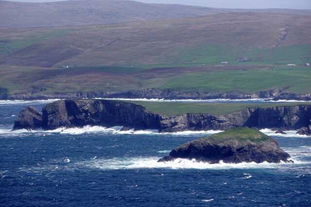
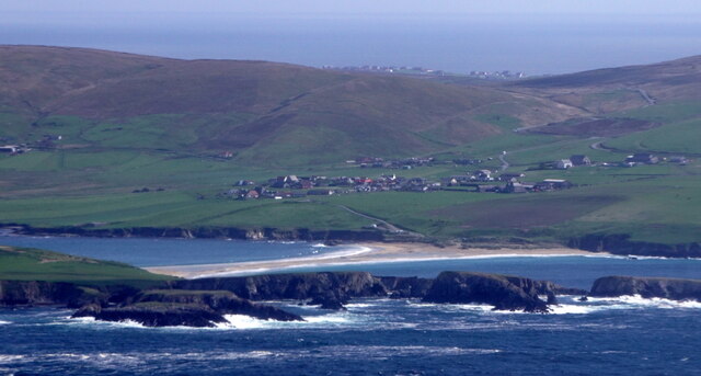
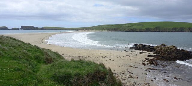
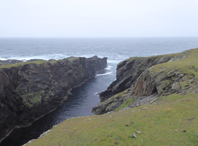
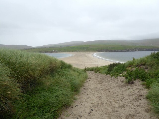
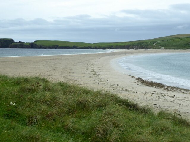
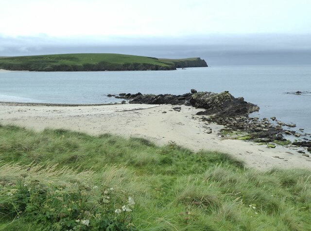
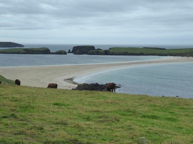
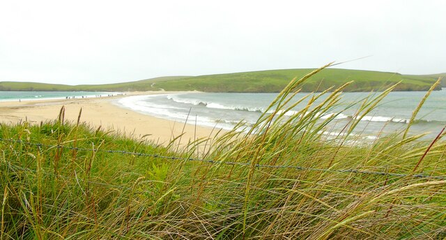
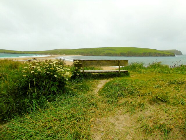
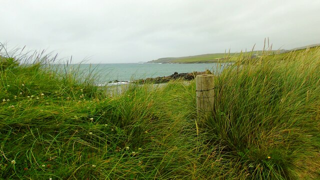
The Tongues is a prominent coastal feature located on the Shetland Islands in Scotland. It is specifically situated on the west coast of the main island, known as Mainland. The Tongues is classified as a headland or a point, jutting out into the North Atlantic Ocean.

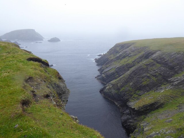
This coastal feature is characterized by its rugged and dramatic cliffs, which reach heights of up to 100 meters. The sheer cliffs are composed of basalt rock formations, formed by volcanic activity millions of years ago. The Tongues offers stunning panoramic views of the surrounding ocean, making it a popular spot for nature enthusiasts and photographers.

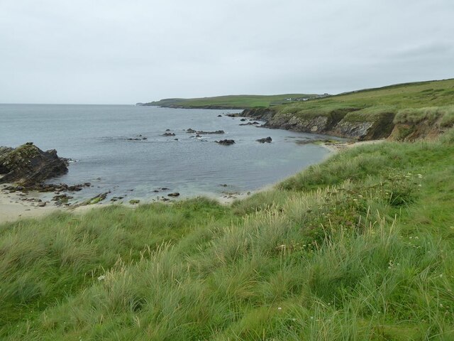
The coastline surrounding The Tongues is known for its rich biodiversity. The area is home to a variety of seabirds, including puffins, fulmars, and kittiwakes, which nest in the cliffs during the breeding season. Visitors to The Tongues may also spot seals and dolphins swimming in the waters below.

Access to The Tongues is relatively easy, with a well-maintained footpath leading to the headland. The trail offers a picturesque walk along the coastline, allowing visitors to appreciate the natural beauty of the area. However, caution should be exercised near the cliff edges, as they can be hazardous, especially during inclement weather.

Overall, The Tongues is a stunning coastal feature on the Shetland Islands, offering breathtaking views, diverse wildlife, and a chance to experience the raw power of the North Atlantic Ocean. It is a must-visit destination for anyone exploring the natural wonders of Scotland's coastline.

If you have any feedback on the listing, please let us know in the comments section below.

The Tongues Images

Images are sourced within 2km of 59.975091/-1.3315405 or Grid Reference HU3721. Thanks to Geograph Open Source API. All images are credited.

Loose Head, St Ninian's Isle, from the air
Hich Holm, St Ninian's Isle, from the air
St Ninian's Ayre from the air
St Ninian's Ayre
St Ninian's Ayre
St Ninian's Ayre
St Ninian's Ayre
Inlet on the south-west corner of St Ninian's Isle Channel separating Sweyn Holm (to the left) from St Ninian's Isle.
Inlet on the south-west corner of St Ninian's Isle
Channel separating Sweyn Holm (to the left) from St Ninian's Isle.
Track on St Ninian's Isle Leading down to the tombolo which ties the island to the mainland.
Track on St Ninian's Isle
Leading down to the tombolo which ties the island to the mainland.
Ruins of St Ninian's Chapel In the middle distance, the tombolo which ties St Ninian's Isle to the mainland.
Ruins of St Ninian's Chapel
In the middle distance, the tombolo which ties St Ninian's Isle to the mainland.
Inlet on the west coast of St Ninian's Isle Out to sea is the island of Hich Holm <a href="https://www.geograph.org.uk/gridref/HU3521">HU3521</a> and to the right, Fora Stack.
Inlet on the west coast of St Ninian's Isle
Out to sea is the island of Hich Holm HU3521 and to the right, Fora Stack.
Rocky shore at Bigton
Tombolo linking Mainland to St Ninian's Isle A textbook example of a tombolo. Bigton Wick to the right, St Ninian's Bay to the left.
Tombolo linking Mainland to St Ninian's Isle
A textbook example of a tombolo. Bigton Wick to the right, St Ninian's Bay to the left.
Bigton Wick Looking across the bay to St Ninian's Isle.
Bigton Wick
Looking across the bay to St Ninian's Isle.
View from Bigton Looking over the tombolo towards St Ninian's Bay and the southern end of St Ninian's Isle.
View from Bigton
Looking over the tombolo towards St Ninian's Bay and the southern end of St Ninian's Isle.
View north from Bigton Ireland Wick and the hamlet of Ireland on the far hillside.
View north from Bigton
Ireland Wick and the hamlet of Ireland on the far hillside.
Tombolo at St Ninian's Isle Taken on St Ninian's beach at Bigton, Shetland, I am looking along the tombolo linking the mainland to St Ninian's Isle, site of the remains of St Ninian's Chapel.
Tombolo at St Ninian's Isle
Taken on St Ninian's beach at Bigton, Shetland, I am looking along the tombolo linking the mainland to St Ninian's Isle, site of the remains of St Ninian's Chapel.
St Ninian's Bay I am standing at the mainland end of the tombolo leading to St Ninian's Isle and looking south down St Ninian's Bay towards Inns Holm with Colsay off to the right. Northern Ness, Fora Ness and Noss Hill can be gilmpsed in the clouded distance.
St Ninian's Bay
I am standing at the mainland end of the tombolo leading to St Ninian's Isle and looking south down St Ninian's Bay towards Inns Holm with Colsay off to the right. Northern Ness, Fora Ness and Noss Hill can be gilmpsed in the clouded distance.
St Ninian's Isle I am just above the beach at Bigton Wick and looking across to the north end of St Ninian's Isle where the ruins of St Ninian's Chapel are to be found. The cliffs of Scarfi Taing are discernible to the right.
St Ninian's Isle
I am just above the beach at Bigton Wick and looking across to the north end of St Ninian's Isle where the ruins of St Ninian's Chapel are to be found. The cliffs of Scarfi Taing are discernible to the right.
Ireland Wick to Griskerry I am on St Ninian's beach, Bigton, Shetland, and looking north west along the coast past the Wick of Ireland (and the settlement of Ireland behind it) towards Griskerry, the summit of which can be glimpsed on the horizon (centre of shot).
Ireland Wick to Griskerry
I am on St Ninian's beach, Bigton, Shetland, and looking north west along the coast past the Wick of Ireland (and the settlement of Ireland behind it) towards Griskerry, the summit of which can be glimpsed on the horizon (centre of shot).
Show me another place!

The Tongues is located at Grid Ref: HU3721 (Lat: 59.975091, Lng: -1.3315405)

Unitary Authority: Shetland Islands

Police Authority: Highlands and Islands

What 3 Words

///eventful.chase.punctual. Near Sandwick, Shetland Islands

Related Wikis

Bigton

Bigton is a small settlement on South Mainland, Shetland, UK. Bigton is within the civil parish of Dunrossness.Bigton lies on the Atlantic coast of the...

St Ninian's Isle

St Ninian's Isle is a small tied island connected by the largest tombolo in the UK to the south-western coast of the Mainland, Shetland, in Scotland. It...

Colsay

Colsay is an uninhabited island off the South West coast of Mainland, Shetland. Fora Ness lies to the south, across the Muckle Sound. The highest elevation...

Levenwick

Levenwick is a small village about 17 miles (27 km) south of Lerwick, on the east side of the South Mainland of Shetland, Scotland. It is part of the parish...

Scousburgh

Scousburgh is a small community in the parish of Dunrossness, in the South Mainland of Shetland, Scotland, overlooking the picturesque Scousburgh Sand...

Dunrossness

Dunrossness, (Old Norse: Dynrastarnes meaning "headland of the loud tide-race", referring to the noise of Sumburgh Roost) is the southernmost parish of...

Clumlie Broch

Clumlie Broch is an Iron Age broch located on Mainland, Shetland, in Scotland (grid reference HU40451811). == Location == Clumlie Broch is located in Dunrossness...

Lochs of Spiggie and Brow

The Lochs of Spiggie and Brow are located west of Boddam in the parish of Dunrossness, in the South Mainland of Shetland, Scotland, about 6 km north of...

Nearby Amenities

Located within 500m of 59.975091,-1.3315405
Post Box
Brand: Royal Mail
Brand Wikidata: Q638098
Operator: Royal Mail
Operator Wikidata: Q638098
Post Box Type: lamp
Ref: ZE2 22
Royal Cypher: scottish_crown
Lat/Long: 59.9730517/-1.3239215
Barrier: cattle_grid
Lat/Long: 59.9730488/-1.3279024
Barrier: cattle_grid
Lat/Long: 59.972928/-1.327999
Recycling
Lat/Long: 59.9730477/-1.3235856
Bigton Community Shop
Addr City: Shetland
Addr Postcode: ZE2 9JA
Addr Village: Bigton
Fhrs Id: 395945
Shop: convenience
Lat/Long: 59.9731242/-1.3238109
Toilets
Lat/Long: 59.9729417/-1.3237492
Bench
Lat/Long: 59.9713793/-1.3304091
Tourism: information
Lat/Long: 59.9712853/-1.3305084
Waste Basket
Lat/Long: 59.971084/-1.3307551
Tourism: guest_house
Lat/Long: 59.97472/-1.324055
Ireland Wick
Natural: bay
Lat/Long: 59.9769411/-1.3314271
Bigton Wick
Natural: bay
Lat/Long: 59.9727859/-1.3360834
Telephone
Booth: K6
Covered: booth
Lat/Long: 59.9734856/-1.3236843
Defibrillator
Defibrillator Location: outside Bigton Community Shop - down right hand side
Emergency: defibrillator
Indoor: no
Lat/Long: 59.9731071/-1.3236877
The data included in this document is from www.openstreetmap.org. The data is made available under ODbL.

Have you been to The Tongues?

Leave your review of The Tongues below (or comments, questions and feedback).