Steina

Coastal Feature, Headland, Point in Shetland

Scotland

Steina

Fugla Stack, Burra, from the air
Fugla Stack, Burra, from the air Credit: Mike Pennington

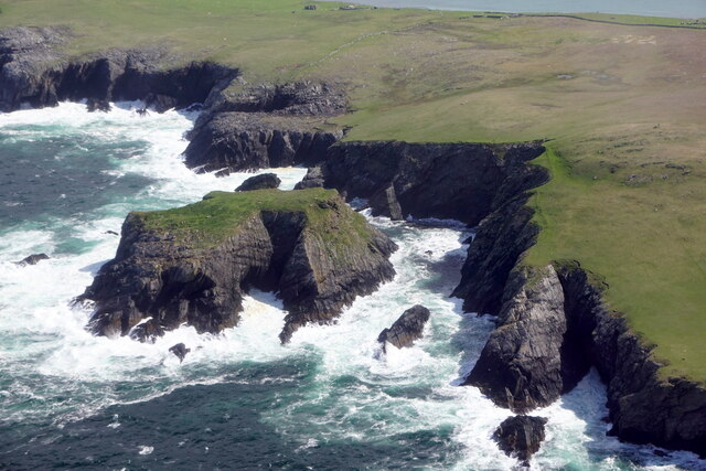
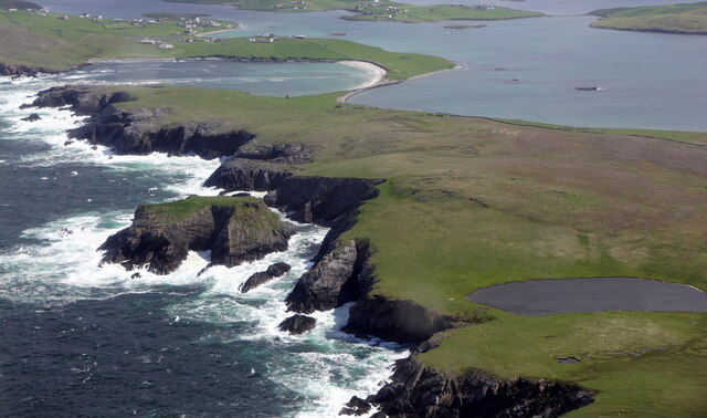
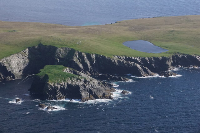
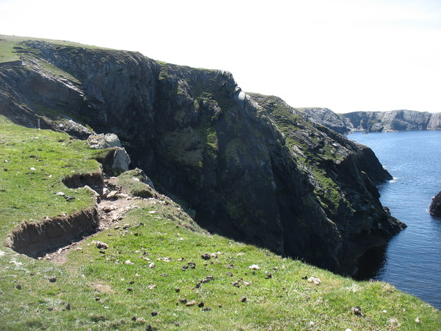
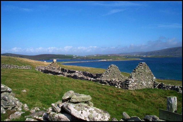
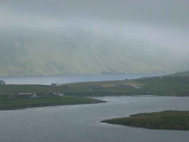
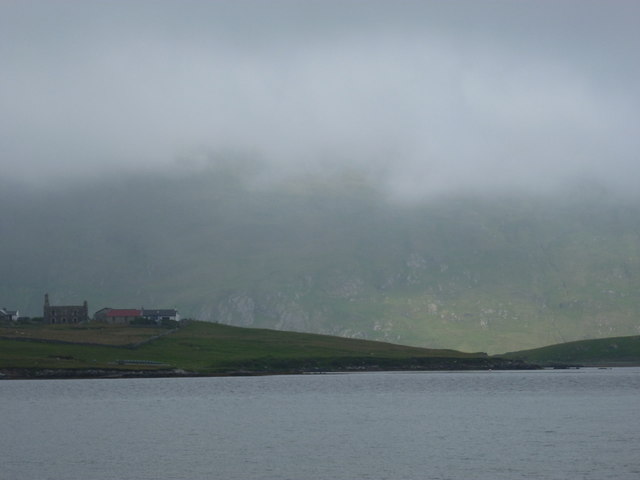
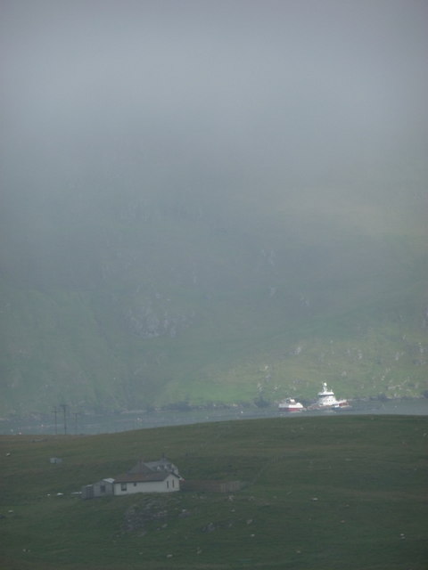
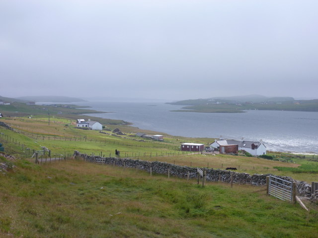
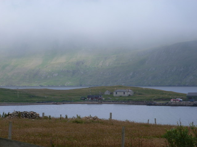
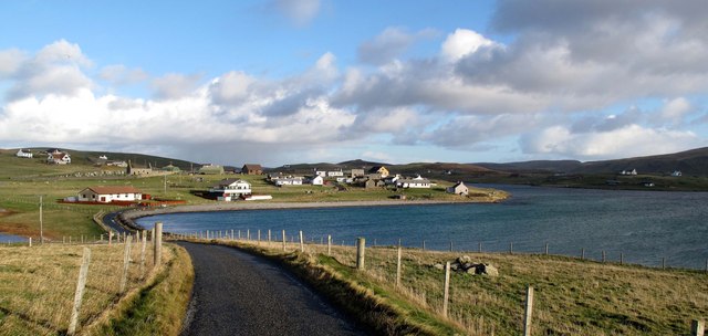
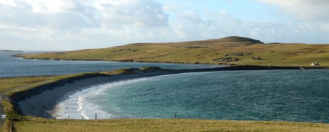
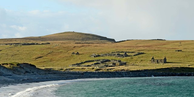
Steina is a prominent coastal feature located in the region of Shetland, which is an archipelago in Scotland. Specifically, Steina is a headland that juts out into the North Sea, forming a distinctive point along the coastline. It is situated on the eastern coast of the main island, known as Mainland Shetland.

This headland is characterized by its rugged and rocky terrain, with steep cliffs that provide breathtaking views of the surrounding sea and landscape. The cliffs are composed of sedimentary rock formations, displaying layers of different colors and textures. The height of the cliffs varies, reaching up to around 100 meters at certain points.

Steina offers a diverse range of flora and fauna, showcasing the unique ecosystem of the Shetland Islands. Various seabirds, such as puffins, fulmars, and kittiwakes, can be spotted nesting on the cliffs during the breeding season. The waters around Steina are also home to a rich marine life, including seals and various species of fish.

Due to its exposed location on the North Sea, Steina is often subject to strong winds and turbulent waves, making it a popular spot for surfing and other water sports. However, caution is always advised due to the unpredictable nature of the sea.

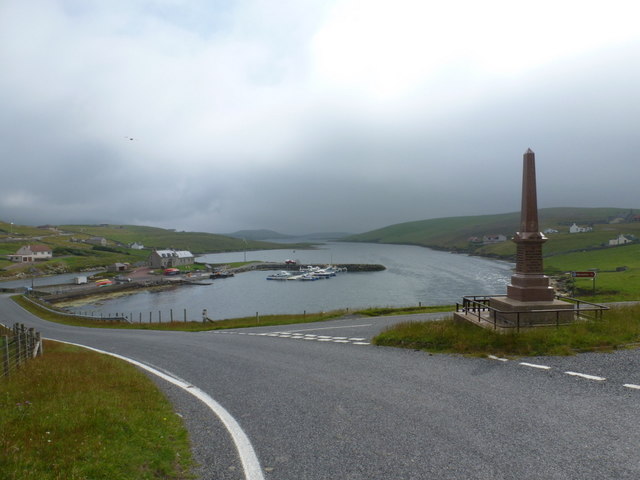
Steina is a popular destination for nature enthusiasts, hikers, and photographers, who are drawn to its dramatic coastal scenery and abundant wildlife. Its location on the eastern coast of Mainland Shetland also makes it easily accessible by road, allowing visitors to explore and appreciate its natural beauty.

If you have any feedback on the listing, please let us know in the comments section below.

Steina Images

Images are sourced within 2km of 60.067499/-1.3537458 or Grid Reference HU3631. Thanks to Geograph Open Source API. All images are credited.

Fugla Stack, Burra, from the air
Sound of Fuglastack, Burra, from the air
Fugla Stack, Kettla Ness, West Burra, from the air Virda Vatn in the background.
Fugla Stack, Kettla Ness, West Burra, from the air
Virda Vatn in the background.
Cliffs on the west side of Kettla Ness It looks as though there will soon be another landslide on this dramatic coast.
Cliffs on the west side of Kettla Ness
It looks as though there will soon be another landslide on this dramatic coast.
At Gossigarth on Kettla Ness Looking towards Banna Minn and Duncansclett.
At Gossigarth on Kettla Ness
Looking towards Banna Minn and Duncansclett.
Derelict Croft The ruins of the croft at Gossigarth with Banna Minn showing behind
Derelict Croft
The ruins of the croft at Gossigarth with Banna Minn showing behind
West Burra: overlooking Bridge End A fine view past the war memorial and down South Voe, the marina nestling below.
West Burra: overlooking Bridge End
A fine view past the war memorial and down South Voe, the marina nestling below.
East Burra: Houss from West Burra Looking across South Voe towards the scattered dwellings of Houss with the mighty slopes of Shetland's south mainland on the far side of Clift Sound beyond.
East Burra: Houss from West Burra
Looking across South Voe towards the scattered dwellings of Houss with the mighty slopes of Shetland's south mainland on the far side of Clift Sound beyond.
Houss: view from Papil Looking across the water separating West Burra (our side) from East Burra, on which we see a few of the buildings, one of them ruined, in the hamlet of Houss. Immediately to the south (right) of these is the narrow strip of land connecting Houss Ness to the 'main' part of East Burra. The Clift Hills, on the mainland, are the backdrop, shrouded in cloud.
Houss: view from Papil
Looking across the water separating West Burra (our side) from East Burra, on which we see a few of the buildings, one of them ruined, in the hamlet of Houss. Immediately to the south (right) of these is the narrow strip of land connecting Houss Ness to the 'main' part of East Burra. The Clift Hills, on the mainland, are the backdrop, shrouded in cloud.
Houss: a house with a dramatic backdrop Looking across to a Houss house, as it were, from West Burra. I haven't been able to exactly locate the house on the map but it's somewhere hereabouts. In the background, a couple of vessels, below the cliffs of the Clift Hills, are catching a very rare bit of sun today - the rarity of the fine weather hinted at by the low mist towards the top of the hills.
Houss: a house with a dramatic backdrop
Looking across to a Houss house, as it were, from West Burra. I haven't been able to exactly locate the house on the map but it's somewhere hereabouts. In the background, a couple of vessels, below the cliffs of the Clift Hills, are catching a very rare bit of sun today - the rarity of the fine weather hinted at by the low mist towards the top of the hills.
East Burra: view down South Voe Looking down South Voe, the long inlet separating the islands of East Burra and West Burra.
East Burra: view down South Voe
Looking down South Voe, the long inlet separating the islands of East Burra and West Burra.
East Burra: across Voe of North House Looking across this small bay, towards a house with coastal outlooks both front and back - Clift Sound is beyond, with the Clift Hills on the Shetland mainland rising into the mist.
East Burra: across Voe of North House
Looking across this small bay, towards a house with coastal outlooks both front and back - Clift Sound is beyond, with the Clift Hills on the Shetland mainland rising into the mist.
Papil, West Burra
Papil, West Burra
Tombolo at Banna Minn
Bridge End South Voe in the foreground, Lang Sound beyond.
Bridge End
South Voe in the foreground, Lang Sound beyond.
Abandoned crofts at Minn
Newton and North Ho Abandoned croft to left of picture.  Newer dispersed settlement.
Newton and North Ho
Abandoned croft to left of picture. Newer dispersed settlement.
Coastline on the west side of West Burra
Show me another place!

Steina is located at Grid Ref: HU3631 (Lat: 60.067499, Lng: -1.3537458)

Unitary Authority: Shetland Islands

Police Authority: Highlands and Islands

What 3 Words

///member.roses.clarifies. Near Scalloway, Shetland Islands

Related Wikis

West Burra

West Burra is one of the Scalloway Islands, a subgroup of the Shetland Islands in Scotland. It is connected by bridge to East Burra. With an area of 743...

Burra, Shetland

Burra (Old Norse: Barrey ) is the collective name for two of the Shetland Islands, West (pop. 753) and East Burra (pop. 66), which are connected by bridge...

Scalloway Islands

The Scalloway Islands are in Shetland opposite Scalloway on south west of the Mainland. They form a mini-archipelago and include: Burra (two islands linked...

East Burra

East Burra (Scots: East Burra; Old Norse: "Barrey") is one of the Scalloway Islands, a subgroup of the Shetland Islands in Scotland. It is connected by...

South Havra

South Havra (Scots: Sooth Haevra; Old Norse: Hafrey), formerly Hevera, is an uninhabited island in the Scalloway Islands, Shetland, Scotland. == Geography... ==

South Mainland

The South Mainland of the Shetland Islands is the southern peninsula of Mainland island. It lies south of Hellister (60° 14′N). The greater southern part...

Little Havra

Little Havra is a small island off the west of South Mainland in Shetland. It is 35 metres (115 ft) at its highest point, upon which there is a cairn....

Oxna

Oxna is one of the Scalloway Islands, lying north west of Burra in Shetland, Scotland. Oxna has an area of 68 hectares (170 acres). The island has been...

Have you been to Steina?

Leave your review of Steina below (or comments, questions and feedback).