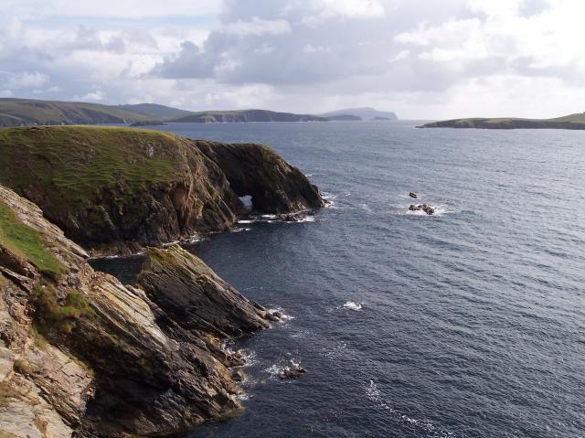
Ruff Loch

Lake, Pool, Pond, Freshwater Marsh in Shetland

Scotland

Ruff Loch
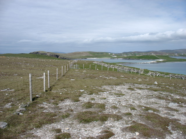
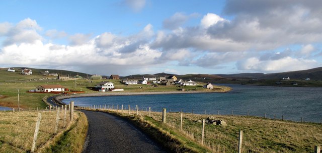
At Gossigarth on Kettla Ness Looking towards Banna Minn and Duncansclett.
At Gossigarth on Kettla Ness Credit: David Purchase

Ruff Loch, located in the Shetland Islands of Scotland, is a picturesque freshwater loch nestled amidst the rolling hills and dramatic landscapes of the region. Spanning an area of approximately 2 hectares, it is a relatively small body of water, often referred to as a pool or pond due to its size. The loch is renowned for its tranquil and serene atmosphere, attracting nature enthusiasts, hikers, and birdwatchers alike.

Surrounded by lush vegetation and reed beds, Ruff Loch serves as a vital habitat for various flora and fauna species. The freshwater marshes around the loch support a diverse range of plant life, including water lilies, bulrushes, and sedges. These marshes provide a breeding ground for numerous amphibians and insects, contributing to the overall biodiversity of the area.

Birdlife thrives in the vicinity of Ruff Loch, making it a popular spot for birdwatching. Common sightings include ducks, swans, and herons, while rarer species such as grebes and divers occasionally visit the loch. The surrounding hills and heathlands also support a number of upland birds, including grouse and snipe.

The calm and reflective nature of Ruff Loch makes it an ideal location for leisure activities such as fishing and boating. Anglers can expect to catch species such as brown trout, which inhabit the loch's clear waters. Additionally, the stunning views of the surrounding landscape make Ruff Loch a popular destination for photographers and nature enthusiasts seeking to capture the beauty of the Shetland Islands.

If you have any feedback on the listing, please let us know in the comments section below.

Ruff Loch Images

Images are sourced within 2km of 60.070438/-1.3507597 or Grid Reference HU3631. Thanks to Geograph Open Source API. All images are credited.
At Gossigarth on Kettla Ness Looking towards Banna Minn and Duncansclett.
At Gossigarth on Kettla Ness
Looking towards Banna Minn and Duncansclett.
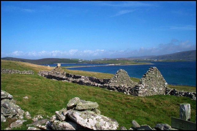
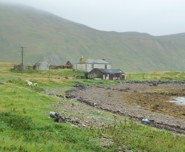
Derelict Croft The ruins of the croft at Gossigarth with Banna Minn showing behind
Derelict Croft
The ruins of the croft at Gossigarth with Banna Minn showing behind
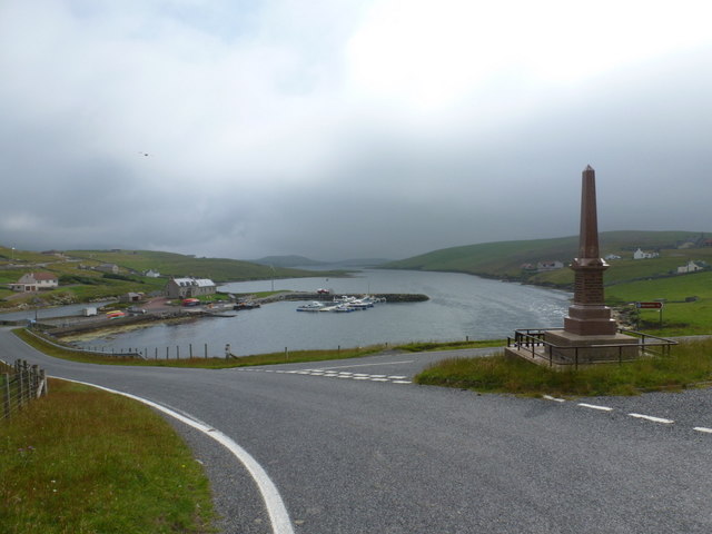
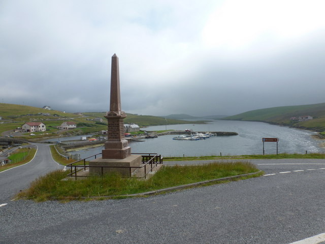
West Burra: overlooking Bridge End A fine view past the war memorial and down South Voe, the marina nestling below.
West Burra: overlooking Bridge End
A fine view past the war memorial and down South Voe, the marina nestling below.
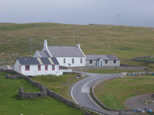
East Burra: the Baptist church Looking across the dip between the two Burras towards this small church on East Burra.
East Burra: the Baptist church
Looking across the dip between the two Burras towards this small church on East Burra.
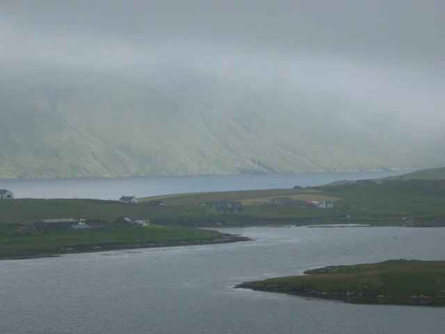
East Burra: Houss from West Burra Looking across South Voe towards the scattered dwellings of Houss with the mighty slopes of Shetland's south mainland on the far side of Clift Sound beyond.
East Burra: Houss from West Burra
Looking across South Voe towards the scattered dwellings of Houss with the mighty slopes of Shetland's south mainland on the far side of Clift Sound beyond.
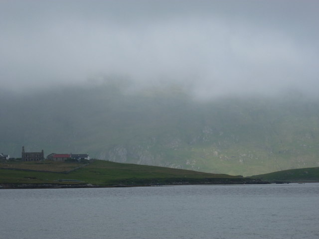
Houss: view from Papil Looking across the water separating West Burra (our side) from East Burra, on which we see a few of the buildings, one of them ruined, in the hamlet of Houss. Immediately to the south (right) of these is the narrow strip of land connecting Houss Ness to the 'main' part of East Burra. The Clift Hills, on the mainland, are the backdrop, shrouded in cloud.
Houss: view from Papil
Looking across the water separating West Burra (our side) from East Burra, on which we see a few of the buildings, one of them ruined, in the hamlet of Houss. Immediately to the south (right) of these is the narrow strip of land connecting Houss Ness to the 'main' part of East Burra. The Clift Hills, on the mainland, are the backdrop, shrouded in cloud.
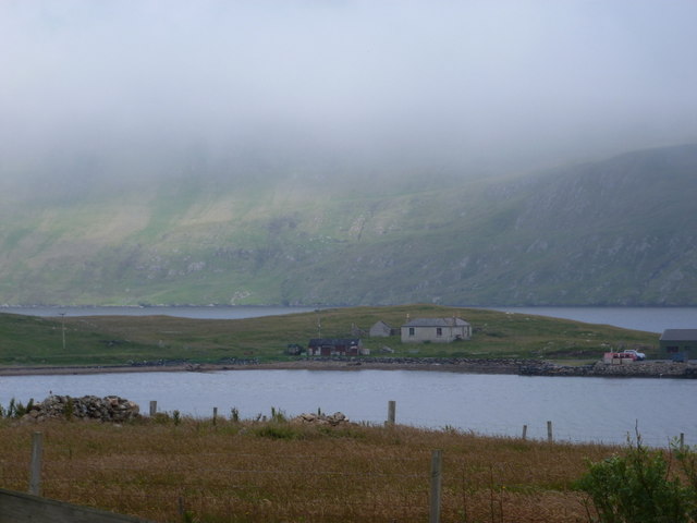
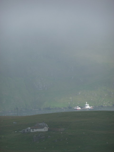
Houss: a house with a dramatic backdrop Looking across to a Houss house, as it were, from West Burra. I haven't been able to exactly locate the house on the map but it's somewhere hereabouts. In the background, a couple of vessels, below the cliffs of the Clift Hills, are catching a very rare bit of sun today - the rarity of the fine weather hinted at by the low mist towards the top of the hills.
Houss: a house with a dramatic backdrop
Looking across to a Houss house, as it were, from West Burra. I haven't been able to exactly locate the house on the map but it's somewhere hereabouts. In the background, a couple of vessels, below the cliffs of the Clift Hills, are catching a very rare bit of sun today - the rarity of the fine weather hinted at by the low mist towards the top of the hills.
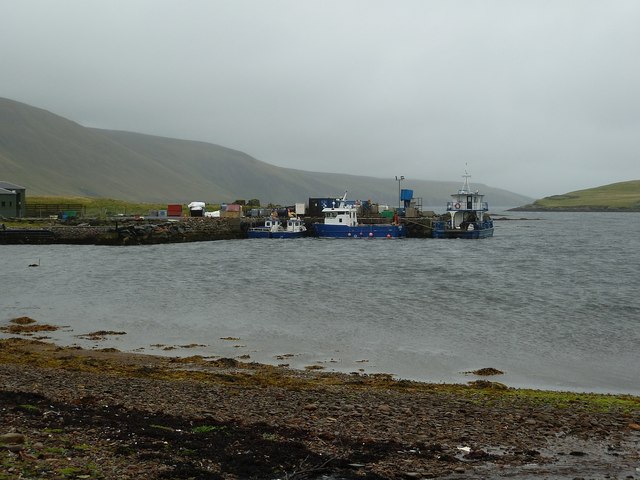
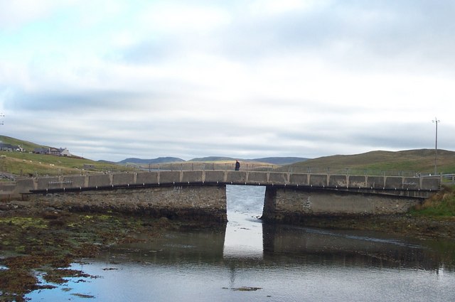
Boats at The Taing The boats seen here are moored at a yard on the east coast of the Voe of North House, on the small peninsula called The Taing on East Burra. East Burra is a very narrow island (as is West Burra) that is linked to Mainland Shetland via bridges to Trondra and West Burra. The bridge between West and East Burra is a simple stone arch bridge in Bridge End.
Boats at The Taing
The boats seen here are moored at a yard on the east coast of the Voe of North House, on the small peninsula called The Taing on East Burra. East Burra is a very narrow island (as is West Burra) that is linked to Mainland Shetland via bridges to Trondra and West Burra. The bridge between West and East Burra is a simple stone arch bridge in Bridge End.
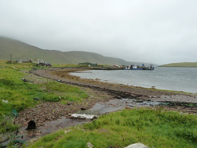
The Taing and Voe of North House The Taing is a small promontory of East Burra island into Clift Sound, with the Voe of North House on the right. The little stream entering the Voe at this point is a drain from the small Loch of Houss a few hundred yards to the north.
A closer view of the end of the Taing can be seen here <a href="https://www.geograph.org.uk/photo/2586774">HU3831 : Boats at The Taing</a> and of the cottages on the left of the image, here <a href="https://www.geograph.org.uk/photo/2695373">HU3831 : Cottages on The Taing</a>
The Taing and Voe of North House
The Taing is a small promontory of East Burra island into Clift Sound, with the Voe of North House on the right. The little stream entering the Voe at this point is a drain from the small Loch of Houss a few hundred yards to the north. A closer view of the end of the Taing can be seen here HU3831 : Boats at The Taing and of the cottages on the left of the image, here HU3831 : Cottages on The Taing
Cottages on The Taing A cluster of current and former dwellings at the northern end of The Taing, a small promontory of East Burra island. The Clift Hills of Mainland Shetland rise up behind them as a quite dramatic backdrop.
Cottages on The Taing
A cluster of current and former dwellings at the northern end of The Taing, a small promontory of East Burra island. The Clift Hills of Mainland Shetland rise up behind them as a quite dramatic backdrop.
West Burra: war memorial The war memorial at Bridge End stands at a fantastic viewpoint as we look beyond it down South Voe, separating East Burra (left) from West Burra.
West Burra: war memorial
The war memorial at Bridge End stands at a fantastic viewpoint as we look beyond it down South Voe, separating East Burra (left) from West Burra.
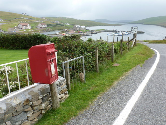
West Burra: postbox № ZE2 14, Bridge End This small postbox serves the southern villages of West Burra, as well as East Burra, and is emptied each weekday and Saturday morning at half past seven.
West Burra: postbox № ZE2 14, Bridge End
This small postbox serves the southern villages of West Burra, as well as East Burra, and is emptied each weekday and Saturday morning at half past seven.
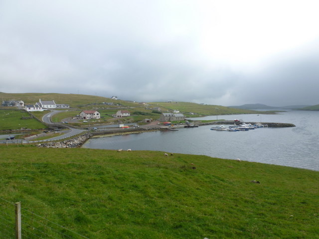
West Burra: the marina Looking down on the marina, which is at the head of South Voe which separates the island of West Burra from East Burra (background).
West Burra: the marina
Looking down on the marina, which is at the head of South Voe which separates the island of West Burra from East Burra (background).
East Burra: view down South Voe Looking down South Voe, the long inlet separating the islands of East Burra and West Burra.
East Burra: view down South Voe
Looking down South Voe, the long inlet separating the islands of East Burra and West Burra.
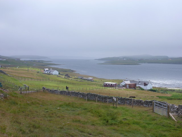
East Burra: across Voe of North House Looking across this small bay, towards a house with coastal outlooks both front and back - Clift Sound is beyond, with the Clift Hills on the Shetland mainland rising into the mist.
East Burra: across Voe of North House
Looking across this small bay, towards a house with coastal outlooks both front and back - Clift Sound is beyond, with the Clift Hills on the Shetland mainland rising into the mist.
Papil, West Burra
Papil, West Burra
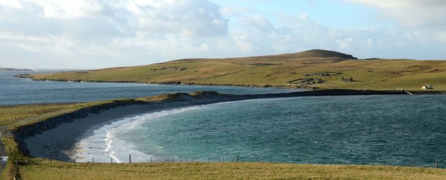
Tombolo at Banna Minn
Bridge End South Voe in the foreground, Lang Sound beyond.
Bridge End
South Voe in the foreground, Lang Sound beyond.
Show me another place!

Ruff Loch is located at Grid Ref: HU3631 (Lat: 60.070438, Lng: -1.3507597)

Unitary Authority: Shetland Islands

Police Authority: Highlands and Islands

What 3 Words

///strays.belief.looms. Near Scalloway, Shetland Islands

Related Wikis

West Burra

West Burra is one of the Scalloway Islands, a subgroup of the Shetland Islands in Scotland. It is connected by bridge to East Burra. With an area of 743...

Burra, Shetland

Burra (Old Norse: Barrey ) is the collective name for two of the Shetland Islands, West (pop. 753) and East Burra (pop. 66), which are connected by bridge...

Scalloway Islands

The Scalloway Islands are in Shetland opposite Scalloway on south west of the Mainland. They form a mini-archipelago and include: Burra (two islands linked...

East Burra

East Burra (Scots: East Burra; Old Norse: "Barrey") is one of the Scalloway Islands, a subgroup of the Shetland Islands in Scotland. It is connected by...

South Mainland

The South Mainland of the Shetland Islands is the southern peninsula of Mainland island. It lies south of Hellister (60° 14′N). The greater southern part...

South Havra

South Havra (Scots: Sooth Haevra; Old Norse: Hafrey), formerly Hevera, is an uninhabited island in the Scalloway Islands, Shetland, Scotland. == Geography... ==

Oxna

Oxna is one of the Scalloway Islands, lying north west of Burra in Shetland, Scotland. Oxna has an area of 68 hectares (170 acres). The island has been...

Little Havra

Little Havra is a small island off the west of South Mainland in Shetland. It is 35 metres (115 ft) at its highest point, upon which there is a cairn....

Have you been to Ruff Loch?

Leave your review of Ruff Loch below (or comments, questions and feedback).