Duncansclett

Settlement in Shetland

Scotland

Duncansclett

Fugla Stack, Burra, from the air
Fugla Stack, Burra, from the air Credit: Mike Pennington

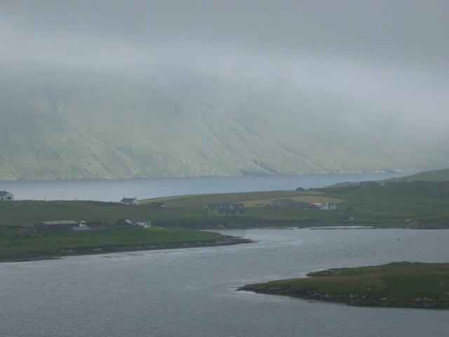
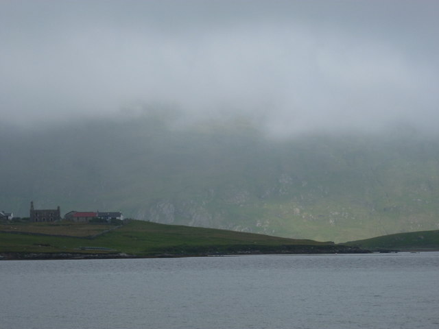
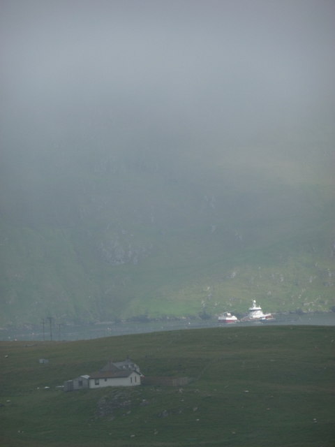
Duncansclett is a small coastal village located in the Shetland Islands, an archipelago off the northeast coast of Scotland. Situated on the northwest coast of the mainland Shetland, Duncansclett is known for its picturesque setting and tranquil atmosphere.

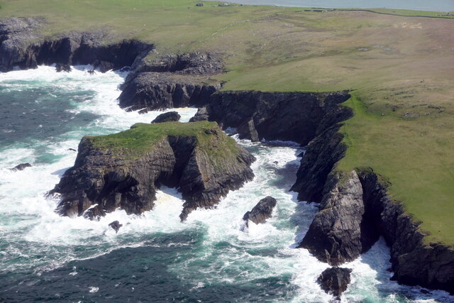
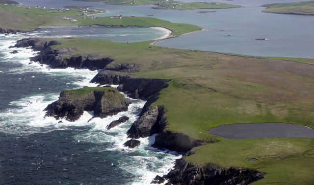
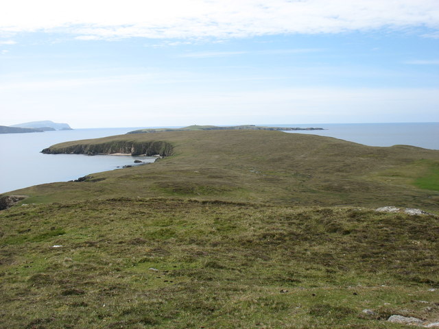
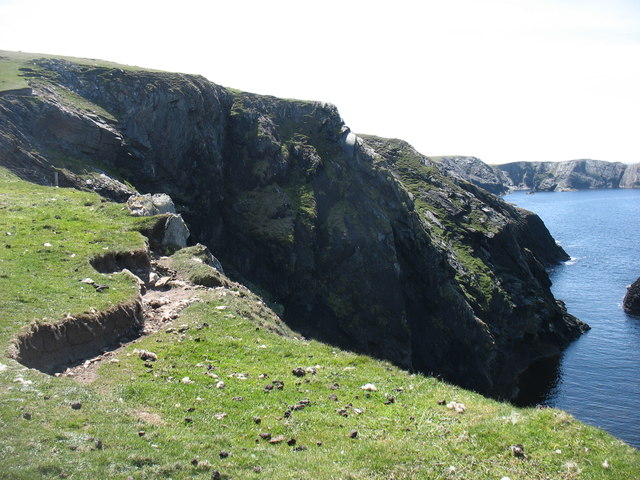
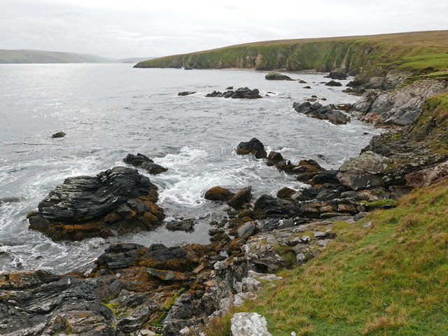
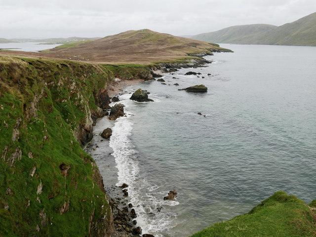
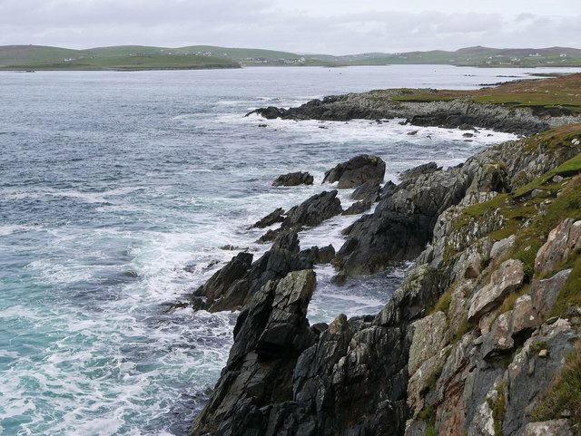
The village is nestled amidst stunning natural landscapes, with rugged cliffs and pristine beaches that offer breathtaking views of the North Sea. Duncansclett is surrounded by rolling green hills and is home to a variety of wildlife, making it a haven for nature enthusiasts.

Although Duncansclett is a relatively small village, it boasts a strong sense of community and is known for its friendly and welcoming residents. The village has a close-knit community center that serves as a hub for social gatherings and events.

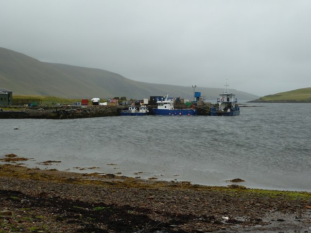
The main industries in Duncansclett are fishing and agriculture, which have been a part of the local economy for generations. The village's fishing heritage is still evident, with a small harbor where local fishermen moor their boats and bring in their daily catch.

While Duncansclett may be secluded, it is well-connected to the rest of the Shetland Islands. The nearby town of Lerwick is a short drive away and offers a range of amenities, including shops, schools, and healthcare facilities.

In summary, Duncansclett is a charming coastal village in the Shetland Islands, known for its stunning natural beauty, strong community spirit, and traditional way of life. It is a hidden gem for those seeking a peaceful and idyllic retreat amidst the rugged beauty of the Scottish coastline.

If you have any feedback on the listing, please let us know in the comments section below.

Duncansclett Images

Images are sourced within 2km of 60.063381/-1.3400129 or Grid Reference HU3631. Thanks to Geograph Open Source API. All images are credited.
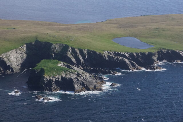
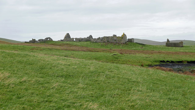
Fugla Stack, Burra, from the air
Sound of Fuglastack, Burra, from the air
Fugla Stack, Kettla Ness, West Burra, from the air Virda Vatn in the background.
Fugla Stack, Kettla Ness, West Burra, from the air
Virda Vatn in the background.
The southern part of Houss Ness Seen from just south of the summit of Ward of Symbister.
The southern part of Houss Ness
Seen from just south of the summit of Ward of Symbister.
Cliffs on the west side of Kettla Ness It looks as though there will soon be another landslide on this dramatic coast.
Cliffs on the west side of Kettla Ness
It looks as though there will soon be another landslide on this dramatic coast.
At Gossigarth on Kettla Ness Looking towards Banna Minn and Duncansclett.
At Gossigarth on Kettla Ness
Looking towards Banna Minn and Duncansclett.
The Haas on Houss Ness A curving bay on the east coast of Houss Ness.
The Haas on Houss Ness
A curving bay on the east coast of Houss Ness.
View over the Haas, Houss Ness Beyond the bay (the Haas) rises the Ward of Symbister, the highest point on Houss Ness.
View over the Haas, Houss Ness
Beyond the bay (the Haas) rises the Ward of Symbister, the highest point on Houss Ness.
Approaching Clivland Bay, Houss Ness A small bay backed by numerous ruined buildings.
Approaching Clivland Bay, Houss Ness
A small bay backed by numerous ruined buildings.
Stream emerging at Clivland Bay Plenty of bubbles in peaty brown water.
Stream emerging at Clivland Bay
Plenty of bubbles in peaty brown water.
Symbister, East Burra An extensive set of ruined buildings.
Symbister, East Burra
An extensive set of ruined buildings.
Burnt Mound at Symbister One of three burnt mounds indicated on the 1:25,000 OS mapping.  This was a smaller mound.  Often features like this are marked on maps yet are hard to find. A Eureka moment followed after the  GPS location was checked. I understand the purpose of burnt mounds is a contentious issue.
Burnt Mound at Symbister
One of three burnt mounds indicated on the 1:25,000 OS mapping. This was a smaller mound. Often features like this are marked on maps yet are hard to find. A Eureka moment followed after the GPS location was checked. I understand the purpose of burnt mounds is a contentious issue.
Symbister This croft site was abandoned in the early 1950s largely because there was no road to it. [P. Guy, Walking the Coastline of Shetland, South Mainland, Shetland Times, Lerwick, 2000.]
Symbister
This croft site was abandoned in the early 1950s largely because there was no road to it. [P. Guy, Walking the Coastline of Shetland, South Mainland, Shetland Times, Lerwick, 2000.]
Derelict Croft The ruins of the croft at Gossigarth with Banna Minn showing behind
Derelict Croft
The ruins of the croft at Gossigarth with Banna Minn showing behind
East Burra: Houss from West Burra Looking across South Voe towards the scattered dwellings of Houss with the mighty slopes of Shetland's south mainland on the far side of Clift Sound beyond.
East Burra: Houss from West Burra
Looking across South Voe towards the scattered dwellings of Houss with the mighty slopes of Shetland's south mainland on the far side of Clift Sound beyond.
Houss: view from Papil Looking across the water separating West Burra (our side) from East Burra, on which we see a few of the buildings, one of them ruined, in the hamlet of Houss. Immediately to the south (right) of these is the narrow strip of land connecting Houss Ness to the 'main' part of East Burra. The Clift Hills, on the mainland, are the backdrop, shrouded in cloud.
Houss: view from Papil
Looking across the water separating West Burra (our side) from East Burra, on which we see a few of the buildings, one of them ruined, in the hamlet of Houss. Immediately to the south (right) of these is the narrow strip of land connecting Houss Ness to the 'main' part of East Burra. The Clift Hills, on the mainland, are the backdrop, shrouded in cloud.
Houss: a house with a dramatic backdrop Looking across to a Houss house, as it were, from West Burra. I haven't been able to exactly locate the house on the map but it's somewhere hereabouts. In the background, a couple of vessels, below the cliffs of the Clift Hills, are catching a very rare bit of sun today - the rarity of the fine weather hinted at by the low mist towards the top of the hills.
Houss: a house with a dramatic backdrop
Looking across to a Houss house, as it were, from West Burra. I haven't been able to exactly locate the house on the map but it's somewhere hereabouts. In the background, a couple of vessels, below the cliffs of the Clift Hills, are catching a very rare bit of sun today - the rarity of the fine weather hinted at by the low mist towards the top of the hills.
Boats at The Taing The boats seen here are moored at a yard on the east coast of the Voe of North House, on the small peninsula called The Taing on East Burra. East Burra is a very narrow island (as is West Burra) that is linked to Mainland Shetland via bridges to Trondra and West Burra. The bridge between West and East Burra is a simple stone arch bridge in Bridge End.
Boats at The Taing
The boats seen here are moored at a yard on the east coast of the Voe of North House, on the small peninsula called The Taing on East Burra. East Burra is a very narrow island (as is West Burra) that is linked to Mainland Shetland via bridges to Trondra and West Burra. The bridge between West and East Burra is a simple stone arch bridge in Bridge End.
Show me another place!

Duncansclett is located at Grid Ref: HU3631 (Lat: 60.063381, Lng: -1.3400129)

Unitary Authority: Shetland Islands

Police Authority: Highlands and Islands

What 3 Words

///vocab.fidgeting.overdrive. Near Sandwick, Shetland Islands

Related Wikis

West Burra

West Burra is one of the Scalloway Islands, a subgroup of the Shetland Islands in Scotland. It is connected by bridge to East Burra. With an area of 743...

Burra, Shetland

Burra (Old Norse: Barrey ) is the collective name for two of the Shetland Islands, West (pop. 753) and East Burra (pop. 66), which are connected by bridge...

Scalloway Islands

The Scalloway Islands are in Shetland opposite Scalloway on south west of the Mainland. They form a mini-archipelago and include: Burra (two islands linked...

East Burra

East Burra (Scots: East Burra; Old Norse: "Barrey") is one of the Scalloway Islands, a subgroup of the Shetland Islands in Scotland. It is connected by...

South Mainland

The South Mainland of the Shetland Islands is the southern peninsula of Mainland island. It lies south of Hellister (60° 14′N). The greater southern part...

South Havra

South Havra (Scots: Sooth Haevra; Old Norse: Hafrey), formerly Hevera, is an uninhabited island in the Scalloway Islands, Shetland, Scotland. == Geography... ==

Little Havra

Little Havra is a small island off the west of South Mainland in Shetland. It is 35 metres (115 ft) at its highest point, upon which there is a cairn....

Oxna

Oxna is one of the Scalloway Islands, lying north west of Burra in Shetland, Scotland. Oxna has an area of 68 hectares (170 acres). The island has been...

Nearby Amenities

Located within 500m of 60.063381,-1.3400129
Papil
Place: hamlet
Lat/Long: 60.0657494/-1.3377553
Duncansclett
Place: hamlet
Lat/Long: 60.0615323/-1.3415088
Power: pole
Lat/Long: 60.0674718/-1.3387951
Power: pole
Lat/Long: 60.0668816/-1.3387603
Power: pole
Lat/Long: 60.0656507/-1.3391055
Power: pole
Lat/Long: 60.0650708/-1.3394268
Power: pole
Lat/Long: 60.0637817/-1.3401979
Power: pole
Lat/Long: 60.0632195/-1.3406941
Power: pole
Lat/Long: 60.0626881/-1.3411152
Power: pole
Lat/Long: 60.0620898/-1.3415954
Power: pole
Lat/Long: 60.0632831/-1.3433837
Power: pole
Lat/Long: 60.0630183/-1.3423854
Bus Stop
Papil
Bus: yes
Fixme: Location unknown
Public Transport: platform
Lat/Long: 60.0617377/-1.3407263
The data included in this document is from www.openstreetmap.org. The data is made available under ODbL.

Have you been to Duncansclett?

Leave your review of Duncansclett below (or comments, questions and feedback).