Blo Geo

Coastal Feature, Headland, Point in Shetland

Scotland

Blo Geo

Whales Wick, Fitful Head, from the air
Whales Wick, Fitful Head, from the air Credit: Mike Pennington

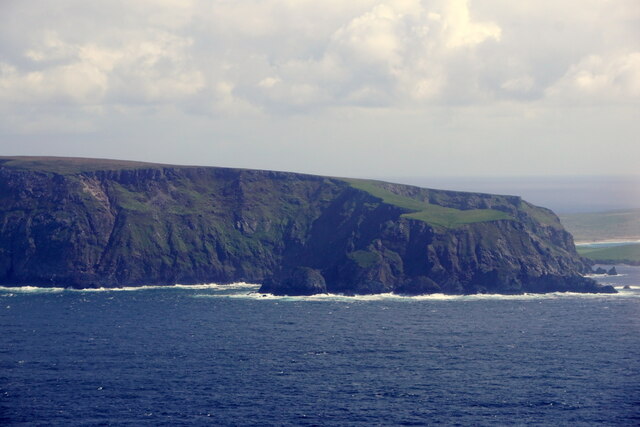
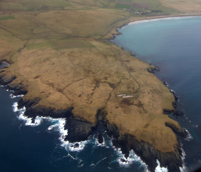
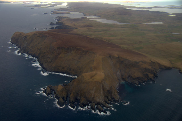
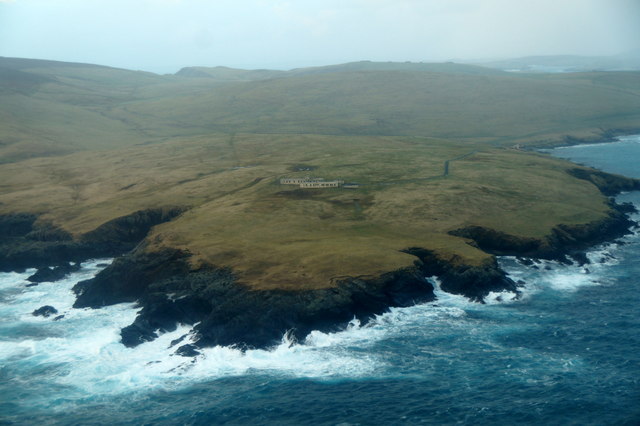
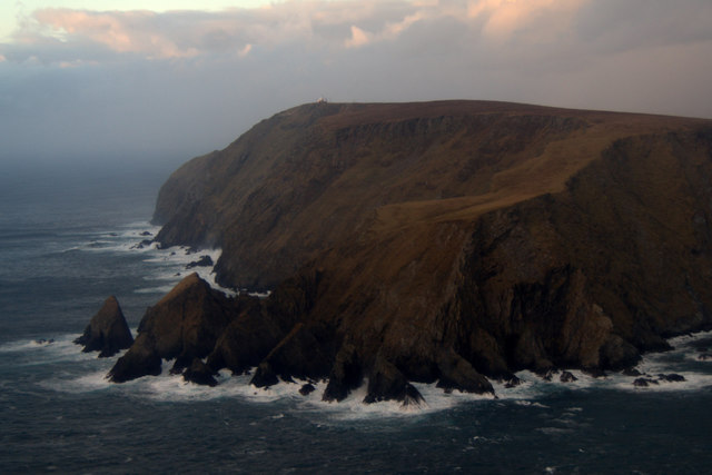
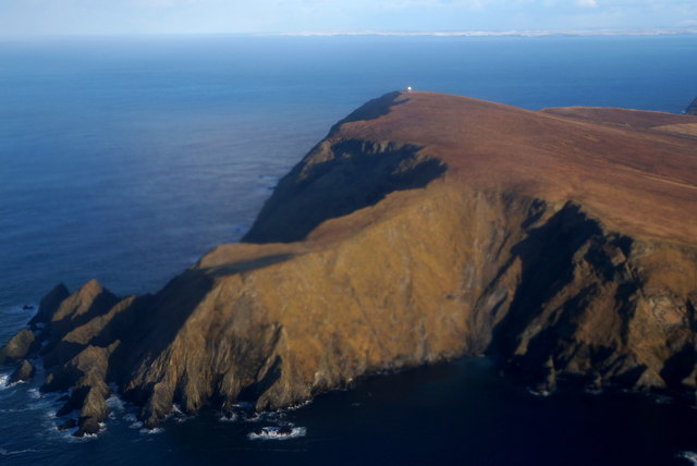
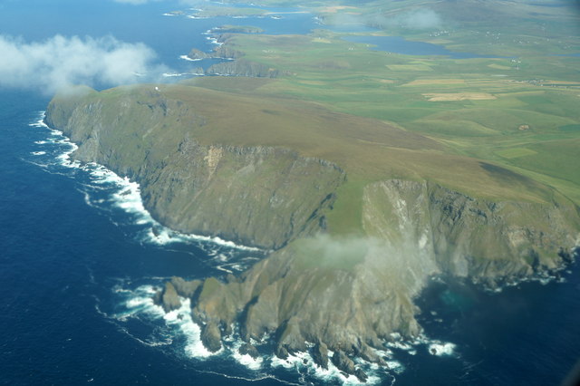
Blo Geo is a prominent coastal feature located on the Shetland Islands, an archipelago in Scotland. It is a headland that juts out into the North Sea, forming a distinctive point along the rugged coastline.

The headland is characterized by steep cliffs that rise dramatically from the sea, creating a striking and picturesque landscape. These cliffs are composed of various types of rock, including sandstone and shale, which have been shaped by centuries of erosion from the powerful waves and winds. This erosion has given the headland its unique shape and features, such as caves, stacks, and arches, which add to its natural beauty.

Blo Geo is known for its diverse wildlife and is a haven for seabirds, including puffins, guillemots, and razorbills, which nest on the cliffs during the breeding season. The surrounding waters are also home to a variety of marine life, such as seals and dolphins, providing ample opportunities for wildlife enthusiasts and photographers.

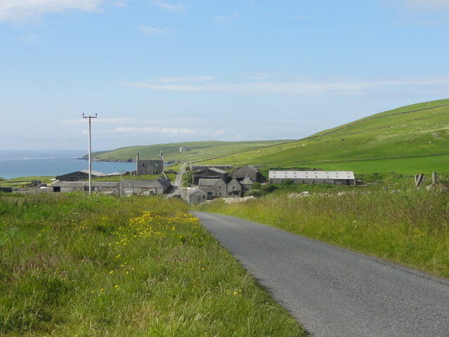
The headland is a popular destination for outdoor enthusiasts, offering stunning coastal walks and panoramic views of the surrounding seascape. Visitors can enjoy the tranquility of the area, as well as the opportunity to explore the nearby beaches and coves. The rugged terrain and unique geology of Blo Geo also make it a popular spot for rock climbing and bouldering.

Overall, Blo Geo is a captivating coastal feature on the Shetland Islands, showcasing the raw beauty and natural diversity of this remote and pristine landscape.

If you have any feedback on the listing, please let us know in the comments section below.
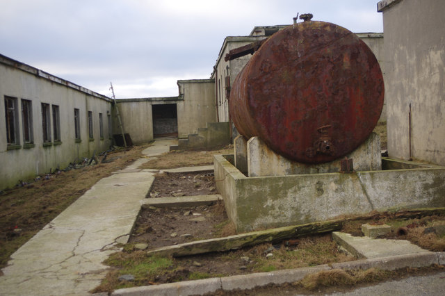
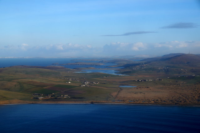
Blo Geo Images

Images are sourced within 2km of 59.888953/-1.3571965 or Grid Reference HU3611. Thanks to Geograph Open Source API. All images are credited.

Whales Wick, Fitful Head, from the air
Quendale Farm & Mill Road leading to Quendale Farm and Mill
Quendale Farm & Mill
Road leading to Quendale Farm and Mill
Bay of Quendale from the air Taken from a plane just after take-off from Sumburgh Airport. The Loch of Hillwell and, further back, the Lochs of Spiggie and Brow can be seen. In the distance some of the rest of Shetland is in sunshine, including Noss and Bressay on the right.
Bay of Quendale from the air
Taken from a plane just after take-off from Sumburgh Airport. The Loch of Hillwell and, further back, the Lochs of Spiggie and Brow can be seen. In the distance some of the rest of Shetland is in sunshine, including Noss and Bressay on the right.
Garths Ness from the air Taken from a plane just after take-off from Sumburgh Airport.
Garths Ness from the air
Taken from a plane just after take-off from Sumburgh Airport.
Garth Wick from the air Taken from a plane just after take-off from Sumburgh Airport. The Lochs of Spiggie and Brow are obvious in the distance.
Garth Wick from the air
Taken from a plane just after take-off from Sumburgh Airport. The Lochs of Spiggie and Brow are obvious in the distance.
Siggar Ness and Fitful Head from the air
Quendale Farm Opposite Quendale Mill is Quendale Farm, above which is a substantial ruined house, a Shetland haa or laird's house.
Quendale Farm
Opposite Quendale Mill is Quendale Farm, above which is a substantial ruined house, a Shetland haa or laird's house.
Quendale Mill The mill dates from the 1860s and is open to the public in summer.
Quendale Mill
The mill dates from the 1860s and is open to the public in summer.
RAF Garths Ness The abandoned remains of a radio navigation station, operational between 1961 and 1978.
RAF Garths Ness
The abandoned remains of a radio navigation station, operational between 1961 and 1978.
RAF Garths Ness The abandoned remains of a radio navigation station, operational between 1961 and 1978.
RAF Garths Ness
The abandoned remains of a radio navigation station, operational between 1961 and 1978.
Garths Ness This headland to the west of the Bay of Quendale was once the sight of a military radio navigation station but is now a lonely spot. Fair Isle can be seen on the horizon.
Garths Ness
This headland to the west of the Bay of Quendale was once the sight of a military radio navigation station but is now a lonely spot. Fair Isle can be seen on the horizon.
Garths Ness from the air From a plane about to land at Sumburgh Airport.
Garths Ness from the air
From a plane about to land at Sumburgh Airport.
Siggar Ness and Fitful Head from the air Taken from a plane coming in to land at Sumburgh Airport.
Siggar Ness and Fitful Head from the air
Taken from a plane coming in to land at Sumburgh Airport.
Quendale and Hillwell from the air Taken from a plane just after take-off from Sumburgh Airport.
Quendale and Hillwell from the air
Taken from a plane just after take-off from Sumburgh Airport.
Siggar Ness and Fitful Head from the air Taken from a plane just after take-off from Sumburgh Airport. There is snow on the west Mainland of Shetland in the distance.
Siggar Ness and Fitful Head from the air
Taken from a plane just after take-off from Sumburgh Airport. There is snow on the west Mainland of Shetland in the distance.
Siggar Ness and Fitful Head from the air
The Cart Shed, Quendale Mill The Mill was originally built in 1867 and its primary purpose was to handle the grain from the Quendale Estate and for crofters from the wider surrounding area. Most of the grinding was done in winter when there was plenty of water in the dam to drive the Mill’s machinery. The Mill ceased operations in 1948.

During the time the Mill was in operation, crofters brought their Oats and Bere by horse and cart to the Mill to be processed into meal for eventual use in the production of Oatmeal and Beremeal bannocks – a staple diet for Shetlanders at the time. Once roads had been improved to allow vehicular transport, crofters from as far afield as Scalloway and Whiteness also joined the others in bringing their grain crops to the Mill for processing. 

Today the Mill is completely renovated and restored with help from the Shetland Amenity Trust.  It has been operated by The South Mainland Community History Group as a visitor attraction since 1993. It is a Category A listed building (LB5417 <span class="nowrap"><a title="http://portal.historicenvironment.scot/designation/LB5417" rel="nofollow ugc noopener" href="http://portal.historicenvironment.scot/designation/LB5417">Link</a><img style="margin-left:2px;" alt="External link" title="External link - shift click to open in new window" src="https://s1.geograph.org.uk/img/external.png" width="10" height="10"/></span>  Historic Environment Scotland).

http:<span class="nowrap"><a title="http://www.quendalemill.co.uk/history.html" rel="nofollow ugc noopener" href="http://www.quendalemill.co.uk/history.html">Link</a><img style="margin-left:2px;" alt="External link" title="External link - shift click to open in new window" src="https://s1.geograph.org.uk/img/external.png" width="10" height="10"/></span>  Quendale Mill website
The Cart Shed, Quendale Mill
The Mill was originally built in 1867 and its primary purpose was to handle the grain from the Quendale Estate and for crofters from the wider surrounding area. Most of the grinding was done in winter when there was plenty of water in the dam to drive the Mill’s machinery. The Mill ceased operations in 1948. During the time the Mill was in operation, crofters brought their Oats and Bere by horse and cart to the Mill to be processed into meal for eventual use in the production of Oatmeal and Beremeal bannocks – a staple diet for Shetlanders at the time. Once roads had been improved to allow vehicular transport, crofters from as far afield as Scalloway and Whiteness also joined the others in bringing their grain crops to the Mill for processing. Today the Mill is completely renovated and restored with help from the Shetland Amenity Trust. It has been operated by The South Mainland Community History Group as a visitor attraction since 1993. It is a Category A listed building (LB5417 LinkExternal link Historic Environment Scotland). http:LinkExternal link Quendale Mill website
Water Wheel, Quendale Mill The Mill was originally built in 1867 and its primary purpose was to handle the grain from the Quendale Estate and for crofters from the wider surrounding area. Most of the grinding was done in winter when there was plenty of water in the dam to drive the Mill’s machinery. The Mill ceased operations in 1948.

During the time the Mill was in operation, crofters brought their Oats and Bere by horse and cart to the Mill to be processed into meal for eventual use in the production of Oatmeal and Beremeal bannocks – a staple diet for Shetlanders at the time. Once roads had been improved to allow vehicular transport, crofters from as far afield as Scalloway and Whiteness also joined the others in bringing their grain crops to the Mill for processing. 

Today the Mill is completely renovated and restored with help from the Shetland Amenity Trust.  It has been operated by The South Mainland Community History Group as a visitor attraction since 1993. It is a Category A listed building (LB5417 <span class="nowrap"><a title="http://portal.historicenvironment.scot/designation/LB5417" rel="nofollow ugc noopener" href="http://portal.historicenvironment.scot/designation/LB5417">Link</a><img style="margin-left:2px;" alt="External link" title="External link - shift click to open in new window" src="https://s1.geograph.org.uk/img/external.png" width="10" height="10"/></span>  Historic Environment Scotland).

http:<span class="nowrap"><a title="http://www.quendalemill.co.uk/history.html" rel="nofollow ugc noopener" href="http://www.quendalemill.co.uk/history.html">Link</a><img style="margin-left:2px;" alt="External link" title="External link - shift click to open in new window" src="https://s1.geograph.org.uk/img/external.png" width="10" height="10"/></span>  Quendale Mill website
Water Wheel, Quendale Mill
The Mill was originally built in 1867 and its primary purpose was to handle the grain from the Quendale Estate and for crofters from the wider surrounding area. Most of the grinding was done in winter when there was plenty of water in the dam to drive the Mill’s machinery. The Mill ceased operations in 1948. During the time the Mill was in operation, crofters brought their Oats and Bere by horse and cart to the Mill to be processed into meal for eventual use in the production of Oatmeal and Beremeal bannocks – a staple diet for Shetlanders at the time. Once roads had been improved to allow vehicular transport, crofters from as far afield as Scalloway and Whiteness also joined the others in bringing their grain crops to the Mill for processing. Today the Mill is completely renovated and restored with help from the Shetland Amenity Trust. It has been operated by The South Mainland Community History Group as a visitor attraction since 1993. It is a Category A listed building (LB5417 LinkExternal link Historic Environment Scotland). http:LinkExternal link Quendale Mill website
Show me another place!

Blo Geo is located at Grid Ref: HU3611 (Lat: 59.888953, Lng: -1.3571965)

Unitary Authority: Shetland Islands

Police Authority: Highlands and Islands

What 3 Words

///acoustics.trailer.gravel. Near Sumburgh, Shetland Islands

Related Wikis

MV Braer

The MV Braer was an oil tanker which ran aground during a storm off Shetland, Scotland, in January 1993, and nearly a week later broke up during the most...

Fitful Head

Fitful Head is a 283-metre-high (928 ft) headland at the southwest corner of Mainland, Shetland, Scotland, some 6 kilometres (3.7 mi) northwest of the...

Lady's Holm

Lady's Holm is an island off southern Mainland in the Shetland Islands. It is not to be confused with the Maiden Stack, which is also known as "Frau Stack...

Little Holm, Dunrossness

Little Holm is a small island to the west of South Mainland in Shetland. It is near Scatness and Lady's Holm. A trawler was wrecked there in 1916. ��2...

Toab, Shetland

Toab is the southernmost village on Mainland, Shetland, Scotland. It is part of Virkie and overlooks Sumburgh Airport. Toab is within the parish of Dunrossness...
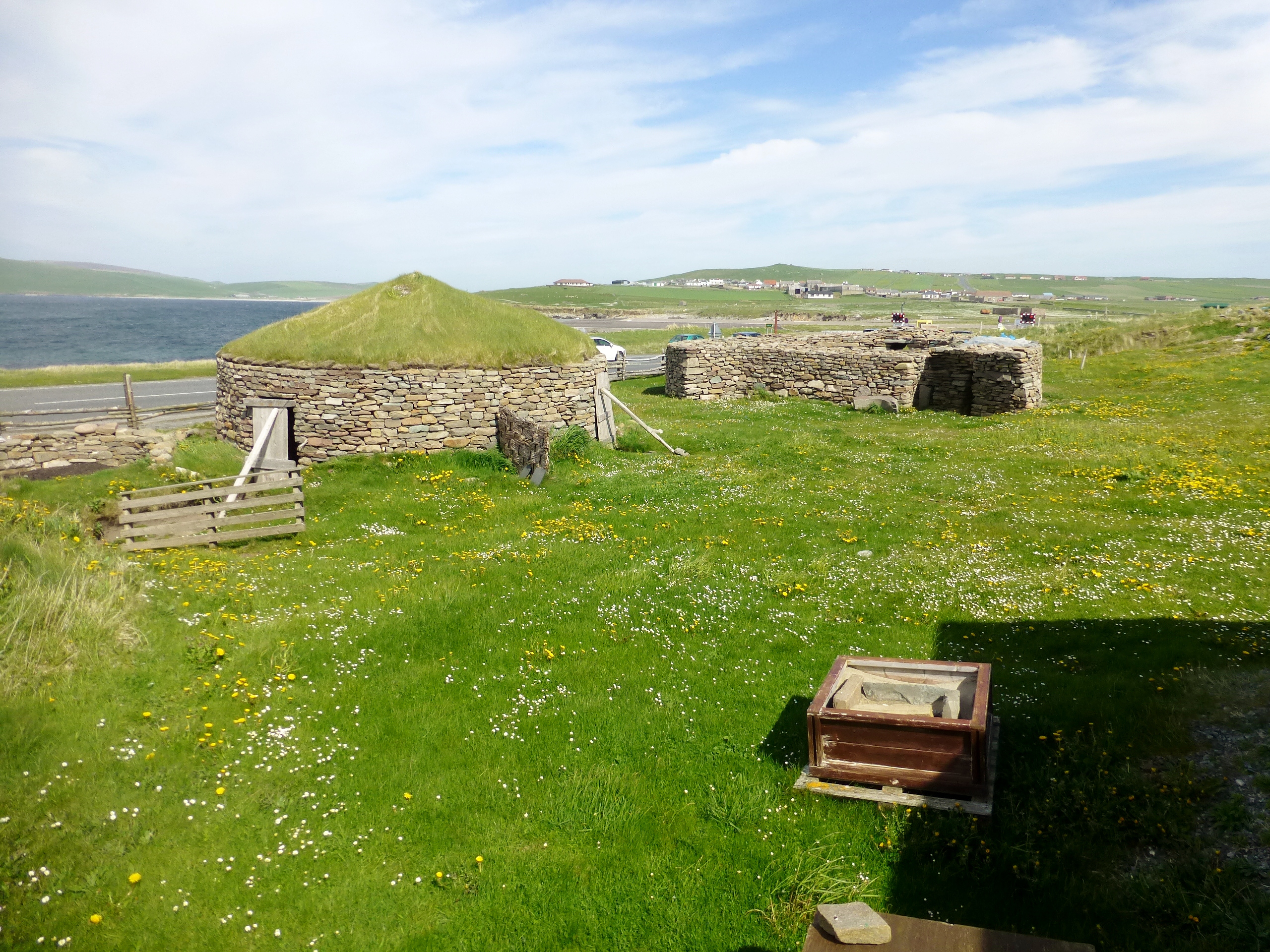
Old Scatness

Old Scatness is an archeological site on Scat Ness, near the village of Scatness, in the parish of Dunrossness in the south end of Mainland, Shetland,...

Virkie

Virkie is the most southerly district of Shetland, other than Fair Isle and is best defined as the area south of the Ward Hill in Dunrossness, also locally...

Scatness

Scatness is a settlement on the headland of Scat Ness at the southern tip of Mainland, Shetland, Scotland, across the West Voe of Sumburgh from Sumburgh...

Have you been to Blo Geo?

Leave your review of Blo Geo below (or comments, questions and feedback).