Western Ledges

Coastal Feature, Headland, Point in Dorset

England

Western Ledges

Church of the Holy Trinity, Trinity Road/North Quay, Weymouth Grade II Anglican parish church of 1834, extended and reoriented 1887. Revd George Chamberline, Rector of Wyke Regis, offered to build a new church for Weymouth at his own expense. The White Hart public house was demolished and in 1834 construction of the new church was started to a design by Philip Wyatt and completed after his death by his nephew Mathew Wyatt. The large crypt that resulted from the sloping site was used for burials until the 1862 Burial Act. The building was consecrated on 6 August 1836 by the Bishop of Winchester. By 1885 the then vicar, Francis Sowter, realising the church was becoming too small suggested a new church be built or the existing one extended. The result in the following year was that the church was to be extended and reoriented to the designs of G R Crickmay. The revised church was opened on 12 April 1887.
Church of the Holy Trinity, Trinity Road/North Quay, Weymouth Credit: Jo and Steve Turner

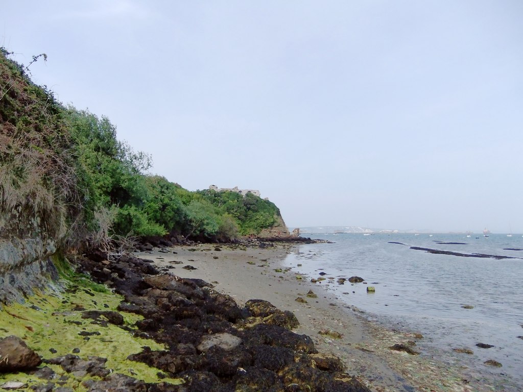
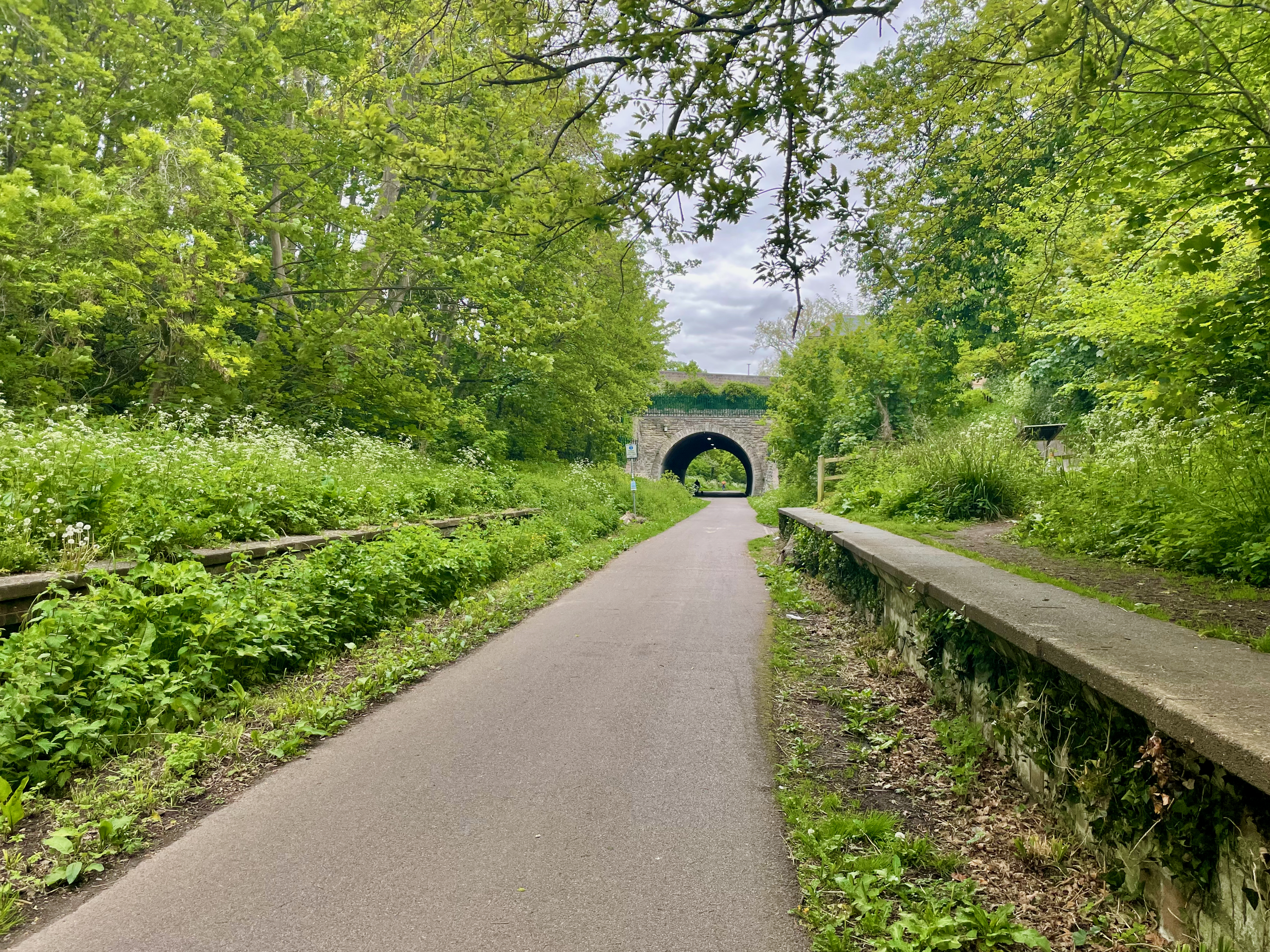
Western Ledges is a prominent coastal feature located in Dorset, England. It is a stunning headland that extends into the English Channel, offering breathtaking views and unique geological formations. This rocky point is situated on the Jurassic Coast, a UNESCO World Heritage Site renowned for its rich geological history.

The headland is characterized by its rugged cliffs, which rise majestically from the sea. These towering limestone cliffs showcase layers of sedimentary rock that date back millions of years, providing a glimpse into the Earth's ancient past. The cliffs are also adorned with vibrant vegetation, including hardy grasses and shrubs, which add to the area's natural beauty.

The Western Ledges headland is an important landmark for navigational purposes, as it helps ships and boats determine their position along the coast. Additionally, the area is popular among outdoor enthusiasts and nature lovers, who are drawn to its scenic beauty and abundant wildlife. Visitors can often spot various seabirds, such as gulls and cormorants, as well as marine creatures like seals and dolphins.

Access to Western Ledges is possible via a coastal footpath that meanders along the cliff edge. This path allows visitors to explore the area and offers stunning views of the surrounding coastline. However, it is important to exercise caution while walking along the cliffs, as they can be steep and unstable in some areas.

Overall, Western Ledges in Dorset is a captivating coastal feature that showcases the area's geological heritage and offers a breathtaking natural landscape for visitors to enjoy.

If you have any feedback on the listing, please let us know in the comments section below.

Western Ledges Images

Images are sourced within 2km of 50.598753/-2.4552069 or Grid Reference SY6777. Thanks to Geograph Open Source API. All images are credited.
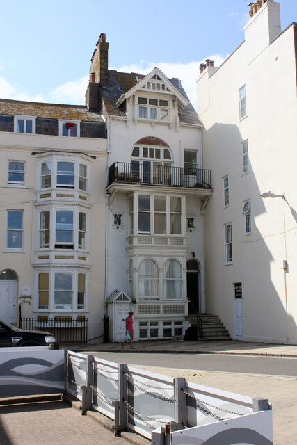
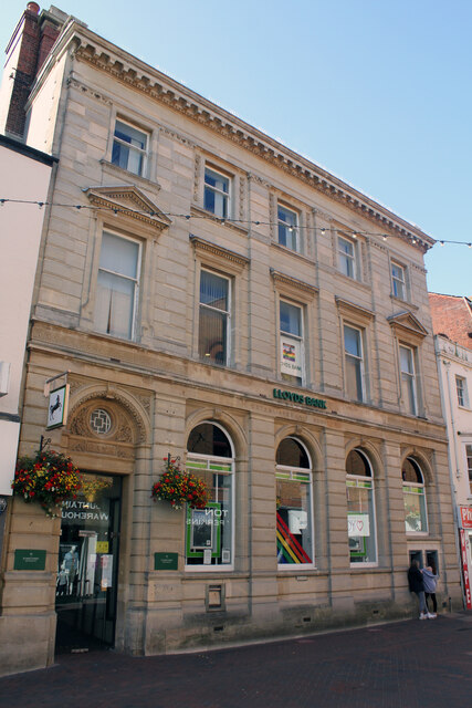
Church of the Holy Trinity, Trinity Road/North Quay, Weymouth Grade II Anglican parish church of 1834, extended and reoriented 1887. Revd George Chamberline, Rector of Wyke Regis, offered to build a new church for Weymouth at his own expense. The White Hart public house was demolished and in 1834 construction of the new church was started to a design by Philip Wyatt and completed after his death by his nephew Mathew Wyatt. The large crypt that resulted from the sloping site was used for burials until the 1862 Burial Act. The building was consecrated on 6 August 1836 by the Bishop of Winchester. By 1885 the then vicar, Francis Sowter, realising the church was becoming too small suggested a new church be built or the existing one extended. The result in the following year was that the church was to be extended and reoriented to the designs of G R Crickmay. The revised church was opened on 12 April 1887.
Church of the Holy Trinity, Trinity Road/North Quay, Weymouth
Grade II Anglican parish church of 1834, extended and reoriented 1887. Revd George Chamberline, Rector of Wyke Regis, offered to build a new church for Weymouth at his own expense. The White Hart public house was demolished and in 1834 construction of the new church was started to a design by Philip Wyatt and completed after his death by his nephew Mathew Wyatt. The large crypt that resulted from the sloping site was used for burials until the 1862 Burial Act. The building was consecrated on 6 August 1836 by the Bishop of Winchester. By 1885 the then vicar, Francis Sowter, realising the church was becoming too small suggested a new church be built or the existing one extended. The result in the following year was that the church was to be extended and reoriented to the designs of G R Crickmay. The revised church was opened on 12 April 1887.
The Old Fish Market, Custom House Quay, Weymouth Grade II Listed market hall. It was built in 1855 by architect Thomas Talbot Bury for the twice-weekly fish market. After only about 13 years it fell into disuse because of coal being unloaded on the quayside and contaminating the fish. It had a number of other uses but finally fell into disrepair. Weyfish restored the building for its original purpose around 1988.
The Old Fish Market, Custom House Quay, Weymouth
Grade II Listed market hall. It was built in 1855 by architect Thomas Talbot Bury for the twice-weekly fish market. After only about 13 years it fell into disuse because of coal being unloaded on the quayside and contaminating the fish. It had a number of other uses but finally fell into disrepair. Weyfish restored the building for its original purpose around 1988.
John Deheer's Warehouse, 9 Custom House Quay, Weymouth Grade II Listed mid to late 19th century warehouse formerly Hanneys Fish Warehouse. Deheer, Cosens, Burdens, Templeman and Hanney are all names tied to the building’s past that was mainly used for storing grain and imported fertilisers. Deheer's closed in 1965 and was converted into a play centre and maritime exhibition around 1997 until February 2017. Mildren Construction with RBstudio Architects renovated and converted the building into a restaurant and apartments during 2020.
John Deheer's Warehouse, 9 Custom House Quay, Weymouth
Grade II Listed mid to late 19th century warehouse formerly Hanneys Fish Warehouse. Deheer, Cosens, Burdens, Templeman and Hanney are all names tied to the building’s past that was mainly used for storing grain and imported fertilisers. Deheer's closed in 1965 and was converted into a play centre and maritime exhibition around 1997 until February 2017. Mildren Construction with RBstudio Architects renovated and converted the building into a restaurant and apartments during 2020.
Royal Dorset Yacht Club, 11 Custom House Quay, Weymouth Grade II Listed former Sailor's Bethel opened in June 1866. A plaque on the wall declares the Christian Seaman's Institute was built (for about £700) on the site of an 18th century baths, but Historic England states in one place that it 're-uses a building erected around 1800 for Harvey's Library and the card assembly'. This contradicts the Historic England listing that quotes an 1866 advertisement that refers to the aforementioned baths. The Royal Dorset Yacht Club moved in in 1975. The ground floor has been used by Rob Perry Marine from about August 2009 and from around July 2015 by Adriatico Restaurant Pizzeria and Bar to about January 2018, then from around February 2019 by Delicious Trading Ltd., I assume who are now trading as Vinolo Wine bar, cheese bar and gin bar.
Royal Dorset Yacht Club, 11 Custom House Quay, Weymouth
Grade II Listed former Sailor's Bethel opened in June 1866. A plaque on the wall declares the Christian Seaman's Institute was built (for about £700) on the site of an 18th century baths, but Historic England states in one place that it 're-uses a building erected around 1800 for Harvey's Library and the card assembly'. This contradicts the Historic England listing that quotes an 1866 advertisement that refers to the aforementioned baths. The Royal Dorset Yacht Club moved in in 1975. The ground floor has been used by Rob Perry Marine from about August 2009 and from around July 2015 by Adriatico Restaurant Pizzeria and Bar to about January 2018, then from around February 2019 by Delicious Trading Ltd., I assume who are now trading as Vinolo Wine bar, cheese bar and gin bar.
Harbour Master, 13 Custom House Quay, Weymouth Grade II Listed mid 19th century warehouse. The Stable pizza and cider restaurant occupied two floors just above the Harbour Master’s office from around 2012 until January 2020 followed shortly afterwards in May 2020 by The Loft restaurant and bar. The building appeared in the 2017 Syncopy film Dunkirk.
Harbour Master, 13 Custom House Quay, Weymouth
Grade II Listed mid 19th century warehouse. The Stable pizza and cider restaurant occupied two floors just above the Harbour Master’s office from around 2012 until January 2020 followed shortly afterwards in May 2020 by The Loft restaurant and bar. The building appeared in the 2017 Syncopy film Dunkirk.
Rear of Bank Buildings 16 Esplanade Weymouth Grade II Listed former hotel of about 1850 that underwent considerable modification, especially to the ground floor, in about 1900. The building currently carries the name of 'Edward Court' in the fanlight over the main front door having previously been the Edward Hotel. A list of John Groves & Sons pubs has, 'Marine Hotel, later [by 1911] Edward Hotel'. Writing in about 1881, in a letter, Lillie Langtry said 'We got in at two and went to the Marine Hotel which turned out to be a pot house of the lowest description in which people shared beds between six and the proprietor was quite drunk and would not show us our rooms...' The Post Office directories of 1859 and 1875 list no bank or hotel on the Esplanade (this section formerly listed as Bellvue) but list 'private hotel, Bank house'. In other 1851, 1852 and 1855 directories the same occupant George Voss is listed as boarding-house keeper at 'Bank Buildings'. I suspect the name is misleading and it never was a bank, particularly as typically a bank would have its name cast into the stone/brickwork. The Marine Hotel probably changed its name with the circa 1900 refurbishment. A 1938 hotel advertisement for a cook requires a reply to a George Kenneth. During WW2 the hotel was requisitioned by the Navy probably for crews of Motor Gun Boats. A local resident talking about the 1950s tells us that 'the hotel was owned by a Mr Hanky, a former London landlord, and that it was a renowned late-night watering hole for the town’s councillors as well as for some rather shady characters'. I can't find when it was converted to flats but the resident association was incorporated in November 1983. From other directories, proprietors are, 1889 Harriet Bowles Marine Hotel, 1895 E N Clapp Marine Hotel, 1911-1915 Albert Whaley Edward Hotel.
Rear of Bank Buildings 16 Esplanade Weymouth
Grade II Listed former hotel of about 1850 that underwent considerable modification, especially to the ground floor, in about 1900. The building currently carries the name of 'Edward Court' in the fanlight over the main front door having previously been the Edward Hotel. A list of John Groves & Sons pubs has, 'Marine Hotel, later [by 1911] Edward Hotel'. Writing in about 1881, in a letter, Lillie Langtry said 'We got in at two and went to the Marine Hotel which turned out to be a pot house of the lowest description in which people shared beds between six and the proprietor was quite drunk and would not show us our rooms...' The Post Office directories of 1859 and 1875 list no bank or hotel on the Esplanade (this section formerly listed as Bellvue) but list 'private hotel, Bank house'. In other 1851, 1852 and 1855 directories the same occupant George Voss is listed as boarding-house keeper at 'Bank Buildings'. I suspect the name is misleading and it never was a bank, particularly as typically a bank would have its name cast into the stone/brickwork. The Marine Hotel probably changed its name with the circa 1900 refurbishment. A 1938 hotel advertisement for a cook requires a reply to a George Kenneth. During WW2 the hotel was requisitioned by the Navy probably for crews of Motor Gun Boats. A local resident talking about the 1950s tells us that 'the hotel was owned by a Mr Hanky, a former London landlord, and that it was a renowned late-night watering hole for the town’s councillors as well as for some rather shady characters'. I can't find when it was converted to flats but the resident association was incorporated in November 1983. From other directories, proprietors are, 1889 Harriet Bowles Marine Hotel, 1895 E N Clapp Marine Hotel, 1911-1915 Albert Whaley Edward Hotel.
46 East Street Weymouth Grade II Listed house inserted at the end of an earlier row and dated 1880 but probable remodelling of earlier property. Apparently now two flats since at least the 1990s.
46 East Street Weymouth
Grade II Listed house inserted at the end of an earlier row and dated 1880 but probable remodelling of earlier property. Apparently now two flats since at least the 1990s.
47A Charlotte Row or 16 Bond Street, Weymouth Grade II Listed 1883 former bank. This building seems confused, its main frontage is on Bond Street but now with a disconnected alley doorway on the Esplanade proclaiming it to be 47A . The listing, last amended in 1997, refers to public toilets on the ground floor but they closed in October 2016 at which time it appears to have been sold. The former Bank by architect Henry John Paull is due to be converted from flats and toilets to single residential use. Will it then revert to the Bond Street address? It was built for Stuckey's Banking Co. Ltd. who merged with Parr's Bank in 1909 who merged with the Westminster Bank in 1918 to form the London County Westminster & Parr's Bank Ltd.; shortened to Westminster Bank Ltd in 1923. In 1968 Westminster Bank merged with National Provincial Bank to become the current NatWest. and shortly after the branch here was closed.
47A Charlotte Row or 16 Bond Street, Weymouth
Grade II Listed 1883 former bank. This building seems confused, its main frontage is on Bond Street but now with a disconnected alley doorway on the Esplanade proclaiming it to be 47A . The listing, last amended in 1997, refers to public toilets on the ground floor but they closed in October 2016 at which time it appears to have been sold. The former Bank by architect Henry John Paull is due to be converted from flats and toilets to single residential use. Will it then revert to the Bond Street address? It was built for Stuckey's Banking Co. Ltd. who merged with Parr's Bank in 1909 who merged with the Westminster Bank in 1918 to form the London County Westminster & Parr's Bank Ltd.; shortened to Westminster Bank Ltd in 1923. In 1968 Westminster Bank merged with National Provincial Bank to become the current NatWest. and shortly after the branch here was closed.
Black Dog Public House, 3 St Mary Street, Weymouth Grade II* Listed late 16th and early 17th century inn. The Black Dog claims to be the oldest pub in Weymouth and one of the few remaining 16th century buildings. It was previously known as the Dove until a landlord (in the 18th century?) purchased the first Newfoundland dog seen in the area and changed the name of the pub in honour of the dog that had brought so much interest and trade. In 1645 (during the siege of Melcombe) the landlord John Chiles battered William Courtney to death in his bed for £288 in gold and £12 in silver. The body, thrown in the sea, was recognised and Chiles and his wife were arrested. In 1758 John (Smoaker) Mills whipped Richard Hawkins to death in front of the fireplace. Reportedly Daniel Defoe was inspired to write Robinson Crusoe after meeting shipwrecked mariner Alexander Selkirk in the pub. King George III reputedly visited in 1804 being a short distance from the King's apartments at Gloucester Lodge. Landlords listed in directories include 1852-1855 Hubert Willis, 1859 Mrs E Wallis, 1875 John J H Longman, 1889 Mrs Emma Longman, 1895 H W Townsend, 1911-1915 Fred Glanvill and 1931 Mrs Eva V Dominy.
Black Dog Public House, 3 St Mary Street, Weymouth
Grade II* Listed late 16th and early 17th century inn. The Black Dog claims to be the oldest pub in Weymouth and one of the few remaining 16th century buildings. It was previously known as the Dove until a landlord (in the 18th century?) purchased the first Newfoundland dog seen in the area and changed the name of the pub in honour of the dog that had brought so much interest and trade. In 1645 (during the siege of Melcombe) the landlord John Chiles battered William Courtney to death in his bed for £288 in gold and £12 in silver. The body, thrown in the sea, was recognised and Chiles and his wife were arrested. In 1758 John (Smoaker) Mills whipped Richard Hawkins to death in front of the fireplace. Reportedly Daniel Defoe was inspired to write Robinson Crusoe after meeting shipwrecked mariner Alexander Selkirk in the pub. King George III reputedly visited in 1804 being a short distance from the King's apartments at Gloucester Lodge. Landlords listed in directories include 1852-1855 Hubert Willis, 1859 Mrs E Wallis, 1875 John J H Longman, 1889 Mrs Emma Longman, 1895 H W Townsend, 1911-1915 Fred Glanvill and 1931 Mrs Eva V Dominy.
Lloyds Bank, 92 St Mary Street, Weymouth Lloyds Bank website gives the Weymouth address as 92 St Mary Street here as described in the Grade II Listing. The bank also has a much more elaborate frontage at 15 St Thomas Street. Consulting directories in 1915 Lloyds is listed at both addresses. Prior to this, in 1889 and 1911 Wilts & Dorset Banking Co. Ltd. is listed at both addresses and in 1911 Lloyds appears at 76 St Thomas Street. Lloyds took over Wilts & Dorset in 1914, presumably relocating to here soon afterwards. In 1855 and 1875 we have an umbrella maker listed at 92 but as this building, according to the listing, was built in 1865, presumably for the Wilts & Dorset, street numbering must have changed in the period 1875-1889.
Lloyds Bank, 92 St Mary Street, Weymouth
Lloyds Bank website gives the Weymouth address as 92 St Mary Street here as described in the Grade II Listing. The bank also has a much more elaborate frontage at 15 St Thomas Street. Consulting directories in 1915 Lloyds is listed at both addresses. Prior to this, in 1889 and 1911 Wilts & Dorset Banking Co. Ltd. is listed at both addresses and in 1911 Lloyds appears at 76 St Thomas Street. Lloyds took over Wilts & Dorset in 1914, presumably relocating to here soon afterwards. In 1855 and 1875 we have an umbrella maker listed at 92 but as this building, according to the listing, was built in 1865, presumably for the Wilts & Dorset, street numbering must have changed in the period 1875-1889.
Granary Wharf, 57 Commercial Road, Weymouth Former warehouses with two Grade II Listings as No.2 and No.4. Granary Quay. Now apartments, the fanlight over the main door appears to address almost the whole building 57 Granary Wharf. This is reflected in the OS map with No.4 Lower St Edmund Street in the rear of the eastern half. The slightly older western half is late 18th or early 19th century and the eastern half early 19th century. Built to the east of a former town bridge (replaced and moved 1769), the warehouses were converted in the 1980s receiving a Civic Society Award in 1988.
Granary Wharf, 57 Commercial Road, Weymouth
Former warehouses with two Grade II Listings as No.2 and No.4. Granary Quay. Now apartments, the fanlight over the main door appears to address almost the whole building 57 Granary Wharf. This is reflected in the OS map with No.4 Lower St Edmund Street in the rear of the eastern half. The slightly older western half is late 18th or early 19th century and the eastern half early 19th century. Built to the east of a former town bridge (replaced and moved 1769), the warehouses were converted in the 1980s receiving a Civic Society Award in 1988.
Weymouth Harbour Weymouth Harbour, photographed from the Town Bridge.
Weymouth Harbour
Weymouth Harbour, photographed from the Town Bridge.
River Wey, Weymouth The River Way flowing through Weymouth, where it will flow into the sea.
River Wey, Weymouth
The River Way flowing through Weymouth, where it will flow into the sea.
Town Bridge, Weymouth Town Bridge is a lifting bridge which crosses the River Wey at Weymouth Harbour.  This bridge dates from 1930, replacing a previous bridge.  There has been a bridge on this site, linking Weymouth and Melcombe Regis, since 1597.

More information about the bridge can be found on the Weymouth Harbour website: <span class="nowrap"><a title="https://www.weymouth-harbour.co.uk/townbridge/" rel="nofollow ugc noopener" href="https://www.weymouth-harbour.co.uk/townbridge/">Link</a><img style="margin-left:2px;" alt="External link" title="External link - shift click to open in new window" src="https://s1.geograph.org.uk/img/external.png" width="10" height="10"/></span>
Town Bridge, Weymouth
Town Bridge is a lifting bridge which crosses the River Wey at Weymouth Harbour. This bridge dates from 1930, replacing a previous bridge. There has been a bridge on this site, linking Weymouth and Melcombe Regis, since 1597. More information about the bridge can be found on the Weymouth Harbour website: LinkExternal link
Trinity Road, Weymouth Trinity Road on the quayside at Weymouth.
Trinity Road, Weymouth
Trinity Road on the quayside at Weymouth.
St. Alban Street, Weymouth St. Alban Street is a narrow street in Weymouth's old town. The sign to the left of the street indicates that it is pedestrianised, except for access between specified times.
St. Alban Street, Weymouth
St. Alban Street is a narrow street in Weymouth's old town. The sign to the left of the street indicates that it is pedestrianised, except for access between specified times.
Radipole Lake, Weymouth The River Wey flows through Radipole Lake as it approaches the centre of Weymouth.
Radipole Lake, Weymouth
The River Wey flows through Radipole Lake as it approaches the centre of Weymouth.
Weymouth beach  Weymouth beach on this glorious Sunday afternoon
Weymouth beach
Weymouth beach on this glorious Sunday afternoon
Show me another place!

Western Ledges is located at Grid Ref: SY6777 (Lat: 50.598753, Lng: -2.4552069)

Unitary Authority: Dorset

Police Authority: Dorset

What 3 Words

///direct.flying.hiding. Near Weymouth, Dorset

Related Wikis

Portland House, Weymouth

Portland House is a 20th-century detached house, located at Weymouth, Dorset, England. It is found in the area known as Bincleaves, overlooking Portland...

Castle Cove, Weymouth

Castle Cove, also known as Sandsfoot Cove, is a small secluded sand beach to the west of Weymouth, in Dorset, southern England. It is in the parish of...

Sandsfoot Castle Halt railway station

Sandsfoot Castle Halt was a small railway station on the Portland Branch Railway between Weymouth and Portland in Dorset. == Station == Opened on 1 August...
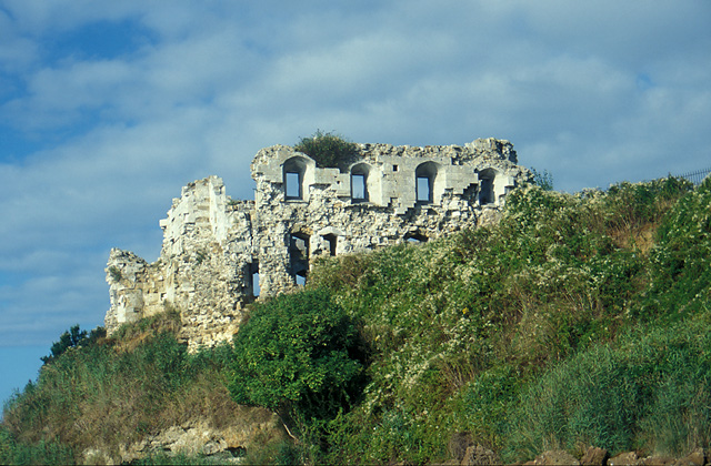
Sandsfoot Castle

Sandsfoot Castle, also known historically as Weymouth Castle, is an artillery fort constructed by Henry VIII near Weymouth, Dorset. It formed part of the...

Rodwell railway station

Rodwell was a small railway station on the Portland Branch Railway in the west of the English county of Dorset. == Station == Opened on 1 June 1870, it...

Newton's Cove

Newton's Cove is a small cove, 0.5 kilometres (0.3 mi) south of Weymouth, Dorset, England. Overlooking Portland Harbour, the cove is close to Nothe Gardens...
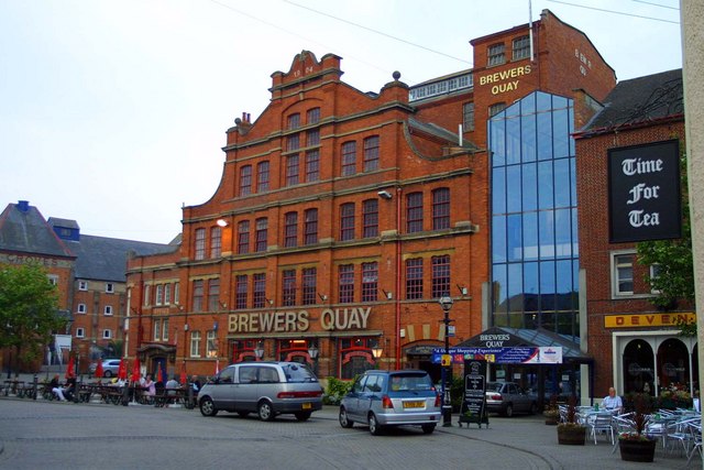
Brewers Quay

Brewers Quay is a converted Victorian brewery on the south side of Hope Square near the Old Harbour in Weymouth, Dorset, southern England. Much of the...

Timewalk

The Timewalk was an exhibition and visitor attraction located in Brewers Quay, Weymouth, Dorset. It opened in 1990 and closed in 2010. One of Weymouth...

Nearby Amenities

Located within 500m of 50.598753,-2.4552069
Created By: almien_coastlines
Source: PGS
Lat/Long: 50.5958112/-2.4602648
Created By: almien_coastlines
Source: PGS
Lat/Long: 50.5962171/-2.4600628
Created By: almien_coastlines
Source: PGS
Lat/Long: 50.5965712/-2.4600118
Created By: almien_coastlines
Source: PGS
Lat/Long: 50.596885/-2.459747
Created By: almien_coastlines
Source: PGS
Lat/Long: 50.597394/-2.458935
Created By: almien_coastlines
Source: PGS
Lat/Long: 50.597518/-2.458129
Created By: almien_coastlines
Source: PGS
Lat/Long: 50.597645/-2.457926
Created By: almien_coastlines
Source: PGS
Lat/Long: 50.598026/-2.457317
Source: PGS
Lat/Long: 50.5983023/-2.45647
Source: PGS
Lat/Long: 50.5985747/-2.4556009
Created By: almien_coastlines
Source: PGS
Lat/Long: 50.598784/-2.454892
Created By: almien_coastlines
Source: PGS
Lat/Long: 50.598912/-2.45469
Created By: almien_coastlines
Source: PGS
Lat/Long: 50.599038/-2.454487
Created By: almien_coastlines
Source: PGS
Lat/Long: 50.599037/-2.454084
Source: PGS
Lat/Long: 50.5993978/-2.4524955
Source: PGS
Lat/Long: 50.5995817/-2.4519268
Source: PGS
Lat/Long: 50.5997587/-2.451723
Source: PGS
Lat/Long: 50.5998745/-2.4517552
Created By: almien_coastlines
Source: PGS
Lat/Long: 50.60005/-2.451656
Source: PGS
Lat/Long: 50.600467/-2.4513582
Source: PGS
Lat/Long: 50.600753/-2.4508969
Source: PGS
Lat/Long: 50.6006781/-2.4506287
Source: PGS
Lat/Long: 50.6011012/-2.4502794
Turning Circle
Lat/Long: 50.6009724/-2.4525515
Noexit: yes
Lat/Long: 50.6017561/-2.4600149
Turning Circle
Lat/Long: 50.6013786/-2.459987
Bus Stop
Bincleaves Road
Bench: yes
Bin: no
Bus: yes
Local Ref: 1200DOB20092
Naptan AtcoCode: 1200DOB20092
Naptan Bearing: N
Naptan CommonName: Bincleaves Road
Naptan Indicator: N-bound
Naptan NaptanCode: dorajgdp
Naptan PlusbusZoneRef: WEYMTH
Naptan Street: Rodwell Road
Naptan Verified: no
Public Transport: platform
Shelter: yes
Tactile Paving: no
Lat/Long: 50.6013626/-2.4588149
Bus Stop
Bincleaves Road
Bench: no
Bin: no
Bus: yes
Lit: no
Local Ref: 1200DOB20008
Naptan AtcoCode: 1200DOB20008
Naptan Bearing: S
Naptan CommonName: Bincleaves Road
Naptan Indicator: S-bound
Naptan NaptanCode: dorajgja
Naptan PlusbusZoneRef: WEYMTH
Naptan Verified: no
Public Transport: platform
Shelter: yes
Tactile Paving: no
Lat/Long: 50.6011772/-2.4587055
Post Box
Collection Times: Mo-Fr 17:30; Sa 12:00
Operator: Royal Mail
Operator Wikidata: Q638098
Post Box Type: lamp
Ref: DT4 29
Ref GB Uprn: 10015408291
Royal Cypher: EIIR
Royal Cypher Wikidata: Q33102113
Source: survey
Lat/Long: 50.6017608/-2.4536643
Post Box
Collection Times: Mo-Fr 09:00; Sa 07:00
Operator: Royal Mail
Operator Wikidata: Q638098
Post Box Type: pillar
Ref: DT4 84D
Ref GB Uprn: 10015358703
Royal Cypher: GR
Royal Cypher Wikidata: Q33102273
Source: survey
Survey Date: 2022-09-10
Lat/Long: 50.6005111/-2.4611371
Post Box
Collection Times: Mo-Fr 09:00; Sa 07:00
Operator: Royal Mail
Operator Wikidata: Q638098
Post Box Type: pillar
Ref: DT4 5D
Ref GB Uprn: 10015471649
Royal Cypher: GVIR
Royal Cypher Wikidata: Q33102169
Source: survey
Survey Date: 2022-09-10
Lat/Long: 50.6015336/-2.4589235
Thomas Fowell Buxton Monument
Historic: memorial
Source: survey
Survey Date: 2023-11-13
Lat/Long: 50.6021158/-2.4521036
Board Title: Thomas Fowell Buxton Monument
Information: board
Source: survey
Survey Date: 2023-11-13
Tourism: information
Lat/Long: 50.6021728/-2.4520634
Noexit: yes
Lat/Long: 50.600331/-2.4615779
Noexit: yes
Lat/Long: 50.6002917/-2.4611074
Noexit: yes
Lat/Long: 50.6010253/-2.4607455
The data included in this document is from www.openstreetmap.org. The data is made available under ODbL.

Have you been to Western Ledges?

Leave your review of Western Ledges below (or comments, questions and feedback).