North Ebb

Coastal Feature, Headland, Point in Orkney

Scotland

North Ebb

Copinsay: sunset over the lighthouse Looking across to the silhouetted lighthouse on the isle of Copinsay from the Aberdeen-Kirkwall-Lerwick ferry. It is four minutes to ten.
Copinsay: sunset over the lighthouse Credit: Chris Downer

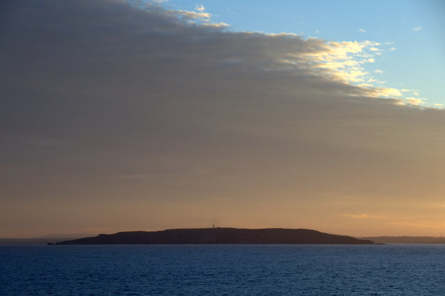
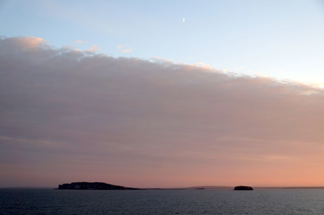
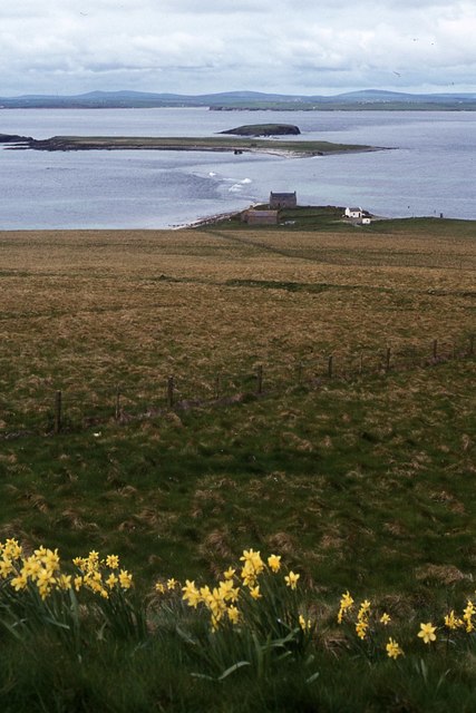
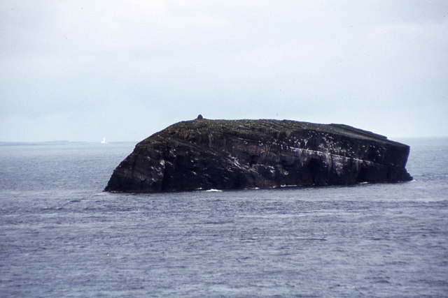
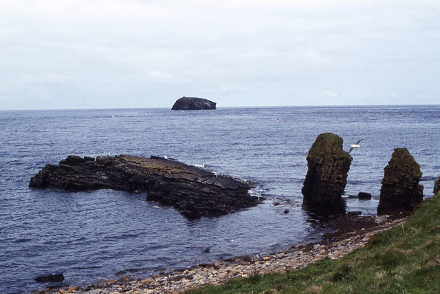
North Ebb is a prominent headland located on the northern coast of the Orkney Islands, an archipelago in Scotland. Positioned near the village of Ebb, it is a captivating coastal feature that attracts both locals and tourists alike.

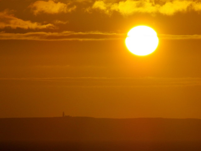
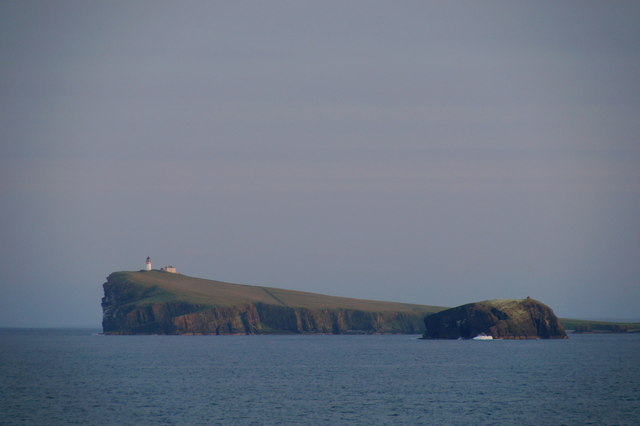
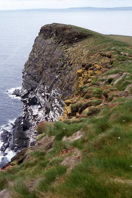
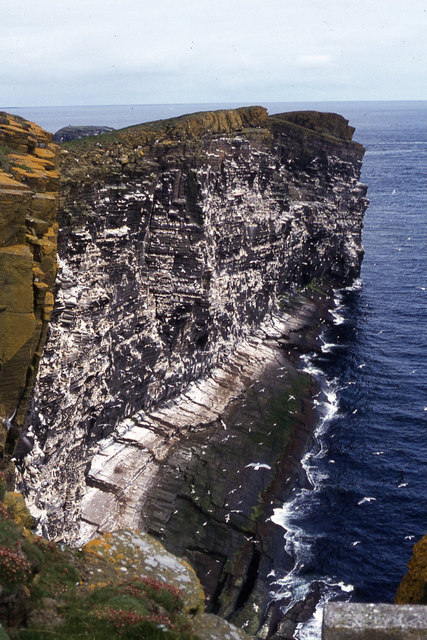
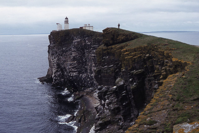
This headland stands tall at approximately 50 meters above sea level, offering breathtaking panoramic views of the surrounding coastline and the North Sea. Its distinct geographical formation comprises layers of rugged cliffs and rocky outcrops, which have been carved over centuries by the relentless waves crashing against them. These cliffs are primarily composed of sandstone and conglomerate rock, giving them a unique reddish hue that contrasts beautifully with the deep blue waters below.

North Ebb is home to a diverse range of flora and fauna, making it an important site for nature enthusiasts. The headland's exposed rocky ledges provide nesting grounds for various seabird species, including puffins, guillemots, and fulmars. Visitors can observe these magnificent creatures as they soar above the waves or dive into the water in search of food.

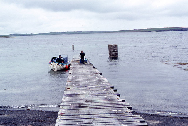
For those seeking outdoor activities, North Ebb offers several opportunities for exploration and adventure. Adventurous hikers can follow the coastal path, which winds its way around the headland, providing access to hidden coves and secluded beaches. The bracing sea breeze and the sound of crashing waves create a serene and invigorating atmosphere.

In summary, North Ebb is a captivating headland on the northern coast of the Orkney Islands. With its stunning cliffs, diverse wildlife, and picturesque views, it is a must-visit destination for nature lovers and outdoor enthusiasts.

If you have any feedback on the listing, please let us know in the comments section below.

North Ebb Images

Images are sourced within 2km of 58.901217/-2.6803223 or Grid Reference HY6001. Thanks to Geograph Open Source API. All images are credited.

Copinsay: sunset over the lighthouse Looking across to the silhouetted lighthouse on the isle of Copinsay from the Aberdeen-Kirkwall-Lerwick ferry. It is four minutes to ten.
Copinsay: sunset over the lighthouse
Looking across to the silhouetted lighthouse on the isle of Copinsay from the Aberdeen-Kirkwall-Lerwick ferry. It is four minutes to ten.
Moon over Copinsay Horse of Copinsay on the left, with the lighthouse just visible on the island. Taken from the ferry from Shetland, somewhere around HY6014.
Moon over Copinsay
Horse of Copinsay on the left, with the lighthouse just visible on the island. Taken from the ferry from Shetland, somewhere around HY6014.
Lighthouse on Copinsay
Copinsay and the Horse of Copinsay
Copinsay from the east Taken from the Aberdeen-Orkney-Shetland ferry 2-3 km to the east.
Copinsay from the east
Taken from the Aberdeen-Orkney-Shetland ferry 2-3 km to the east.
Copinsay and the Horse of Copinsay from the east Taken from the Aberdeen-Orkney-Shetland ferry 2-3 km to the east.
Copinsay and the Horse of Copinsay from the east
Taken from the Aberdeen-Orkney-Shetland ferry 2-3 km to the east.
Horse of Copinsay and Copinsay from the north-east Taken from the Aberdeen-Orkney-Shetland ferry several km to the NE.
Horse of Copinsay and Copinsay from the north-east
Taken from the Aberdeen-Orkney-Shetland ferry several km to the NE.
Copinsay and the Horse of Copinsay at dusk Taken from the Aberdeen-Orkney-Shetland ferry a few kilometres to the NE.
Copinsay and the Horse of Copinsay at dusk
Taken from the Aberdeen-Orkney-Shetland ferry a few kilometres to the NE.
Landing jetty on Copinsay
Copinsay - Island farm and road up to lighthouse
Copinsay - Island farm and associated buildings
Copinsay - southeast facing cliffs near lighthouse
Copinsay - rough grazing on slope west of lighthouse
Copinsay - The lighthouse
Copinsay - cliffs northeast of lighthouse
Copinsay - view southwest along cliffs to lighthouse
The Horse of Copinsay from North View, Copinsay
Copinsay - rock stacks at Sandgeo Taing
Show me another place!

North Ebb is located at Grid Ref: HY6001 (Lat: 58.901217, Lng: -2.6803223)

Unitary Authority: Orkney Islands

Police Authority: Highlands and Islands

What 3 Words

///launcher.thinking.smudges. Near Deerness, Orkney Islands

Related Wikis

Copinsay

Copinsay (Old Norse: Kolbeinsey) is one of the Orkney Islands in Scotland, lying off the east coast of the Orkney Mainland. The smaller companion island...

Corn Holm

Corn Holm is a small tidal island in Orkney, near Copinsay to the west, off the north-eastern coast of Scotland. There was once a small chapel there, and...

Black Holm

Black Holm is a small tidal island in the Orkney Islands, near Copinsay to the west of Corn Holm off the north-eastern coast of Scotland. == Geography... ==

Horse of Copinsay

The Horse of Copinsay, also known as the Horse, is a rectangular uninhabited sea stack to the north east of Copinsay in the Orkney Islands, Scotland....

Point of Ayre, Orkney

There are also two similarly named points in the British Isles: Point of Ayre, Isle of Man and Point of Ayr, Wales.Point of Ayre is a headland in the parish...

The Gloup

The Gloup () is a collapsed sea cave in the Mull Head Nature Reserve in the islands of Orkney, Scotland. The name derives from the Old Norse "gluppa",...

Deerness

Deerness (, locally , Old Norse: Dyrnes) is a quoad sacra parish (i.e. one created and functioning for ecclesiastical purposes only) and peninsula in Mainland...

St Peter's Pool, Orkney

St Peter's Pool is a bay in the East Mainland of Orkney, Scotland. This bay was the site of significant coastal defences during World War II, when a German...

Nearby Amenities

Located within 500m of 58.901217,-2.6803223
Created By: almien_coastlines mod
Lat/Long: 58.896968/-2.680921
Created By: almien_coastlines mod
Lat/Long: 58.900818/-2.685089
Created By: almien_coastlines mod
Lat/Long: 58.901064/-2.68113
Created By: almien_coastlines mod
Lat/Long: 58.901445/-2.680137
Created By: almien_coastlines mod
Lat/Long: 58.900173/-2.683117
Created By: almien_coastlines mod
Lat/Long: 58.900954/-2.688551
Created By: almien_coastlines mod
Lat/Long: 58.900552/-2.680888
Created By: almien_coastlines mod
Lat/Long: 58.900693/-2.686575
Created By: almien_coastlines mod
Lat/Long: 58.899145/-2.681642
Created By: almien_coastlines mod
Lat/Long: 58.902197/-2.6737
Created By: almien_coastlines mod
Lat/Long: 58.900179/-2.68559
Created By: almien_coastlines mod
Lat/Long: 58.901952/-2.678154
Created By: almien_coastlines mod
Lat/Long: 58.902207/-2.677657
Created By: almien_coastlines mod
Lat/Long: 58.900169/-2.681633
Created By: almien_coastlines mod
Lat/Long: 58.899402/-2.682135
Created By: almien_coastlines mod
Lat/Long: 58.9017/-2.67964
Created By: almien_coastlines mod
Lat/Long: 58.897736/-2.680914
Created By: almien_coastlines mod
Lat/Long: 58.898759/-2.68041
Created By: almien_coastlines mod
Lat/Long: 58.897991/-2.680417
Created By: almien_coastlines mod
Lat/Long: 58.899662/-2.683616
Created By: almien_coastlines mod
Lat/Long: 58.900694/-2.687069
Created By: almien_coastlines mod
Lat/Long: 58.902194/-2.67271
Created By: almien_coastlines mod
Lat/Long: 58.90119/-2.680634
Created By: almien_coastlines mod
Lat/Long: 58.899921/-2.685097
Created By: almien_coastlines mod
Lat/Long: 58.898887/-2.680655
Created By: almien_coastlines mod
Lat/Long: 58.902202/-2.675678
Created By: almien_coastlines mod
Lat/Long: 58.900051/-2.685345
Created By: almien_coastlines mod
Lat/Long: 58.900295/-2.680642
The data included in this document is from www.openstreetmap.org. The data is made available under ODbL.

Have you been to North Ebb?

Leave your review of North Ebb below (or comments, questions and feedback).