Copinsay Skerry

Island in Orkney

Scotland

Copinsay Skerry

Copinsay: sunset over the lighthouse Looking across to the silhouetted lighthouse on the isle of Copinsay from the Aberdeen-Kirkwall-Lerwick ferry. It is four minutes to ten.
Copinsay: sunset over the lighthouse Credit: Chris Downer

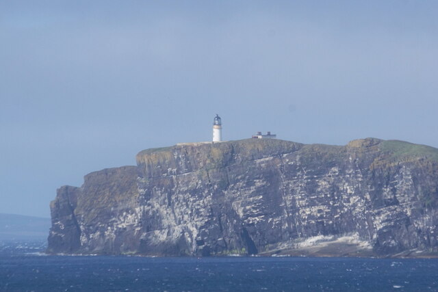
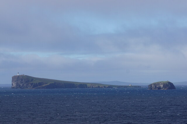
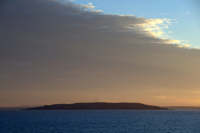
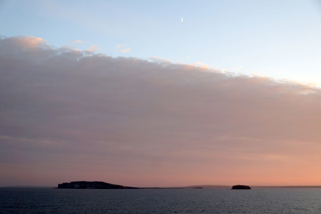
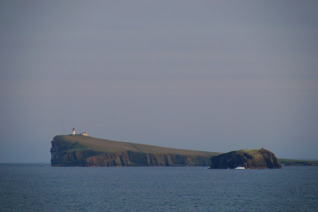
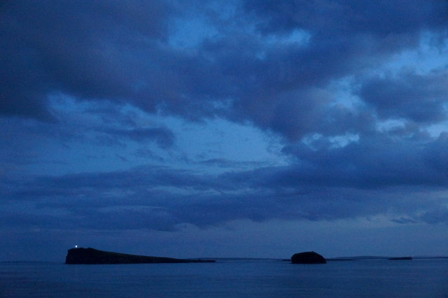
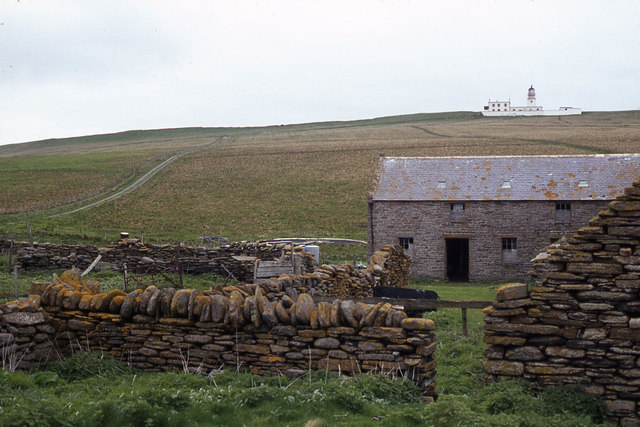
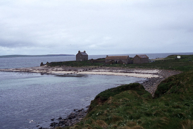
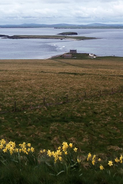
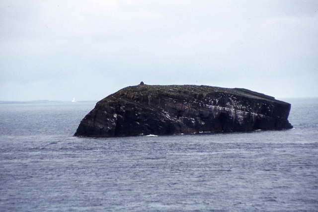
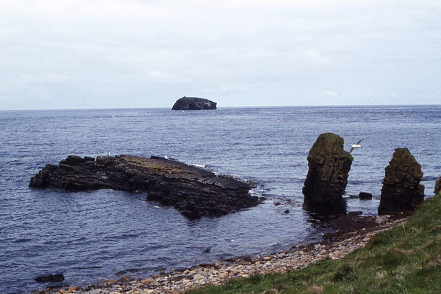
Copinsay Skerry is a small uninhabited island located in the Orkney archipelago, off the northeastern coast of Scotland. It is situated approximately 5 kilometers east of the mainland and is part of the Copinsay Nature Reserve. The island is roughly 0.3 square kilometers in size and is characterized by its rugged and rocky terrain.

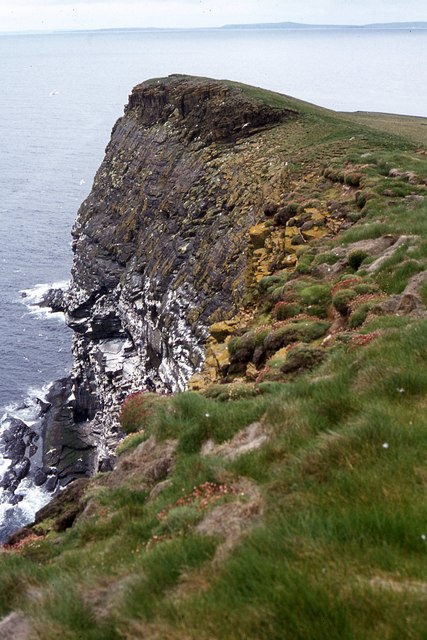
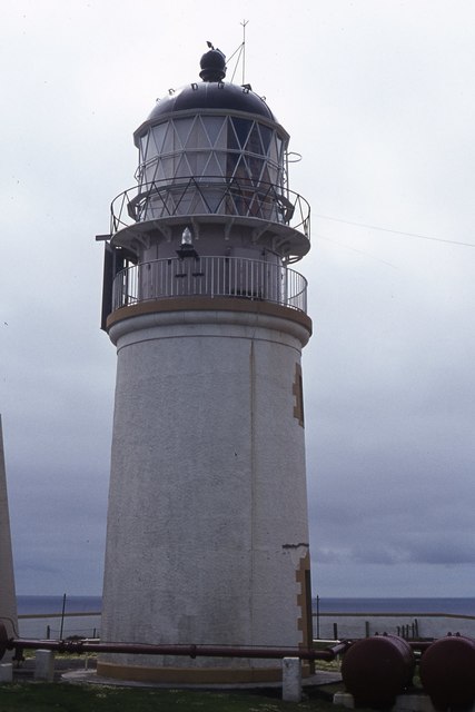
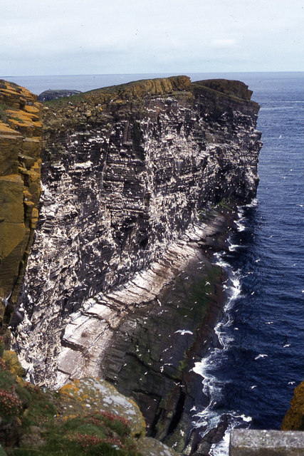
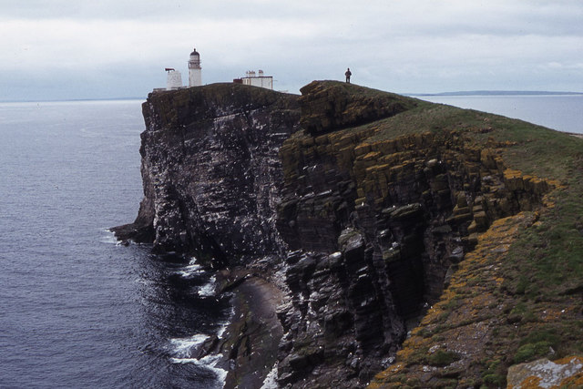
One of the most distinctive features of Copinsay Skerry is its dramatic coastline, which is dotted with sea caves, natural arches, and towering cliffs. These cliffs provide nesting sites for a variety of seabirds, including puffins, guillemots, and fulmars, making the island a popular destination for birdwatchers and nature enthusiasts.

The island's vegetation is predominantly grassy and heathland, with patches of shrubs and wildflowers. Despite its small size, Copinsay Skerry is home to a diverse range of plant species, including sea thrift, sea campion, and bird's-foot trefoil.

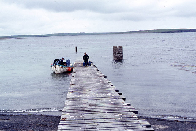
Access to Copinsay Skerry is limited, with no regular passenger ferry service. However, boat trips can be arranged from nearby harbors, allowing visitors to explore the island's natural beauty and observe its wildlife. The surrounding waters are also known for their rich marine life, with seals, dolphins, and occasionally whales spotted in the area.

Overall, Copinsay Skerry offers a unique and unspoiled natural environment, providing a sanctuary for both terrestrial and marine wildlife. Its remote location and untouched scenery make it a haven for those seeking solitude and a deep appreciation for the natural world.

If you have any feedback on the listing, please let us know in the comments section below.

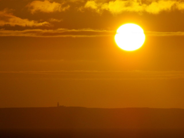
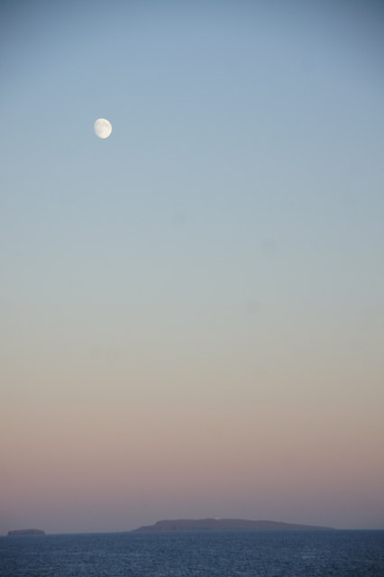
Copinsay Skerry Images

Images are sourced within 2km of 58.900699/-2.6848246 or Grid Reference HY6001. Thanks to Geograph Open Source API. All images are credited.

Copinsay: sunset over the lighthouse Looking across to the silhouetted lighthouse on the isle of Copinsay from the Aberdeen-Kirkwall-Lerwick ferry. It is four minutes to ten.
Copinsay: sunset over the lighthouse
Looking across to the silhouetted lighthouse on the isle of Copinsay from the Aberdeen-Kirkwall-Lerwick ferry. It is four minutes to ten.
Moon over Copinsay Horse of Copinsay on the left, with the lighthouse just visible on the island. Taken from the ferry from Shetland, somewhere around HY6014.
Moon over Copinsay
Horse of Copinsay on the left, with the lighthouse just visible on the island. Taken from the ferry from Shetland, somewhere around HY6014.
Lighthouse on Copinsay
Copinsay and the Horse of Copinsay
Copinsay from the east Taken from the Aberdeen-Orkney-Shetland ferry 2-3 km to the east.
Copinsay from the east
Taken from the Aberdeen-Orkney-Shetland ferry 2-3 km to the east.
Copinsay and the Horse of Copinsay from the east Taken from the Aberdeen-Orkney-Shetland ferry 2-3 km to the east.
Copinsay and the Horse of Copinsay from the east
Taken from the Aberdeen-Orkney-Shetland ferry 2-3 km to the east.
Horse of Copinsay and Copinsay from the north-east Taken from the Aberdeen-Orkney-Shetland ferry several km to the NE.
Horse of Copinsay and Copinsay from the north-east
Taken from the Aberdeen-Orkney-Shetland ferry several km to the NE.
Copinsay and the Horse of Copinsay at dusk Taken from the Aberdeen-Orkney-Shetland ferry a few kilometres to the NE.
Copinsay and the Horse of Copinsay at dusk
Taken from the Aberdeen-Orkney-Shetland ferry a few kilometres to the NE.
Landing jetty on Copinsay
Copinsay - Island farm and road up to lighthouse
Copinsay - Island farm and associated buildings
Copinsay - southeast facing cliffs near lighthouse
Copinsay - rough grazing on slope west of lighthouse
Copinsay - The lighthouse
Copinsay - cliffs northeast of lighthouse
Copinsay - view southwest along cliffs to lighthouse
The Horse of Copinsay from North View, Copinsay
Copinsay - rock stacks at Sandgeo Taing
Show me another place!

Copinsay Skerry is located at Grid Ref: HY6001 (Lat: 58.900699, Lng: -2.6848246)

Unitary Authority: Orkney Islands

Police Authority: Highlands and Islands

What 3 Words

///expecting.moats.premature. Near Deerness, Orkney Islands

Related Wikis

Copinsay

Copinsay (Old Norse: Kolbeinsey) is one of the Orkney Islands in Scotland, lying off the east coast of the Orkney Mainland. The smaller companion island...

Corn Holm

Corn Holm is a small tidal island in Orkney, near Copinsay to the west, off the north-eastern coast of Scotland. There was once a small chapel there, and...

Black Holm

Black Holm is a small tidal island in the Orkney Islands, near Copinsay to the west of Corn Holm off the north-eastern coast of Scotland. == Geography... ==

Horse of Copinsay

The Horse of Copinsay, also known as the Horse, is a rectangular uninhabited sea stack to the north east of Copinsay in the Orkney Islands, Scotland....

Nearby Amenities

Located within 500m of 58.900699,-2.6848246
Created By: almien_coastlines mod
Lat/Long: 58.902496/-2.691505
Created By: almien_coastlines mod
Lat/Long: 58.902881/-2.69175
Created By: almien_coastlines mod
Lat/Long: 58.896968/-2.680921
Created By: almien_coastlines mod
Lat/Long: 58.900818/-2.685089
Created By: almien_coastlines mod
Lat/Long: 58.901064/-2.68113
Created By: almien_coastlines mod
Lat/Long: 58.901086/-2.690282
Created By: almien_coastlines mod
Lat/Long: 58.900443/-2.68905
Created By: almien_coastlines mod
Lat/Long: 58.901445/-2.680137
Created By: almien_coastlines mod
Lat/Long: 58.900173/-2.683117
Created By: almien_coastlines mod
Lat/Long: 58.900954/-2.688551
Created By: almien_coastlines mod
Lat/Long: 58.900552/-2.680888
Created By: almien_coastlines mod
Lat/Long: 58.900572/-2.689297
Created By: almien_coastlines mod
Lat/Long: 58.900693/-2.686575
Created By: almien_coastlines mod
Lat/Long: 58.899145/-2.681642
Created By: almien_coastlines mod
Lat/Long: 58.90211/-2.690272
Created By: almien_coastlines mod
Lat/Long: 58.900179/-2.68559
Created By: almien_coastlines mod
Lat/Long: 58.901952/-2.678154
Created By: almien_coastlines mod
Lat/Long: 58.902207/-2.677657
Created By: almien_coastlines mod
Lat/Long: 58.900169/-2.681633
Created By: almien_coastlines mod
Lat/Long: 58.899402/-2.682135
Created By: almien_coastlines mod
Lat/Long: 58.9017/-2.67964
Created By: almien_coastlines mod
Lat/Long: 58.897736/-2.680914
Created By: almien_coastlines mod
Lat/Long: 58.898759/-2.68041
Created By: almien_coastlines mod
Lat/Long: 58.901211/-2.689043
Created By: almien_coastlines mod
Lat/Long: 58.897991/-2.680417
Created By: almien_coastlines mod
Lat/Long: 58.899662/-2.683616
Created By: almien_coastlines mod
Lat/Long: 58.900694/-2.687069
Created By: almien_coastlines mod
Lat/Long: 58.90119/-2.680634
Created By: almien_coastlines mod
Lat/Long: 58.899921/-2.685097
Created By: almien_coastlines mod
Lat/Long: 58.898887/-2.680655
Created By: almien_coastlines mod
Lat/Long: 58.900051/-2.685345
Created By: almien_coastlines mod
Lat/Long: 58.900295/-2.680642
Created By: almien_coastlines mod
Lat/Long: 58.903137/-2.691747
The data included in this document is from www.openstreetmap.org. The data is made available under ODbL.

Have you been to Copinsay Skerry?

Leave your review of Copinsay Skerry below (or comments, questions and feedback).