Sow Skerry

Island in Orkney

Scotland

Sow Skerry

Copinsay: sunset over the lighthouse Looking across to the silhouetted lighthouse on the isle of Copinsay from the Aberdeen-Kirkwall-Lerwick ferry. It is four minutes to ten.
Copinsay: sunset over the lighthouse Credit: Chris Downer

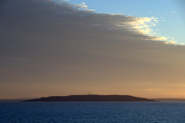
Sow Skerry is a small island located in the Orkney archipelago, situated off the northeastern coast of Scotland. The island is part of the North Isles and is located approximately 13 kilometers northeast of Kirkwall, the main town in Orkney.

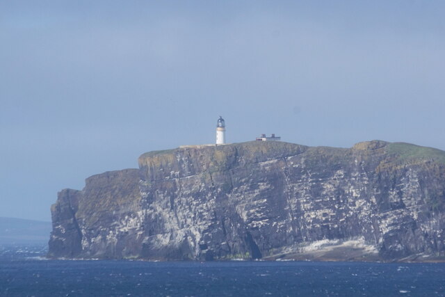
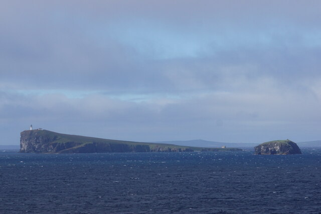
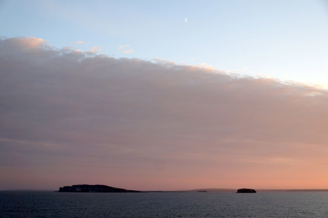
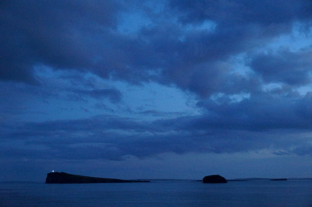
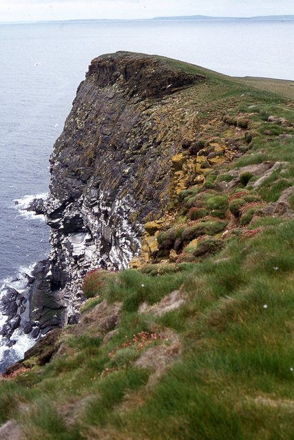
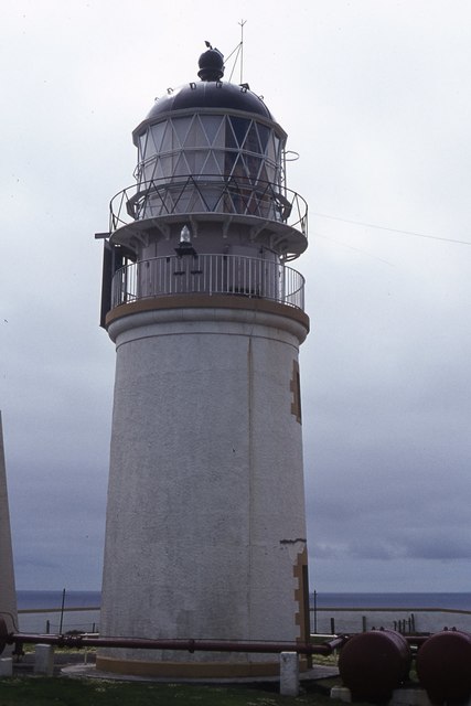
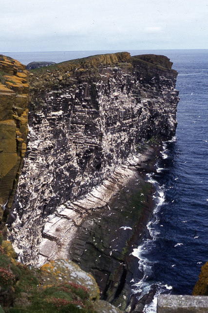
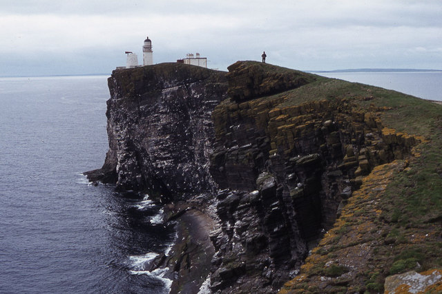
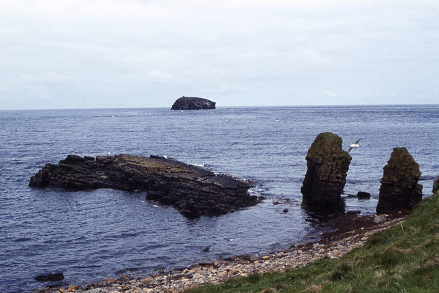
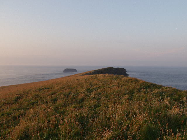
Sow Skerry is a rocky and uninhabited island, measuring around 900 meters in length and 200 meters in width. It is known for its rugged and dramatic coastline, characterized by towering cliffs and jagged rocks. The island's name is derived from the Old Norse "Skrár," meaning a skerry or rocky reef, indicating the treacherous nature of the surrounding waters.

The island is a haven for various species of seabirds, including guillemots, razorbills, and puffins, which nest along the cliffs during the breeding season. The surrounding waters are also home to a diverse range of marine life, including seals, dolphins, and occasionally, whales.

Due to its remote location and challenging terrain, Sow Skerry is not easily accessible to visitors. However, it is often admired from boat trips and excursions, allowing tourists to appreciate its natural beauty and observe the abundant wildlife.

Sow Skerry exemplifies the rugged and untamed character of the Orkney Islands, providing a glimpse into the region's rich natural heritage and attracting nature enthusiasts and wildlife lovers from around the world.

If you have any feedback on the listing, please let us know in the comments section below.
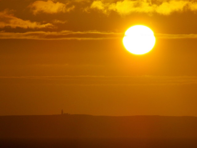
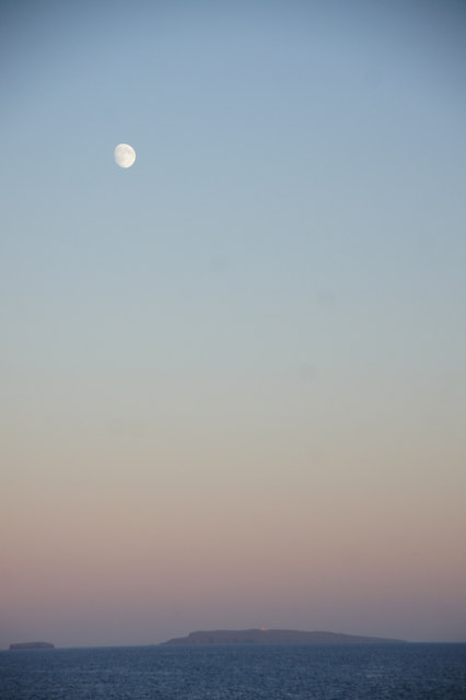
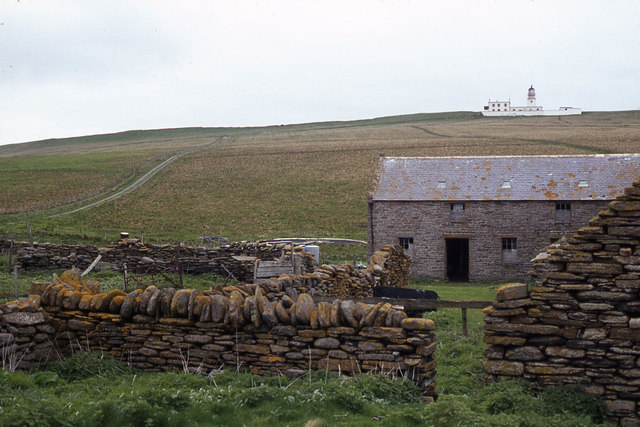
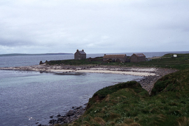
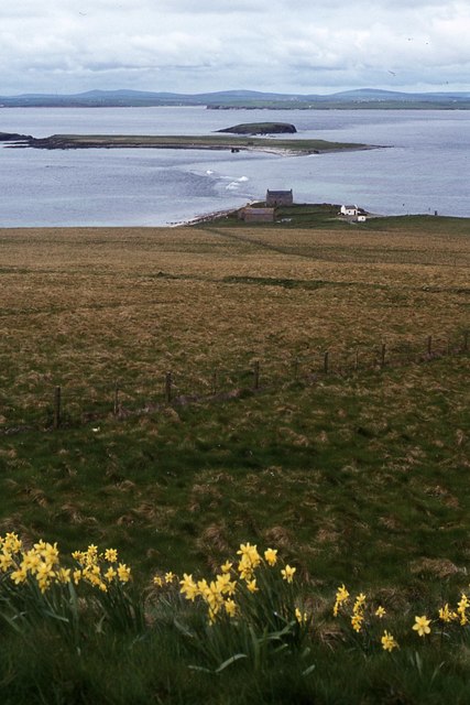
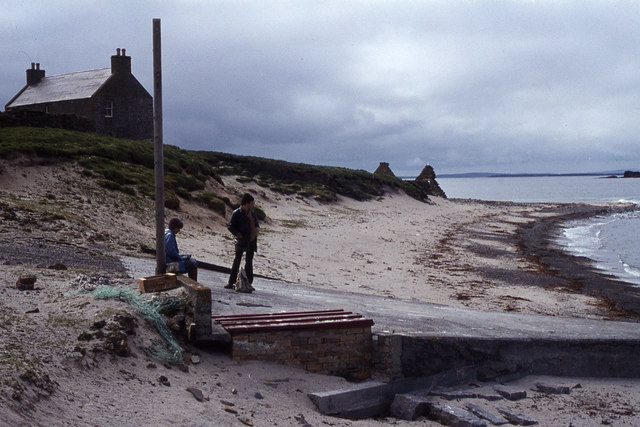
Sow Skerry Images

Images are sourced within 2km of 58.898907/-2.6907593 or Grid Reference HY6001. Thanks to Geograph Open Source API. All images are credited.

Copinsay: sunset over the lighthouse Looking across to the silhouetted lighthouse on the isle of Copinsay from the Aberdeen-Kirkwall-Lerwick ferry. It is four minutes to ten.
Copinsay: sunset over the lighthouse
Looking across to the silhouetted lighthouse on the isle of Copinsay from the Aberdeen-Kirkwall-Lerwick ferry. It is four minutes to ten.
Moon over Copinsay Horse of Copinsay on the left, with the lighthouse just visible on the island. Taken from the ferry from Shetland, somewhere around HY6014.
Moon over Copinsay
Horse of Copinsay on the left, with the lighthouse just visible on the island. Taken from the ferry from Shetland, somewhere around HY6014.
Lighthouse on Copinsay
Copinsay and the Horse of Copinsay
Copinsay from the east Taken from the Aberdeen-Orkney-Shetland ferry 2-3 km to the east.
Copinsay from the east
Taken from the Aberdeen-Orkney-Shetland ferry 2-3 km to the east.
Copinsay and the Horse of Copinsay from the east Taken from the Aberdeen-Orkney-Shetland ferry 2-3 km to the east.
Copinsay and the Horse of Copinsay from the east
Taken from the Aberdeen-Orkney-Shetland ferry 2-3 km to the east.
Copinsay and the Horse of Copinsay at dusk Taken from the Aberdeen-Orkney-Shetland ferry a few kilometres to the NE.
Copinsay and the Horse of Copinsay at dusk
Taken from the Aberdeen-Orkney-Shetland ferry a few kilometres to the NE.
Landing jetty on Copinsay
Copinsay - Island farm and road up to lighthouse
Copinsay - Island farm and associated buildings
Copinsay - southeast facing cliffs near lighthouse
Copinsay - rough grazing on slope west of lighthouse
Copinsay - The lighthouse
Copinsay - cliffs northeast of lighthouse
Copinsay - view southwest along cliffs to lighthouse
Copinsay - rock stacks at Sandgeo Taing
Copinsay - Waiting for the return boat at top of jetty
Summit ridge on Island of Copinsay Copinsay is an escarpment, with a long north-westerly facing slope leading up to its highest point, then cliffs sheer into the water to the south east.  The picture was taken one evening and shows the summit ridge, looking north east to the Horse of Copinsay (HY6202)
Summit ridge on Island of Copinsay
Copinsay is an escarpment, with a long north-westerly facing slope leading up to its highest point, then cliffs sheer into the water to the south east. The picture was taken one evening and shows the summit ridge, looking north east to the Horse of Copinsay (HY6202)
Show me another place!

Sow Skerry is located at Grid Ref: HY6001 (Lat: 58.898907, Lng: -2.6907593)

Unitary Authority: Orkney Islands

Police Authority: Highlands and Islands

What 3 Words

///once.thrusters.hotspot. Near Deerness, Orkney Islands

Related Wikis

Corn Holm

Corn Holm is a small tidal island in Orkney, near Copinsay to the west, off the north-eastern coast of Scotland. There was once a small chapel there, and...

Copinsay

Copinsay (Old Norse: Kolbeinsey) is one of the Orkney Islands in Scotland, lying off the east coast of the Orkney Mainland. The smaller companion island...

Black Holm

Black Holm is a small tidal island in the Orkney Islands, near Copinsay to the west of Corn Holm off the north-eastern coast of Scotland. == Geography... ==

Horse of Copinsay

The Horse of Copinsay, also known as the Horse, is a rectangular uninhabited sea stack to the north east of Copinsay in the Orkney Islands, Scotland....

Nearby Amenities

Located within 500m of 58.898907,-2.6907593
Created By: almien_coastlines mod
Lat/Long: 58.902496/-2.691505
Created By: almien_coastlines mod
Lat/Long: 58.902881/-2.69175
Created By: almien_coastlines mod
Lat/Long: 58.900818/-2.685089
Created By: almien_coastlines mod
Lat/Long: 58.901086/-2.690282
Created By: almien_coastlines mod
Lat/Long: 58.899949/-2.696474
Created By: almien_coastlines mod
Lat/Long: 58.900443/-2.68905
Created By: almien_coastlines mod
Lat/Long: 58.900173/-2.683117
Created By: almien_coastlines mod
Lat/Long: 58.900954/-2.688551
Created By: almien_coastlines mod
Lat/Long: 58.900572/-2.689297
Created By: almien_coastlines mod
Lat/Long: 58.900693/-2.686575
Created By: almien_coastlines mod
Lat/Long: 58.901606/-2.693491
Created By: almien_coastlines mod
Lat/Long: 58.90211/-2.690272
Created By: almien_coastlines mod
Lat/Long: 58.900179/-2.68559
Created By: almien_coastlines mod
Lat/Long: 58.899402/-2.682135
Created By: almien_coastlines mod
Lat/Long: 58.901097/-2.69498
Created By: almien_coastlines mod
Lat/Long: 58.901211/-2.689043
Created By: almien_coastlines mod
Lat/Long: 58.899662/-2.683616
Created By: almien_coastlines mod
Lat/Long: 58.900694/-2.687069
Created By: almien_coastlines mod
Lat/Long: 58.899946/-2.695485
Created By: almien_coastlines mod
Lat/Long: 58.899921/-2.685097
Created By: almien_coastlines mod
Lat/Long: 58.900051/-2.685345
Created By: almien_coastlines mod
Lat/Long: 58.903137/-2.691747
The data included in this document is from www.openstreetmap.org. The data is made available under ODbL.

Have you been to Sow Skerry?

Leave your review of Sow Skerry below (or comments, questions and feedback).