Taking Head

Coastal Feature, Headland, Point in East Lothian

Scotland

Taking Head

Walkers on Seacliff Beach The Bass Rock dominates the background.
Walkers on Seacliff Beach Credit: Walter Baxter

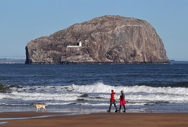
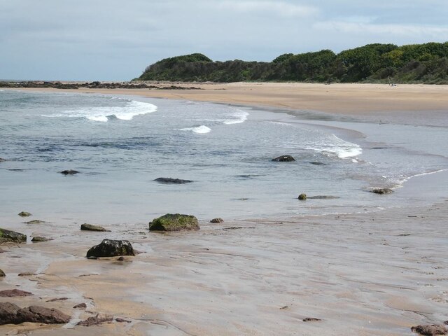
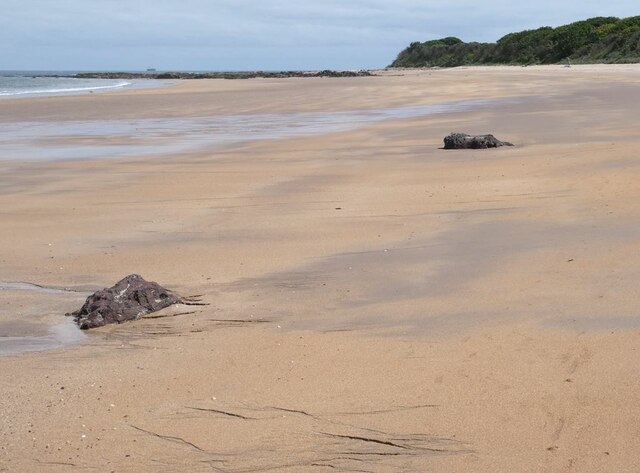
Located in East Lothian, Scotland, Tantallon Head, also known as Taking Head, is a prominent coastal feature that serves as a headland or point along the coastline. Stretching approximately 300 meters out into the North Sea, it offers stunning panoramic views of the surrounding area.

Taking Head is characterized by its towering cliffs, which rise up to 50 meters above sea level, providing a dramatic backdrop against the crashing waves below. The cliffs are composed of rugged, red sandstone, adding to the area's unique aesthetic appeal.

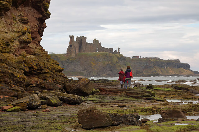
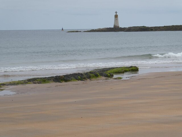
At the tip of Taking Head, the land tapers off to a narrow promontory, creating a distinct point that juts out into the sea. This geological formation provides a natural defense and has historically been of strategic importance, with the remnants of Tantallon Castle perched on the headland. These castle ruins, dating back to the 14th century, further contribute to the area's allure and attract visitors interested in exploring its rich history.

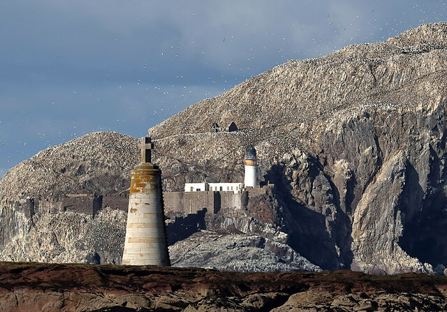
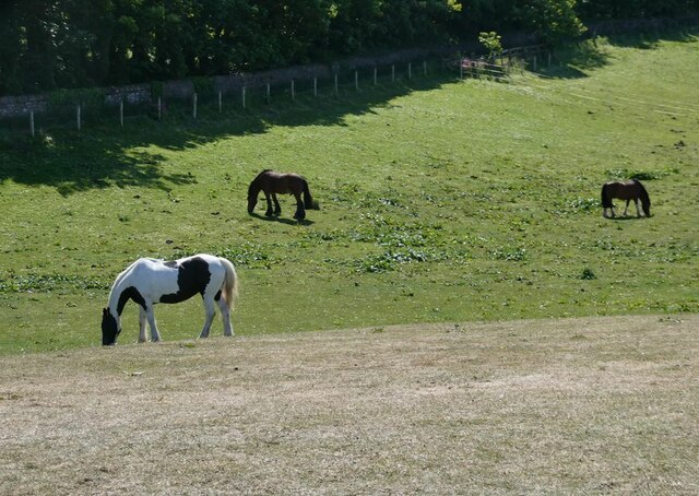
Aside from its historical significance, Taking Head also boasts a diverse array of wildlife. The cliffs provide nesting sites for various seabirds, including gulls, fulmars, and kittiwakes. Visitors can often spot these birds soaring overhead or perched on the cliff ledges. The surrounding waters are also home to seals and occasionally dolphins, offering opportunities for wildlife enthusiasts to observe these marine creatures in their natural habitat.

Overall, Taking Head in East Lothian is a striking coastal feature, combining historical significance, breathtaking views, and a diverse range of wildlife, making it a must-visit destination for nature lovers and history enthusiasts alike.

If you have any feedback on the listing, please let us know in the comments section below.

Taking Head Images

Images are sourced within 2km of 56.059033/-2.6598657 or Grid Reference NT5985. Thanks to Geograph Open Source API. All images are credited.

Walkers on Seacliff Beach The Bass Rock dominates the background.
Walkers on Seacliff Beach
The Bass Rock dominates the background.
St Baldred’s Cross The stone structure topped with a cross is a shipping beacon on the rocky outcrop of St Baldred’s Boat at Seacliff on the East Lothian Coast. This telephoto shot from Car Rocks has foreshortened the Bass Rock in the background.
St Baldred’s Cross
The stone structure topped with a cross is a shipping beacon on the rocky outcrop of St Baldred’s Boat at Seacliff on the East Lothian Coast. This telephoto shot from Car Rocks has foreshortened the Bass Rock in the background.
Low tide at Seacliff The walkers are looking towards Tantallon Castle.
Low tide at Seacliff
The walkers are looking towards Tantallon Castle.
Shades of grey at Seacliff There was an interesting grey sky during my morning walk on Seacliff Beach.
Shades of grey at Seacliff
There was an interesting grey sky during my morning walk on Seacliff Beach.
Seacliff Harbour Tantallon Castle <a href="https://www.geograph.org.uk/gridref/NT5985">NT5985</a> on the far headland.
Seacliff Harbour
Tantallon Castle NT5985 on the far headland.
Rock on  Seacliff Beach
Rock on Seacliff Beach
The Gegan and Bass Rock The red sandstone of the headland of the Gegan stands in striking contrast to the white guano-covered Bass Rock <a href="https://www.geograph.org.uk/gridref/NT6087">NT6087</a> beyond.
The Gegan and Bass Rock
The red sandstone of the headland of the Gegan stands in striking contrast to the white guano-covered Bass Rock NT6087 beyond.
The Gegan and Bass Rock The red sandstone of the headland of the Gegan (A tidal island) stands in striking contrast to the white guano-covered Bass Rock <a href="https://www.geograph.org.uk/gridref/NT6087">NT6087</a> beyond.
The Gegan and Bass Rock
The red sandstone of the headland of the Gegan (A tidal island) stands in striking contrast to the white guano-covered Bass Rock NT6087 beyond.
St  Baldred's Cross This cross on a tidal reef also serves as a navigation marker at the mouth of  the Firth of Forth.
St Baldred's Cross
This cross on a tidal reef also serves as a navigation marker at the mouth of the Firth of Forth.
Horses grazing in a field above Seacliff Bay
Cliff and tidal platform at the Gegan With a distant view of the Isle of May <a href="https://www.geograph.org.uk/gridref/NT6599">NT6599</a>.
Cliff and tidal platform at the Gegan
With a distant view of the Isle of May NT6599.
Seacliff Harbour Tantallon Castle <a href="https://www.geograph.org.uk/gridref/NT5985">NT5985</a> on the far headland.
Seacliff Harbour
Tantallon Castle NT5985 on the far headland.
Rocky shoreline west of the Gegan Tantallon Castle <a href="https://www.geograph.org.uk/gridref/NT5985">NT5985</a> on the cliff.
Rocky shoreline west of the Gegan
Tantallon Castle NT5985 on the cliff.
Seacliff Bay Remote bay on the coast south of Tantallon Castle.
Seacliff Bay
Remote bay on the coast south of Tantallon Castle.
Prominent rock at Seacliff Bay The Gegan beyond.
Prominent rock at Seacliff Bay
The Gegan beyond.
The broad sands of Seacliff Bay Remote bay on the coast south of Tantallon Castle.
The broad sands of Seacliff Bay
Remote bay on the coast south of Tantallon Castle.
Seacliff Bay Remote bay on the coast south of Tantallon Castle, seen from the car park on the cliff top. In view are the Gegan and Bass Rock <a href="https://www.geograph.org.uk/gridref/NT6087">NT6087</a>.
Seacliff Bay
Remote bay on the coast south of Tantallon Castle, seen from the car park on the cliff top. In view are the Gegan and Bass Rock NT6087.
Seacliff Bay And the rocky tidal reef running out to St Baldred's Cross <a href="https://www.geograph.org.uk/gridref/NT6085">NT6085</a>.
Seacliff Bay
And the rocky tidal reef running out to St Baldred's Cross NT6085.
Show me another place!

Taking Head is located at Grid Ref: NT5985 (Lat: 56.059033, Lng: -2.6598657)

Unitary Authority: East Lothian

Police Authority: The Lothians and Scottish Borders

What 3 Words

///merit.unfocused.chair. Near North Berwick, East Lothian

Related Wikis

Canty Bay

Canty Bay is a small inlet and coastal hamlet on the northern coast of East Lothian, Scotland. It is 2 miles (3.2 km) east of North Berwick and is opposite...

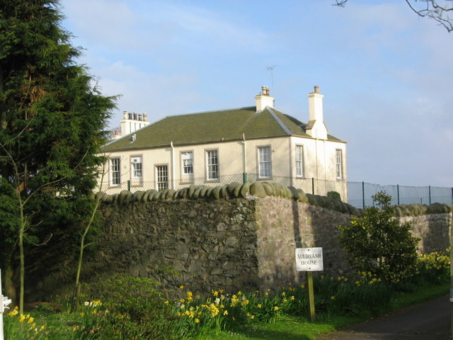
Auldhame & Scoughall

Auldhame and Scoughall are hamlets in East Lothian, Scotland. They are close to the town of North Berwick and the village of Whitekirk, and are approximately...
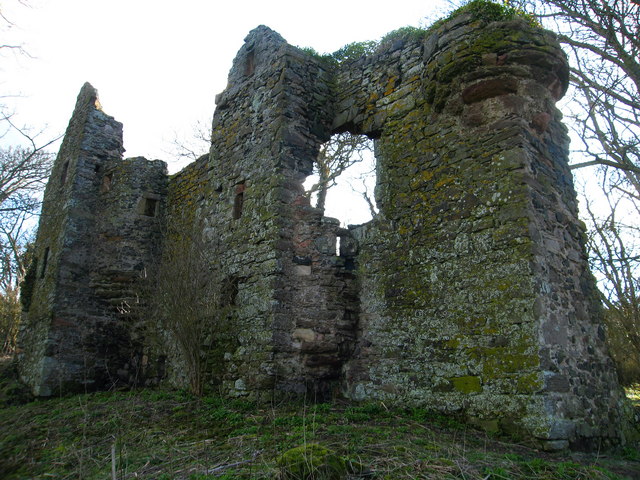
Auldhame Castle

Auldhame Castle is a ruined L-plan tower house standing on a ridge above Seacliff beach, about 3 miles east of North Berwick in East Lothian, and less...

Seacliff

Seacliff comprises a beach, an estate and a harbour. It lies 4 miles (6 kilometres) east of North Berwick, East Lothian, Scotland. == History == The beach...

Nearby Amenities

Located within 500m of 56.059033,-2.6598657
Well
Natural: spring
Source: OS_OpenData_StreetView
Lat/Long: 56.0565406/-2.653946
Canty Bay
Natural: bay
Lat/Long: 56.0585442/-2.6649168
Disused: yes
Old Name: Radar Research facility
Lat/Long: 56.0589388/-2.6549184
Gin Head
Locality: bay
Lat/Long: 56.0594808/-2.6538078
Canty Bay
Place: hamlet
Lat/Long: 56.0574855/-2.6658108
Gin Head
Place: locality
Lat/Long: 56.0591154/-2.6550248
Barrier: stile
Lat/Long: 56.0589672/-2.6591371
Power: pole
Lat/Long: 56.0547673/-2.6578257
Power: pole
Lat/Long: 56.0553526/-2.6574712
Power: pole
Lat/Long: 56.0560074/-2.6571124
Power: pole
Lat/Long: 56.0566891/-2.6568061
Power: pole
Lat/Long: 56.0575358/-2.6564297
The data included in this document is from www.openstreetmap.org. The data is made available under ODbL.

Have you been to Taking Head?

Leave your review of Taking Head below (or comments, questions and feedback).