Farm, Low

Settlement in Yorkshire

England

Farm, Low

Moseley Bottom The  entrance to the railway tunnel at Moseley Bottom on the Leeds to Harrogate line
Moseley Bottom Credit: Mick Melvin

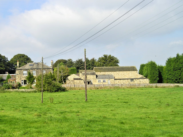
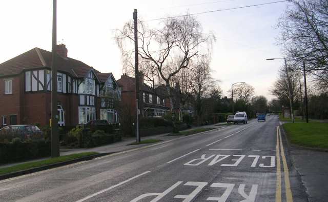
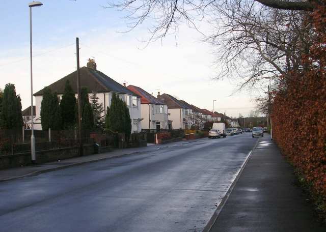
Farm, Low is a small village located in the county of Yorkshire, England. Situated in the rural countryside, this picturesque village is known for its tranquil and idyllic surroundings. With a population of around 300 residents, Farm, Low offers a close-knit community atmosphere.

The village is characterized by its traditional architecture, with charming stone cottages and farmhouses dotting the landscape. The stunning natural beauty of the area is enhanced by rolling hills, vast green fields, and meandering streams. The village is surrounded by fertile farmland, which has been the backbone of the local economy for generations.

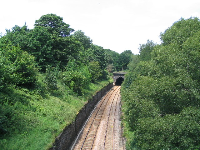
Farm, Low is a prime destination for nature lovers and outdoor enthusiasts. The surrounding countryside provides ample opportunities for activities such as hiking, cycling, and horseback riding. The village is also home to several well-maintained footpaths that offer breathtaking views of the Yorkshire Dales.

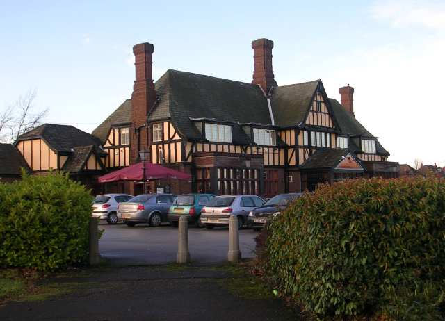
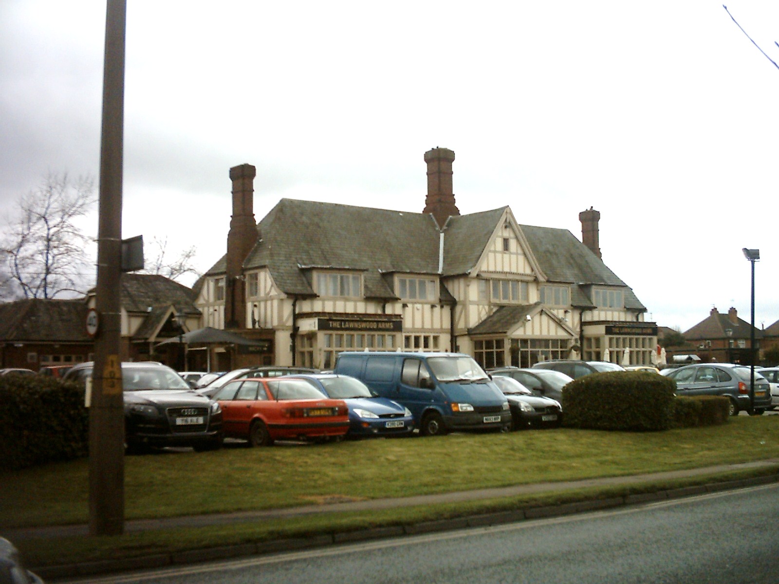
Despite its small size, Farm, Low offers a range of amenities to its residents. The village boasts a local pub, where residents and visitors can enjoy a pint of locally brewed beer and hearty meals. Additionally, there is a village hall that hosts various community events and gatherings throughout the year.

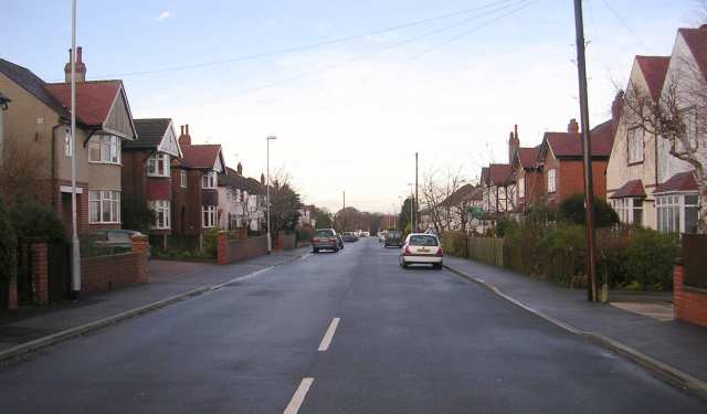
Farm, Low is well-connected to neighboring towns and cities, with good transport links and easy access to major roadways. This allows residents to enjoy the tranquility of rural living while still being within reach of larger urban centers.

Overall, Farm, Low is a charming and peaceful village that offers a slice of traditional Yorkshire countryside life. Its stunning natural surroundings, strong sense of community, and convenient location make it an appealing place to live or visit.

If you have any feedback on the listing, please let us know in the comments section below.

Farm, Low Images

Images are sourced within 2km of 53.850054/-1.606551 or Grid Reference SE2539. Thanks to Geograph Open Source API. All images are credited.
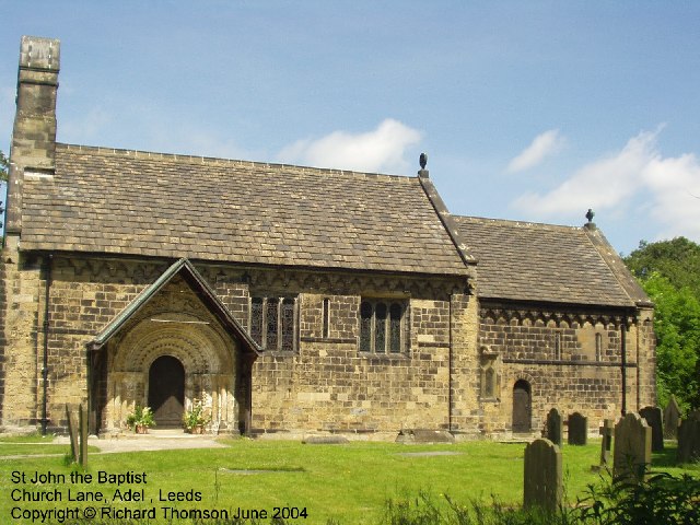
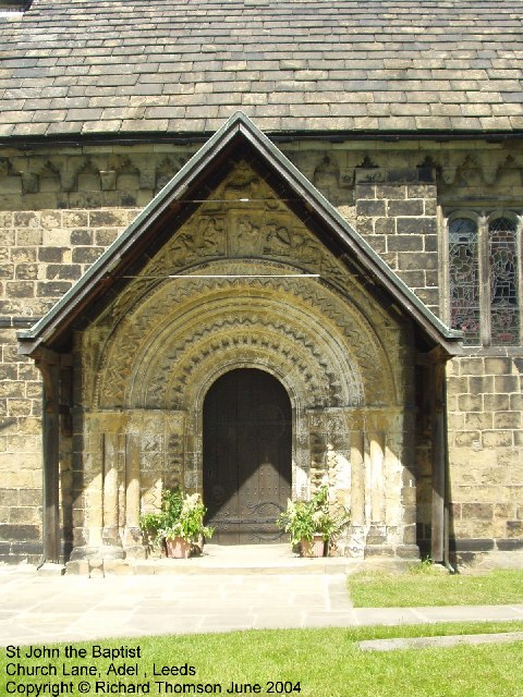
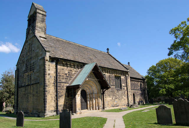
Moseley Bottom The  entrance to the railway tunnel at Moseley Bottom on the Leeds to Harrogate line
Moseley Bottom
The entrance to the railway tunnel at Moseley Bottom on the Leeds to Harrogate line
Cookridge Methodist Church, Tinshill Road, Cookridge, Leeds The church is near the junction of Tinshill Road and Otley Old Road. This is the view from Tinshill Road looking south-east
Cookridge Methodist Church, Tinshill Road, Cookridge, Leeds
The church is near the junction of Tinshill Road and Otley Old Road. This is the view from Tinshill Road looking south-east
St John The Baptist Church, Church Lane, Adel, Leeds This is one of the oldest churches in the Leeds area, dating back to Norman times (11th-12th century). Unusually for such an old church, it was not developed, enlarged or extended in Victorian times.
St John The Baptist Church, Church Lane, Adel, Leeds
This is one of the oldest churches in the Leeds area, dating back to Norman times (11th-12th century). Unusually for such an old church, it was not developed, enlarged or extended in Victorian times.
Adel Methodist Church, Holt Lane, Adel, Leeds
St John the Baptist Church, Church Lane, Adel, Leeds This church has a lovely Norman doorway.
St John the Baptist Church, Church Lane, Adel, Leeds
This church has a lovely Norman doorway.
Road repairs, Long Causeway, Adel, Leeds At the north end of Long Causeway, by its junction with Stairfoot Lane and Back Church Lane
Road repairs, Long Causeway, Adel, Leeds
At the north end of Long Causeway, by its junction with Stairfoot Lane and Back Church Lane
Sunrise at Holt Park. Even urban sprawl can have its charm given the right light.
Sunrise at Holt Park.
Even urban sprawl can have its charm given the right light.
Adel, St John the Baptist Norman Door Ring (1963) The original Norman bronze piece shown was stolen in 2002 and was replaced in replica. The handle is in the form of a monster’s head, probably a lion, with a mouth swallowing a man. 

Acknowledgements.

1. Nikolaus Pevsner. The Buildings of England. Yorkshire: The West Riding. 1959.

2. Leeds / Susan Wrathmell with John Minnis / and contributions by Janet Douglas ... [et al.] 2005.

3. Leodis - a photographic archive of Leeds. <span class="nowrap"><a title="http://www.leodis.net" rel="nofollow ugc noopener" href="http://www.leodis.net">Link</a><img style="margin-left:2px;" alt="External link" title="External link - shift click to open in new window" src="https://s1.geograph.org.uk/img/external.png" width="10" height="10"/></span>
Adel, St John the Baptist Norman Door Ring (1963)
The original Norman bronze piece shown was stolen in 2002 and was replaced in replica. The handle is in the form of a monster’s head, probably a lion, with a mouth swallowing a man. Acknowledgements. 1. Nikolaus Pevsner. The Buildings of England. Yorkshire: The West Riding. 1959. 2. Leeds / Susan Wrathmell with John Minnis / and contributions by Janet Douglas ... [et al.] 2005. 3. Leodis - a photographic archive of Leeds. LinkExternal link
Adel Church St John the Baptist Church, Adel. Built 1170 on a prehistoric trade route between the East and West Ridings.
Pevsner wrote that this is the most complete Norman church in Yorkshire.  Apart from its celebrated Norman archway now protected by the porch structure shown here, an unusual feature of this church are the corbels.These are decorated in a similar grotesque style to that of the gargoyles at Ripon Cathedral which it seems they must pre-date.
Adel Church
St John the Baptist Church, Adel. Built 1170 on a prehistoric trade route between the East and West Ridings. Pevsner wrote that this is the most complete Norman church in Yorkshire. Apart from its celebrated Norman archway now protected by the porch structure shown here, an unusual feature of this church are the corbels.These are decorated in a similar grotesque style to that of the gargoyles at Ripon Cathedral which it seems they must pre-date.
Manor Farm This house farm is less than 50 m from the last suburban houses of North Leeds.
Manor Farm
This house farm is less than 50 m from the last suburban houses of North Leeds.
Cricket Pitch
Cricket Pitch
Holt Park District Centre The central aisle of the centre is between the Leisure Centre on the left, and shops on the right. It was never beautiful, but it used to have more activity than it does now. I remember 20 years ago, there was a newsagents, a greengrocers, a travel agent and a large chemists shop. Now ASDA occupies most of the shops, and the 2 shops remaining down this end are the opticians and a smaller chemist.
Redevelopment is planned, but I don't know how soon.
Holt Park District Centre
The central aisle of the centre is between the Leisure Centre on the left, and shops on the right. It was never beautiful, but it used to have more activity than it does now. I remember 20 years ago, there was a newsagents, a greengrocers, a travel agent and a large chemists shop. Now ASDA occupies most of the shops, and the 2 shops remaining down this end are the opticians and a smaller chemist. Redevelopment is planned, but I don't know how soon.
The Lawnswood Arms - Otley Road
Gainsbro Avenue
Gainsbro Avenue
Adel Methodist Church Hall - Gainsbro Avenue
Adel Methodist Church - Holt Lane
Gainsbro Drive - Holt Lane
Show me another place!

Farm, Low is located at Grid Ref: SE2539 (Lat: 53.850054, Lng: -1.606551)

Division: West Riding

Unitary Authority: Leeds

Police Authority: West Yorkshire

What 3 Words

///regime.unique.aims. Near Horsforth, West Yorkshire

Related Wikis

Lawnswood

Lawnswood is a small suburb in the north west of the city of Leeds in West Yorkshire, England. As such it is north north east of the West Yorkshire Urban...

Leeds North West (UK Parliament constituency)

Leeds North West is a constituency in the City of Leeds which has been represented in the House of Commons of the UK Parliament since 2017 by Alex Sobel...

Ralph Thoresby School

Ralph Thoresby School is a foundation secondary school and sixth form located in Holt Park, Leeds, West Yorkshire, England. Named after the antiquarian...

Ireland Wood

Ireland Wood is a small residential area in north-west Leeds, West Yorkshire, England named after the Woodland Trust wood which it contains. It is approximately...

Nearby Amenities

Located within 500m of 53.850054,-1.606551
Bus Stop
Raynel Drive Otley Old Road
Bus: yes
Local Ref: 45010751
Naptan AtcoCode: 450010751
Naptan Bearing: SW
Naptan CommonName: Raynel Drive Otley Old Road
Naptan Crossing: Otley Old Road
Naptan Indicator: Stop 45010751
Naptan Landmark: St Pauls Church
Naptan PlusbusZoneRef: LEEDS
Naptan ShortCommonName: Otley Old Road
Naptan Street: Raynel Drive
Naptan Verified: no
Public Transport: platform
Shelter: no
Source: naptan_import
Lat/Long: 53.8502027/-1.6063515
Bus Stop
Otley Old Road Hospital Lane
Bench: yes
Bus: yes
Local Ref: 45010753
Naptan AtcoCode: 450010753
Naptan Bearing: W
Naptan CommonName: Otley Old Road Hospital Lane
Naptan Crossing: Hospital Lane
Naptan Indicator: Stop 45010753
Naptan PlusbusZoneRef: LEEDS
Naptan ShortCommonName: Hosipal Lane
Naptan Street: Otley Old Road
Naptan Verified: no
Public Transport: platform
Shelter: yes
Source: naptan_import
Lat/Long: 53.8504659/-1.6081654
Bus Stop
Otley Old Road Hospital Lane
Bench: yes
Bin: yes
Bus: yes
Lit: yes
Local Ref: 45010761
Naptan AtcoCode: 450010761
Naptan Bearing: E
Naptan CommonName: Otley Old Road Hospital Lane
Naptan Crossing: Hospital Lane
Naptan Indicator: Stop 45010761
Naptan PlusbusZoneRef: LEEDS
Naptan ShortCommonName: Hospital Lane
Naptan Street: Otley Old Road
Naptan Verified: no
Public Transport: platform
Shelter: yes
Source: naptan_import
Lat/Long: 53.850379/-1.6073489
Bus Stop
Raynel Approach Otley Old Road
Bus: yes
Local Ref: 45011534
Naptan AtcoCode: 450011534
Naptan Bearing: NE
Naptan CommonName: Raynel Approach Otley Old Road
Naptan Crossing: Otley Old Road
Naptan Indicator: Stop 45011534
Naptan Landmark: Church
Naptan PlusbusZoneRef: LEEDS
Naptan ShortCommonName: Otley Old Road
Naptan Street: Raynel Approach
Naptan Verified: no
Public Transport: platform
Source: naptan_import
Lat/Long: 53.8503376/-1.6063654
Bus Stop
Raynel Mount Raynel Drive
Bus: yes
Local Ref: 45011535
Naptan AtcoCode: 450011535
Naptan Bearing: W
Naptan CommonName: Raynel Mount Raynel Drive
Naptan Crossing: Raynel Drive
Naptan Indicator: Stop 45011535
Naptan Notes: Stop re-located further up 21/09/07
Naptan PlusbusZoneRef: LEEDS
Naptan ShortCommonName: Raynel Drive
Naptan Street: Raynel Drive
Naptan Verified: no
Public Transport: platform
Source: naptan_import
Lat/Long: 53.8511391/-1.6040929
Bus Stop
Raynel Drive Raynel Mount
Bus: yes
Local Ref: 45011536
Naptan AtcoCode: 450011536
Naptan Bearing: N
Naptan CommonName: Raynel Drive Raynel Mount
Naptan Crossing: Raynel Mount
Naptan Indicator: Stop 45011536
Naptan PlusbusZoneRef: LEEDS
Naptan ShortCommonName: Raynel Mount
Naptan Street: Raynel Drive
Naptan Verified: no
Public Transport: platform
Source: naptan_import
Lat/Long: 53.8514233/-1.6030565
Bus Stop
Raynel Drive Raynel Gardens
Bus: yes
Local Ref: 45011537
Naptan AtcoCode: 450011537
Naptan Bearing: N
Naptan CommonName: Raynel Drive Raynel Gardens
Naptan Crossing: Raynel Gardens
Naptan Indicator: Stop 45011537
Naptan PlusbusZoneRef: LEEDS
Naptan ShortCommonName: Raynel Gardens
Naptan Street: Raynel Drive
Naptan Verified: no
Public Transport: platform
Source: naptan_import
Lat/Long: 53.8531748/-1.6027055
Bus Stop
Raynel Drive Raynel Gardens
Bus: yes
Local Ref: 45011538
Naptan AtcoCode: 450011538
Naptan Bearing: S
Naptan CommonName: Raynel Drive Raynel Gardens
Naptan Crossing: Raynel Gardens
Naptan Indicator: Stop 45011538
Naptan PlusbusZoneRef: LEEDS
Naptan ShortCommonName: Raynel Gardens
Naptan Street: Raynel Drive
Naptan Verified: no
Public Transport: platform
Source: naptan_import
Lat/Long: 53.8530931/-1.6024782
Bus Stop
Otley Old Road Iveson Drive
Bus: yes
Local Ref: 45011540
Naptan AtcoCode: 450011540
Naptan Bearing: S
Naptan CommonName: Otley Old Road Iveson Drive
Naptan Crossing: Iveson Drive
Naptan Indicator: Stop 45011540
Naptan PlusbusZoneRef: LEEDS
Naptan ShortCommonName: Iveson Drive
Naptan Street: Otley Old Road
Naptan Verified: no
Public Transport: platform
Shelter: yes
Source: naptan_import
Lat/Long: 53.848155/-1.6040906
Bus Stop
Iveson Approach Iveson Grove
Bench: no
Bin: yes
Bus: yes
Lit: yes
Local Ref: 45011543
Naptan AtcoCode: 450011543
Naptan Bearing: NE
Naptan CommonName: Iveson Approach Iveson Grove
Naptan Crossing: Iveson Grove
Naptan Indicator: Stop 45011543
Naptan Landmark: Royal Mail Sorting Office
Naptan PlusbusZoneRef: LEEDS
Naptan ShortCommonName: Iveson Grove
Naptan Street: Iveson Approach
Naptan Verified: no
Public Transport: platform
Shelter: no
Source: naptan_import
Tactile Paving: no
Lat/Long: 53.8460133/-1.6060716
Bus Stop
Iveson Approach Otley Old Road
Bus: yes
Local Ref: 45011545
Naptan AtcoCode: 450011545
Naptan Bearing: NE
Naptan CommonName: Iveson Approach Otley Old Road
Naptan Crossing: Otley Old Road
Naptan Indicator: Stop 45011545
Naptan Landmark: School
Naptan Notes: Opp Wise Owl PH
Naptan PlusbusZoneRef: LEEDS
Naptan ShortCommonName: Otley Old Road
Naptan Street: Iveson Approach
Naptan Verified: no
Public Transport: platform
Shelter: no
Source: naptan_import
Lat/Long: 53.8468024/-1.6040877
Bus Stop
Iveson Approach Iveson Grove
Bench: yes
Bin: no
Bus: yes
Lit: yes
Local Ref: 45011546
Naptan AtcoCode: 450011546
Naptan Bearing: SW
Naptan CommonName: Iveson Approach Iveson Grove
Naptan Crossing: Iverson Grove
Naptan Indicator: Stop 45011546
Naptan Landmark: Sorting Office
Naptan PlusbusZoneRef: LEEDS
Naptan ShortCommonName: Iverson Grove
Naptan Street: Iveson Approach
Naptan Verified: no
Public Transport: platform
Shelter: yes
Source: naptan_import
Tactile Paving: no
Lat/Long: 53.8457983/-1.6063016
Bus Stop
Otley Old Road Iveson Drive
Bench: yes
Bin: no
Bus: yes
Local Ref: 45011547
Naptan AtcoCode: 450011547
Naptan Bearing: NW
Naptan CommonName: Otley Old Road Iveson Drive
Naptan Crossing: Iveson Drive
Naptan Indicator: Stop 45011547
Naptan Landmark: School
Naptan PlusbusZoneRef: LEEDS
Naptan ShortCommonName: Iveson Drive
Naptan Street: Otley Old Road
Naptan Verified: no
Public Transport: platform
Shelter: yes
Source: naptan_import
Tactile Paving: no
Lat/Long: 53.8477602/-1.6043072
Bus Stop
Otley Old Road Iveson Drive
Bus: yes
Local Ref: 45011550
Naptan AtcoCode: 450011550
Naptan Bearing: N
Naptan CommonName: Otley Old Road Iveson Drive
Naptan Crossing: Iveson Drive
Naptan Indicator: Stop 45011550
Naptan Landmark: School
Naptan PlusbusZoneRef: LEEDS
Naptan ShortCommonName: Iveson Drive
Naptan Street: Otley Old Road
Naptan Verified: no
Public Transport: platform
Shelter: yes
Source: naptan_import
Lat/Long: 53.847363/-1.6037941
New Adel Lane
Naptan AtcoCode: 450028265
Naptan Bearing: N
Naptan BusStopType: CUS
Naptan CommonName: New Adel Lane
Naptan Crossing: The Drive
Naptan Landmark: Unknown
Naptan PlusbusZoneRef: LEEDS
Naptan ShortCommonName: New Adel Lane
Naptan Street: New Adel Lane
Naptan Verified: no
Source: naptan_import
Lat/Long: 53.8479026/-1.6011745
New Adel Lane South
Naptan AtcoCode: 450028266
Naptan Bearing: S
Naptan BusStopType: CUS
Naptan CommonName: New Adel Lane South
Naptan Crossing: The Drive
Naptan Landmark: Unknown
Naptan PlusbusZoneRef: LEEDS
Naptan ShortCommonName: New Adel Lane Sth
Naptan Street: New Adel Lane
Naptan Verified: no
Source: naptan_import
Lat/Long: 53.8477224/-1.6010395
Turning Circle
Lat/Long: 53.8506254/-1.6040877
Turning Circle
Lat/Long: 53.8512963/-1.6062635
Barrier: bollard
Lat/Long: 53.853962/-1.6071074
Turning Circle
Lat/Long: 53.8490081/-1.6032317
Turning Circle
Lat/Long: 53.8483731/-1.6027947
Turning Circle
Lat/Long: 53.8476515/-1.6018914
Turning Circle
Lat/Long: 53.8504355/-1.5998412
Turning Circle
Lat/Long: 53.8515312/-1.6123261
Turning Circle
Lat/Long: 53.849549/-1.6092537
Turning Circle
Lat/Long: 53.8485582/-1.6058441
Turning Circle
Lat/Long: 53.8494905/-1.6074527
Turning Circle
Lat/Long: 53.8480517/-1.6094903
Turning Circle
Lat/Long: 53.8493185/-1.608361
Parking
Parking: surface
Lat/Long: 53.8460526/-1.6078675
Crossing
Crossing: marked
Crossing Island: no
Crossing Ref: zebra
Kerb: flush
Tactile Paving: yes
Lat/Long: 53.850164/-1.6068119
Library
Source: OS_OpenData_StreetView
Lat/Long: 53.8459372/-1.6056275
Turning Circle
Lat/Long: 53.849656/-1.6089426
Turning Circle
Lat/Long: 53.8507878/-1.6082568
Post Box
Brand: Royal Mail
Brand Wikidata: Q638098
Brand Wikipedia: en:Royal Mail
Operator: Royal Mail
Operator Wikidata: Q638098
Post Box Type: pillar
Ref: LS16 905
Royal Cypher: GVIR
Royal Cypher Wikidata: Q33102169
Lat/Long: 53.848541/-1.6039235
Post Box
Brand: Royal Mail
Brand Wikidata: Q638098
Brand Wikipedia: en:Royal Mail
Operator: Royal Mail
Operator Wikidata: Q638098
Post Box Type: pillar
Ref: LS16 24
Royal Cypher: GVIR
Royal Cypher Wikidata: Q33102169
Lat/Long: 53.8503032/-1.6107798
Post Box
Brand: Royal Mail
Brand Wikidata: Q638098
Brand Wikipedia: en:Royal Mail
Operator: Royal Mail
Operator Wikidata: Q638098
Post Box Type: pillar
Ref: LS16 774
Royal Cypher: GR
Royal Cypher Wikidata: Q33102273
Lat/Long: 53.8515596/-1.6010725
Post Box
Brand: Royal Mail
Brand Wikidata: Q638098
Brand Wikipedia: en:Royal Mail
Operator: Royal Mail
Operator Wikidata: Q638098
Post Box Type: pillar
Ref: LS16 901
Lat/Long: 53.8534753/-1.6045804
Crossing
Crossing: uncontrolled
Crossing Island: no
Crossing Markings: zebra
Crossing Ref: zebra
Kerb: flush
Tactile Paving: yes
Lat/Long: 53.8474297/-1.6037373
Bicycle Parking
Bicycle Parking: stands
Capacity: 6
Covered: no
Lat/Long: 53.8510474/-1.6054424
Bicycle Parking
Bicycle Parking: stands
Capacity: 4
Covered: no
Lat/Long: 53.848652/-1.6039914
Post Office
Ireland Wood Post Office
Addr City: Leeds
Addr Postcode: LS16 6LQ
Brand: Post Office
Brand Wikidata: Q1783168
Check Date: 2022-01-15
Operator: Shop Local
Ref Pol Id: 9895
Website: https://www.postoffice.co.uk/branch-finder/2513234/ireland-wood
Lat/Long: 53.8485697/-1.603758
Cafe
Residence 74 Café & Bar
Addr City: Leeds
Addr Housenumber: 74
Addr Postcode: LS16 6LQ
Addr Street: Otley Old Road
Fhrs Id: 1098252
Old Name: Mochaccino
Lat/Long: 53.8486298/-1.6037929
Pharmacy
WA Hawkin & Sons Pharmacy
Healthcare: pharmacy
Lat/Long: 53.848739/-1.6038693
Logan Stores
Addr City: Leeds
Addr Housenumber: 80
Addr Postcode: LS16 6LQ
Addr Street: Otley Old Road
Fhrs Id: 650659
Shop: convenience
Lat/Long: 53.8487865/-1.6039029
Dentist
Cookridge Dental Practice
Healthcare: dentist
Lat/Long: 53.8484115/-1.6036641
Atm
Lat/Long: 53.8485396/-1.6038251
Barrier: bollard
Lat/Long: 53.8489985/-1.6033609
Barrier: bollard
Lat/Long: 53.8489368/-1.6036586
Turning Circle
Lat/Long: 53.8495012/-1.6138325
Turning Circle
Lat/Long: 53.8498982/-1.6129801
Turning Circle
Lat/Long: 53.8501127/-1.6087422
Turning Circle
Lat/Long: 53.8492893/-1.6112485
Turning Circle
Lat/Long: 53.8526082/-1.605276
Turning Circle
Lat/Long: 53.8505705/-1.6076527
Cafe
Keepers Coffee And Kitchen
Addr City: Leeds
Addr Housenumber: 76
Addr Postcode: LS16 6LQ
Addr Street: Otley Old Road
Addr Suburb: Cookridge
Fhrs Id: 1028729
Lat/Long: 53.8486794/-1.6038309
Kindergarten
Ireland Wood Childrens Centre
Addr City: Leeds
Addr Housename: Ireland Wood Primary School
Addr Postcode: LS16 6BW
Addr Street: Raynel Gardens
Addr Suburb: Lawnswood
Fhrs Id: 323361
Lat/Long: 53.8525551/-1.6050419
Turning Circle
Lat/Long: 53.8501184/-1.6077791
Childcare
Dawn 'Til Dusk OOSC
Addr City: Leeds
Addr Housename: Holy Name Catholic Voluntary Academy
Addr Postcode: LS16 6NT
Addr Street: Iveson Approach
Addr Suburb: Lawnswood
Fhrs Id: 1198457
Not Addr Postcode: LS16 6HW
Lat/Long: 53.8471438/-1.6045404
Social Facility
Raynel Drive Community Home
Addr City: Leeds
Addr Housenumber: 7-9
Addr Postcode: LS16 6BS
Addr Street: Raynel Drive
Addr Suburb: Lawnswood
Fhrs Id: 1101699
Social Facility: assisted_living
Lat/Long: 53.8504694/-1.6050828
Waste Basket
Collection Times: Mo-Fr
Ref UK Leedscc Bin: 1547
Lat/Long: 53.846757/-1.604404
Waste Basket
Collection Times: Mo-Fr
Ref UK Leedscc Bin: 2405
Lat/Long: 53.847592/-1.60414
Waste Basket
Collection Times: Mo-Fr
Ref UK Leedscc Bin: 1546
Lat/Long: 53.846111/-1.605918
Waste Basket
Collection Times: Mo-Fr
Ref UK Leedscc Bin: 1548
Lat/Long: 53.845916/-1.606338
Waste Basket
Collection Times: Mo-Fr
Ref UK Leedscc Bin: 2406
Lat/Long: 53.848069/-1.60386
Waste Basket
Collection Times: Mo-Fr
Ref UK Leedscc Bin: 2407
Lat/Long: 53.848797/-1.604318
Waste Basket
Collection Times: Mo-Fr
Ref UK Leedscc Bin: 1552
Lat/Long: 53.847529/-1.608015
Waste Basket
Collection Times: Mo-Fr
Ref UK Leedscc Bin: 2688
Lat/Long: 53.851014/-1.605542
Waste Basket
Collection Times: Mo-Fr
Ref UK Leedscc Bin: 2687
Lat/Long: 53.851562/-1.604747
Waste Basket
Collection Times: Mo-Fr
Ref UK Leedscc Bin: 2690
Lat/Long: 53.851741/-1.605305
Waste Basket
Collection Times: Mo-Fr
Ref UK Leedscc Bin: 2341
Lat/Long: 53.850492/-1.607715
Waste Basket
Collection Times: Mo-Fr
Ref UK Leedscc Bin: 2689
Lat/Long: 53.853455/-1.604791
Waste Basket
Collection Times: Mo-Fr
Ref UK Leedscc Bin: 1033
Lat/Long: 53.854053/-1.605311
Waste Basket
Collection Times: Mo-Fr
Ref UK Leedscc Bin: 2408
Lat/Long: 53.851084/-1.610564
Crossing
Crossing: marked
Lat/Long: 53.8528946/-1.6050346
Leisure: fitness_station
Sport: fitness
Lat/Long: 53.8536826/-1.6101456
Iveson Approach Otley Old Road
Bus: yes
Public Transport: stop_position
Lat/Long: 53.8467561/-1.6040484
Otley Old Road Iveson Drive
Bus: yes
Public Transport: stop_position
Lat/Long: 53.8473786/-1.6037048
Otley Old Road Iveson Drive
Bus: yes
Local Ref: 45011540
Public Transport: stop_position
Lat/Long: 53.8481481/-1.604171
Otley Old Road Iveson Drive
Bus: yes
Public Transport: stop_position
Lat/Long: 53.8477683/-1.6042748
Otley Old Road Hospital Lane
Bus: yes
Public Transport: stop_position
Lat/Long: 53.8503317/-1.6073811
Otley Old Road Hospital Lane
Bus: yes
Public Transport: stop_position
Lat/Long: 53.8505169/-1.6081456
Bench
Lat/Long: 53.8516023/-1.6011192
Crossing
Lat/Long: 53.8483942/-1.6012347
Crossing
Lat/Long: 53.8469636/-1.6013507
Shop Local
Check Date: 2022-01-15
Shop: convenience
Lat/Long: 53.848556/-1.6038014
Low Farm
Place: neighbourhood
Lat/Long: 53.8503826/-1.6083413
Entrance: yes
Lat/Long: 53.8473491/-1.6031121
The data included in this document is from www.openstreetmap.org. The data is made available under ODbL.

Have you been to Farm, Low?

Leave your review of Farm, Low below (or comments, questions and feedback).