Perch Rock

Coastal Feature, Headland, Point in Cheshire

England

Perch Rock

Cycle path, King's Parade Wallasey - New Brighton coast path and defences.
Cycle path, King's Parade Credit: Richard Webb

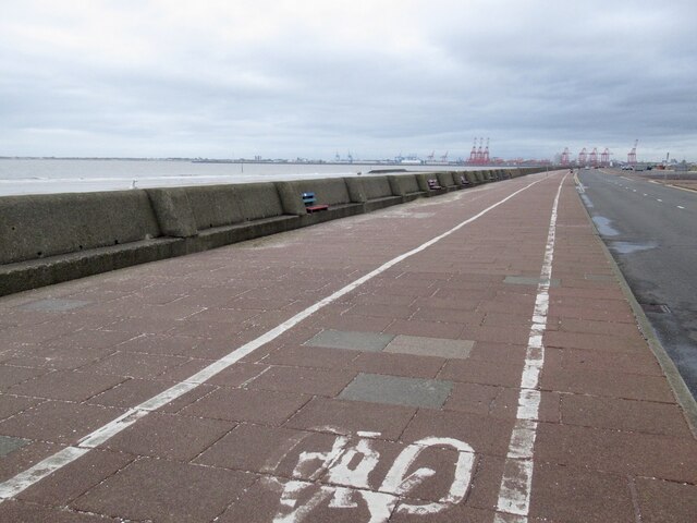
Perch Rock, located in Cheshire, England, is a prominent coastal feature that boasts a picturesque headland jutting out into the Irish Sea. Situated at the mouth of the River Mersey, it is a notable point along the coastline and has historical significance.

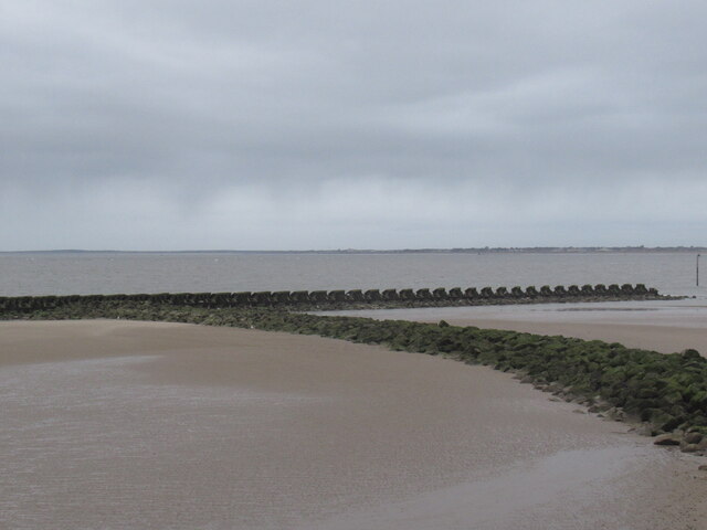
The headland itself is formed by a series of sedimentary rock formations, primarily sandstone, which have been shaped by natural erosion processes over thousands of years. This has resulted in the creation of a distinctive and prominent rocky outcrop, which provides a scenic backdrop to the surrounding area.

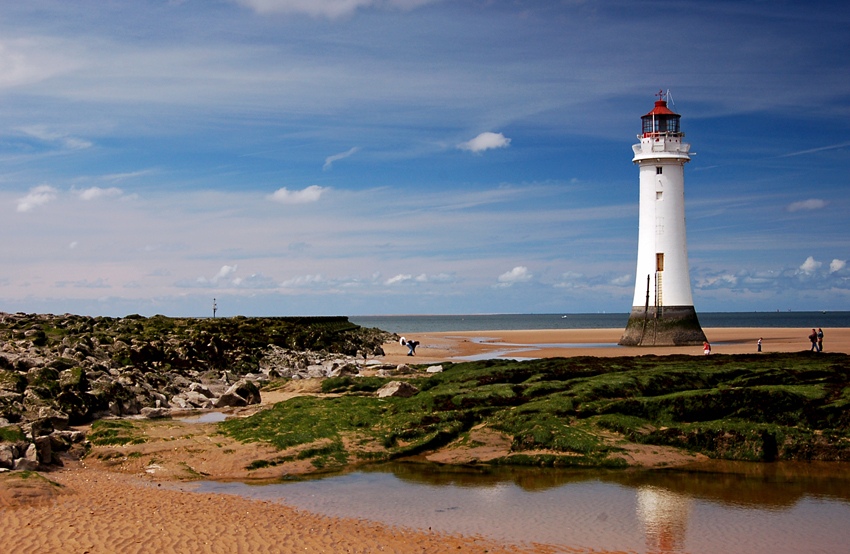
One of the most recognizable features of Perch Rock is its iconic lighthouse, known as Perch Rock Lighthouse or New Brighton Lighthouse. Built in 1830, this striking structure stands at approximately 90 feet tall and is constructed of cast iron, making it one of the oldest surviving cast-iron lighthouses in the country. Originally designed to guide ships safely into the Port of Liverpool, it is now a popular tourist attraction.

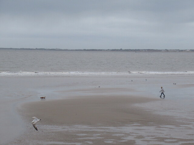
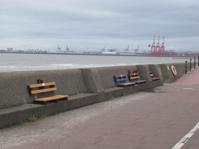
The headland offers stunning panoramic views of the Irish Sea, providing visitors with a unique opportunity to observe the ocean's power as waves crash against the rocky shoreline. The area is a haven for wildlife, with various seabirds and marine creatures frequently spotted in the vicinity.

Perch Rock and its lighthouse have also played a significant role in maritime history, serving as a navigational aid for sailors for centuries. It continues to be an important landmark for ships entering and leaving the River Mersey and remains a symbol of the region's maritime heritage.

Overall, Perch Rock in Cheshire is a captivating coastal feature, combining natural beauty, historical significance, and a picturesque lighthouse that attracts visitors from near and far.

If you have any feedback on the listing, please let us know in the comments section below.

Perch Rock Images

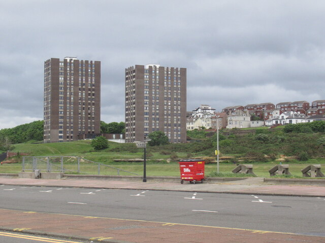
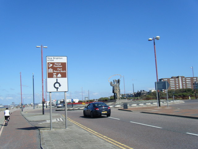
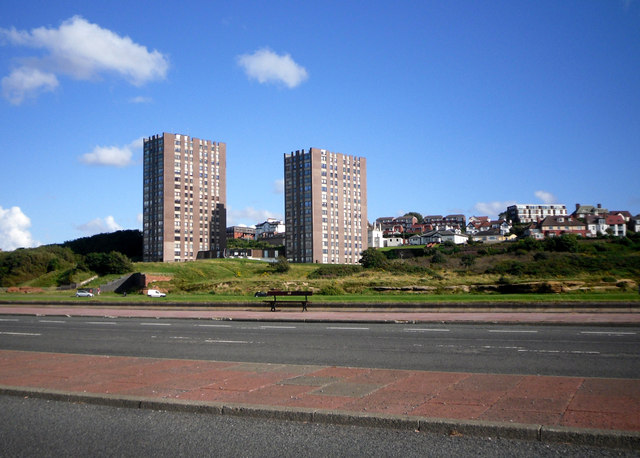
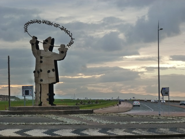
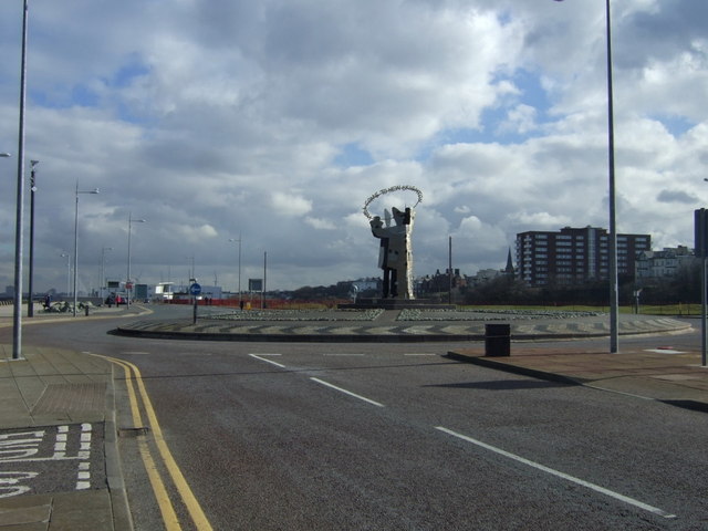
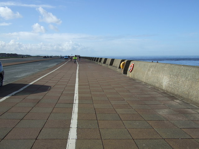
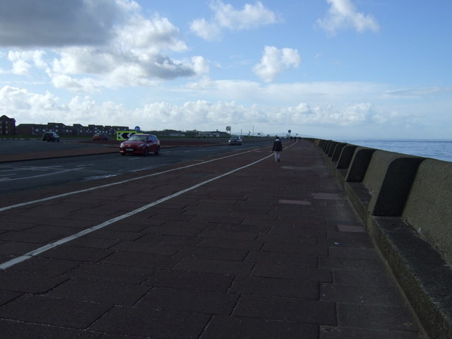
Images are sourced within 2km of 53.443677/-3.0414344 or Grid Reference SJ3094. Thanks to Geograph Open Source API. All images are credited.

Cycle path, King's Parade Wallasey - New Brighton coast path and defences.
Cycle path, King's Parade
Wallasey - New Brighton coast path and defences.
Beach, Wallasey Wind, rain - Summer at the English seaside.
Beach, Wallasey
Wind, rain - Summer at the English seaside.
King's Parade, New Brighton
Breakwater, New Brighton
The Cliff, New Brighton Flats with a view.  Between the towers and sea there is a large area of undeveloped links.
The Cliff, New Brighton
Flats with a view. Between the towers and sea there is a large area of undeveloped links.
Kings Parade roundabout
'Welcome to New Brighton' Clown sign on roundabout
Rolleston Drive/Grove Road junction
Eyesore Seashore Two random tower blocks dumped on the sea front, with trad buildings behind peering round them for a glimpse of the beach.
I guess the people in the blocks get a nice view.
Pity about everyone else.
Eyesore Seashore
Two random tower blocks dumped on the sea front, with trad buildings behind peering round them for a glimpse of the beach. I guess the people in the blocks get a nice view. Pity about everyone else.
Welcome to New Brighton - from behind
Roundabout on Kings Parade, New Brighton
Promenade, New Brighton Heading west.
Promenade, New Brighton
Heading west.
Promenade, New Brighton Heading south west.
Promenade, New Brighton
Heading south west.
Kings Parade, New Brighton
Promenade, New Brighton  Heading south west.
Promenade, New Brighton
Heading south west.
Houses on Coastal Drive
West end of New Brighton beach
Breakwater at the west end of New Brighton beach
Show me another place!

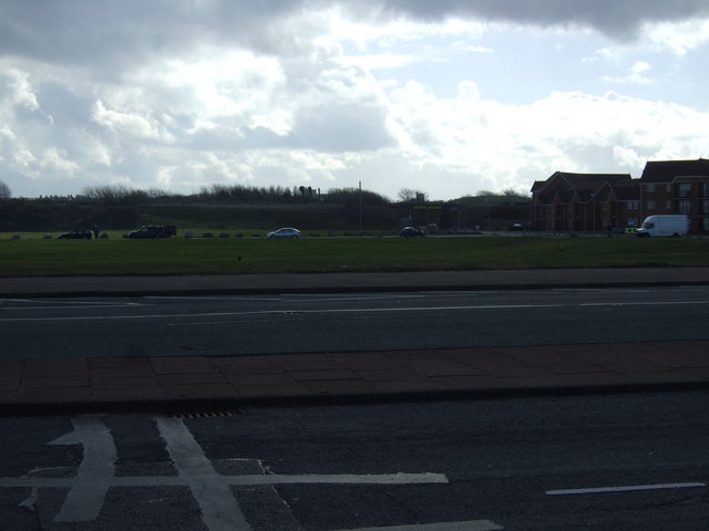
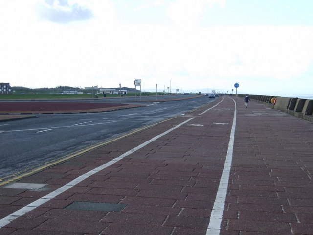
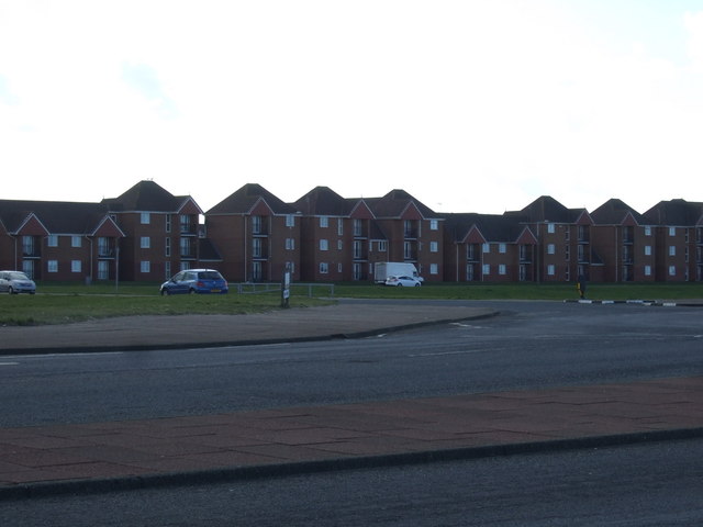
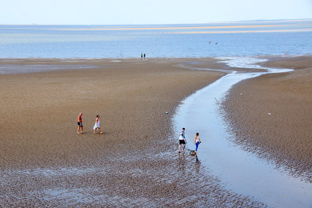
Perch Rock is located at Grid Ref: SJ3094 (Lat: 53.443677, Lng: -3.0414344)

Unitary Authority: Wirral

Police Authority: Merseyside

What 3 Words

///fines.frog.chins. Near Wallasey, Merseyside

Nearby Locations

Marine Lake Perch Rock

Related Wikis

New Brighton Lighthouse

New Brighton Lighthouse (also known as Perch Rock Lighthouse and called Black Rock Lighthouse in the 19th century) is a decommissioned lighthouse situated...

Fort Perch Rock

Fort Perch Rock is a former defence installation situated at the mouth of Liverpool Bay in New Brighton. Built in the 1820s to defend the Port of Liverpool...

Marine Point

Marine Point is a shopping and leisure complex in New Brighton, Merseyside, England. The development was built at an estimated cost of £65 million. In...

Floral Pavilion Theatre

The Floral Pavilion is a theatre in the seaside town of New Brighton, on the Wirral Peninsula in England. Situated on the promenade overlooking the River...

Nearby Amenities

Located within 500m of 53.443677,-3.0414344
Source: PGS
Lat/Long: 53.4407659/-3.0387825
Fort Perch Rock
Addr City: Wallasey
Addr Postcode: CH45 2JU
Addr Street: Marine Promenade
Email: info@fortperchrock.org.uk
Museum: history
Opening Hours: closed
Operator: Doug Darroch
Operator Type: private
Phone: +1 797 628 2120
Tourism: museum
Website: http://www.fortperchrock.org.uk/
Wikidata: Q113370598
Lat/Long: 53.4425296/-3.0404851
Travelodge
Addr Postcode: CH45 2PB
Addr Street: Marine Point
Brand: Travelodge
Brand Wikidata: Q9361374
Brand Wikipedia: en:Travelodge UK
Fhrs Id: 395209
Internet Access: wlan
Internet Access Fee: customers
Internet Access Ssid: Travelodge WiFi
Source: survey
Source Addr: FHRS Open Data
Tourism: hotel
Website: https://www.travelodge.co.uk/hotels/509/Wallasey-New-Brighton-hotel
Lat/Long: 53.4410741/-3.0456698
Seamark Beacon Lateral Category: starboard
Seamark Beacon Lateral Colour: green
Seamark Beacon Lateral System: iala-a
Seamark Information: 2 meters apart.
Seamark Light Category: vertical
Seamark Light Character: F
Seamark Light Colour: green
Seamark Light Height: 4
Seamark Light Multiple: 2
Seamark Light Range: 6
Seamark Light Reference: A 4952.2
Seamark Name: No.12
Seamark Topmark Colour: green
Seamark Topmark Shape: cone, point up
Seamark Type: beacon_lateral
Source: US NGA Pub. 114. 2011-05-26.
Lat/Long: 53.44335/-3.03705
Seamark Beacon Lateral Category: starboard
Seamark Beacon Lateral Colour: green
Seamark Beacon Lateral System: iala-a
Seamark Information: 2 meters apart.
Seamark Light Category: vertical
Seamark Light Character: F
Seamark Light Colour: green
Seamark Light Height: 4
Seamark Light Multiple: 2
Seamark Light Range: 6
Seamark Light Reference: A 4952
Seamark Name: No.13
Seamark Topmark Colour: green
Seamark Topmark Shape: cone, point up
Seamark Type: beacon_lateral
Source: US NGA Pub. 114. 2011-05-26.
Lat/Long: 53.4408833/-3.0355667
Seamark Beacon Lateral Category: starboard
Seamark Beacon Lateral Colour: green
Seamark Beacon Lateral System: iala-a
Seamark Light Category: vertical
Seamark Light Character: F
Seamark Light Colour: green
Seamark Light Height: 4
Seamark Light Multiple: 2
Seamark Light Range: 6
Seamark Light Reference: A 4952.4
Seamark Name: No.11
Seamark Topmark Colour: green
Seamark Topmark Shape: cone, point up
Seamark Type: beacon_lateral
Lat/Long: 53.44615/-3.0467833
Attraction: historic
Historic: city_gate
Lat/Long: 53.4423822/-3.0408289
Funfair
Tourism: theme_park
Lat/Long: 53.4400377/-3.0408951
Cafe
Seaside Cafe
Addr Housenumber: 62-63
Addr Postcode: CH45 2JS
Addr Street: Marine Promenade
Fhrs Id: 394395
Source Addr: FHRS Open Data
Lat/Long: 53.4401587/-3.0429672
Cinema
the Light
Addr Postcode: CH45 2PB
Addr Street: Marine Point
Fhrs Id: 395720
Source: survey
Source Addr: FHRS Open Data
Wikidata: Q41020631
Lat/Long: 53.4404287/-3.0455153
Cafe
Starbucks
Addr Housenumber: 12
Addr Postcode: CH45 2PB
Addr Street: Marine Point
Brand: Starbucks
Brand Wikidata: Q37158
Brand Wikipedia: en:Starbucks
Cuisine: coffee_shop
Fhrs Id: 395802
Official Name: Starbucks Coffee
Source: survey
Source Addr: FHRS Open Data
Takeaway: yes
Website: https://www.starbucks.com/store-locator/store/69608/new-wallasey-marine-point-rp-wallasey-water-front-retail-park-wallasey-eng-ch-4
Lat/Long: 53.4401674/-3.045382
Queen's Royal Hotel
Addr Postcode: CH45 2JT
Addr Street: Marine Promenade
Fhrs Id: 394838
Internet Access: wlan
Source: survey
Source Addr: FHRS Open Data
Tourism: hotel
Lat/Long: 53.4398775/-3.0433668
Fast Food
Burger King
Addr Housenumber: 5
Addr Postcode: CH45 2PB
Addr Street: Marine Point
Brand: Burger King
Brand Wikidata: Q177054
Brand Wikipedia: en:Burger King
Contact Website: https://locations.burgerking.co.uk/new-brighton/unit-4-marine-point
Cuisine: burger
Fhrs Id: 692453
Internet Access: wlan
Smoking: no
Source: survey
Source Addr: FHRS Open Data
Takeaway: yes
Wheelchair: yes
Lat/Long: 53.4408458/-3.0451158
The Master Mariner
Addr City: New Brighton
Addr Country: GB
Addr Housenumber: 3-5
Addr Postcode: CH45 2JT
Addr Street: Union Terrace
Check Date: 2023-04-08
Disused Amenity: pub
Disused Internet Access: wlan
Fhrs Id: 569883
Food: yes
Phone: +44 151 346 8950
Real Ale: yes
Source Addr: FHRS Open Data
Wheelchair: yes
Wikidata: Q88917397
Lat/Long: 53.4397903/-3.0441788
Pub
The Seahorse
Addr Housenumber: 9
Addr Postcode: CH45 2PB
Addr Street: Marine Point
Brand: Hungry Horse
Brand Wikidata: Q5943510
Brand Wikipedia: en:Hungry Horse
Fhrs Id: 505344
Opening Hours: Su-Th 09:00-23:00; Fr-Sa 09:00-12:00
Operator: Hungry Horse
Phone: +44 151 638 9894
Source: survey
Source Addr: FHRS Open Data
Website: https://www.hungryhorse.co.uk/pubs/merseyside/seahorse/
Lat/Long: 53.4408409/-3.0455985
Source: PGS
Lat/Long: 53.4412849/-3.0393551
Source: PGS
Lat/Long: 53.4418563/-3.042582
Turning Circle
Lat/Long: 53.4399934/-3.0444644
Toilets
Fee: no
Wheelchair: yes
Lat/Long: 53.4411485/-3.045249
Source: PGS
Lat/Long: 53.4419941/-3.0400643
Cafe
The Floral Cafe
Source: survey
Lat/Long: 53.4401426/-3.0390728
Cafe
Caffe Cream
Addr Housenumber: 1
Addr Postcode: CH45 2PB
Addr Street: Marine Point
Fhrs Id: 433817
Source: survey
Source Addr: FHRS Open Data
Lat/Long: 53.4403787/-3.0442352
Disused Amenity: pub
Old Name: Traveller's Rest
Source: survey
Lat/Long: 53.439692/-3.0443751
Restaurant
Marino Lounge
Addr Housenumber: 5
Addr Postcode: CH45 2PB
Addr Street: Marine Point
Brand: Lounges
Brand Wikidata: Q114313933
Fhrs Id: 546968
Source: survey
Source Addr: FHRS Open Data
Website: https://thelounges.co.uk/marino/
Wheelchair: yes
Lat/Long: 53.4410053/-3.0451368
Addr Housenumber: 41
Source: survey
Lat/Long: 53.4394642/-3.0425649
Pub
The Stage Door Tap
Internet Access: wlan
Real Ale: yes
Source: survey
Lat/Long: 53.4399413/-3.0433562
Addr Flats: 1-6
Addr Housenumber: 43
Addr Interpolation: all
Addr Street: Virginia Road
Source: survey
Lat/Long: 53.4394359/-3.0427421
Fast Food
Subway
Addr Housenumber: 14
Addr Postcode: CH45 2PB
Addr Street: Marine Point
Brand: Subway
Brand Wikidata: Q244457
Brand Wikipedia: en:Subway (restaurant)
Contact Website: https://restaurants.subway.com/united-kingdom/en/wallasey/kings-paradenew-brighton
Cuisine: sandwich
Fhrs Id: 615903
Source: survey
Source Addr: FHRS Open Data
Takeaway: yes
Lat/Long: 53.440131/-3.0456168
Restaurant
Prezzo
Addr Housenumber: 3
Addr Postcode: CH45 2PB
Addr Street: Marine Point
Brand: Prezzo
Brand Wikidata: Q7242489
Brand Wikipedia: en:Prezzo (restaurant)
Cuisine: italian
Fhrs Id: 433818
Source: survey
Source Addr: FHRS Open Data
Lat/Long: 53.4406124/-3.0449222
Addr Housenumber: 27
Addr Street: Waterloo Road
Source: survey
Lat/Long: 53.439433/-3.0430943
Restaurant
Ayla Turkish Restaurant
Addr City: New Brighton
Addr Housenumber: 7
Addr Postcode: CH45 2PB
Addr Street: Marine Point, King's Parade
Cuisine: turkish
Phone: +441516390303
Lat/Long: 53.4410328/-3.0456369
Defibrillator
Defibrillator Location: on wall outside public toilets
Emergency: defibrillator
Indoor: no
Level: 0
Lat/Long: 53.4411143/-3.0453061
Barrier: lift_gate
Lat/Long: 53.4419573/-3.0405749
Seamark Buoy Lateral Colour: green
Seamark Buoy Lateral Shape: conical
Seamark Type: buoy_lateral
Lat/Long: 53.4472704/-3.0369392
Cafe
The Mess
Cuisine: cafe;italian_pizza;ice_cream
Opening Hours: Mo-Fr 09:00-17:00, Sa-Su 09:00-18:00
Website: http://www.themess.club/
Lat/Long: 53.4424383/-3.0409285
Lifeguard
Emergency: lifeguard
Operator: Royal National Lifeboat Institution
Operator Short: RNLI
Operator Wikidata: Q2166873
Lat/Long: 53.4419105/-3.041991
Restaurant
Nando's
Brand: Nando's
Brand Wikidata: Q3472954
Cuisine: chicken;portuguese
Lat/Long: 53.4404517/-3.0446739
The data included in this document is from www.openstreetmap.org. The data is made available under ODbL.

Have you been to Perch Rock?

Leave your review of Perch Rock below (or comments, questions and feedback).