Ruberry

Coastal Feature, Headland, Point in Orkney

Scotland

Ruberry

The Pegal Burn heading for Pegal Bay
The Pegal Burn heading for Pegal Bay Credit: David Medcalf

Ruberry is a headland located on the coast of Orkney, an archipelago in the northern part of Scotland. Situated on the eastern side of the main island, Ruberry stands as a prominent coastal feature, jutting out into the North Sea. This headland is known for its rugged cliffs, which rise vertically from the sea, offering breathtaking views of the surrounding waters and nearby islands.

The landscape of Ruberry is characterized by its dramatic geology. The headland is primarily composed of sandstone and shale, which have been weathered and eroded over millions of years, resulting in the striking cliffs that can be seen today. These cliffs provide nesting sites for various seabird species, such as guillemots and fulmars, adding to the area's natural beauty and ecological significance.

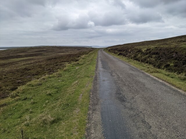
Visitors to Ruberry can explore the headland by following a network of coastal paths that wind their way along the cliff tops. The paths offer stunning vistas of the sea below, as well as opportunities to spot wildlife and enjoy the peaceful tranquility of the area. At low tide, it is also possible to access small coves and rocky beaches nestled at the base of the cliffs, providing an opportunity for beachcombing and exploration.

Ruberry is a popular destination for outdoor enthusiasts, nature lovers, and photographers, who are drawn to its striking coastal scenery and abundant wildlife. It is also a site of geological interest, attracting geologists and researchers studying the region's fascinating geological history.

If you have any feedback on the listing, please let us know in the comments section below.
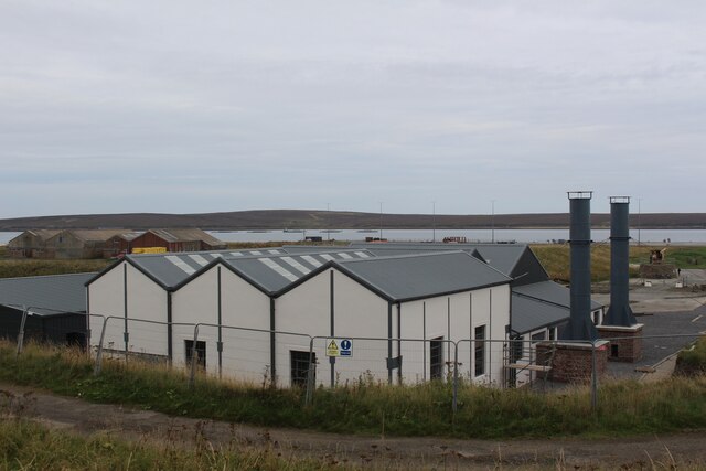
Ruberry Images

Images are sourced within 2km of 58.851198/-3.1982668 or Grid Reference ND3096. Thanks to Geograph Open Source API. All images are credited.

The Pegal Burn heading for Pegal Bay
Moorland above Pegal Bay
Drainage ditches
Drainage ditches
Chalupa Chalupa, is a Mexican dish, but I have been unable, so far, to find out why a croft house soberly named Scews on the maps, and apparently without vehicle access, should rejoice in this eye-catchingly colourful sign over the entrance to its path.
Chalupa
Chalupa, is a Mexican dish, but I have been unable, so far, to find out why a croft house soberly named Scews on the maps, and apparently without vehicle access, should rejoice in this eye-catchingly colourful sign over the entrance to its path.
Old Milestone by the B9047, Hoy and Graemsay parish Milestone by the B9047, in parish of Hoy and Graemsay (Hoy District), East of Pegal Hill, on verge.

Inscription reads:-
N.NESS
5
{<-arrow}
HOY
6
{arrow->}

Grade C(S) listed.
Reference: LB48377 <span class="nowrap"><a title="http://portal.historicenvironment.scot/designation/LB48377" rel="nofollow ugc noopener" href="http://portal.historicenvironment.scot/designation/LB48377">Link</a><img style="margin-left:2px;" alt="External link" title="External link - shift click to open in new window" src="https://s1.geograph.org.uk/img/external.png" width="10" height="10"/></span>

Surveyed

Milestone Society National ID: OR_HYHYNN06
Old Milestone by the B9047, Hoy and Graemsay parish
Milestone by the B9047, in parish of Hoy and Graemsay (Hoy District), East of Pegal Hill, on verge. Inscription reads:- N.NESS 5 {<-arrow} HOY 6 {arrow->} Grade C(S) listed. Reference: LB48377 LinkExternal link Surveyed Milestone Society National ID: OR_HYHYNN06
Lyness Ro-Ro Terminal Site Signbaord
Scapa Flow Museum Site Signboard
Lyness Pump House The pump house served the naval base at Scapa Flow. It has been converted to a visitor centre but is currently (2021) closed for redevelopment.
Lyness Pump House
The pump house served the naval base at Scapa Flow. It has been converted to a visitor centre but is currently (2021) closed for redevelopment.
Pelamis Wave Energy Convertor For information on the P2-002 wave machine see &lt;span class=&quot;nowrap&quot;&gt;&lt;a title=&quot;https://www.emec.org.uk/about-us/wave-clients/pelamis-wave-power/&quot; rel=&quot;nofollow ugc noopener&quot; href=&quot;https://www.emec.org.uk/about-us/wave-clients/pelamis-wave-power/&quot;&gt;Link&lt;/a&gt;&lt;img style=&quot;margin-left:2px;&quot; alt=&quot;External link&quot; title=&quot;External link - shift click to open in new window&quot; src=&quot;https://s1.geograph.org.uk/img/external.png&quot; width=&quot;10&quot; height=&quot;10&quot;/&gt;&lt;/span&gt;
Pelamis Wave Energy Convertor
For information on the P2-002 wave machine see LinkExternal link
The delightful Emily's Tea Room Which serves good tea and good cake!
The delightful Emily's Tea Room
Which serves good tea and good cake!
The road across the moorland
Rysa Sound and the island of Rysa Little
Looking down to Mill Bay
Derelict croft at Greengears
Lots of chimney pots on Rysa Lodge
Muckle Rysa farm
Muckle Rysa farm
The Scapa Flow Museum It was, sadly, closed for redevelopment when I was there, but opened again in July 2022. See: &lt;span class=&quot;nowrap&quot;&gt;&lt;a title=&quot;https://www.orkney.gov.uk/Service-Directory/S/scapa-flow-museum&quot; rel=&quot;nofollow ugc noopener&quot; href=&quot;https://www.orkney.gov.uk/Service-Directory/S/scapa-flow-museum&quot;&gt;Link&lt;/a&gt;&lt;img style=&quot;margin-left:2px;&quot; alt=&quot;External link&quot; title=&quot;External link - shift click to open in new window&quot; src=&quot;https://s1.geograph.org.uk/img/external.png&quot; width=&quot;10&quot; height=&quot;10&quot;/&gt;&lt;/span&gt;
The Scapa Flow Museum
It was, sadly, closed for redevelopment when I was there, but opened again in July 2022. See: LinkExternal link
Information panel for Rinnigill Camp The camp was on the opposite side of Ore Bay. The complex military infrastructure developed in war time was just amazing, as shown in the aerial photo from that time.
Information panel for Rinnigill Camp
The camp was on the opposite side of Ore Bay. The complex military infrastructure developed in war time was just amazing, as shown in the aerial photo from that time.
Show me another place!

Ruberry is located at Grid Ref: ND3096 (Lat: 58.851198, Lng: -3.1982668)

Unitary Authority: Orkney Islands

Police Authority: Highlands and Islands

What 3 Words

///basically.pigtails.snail. Near Lyness, Orkney Islands

Related Wikis

Gutter Sound

Gutter Sound is a sound in Orkney, Scotland, part of Scapa Flow. It lies to the west of the main harbour between the internal islands of Cava and Fara...

Rysa Little

Rysa Little, commonly referred to as Rysa, is an uninhabited island in the Orkney archipelago in Scotland. It is approximately 32 hectares (79 acres) in...

Fara, Orkney

Fara (, Old Norse: Færey ) is a small island in Orkney, Scotland, lying in Scapa Flow between the islands of Flotta and Hoy. It has been uninhabited since...

Scapa Flow Museum

Scapa Flow Museum is a war museum in Lyness on the Island of Hoy, Orkney, Scotland. Housed within a refurbished Romney hut and oil fuel pump house at the...

Nearby Amenities

Located within 500m of 58.851198,-3.1982668
Power: pole
Lat/Long: 58.8527397/-3.2032388
Power: pole
Lat/Long: 58.8520183/-3.2035232
Power: pole
Lat/Long: 58.8510263/-3.2038879
Power: pole
Lat/Long: 58.8490936/-3.2045665
The data included in this document is from www.openstreetmap.org. The data is made available under ODbL.

Have you been to Ruberry?

Leave your review of Ruberry below (or comments, questions and feedback).