Southerness Point

Coastal Feature, Headland, Point in Kirkcudbrightshire

Scotland

Southerness Point

Southerness Lighthouse The Southerness lighthouse is the second oldest lighthouse still in existence in Scotland (<span class="nowrap"><a title="http://www.engineering-timelines.com/scripts/engineeringItem.asp?id=182" rel="nofollow ugc noopener" href="http://www.engineering-timelines.com/scripts/engineeringItem.asp?id=182">Link</a><img style="margin-left:2px;" alt="External link" title="External link - shift click to open in new window" src="https://s1.geograph.org.uk/img/external.png" width="10" height="10"/></span> Engineering Timelines). The square-based tower was commissioned by the Town Council of Dumfries in 1748 to assist in the safe passage through the Solway Firth of ships heading to the Nith Estuary. At that time roads in South West Scotland were quite sparse so the bulk of trade, even between local villages, was carried out by sea. Dumfries was a major port and there were regular connections with Liverpool and, especially, Ireland. Construction was completed in 1749. Originally a navigational marker, it became a lighthouse probably circa 1811. The lighthouse was decommissioned in 1936.

The lighthouse is a Category A listed building (LB10415 <span class="nowrap"><a title="http://portal.historicenvironment.scot/designation/LB10415" rel="nofollow ugc noopener" href="http://portal.historicenvironment.scot/designation/LB10415">Link</a><img style="margin-left:2px;" alt="External link" title="External link - shift click to open in new window" src="https://s1.geograph.org.uk/img/external.png" width="10" height="10"/></span> Historic Environment Scotland).
Southerness Lighthouse Credit: David Dixon

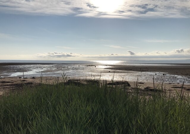
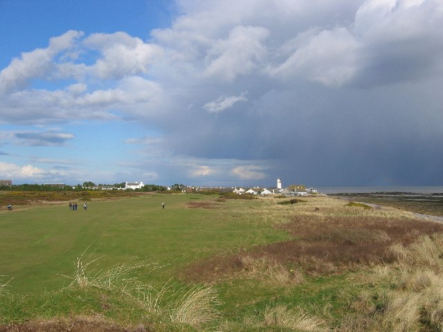
Southerness Point is a prominent headland located in Kirkcudbrightshire, Scotland. Situated on the southern shores of the Solway Firth, this coastal feature offers breathtaking views and a variety of natural attractions.

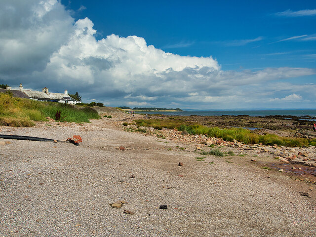
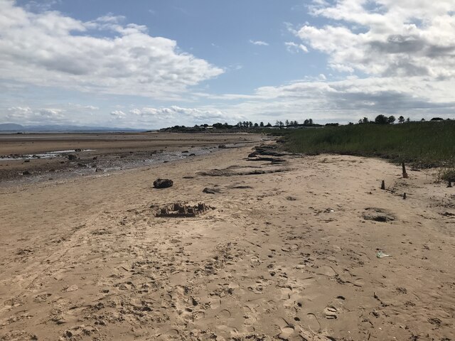
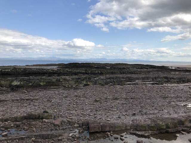
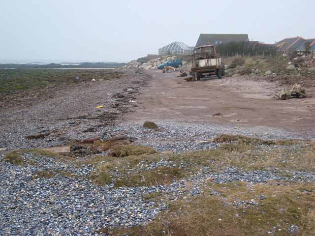
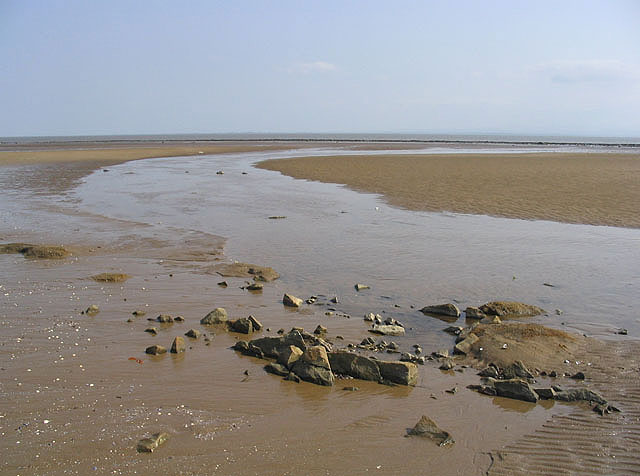
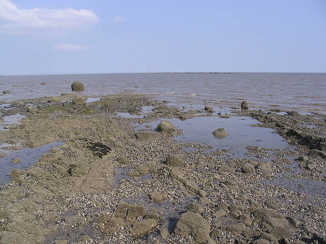
Stretching out into the Irish Sea, Southerness Point is characterized by its rugged cliffs and rocky coastline. The headland is formed by layers of sedimentary rocks, showcasing the area's geological history. Visitors can observe the striking layers and formations, which give the cliffs a unique and picturesque appearance.

The point is a popular destination for nature enthusiasts and outdoor adventurers. It is home to a diverse range of flora and fauna, including various seabird species, seals, and even the occasional dolphin or porpoise. Birdwatchers in particular flock to the area to spot species such as puffins, gannets, and kittiwakes.

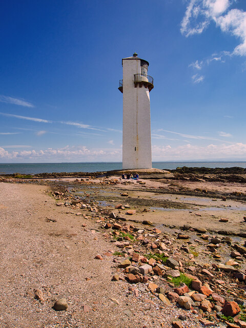
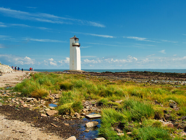
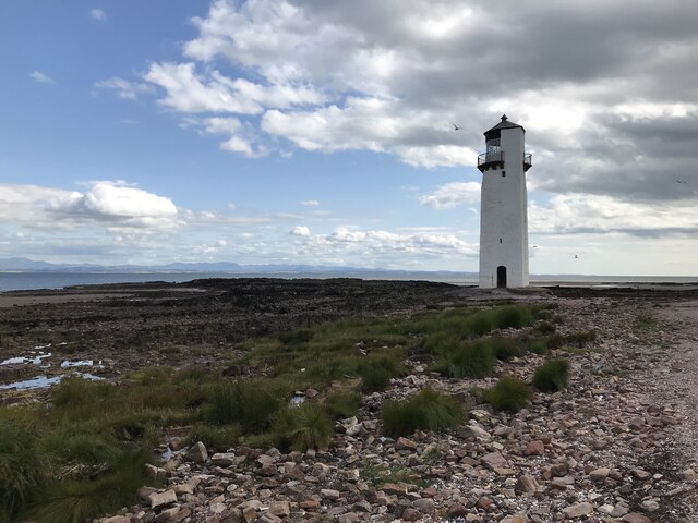
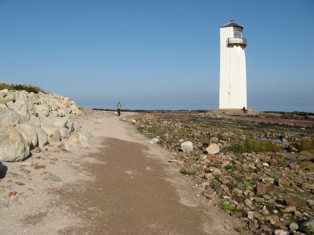
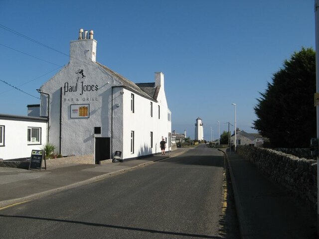
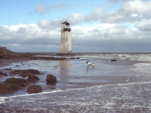
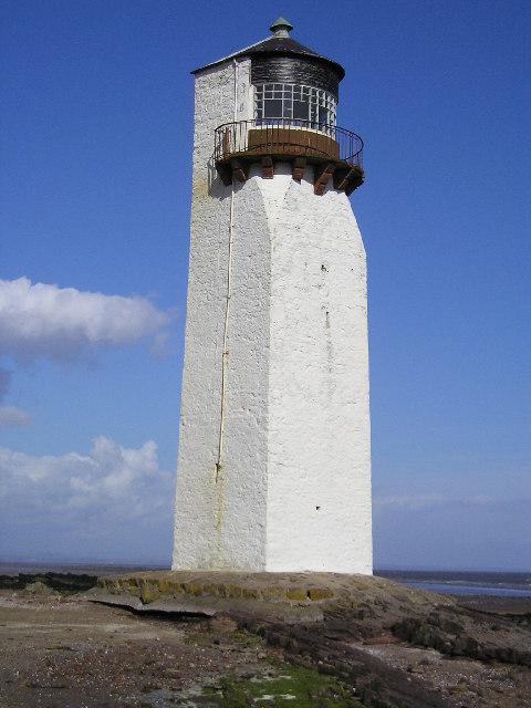
In addition to its natural beauty, Southerness Point offers visitors a chance to explore its rich history. The ruins of Southerness Lighthouse, built in 1749, stand as a testament to the area's maritime heritage. The lighthouse was decommissioned in 1936 but still serves as a landmark and a reminder of the past.

The headland is also a popular spot for recreational activities such as walking, picnicking, and photography. There are well-maintained footpaths that lead visitors along the cliff edges, providing stunning vistas of the coastline and the surrounding countryside.

Overall, Southerness Point is a captivating coastal feature that combines natural beauty, history, and outdoor activities. Whether one is seeking tranquility, wildlife spotting, or a glimpse into the area's past, this headland offers a truly remarkable experience.

If you have any feedback on the listing, please let us know in the comments section below.

Southerness Point Images

Images are sourced within 2km of 54.872437/-3.5950651 or Grid Reference NX9754. Thanks to Geograph Open Source API. All images are credited.

Southerness Lighthouse The Southerness lighthouse is the second oldest lighthouse still in existence in Scotland (<span class="nowrap"><a title="http://www.engineering-timelines.com/scripts/engineeringItem.asp?id=182" rel="nofollow ugc noopener" href="http://www.engineering-timelines.com/scripts/engineeringItem.asp?id=182">Link</a><img style="margin-left:2px;" alt="External link" title="External link - shift click to open in new window" src="https://s1.geograph.org.uk/img/external.png" width="10" height="10"/></span> Engineering Timelines). The square-based tower was commissioned by the Town Council of Dumfries in 1748 to assist in the safe passage through the Solway Firth of ships heading to the Nith Estuary. At that time roads in South West Scotland were quite sparse so the bulk of trade, even between local villages, was carried out by sea. Dumfries was a major port and there were regular connections with Liverpool and, especially, Ireland. Construction was completed in 1749. Originally a navigational marker, it became a lighthouse probably circa 1811. The lighthouse was decommissioned in 1936.

The lighthouse is a Category A listed building (LB10415 <span class="nowrap"><a title="http://portal.historicenvironment.scot/designation/LB10415" rel="nofollow ugc noopener" href="http://portal.historicenvironment.scot/designation/LB10415">Link</a><img style="margin-left:2px;" alt="External link" title="External link - shift click to open in new window" src="https://s1.geograph.org.uk/img/external.png" width="10" height="10"/></span> Historic Environment Scotland).
Southerness Lighthouse
The Southerness lighthouse is the second oldest lighthouse still in existence in Scotland (LinkExternal link Engineering Timelines). The square-based tower was commissioned by the Town Council of Dumfries in 1748 to assist in the safe passage through the Solway Firth of ships heading to the Nith Estuary. At that time roads in South West Scotland were quite sparse so the bulk of trade, even between local villages, was carried out by sea. Dumfries was a major port and there were regular connections with Liverpool and, especially, Ireland. Construction was completed in 1749. Originally a navigational marker, it became a lighthouse probably circa 1811. The lighthouse was decommissioned in 1936. The lighthouse is a Category A listed building (LB10415 LinkExternal link Historic Environment Scotland).
Lighthouse at Southerness Point The Southerness lighthouse is at present the second oldest lighthouse still in existence in Scotland (<span class="nowrap"><a title="http://www.engineering-timelines.com/scripts/engineeringItem.asp?id=182" rel="nofollow ugc noopener" href="http://www.engineering-timelines.com/scripts/engineeringItem.asp?id=182">Link</a><img style="margin-left:2px;" alt="External link" title="External link - shift click to open in new window" src="https://s1.geograph.org.uk/img/external.png" width="10" height="10"/></span> Engineering Timelines). The square-based tower was commissioned by the Town Council of Dumfries in 1748 to assist in the safe passage through the Solway Firth of ships heading to the Nith Estuary. At that time roads in South West Scotland were quite sparse so the bulk of trade, even between local villages, was carried out by sea. Dumfries was a major port and there were regular connections with Liverpool and, especially, Ireland. Construction was completed in 1749. Originally a navigational marker, it became a lighthouse probably circa 1811. The lighthouse was decommissioned in 1936.

The lighthouse is a Category A listed building (LB10415 <span class="nowrap"><a title="http://portal.historicenvironment.scot/designation/LB10415" rel="nofollow ugc noopener" href="http://portal.historicenvironment.scot/designation/LB10415">Link</a><img style="margin-left:2px;" alt="External link" title="External link - shift click to open in new window" src="https://s1.geograph.org.uk/img/external.png" width="10" height="10"/></span> Historic Environment Scotland).
Lighthouse at Southerness Point
The Southerness lighthouse is at present the second oldest lighthouse still in existence in Scotland (LinkExternal link Engineering Timelines). The square-based tower was commissioned by the Town Council of Dumfries in 1748 to assist in the safe passage through the Solway Firth of ships heading to the Nith Estuary. At that time roads in South West Scotland were quite sparse so the bulk of trade, even between local villages, was carried out by sea. Dumfries was a major port and there were regular connections with Liverpool and, especially, Ireland. Construction was completed in 1749. Originally a navigational marker, it became a lighthouse probably circa 1811. The lighthouse was decommissioned in 1936. The lighthouse is a Category A listed building (LB10415 LinkExternal link Historic Environment Scotland).
Coastal Path at Southerness
Southerness Southerness is a small, compact coastal village located approximately 2 miles south of the A710 between Caulkerbush and Kirkbean. The town today is mainly a tourist village dominated by the Southerness Holiday Village with its large number of static caravans.
Southerness
Southerness is a small, compact coastal village located approximately 2 miles south of the A710 between Caulkerbush and Kirkbean. The town today is mainly a tourist village dominated by the Southerness Holiday Village with its large number of static caravans.
Gillfoot Bay
Gillfoot Bay
Southerness Lighthouse
Southerness Point
Southerness Point
Gillfoot Bay
Gillfoot Bay
Lighthouse and sea defences Southerness is suffering from erosion, and even the concrete at the base of the lighthouse is showing signs of undermining. Change here has been profound, and I remember a wide sandy beach here in the 1980s, where it was customary to drive straight onto the sand to park.
Lighthouse and sea defences
Southerness is suffering from erosion, and even the concrete at the base of the lighthouse is showing signs of undermining. Change here has been profound, and I remember a wide sandy beach here in the 1980s, where it was customary to drive straight onto the sand to park.
Paul Jones Hotel with lighthouse Icons of Southerness, and memories that I could not suppress.
Paul Jones Hotel with lighthouse
Icons of Southerness, and memories that I could not suppress.
Southerness Lighthouse shore 1986 I was shocked to find that the sandy shore which I remember from our first family holidays had vanished. Compare this image with <a href="https://www.geograph.org.uk/photo/6971076">NX9754 : Lighthouse and sea defences</a>. Great amusement ensued when we realised that our only spaniel never to have starred in a geograph appears centre-stage. It was customary in those days to park cars on the sand at low tide, but now it is impossible even to leave the short access lane due to the abrupt drop at its end. The reverse change is noted to the west of Sandyhills (see <a href="https://www.geograph.org.uk/photo/6970251">NX8854 : Needle's Eye</a>).
It has taken a while to locate and scan this original transparency, taken with my Praktica TL3 (huge and incredibly heavy after my customary Powershot 710) on Kodachrome 200 film. My scanner is not so well specified!
Southerness Lighthouse shore 1986
I was shocked to find that the sandy shore which I remember from our first family holidays had vanished. Compare this image with NX9754 : Lighthouse and sea defences. Great amusement ensued when we realised that our only spaniel never to have starred in a geograph appears centre-stage. It was customary in those days to park cars on the sand at low tide, but now it is impossible even to leave the short access lane due to the abrupt drop at its end. The reverse change is noted to the west of Sandyhills (see NX8854 : Needle's Eye). It has taken a while to locate and scan this original transparency, taken with my Praktica TL3 (huge and incredibly heavy after my customary Powershot 710) on Kodachrome 200 film. My scanner is not so well specified!
Southerness. A small resort by the lighthouse. View towards a storm from the golfcourse.
Southerness.
A small resort by the lighthouse. View towards a storm from the golfcourse.
Southerness Lighthouse
The beach at Southerness
Caravan Park Overlooking Gillfoot Bay near Southerness.
Caravan Park
Overlooking Gillfoot Bay near Southerness.
Gillfoot Bay Low tide at Gillfoot Bay, northeast of Southerness.
Gillfoot Bay
Low tide at Gillfoot Bay, northeast of Southerness.
The shoreline at Southerness Exposed rocks as the tide goes out. Grid reference by GPS.
The shoreline at Southerness
Exposed rocks as the tide goes out. Grid reference by GPS.
The clubhouse at Southerness Golf Course
Show me another place!

Southerness Point is located at Grid Ref: NX9754 (Lat: 54.872437, Lng: -3.5950651)

Unitary Authority: Dumfries and Galloway

Police Authority: Dumfries and Galloway

What 3 Words

///quack.exclusive.billiard. Near Silloth, Cumbria

Related Wikis

Southerness Lighthouse

Southerness lighthouse is located at the village of Southerness in South West Scotland. It is at present the second oldest lighthouse in Scotland. The...
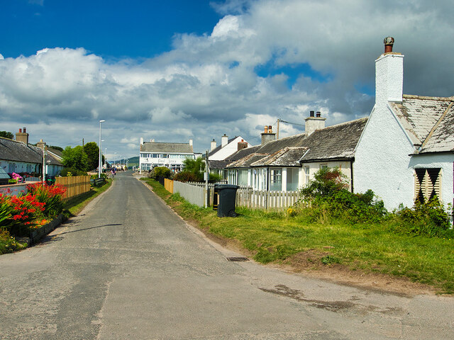
Southerness

Southerness (/sʌðə'nɛs/; Scots: Satterness) is a small, compact coastal village in Dumfries and Galloway, Scotland. Southerness is located approximately...

John Paul Jones Cottage Museum

The John Paul Jones Cottage Museum is located on the Arbigland Estate near Kirkbean in the historical county of Kirkcudbrightshire, Dumfries and Galloway...

Kirkbean

Kirkbean (Scottish Gaelic: Cille Bheathain) is a Scottish village and civil parish on the Solway Firth, in the historic county of Kirkcudbrightshire and...

Criffel

Criffel is a hill in the historical county of Kirkcudbrightshire, Dumfries and Galloway, south-west Scotland. It is 570 m (1,870 ft) high but appears higher...

Nearby Amenities

Located within 500m of 54.872437,-3.5950651
Source: PGS
Lat/Long: 54.8718755/-3.602781
Source: PGS
Lat/Long: 54.8719294/-3.601498
Source: PGS
Lat/Long: 54.872273/-3.5977857
Source: PGS
Lat/Long: 54.8723077/-3.5971334
Source: PGS
Lat/Long: 54.8728128/-3.5954455
Source: PGS
Lat/Long: 54.8727817/-3.5949042
Source: PGS
Lat/Long: 54.8730695/-3.5946059
Source: PGS
Lat/Long: 54.874631/-3.594267
Source: PGS
Lat/Long: 54.8749981/-3.5943229
Source: PGS
Lat/Long: 54.8757375/-3.593775
Source: PGS
Lat/Long: 54.8759626/-3.5937787
Source: PGS
Lat/Long: 54.8763372/-3.594003
Source: PGS
Lat/Long: 54.8765382/-3.5941912
Source: PGS
Lat/Long: 54.8767721/-3.594317
Southerness
Is In: Dumfries & Galloway, Scotland, UK
Name Sco: Satterness
Place: hamlet
Lat/Long: 54.8749945/-3.5977025
Parking
Access: customers
Fee: yes
Parking: surface
Lat/Long: 54.8742095/-3.5984059
Bus Stop
Holiday Village
Bench: yes
Bin: yes
Bus: yes
Lit: no
Naptan AtcoCode: 680000029501
Naptan Bearing: NW
Naptan CommonName: Holiday Village
Naptan Indicator: Shelter
Naptan Landmark: Holiday Park
Naptan NaptanCode: 34235768
Naptan Notes: none
Naptan Street: C22
Naptan Verified: no
Public Transport: platform
Shelter: yes
Source: naptan_import
Tactile Paving: no
Lat/Long: 54.8752094/-3.5996775
Southerness lighthouse
Man Made: lighthouse
Seamark Landmark Category: tower
Seamark Name: Southerness lighthouse
Seamark Type: landmark
Wikidata: Q7570747
Wikipedia: en:Southerness Lighthouse
Lat/Long: 54.8729255/-3.5952516
Toilets
Lat/Long: 54.8741524/-3.5978963
Post Box
Brand: Royal Mail
Brand Wikidata: Q638098
Collection Times: Mo-Fr 12:00; Sa 10:45
Operator: Royal Mail
Operator Wikidata: Q638098
Post Box Type: wall
Ref: DG2 113
Royal Cypher: scottish_crown
Source: survey
Lat/Long: 54.8732912/-3.5958796
Pub
The 19th Hole
Lat/Long: 54.8744008/-3.5988479
Paul Jones Hotel
Tourism: hotel
Lat/Long: 54.8741333/-3.5971081
Fast Food
JJs Fish and Chips
Lat/Long: 54.8745475/-3.597929
Telephone
Booth: KX100
Covered: booth
Man Made: telephone_box
Lat/Long: 54.8741632/-3.5978136
Post Box
Brand: Royal Mail
Brand Wikidata: Q638098
Collection Times: Mo-Fr 12:00; Sa 11:00
Operator: Royal Mail
Operator Wikidata: Q638098
Post Box Type: lamp
Ref: DG2 104
Royal Cypher: scottish_crown
Source: survey
Lat/Long: 54.8746092/-3.5982561
Noexit: yes
Lat/Long: 54.8758737/-3.5986325
Noexit: yes
Lat/Long: 54.8756018/-3.5981565
The data included in this document is from www.openstreetmap.org. The data is made available under ODbL.

Have you been to Southerness Point?

Leave your review of Southerness Point below (or comments, questions and feedback).