Providence Dock

Coastal Feature, Headland, Point in Cumberland Copeland

England

Providence Dock

A595 at Parton Brow
A595 at Parton Brow Credit: Colin Pyle

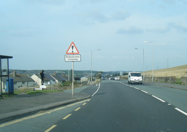
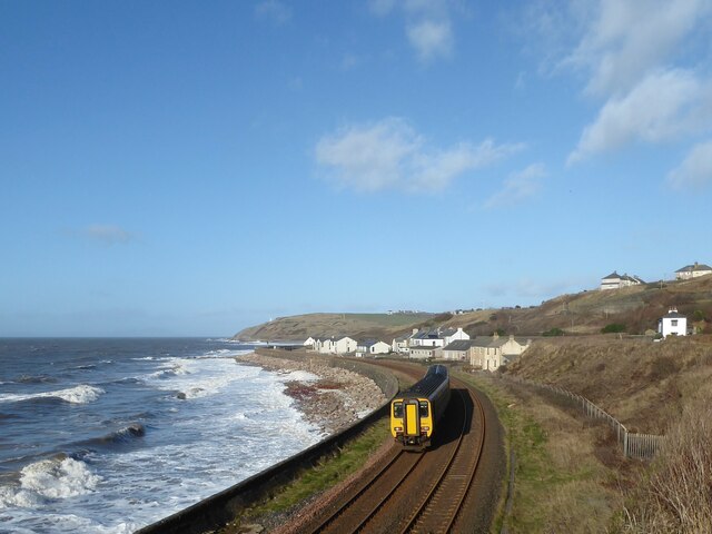
Providence Dock is a prominent coastal feature located in Cumberland, a county in the northeastern region of England. Situated on the coast, it is specifically classified as a headland or point due to its protrusion into the sea. The dock is positioned at the mouth of the Providence River, which flows into the North Sea.

This coastal feature is characterized by its rocky and rugged terrain, formed by the relentless erosion of the sea against the land over centuries. The dock offers stunning panoramic views of the surrounding sea and coastline, making it a popular spot for locals and tourists alike.

The Providence Dock is known for its rich biodiversity and is home to a variety of marine species. The rocky shores provide a habitat for numerous intertidal organisms such as crabs, mussels, and barnacles. It also serves as a nesting site for seabirds, including gulls and cormorants.

Due to its geographical location, Providence Dock is susceptible to strong tidal currents and occasional storms, which have shaped its distinctive features. The headland acts as a natural barrier, protecting the nearby coastal areas from the full force of the sea.

Visitors to Providence Dock can explore the surrounding area, enjoying activities such as hiking, birdwatching, and photography. The dock also provides access to the sea for fishing enthusiasts, who can try their luck in catching a variety of fish species.

In conclusion, Providence Dock in Cumberland is a picturesque coastal feature that offers breathtaking views, diverse marine life, and recreational opportunities for nature lovers and outdoor enthusiasts.

If you have any feedback on the listing, please let us know in the comments section below.

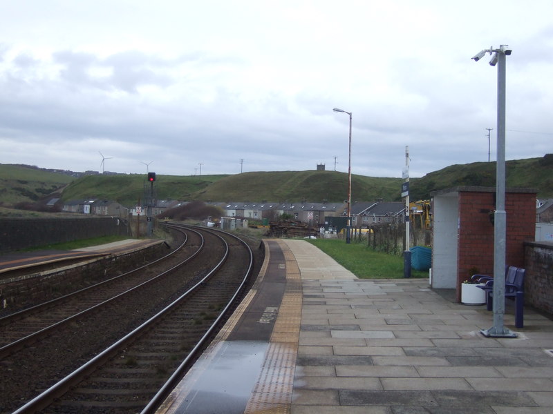
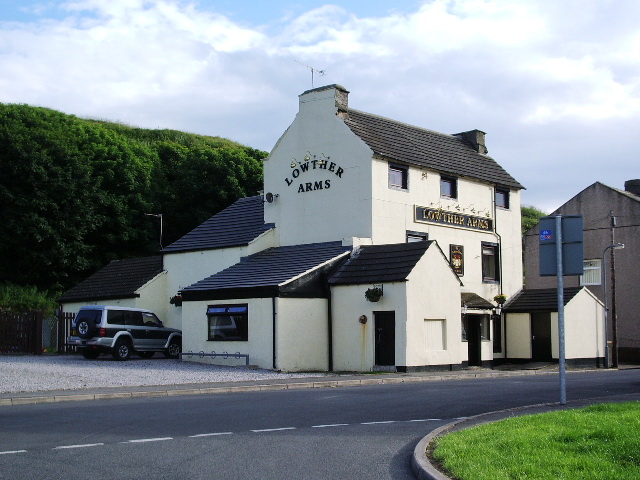
Providence Dock Images

Images are sourced within 2km of 54.577887/-3.583768 or Grid Reference NX9721. Thanks to Geograph Open Source API. All images are credited.

A595 at Parton Brow
A595 at Parton Brow
A595 north of Parton
Tanyard Bay Class 156 number 156471 forming the 14.38 train from Whitehaven to Carlisle rounds Tanyard Bay on the approach to Parton.
Tanyard Bay
Class 156 number 156471 forming the 14.38 train from Whitehaven to Carlisle rounds Tanyard Bay on the approach to Parton.
Bridge number 10 Parton was originally a fishing community and it was cut off from the sea when the Whitehaven Junction Railway was opened in 1847.  Several small bridges were constructed to allow passage from the village to the shore.  This one is bridge number 10, with the national identifier CBC2/10 (Carnforth-Barrow-Carlisle section 2 bridge number 10).
The signal number BY22R is for the down (northbound) line towards Carlisle and is controlled from Bransty Signalbox at Whitehaven.  The signal head is angled to allow adequate sighting on this sharply curved section of track.
Bridge number 10
Parton was originally a fishing community and it was cut off from the sea when the Whitehaven Junction Railway was opened in 1847. Several small bridges were constructed to allow passage from the village to the shore. This one is bridge number 10, with the national identifier CBC2/10 (Carnforth-Barrow-Carlisle section 2 bridge number 10). The signal number BY22R is for the down (northbound) line towards Carlisle and is controlled from Bransty Signalbox at Whitehaven. The signal head is angled to allow adequate sighting on this sharply curved section of track.
St Bridget's Church, Moresby St Bridget's is the parish church of Moresby, located near Moresby Hall, just north of Parton. The present church was built in 1822, replacing an earlier 13th century church here - the ancient chancel arch of the old church stands in the churchyard. The church is on the site of a former Roman camp, known as Gabrosentum. St Bridget's Church is Grade II listed on the National Heritage List for England.
St Bridget's Church, Moresby
St Bridget's is the parish church of Moresby, located near Moresby Hall, just north of Parton. The present church was built in 1822, replacing an earlier 13th century church here - the ancient chancel arch of the old church stands in the churchyard. The church is on the site of a former Roman camp, known as Gabrosentum. St Bridget's Church is Grade II listed on the National Heritage List for England.
Old Milestone by A595, East of Police Station; 50m West Brewery Bottom Recently restored 
The Milestone is located on grass verge on the North of the road.  Parish of Parton (Copeland District). Metal plate attached to stone post, Whitehaven plate stone design, erected by the Whitehaven turnpike trust in the 19th Century. An earlier photograph can be found here: <a title="https://www.geograph.org.uk/photo/5623131" href="https://www.geograph.org.uk/photo/5623131">Link</a> 

Inscription reads:- TO WORKINGTON / 6 MILES : : TO WHITEHAVEN / 2 MILES  Grade II listed. List Entry Number: 1312397 <span class="nowrap"><a title="https://historicengland.org.uk/listing/the-list/list-entry/1312397" rel="nofollow ugc noopener" href="https://historicengland.org.uk/listing/the-list/list-entry/1312397">Link</a><img style="margin-left:2px;" alt="External link" title="External link - shift click to open in new window" src="https://s1.geograph.org.uk/img/external.png" width="10" height="10"/></span> 

Milestone Society National ID: CU_WHWO02
Old Milestone by A595, East of Police Station; 50m West Brewery Bottom
Recently restored The Milestone is located on grass verge on the North of the road.  Parish of Parton (Copeland District). Metal plate attached to stone post, Whitehaven plate stone design, erected by the Whitehaven turnpike trust in the 19th Century. An earlier photograph can be found here: Link  Inscription reads:- TO WORKINGTON / 6 MILES : : TO WHITEHAVEN / 2 MILES Grade II listed. List Entry Number: 1312397 LinkExternal link Milestone Society National ID: CU_WHWO02
St. Bridgets Church and Site of Roman Moresby Fort, Parton Moresby Roman Fort was built probably built after 130AD by 20th Legion.

The Chancel arch (Right of  Current Church) dates from a former medieval church. Probably C13.
St. Bridgets Church and Site of Roman Moresby Fort, Parton
Moresby Roman Fort was built probably built after 130AD by 20th Legion. The Chancel arch (Right of Current Church) dates from a former medieval church. Probably C13.
St Bridget's Church, Moresby
Low Moresby (road) towards the A595
All that remains of old church at Moresby Built upon the site of an old Roman fort
All that remains of old church at Moresby
Built upon the site of an old Roman fort
St. Bridget's church at Moresby
Parton railway station, Cumbria Opened in 1847 by the Whitehaven Junction Railway (later part of the London & North Western Railway empire) on the line from Barrow-in-Furness to Carlisle. View north towards Harrington and Carlisle.
Parton railway station, Cumbria
Opened in 1847 by the Whitehaven Junction Railway (later part of the London & North Western Railway empire) on the line from Barrow-in-Furness to Carlisle. View north towards Harrington and Carlisle.
Wind Turbine, near Harrington Wind Turnbine off Lowca Top Road.
Wind Turbine, near Harrington
Wind Turnbine off Lowca Top Road.
Local Train near Harrington Northern Rail train service south of Harrington on the Cumbrian Coast Line.
Local Train near Harrington
Northern Rail train service south of Harrington on the Cumbrian Coast Line.
Parton Milestone Grade II listed milestone beside the A595. "mid C19. Single sandstone block c2 ft high with chamfered top; square in plan, set diagonally to road. Painted white with rectangular
cast-iron plate to north face; border and raised sans-serif lettering picked out
in black: TO WHITEHAVEN 2 MILES. Plate missing from south face". The missing plate showed Workington 6 miles & Cockermouth 12 miles.
Parton Milestone
Grade II listed milestone beside the A595. "mid C19. Single sandstone block c2 ft high with chamfered top; square in plan, set diagonally to road. Painted white with rectangular cast-iron plate to north face; border and raised sans-serif lettering picked out in black: TO WHITEHAVEN 2 MILES. Plate missing from south face". The missing plate showed Workington 6 miles & Cockermouth 12 miles.
Parton station One of the stations you may not have heard of, and few people use. Near the rocky beach.
Parton station
One of the stations you may not have heard of, and few people use. Near the rocky beach.
Coastline between Cunning and Micklam Points
Coastline north of Cunning Point
Show me another place!

Providence Dock is located at Grid Ref: NX9721 (Lat: 54.577887, Lng: -3.583768)

Administrative County: Cumbria

District: Copeland

Police Authority: Cumbria

What 3 Words

///small.shape.pigs. Near Whitehaven, Cumbria

Related Wikis

Lowca Beck

Lowca Beck is a beck in the county of Cumbria, England.The beck rises (as Distington Beck) in the vicinity of Gilgarran and flows by Distington and the...

Lowca railway station

Lowca had two railway stations that served the village of Lowca in the former county of Cumberland, England, which is now part of Cumbria.The line was...

Parton Halt railway station

Parton Halt railway station was opened by the LNWR and FR Joint Railway ("The Joint Line") in January 1915 and closed by the LMSR fourteen years later...

Lowca

Lowca is a village and civil parish in the English county of Cumbria, just to the north of the village of Moresby. It had a population of 773 in 2001,...
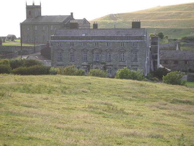
Moresby Hall

Moresby Hall is a former manor house and hotel in Parton, Cumbria, England, overlooking the Cumbrian Fells, and just to the north of the village of Moresby...

Parton railway station

Parton railway station is a railway station serving the village of Parton in Cumbria, England. It is on the Cumbrian Coast Line, which runs between Carlisle...

Micklam railway station

Micklam railway station served the fireclay mine and brickworks at Micklam, a short distance north of Lowca in the former county of Cumberland, England...

Parton, Cumbria

Parton is a village and civil parish on the Cumbrian coast, overlooking the Solway Firth, 1¼ miles (2 km) from Whitehaven in England. The parish had a...

Nearby Amenities

Located within 500m of 54.577887,-3.583768
Created By: almien_coastlines
Source: PGS
Lat/Long: 54.5817502/-3.583126
Created By: almien_coastlines
Source: PGS
Lat/Long: 54.5814942/-3.583122
Created By: almien_coastlines
Source: PGS
Lat/Long: 54.5807262/-3.583111
Created By: almien_coastlines
Source: PGS
Lat/Long: 54.5804692/-3.583108
Created By: almien_coastlines
Source: PGS
Lat/Long: 54.5799572/-3.5831
Created By: almien_coastlines
Source: PGS
Lat/Long: 54.5794452/-3.583093
Created By: almien_coastlines
Source: PGS
Lat/Long: 54.5789332/-3.583086
Created By: almien_coastlines
Source: PGS
Lat/Long: 54.5785061/-3.5829184
Created By: almien_coastlines
Source: PGS
Lat/Long: 54.5778939/-3.5826386
Created By: almien_coastlines
Source: PGS
Lat/Long: 54.5772228/-3.5823195
Created By: almien_coastlines
Source: PGS
Lat/Long: 54.5764959/-3.5823362
Created By: almien_coastlines
Source: PGS
Lat/Long: 54.5761717/-3.5818939
Created By: almien_coastlines
Source: PGS
Lat/Long: 54.5755767/-3.5819339
Created By: almien_coastlines
Source: PGS
Lat/Long: 54.5749041/-3.5813669
Created By: almien_coastlines
Source: PGS
Lat/Long: 54.5749094/-3.5812986
Created By: almien_coastlines
Source: PGS
Lat/Long: 54.5743301/-3.5810587
Created By: almien_coastlines
Source: PGS
Lat/Long: 54.5739408/-3.5808135
Created By: almien_coastlines
Source: PGS
Lat/Long: 54.5736892/-3.5811138
Parton South Junction
Railway: switch
Lat/Long: 54.5766984/-3.580831
Railway: switch
Lat/Long: 54.5767154/-3.5807587
The data included in this document is from www.openstreetmap.org. The data is made available under ODbL.

Have you been to Providence Dock?

Leave your review of Providence Dock below (or comments, questions and feedback).