Cunning Point
Coastal Feature, Headland, Point in Cumberland Copeland
England
Cunning Point

Cunning Point is a prominent coastal feature located in Cumberland, a region known for its stunning natural beauty in the northeastern part of England. Situated along the rugged coastline, Cunning Point is a headland that juts out into the North Sea, offering breathtaking views and a unique geological formation.
Standing at an elevation of approximately 40 meters (130 feet), Cunning Point is characterized by its steep cliffs, which are composed of sedimentary rock layers formed over millions of years. The cliffs are constantly being eroded by the powerful forces of wind and water, creating a dynamic and ever-changing landscape.
The point is named after its cunning appearance, as it is said to resemble the head of a fox from a certain angle. This distinctive feature adds to the allure of Cunning Point, attracting photographers, nature enthusiasts, and hikers who come to witness its beauty and explore the surrounding area.
The headland is also home to a diverse range of flora and fauna, including various seabirds that nest on the cliffs during the breeding season. Visitors to Cunning Point may have the opportunity to spot species such as puffins, gannets, and fulmars, adding an element of wildlife observation to their experience.
The area surrounding Cunning Point is a designated conservation site, ensuring the preservation of its natural heritage. Access to the point is possible via a well-maintained coastal path, which allows visitors to enjoy a leisurely stroll while taking in the stunning views of the North Sea and the surrounding coastline.
Overall, Cunning Point is a remarkable coastal feature that showcases the raw beauty of Cumberland's rugged coastline, making it a must-visit destination for nature lovers and those seeking a unique and picturesque experience.
If you have any feedback on the listing, please let us know in the comments section below.
Cunning Point Images
Images are sourced within 2km of 54.591361/-3.5830063 or Grid Reference NX9722. Thanks to Geograph Open Source API. All images are credited.


Cunning Point is located at Grid Ref: NX9722 (Lat: 54.591361, Lng: -3.5830063)
Administrative County: Cumbria
District: Copeland
Police Authority: Cumbria
What 3 Words
///clipboard.resold.interests. Near Distington, Cumbria
Nearby Locations
Related Wikis

Micklam railway station
Micklam railway station served the fireclay mine and brickworks at Micklam, a short distance north of Lowca in the former county of Cumberland, England...

Lowca
Lowca is a village and civil parish in the English county of Cumbria, just to the north of the village of Moresby. It had a population of 773 in 2001,...
Lowca railway station
Lowca had two railway stations that served the village of Lowca in the former county of Cumberland, England, which is now part of Cumbria.The line was...
Copperas Hill railway station
Copperas Hill railway station served the small clifftop community of Copperas Hill, south of Harrington in the former county of Cumberland, England, which...
Lowca Beck
Lowca Beck is a beck in the county of Cumbria, England.The beck rises (as Distington Beck) in the vicinity of Gilgarran and flows by Distington and the...
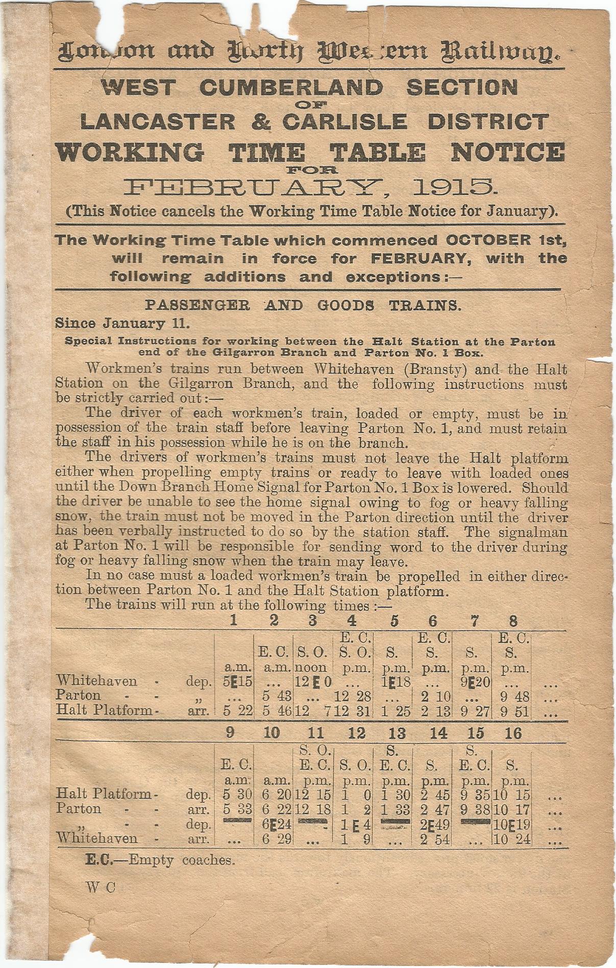
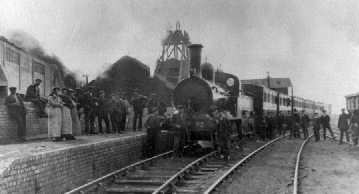
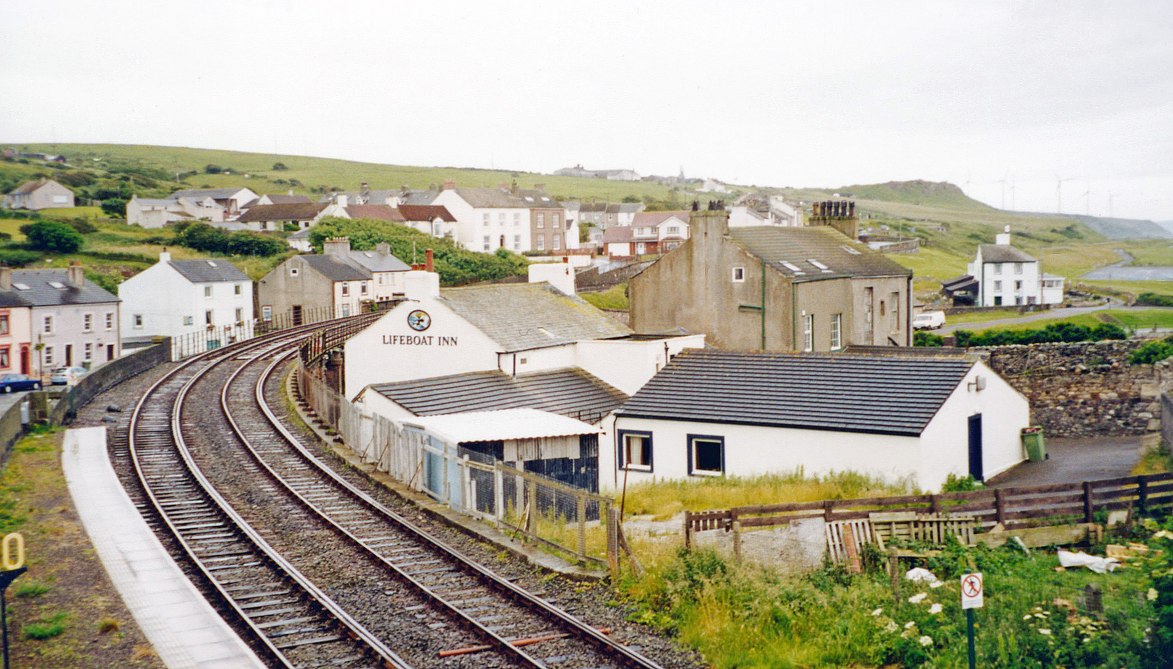
Parton Halt railway station
Parton Halt railway station was opened by the LNWR and FR Joint Railway ("The Joint Line") in January 1915 and closed by the LMSR fourteen years later...
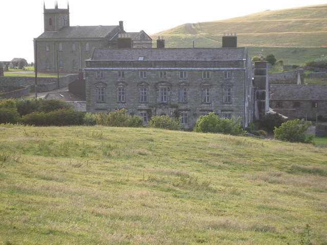
Moresby Hall
Moresby Hall is a former manor house and hotel in Parton, Cumbria, England, overlooking the Cumbrian Fells, and just to the north of the village of Moresby...
Rose Hill Platform railway station
Rose Hill Platform served workmen in the Rose Hill area of Harrington in the former county of Cumberland, England, which is now part of Cumbria. The halt...
Nearby Amenities
Located within 500m of 54.591361,-3.5830063Have you been to Cunning Point?
Leave your review of Cunning Point below (or comments, questions and feedback).