Middle Gate

Coastal Feature, Headland, Point in Devon North Devon

England

Middle Gate

South West Coast Path The South West Coast Path National Trail - 630 miles of superb coastal walking. From Minehead on the edge of the Exmoor National Park to the shores of Poole Harbour in Dorset. It is the longest of all Britain's National Trails.
Website: <span class="nowrap"><a title="http://www.southwestcoastpath.com/" rel="nofollow ugc noopener" href="http://www.southwestcoastpath.com/">Link</a><img style="margin-left:2px;" alt="External link" title="External link - shift click to open in new window" src="https://s1.geograph.org.uk/img/external.png" width="10" height="10"/></span>
South West Coast Path Credit: Lauren

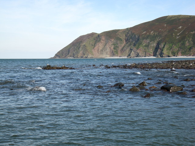
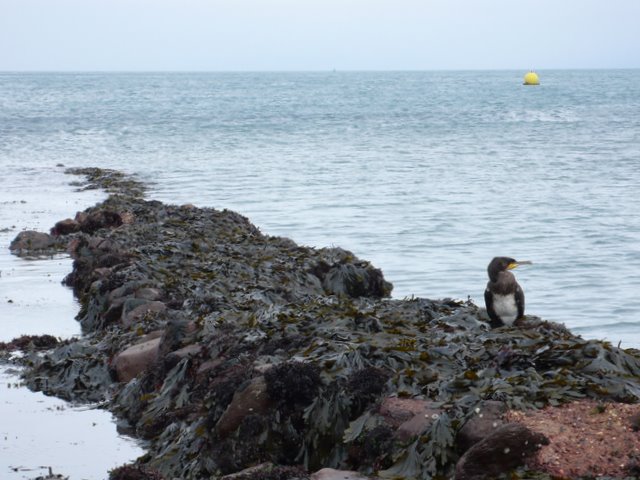
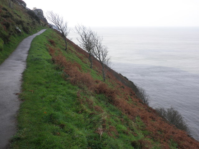
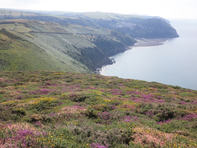
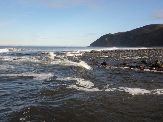
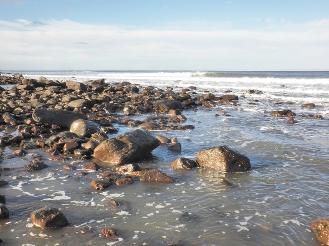
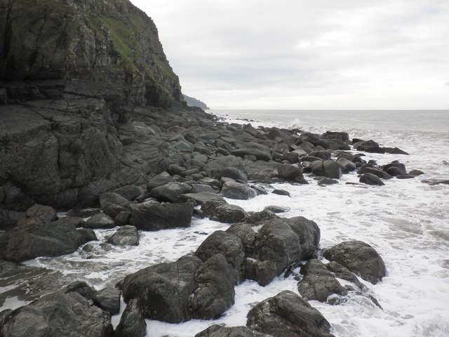
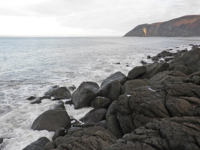
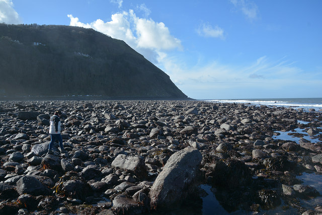
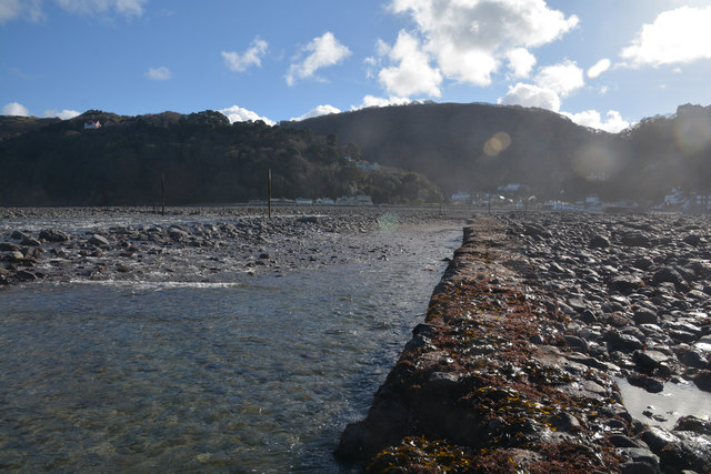
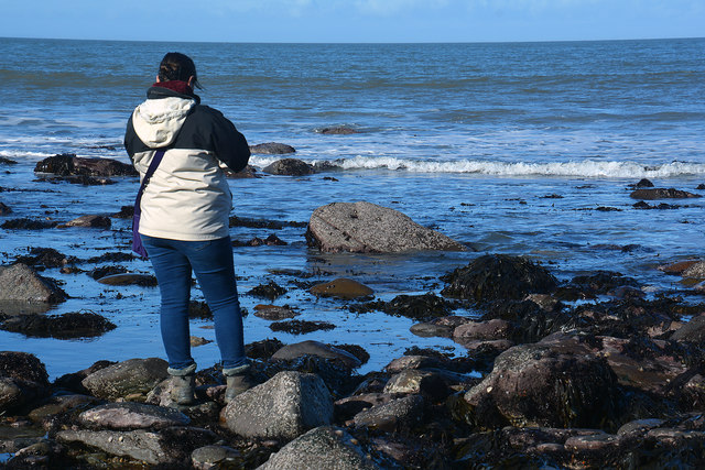
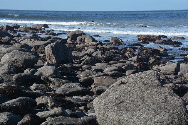
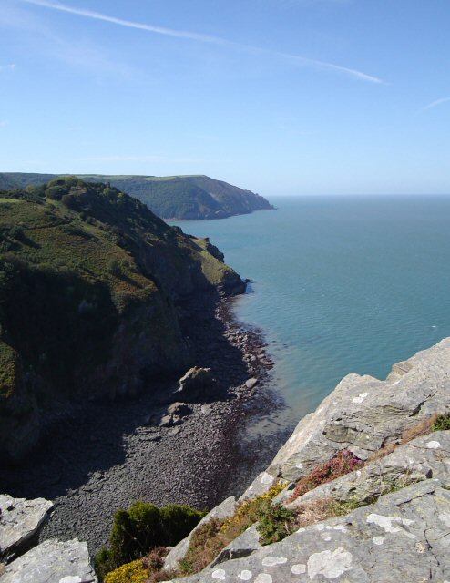
Middle Gate is a picturesque headland located in Devon, England. This coastal feature is known for its stunning views of the surrounding landscape and the nearby sea. The headland juts out into the ocean, providing a perfect vantage point for watching the waves crash against the rocky cliffs below.

Middle Gate is a popular spot for both locals and tourists, who come to admire the natural beauty of the area and take in the fresh sea air. The headland is also a great place for birdwatching, with a variety of seabirds and other wildlife often spotted in the area.

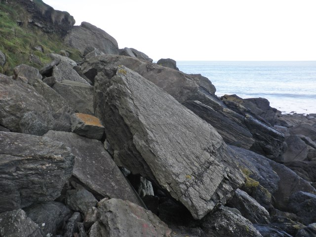
Visitors to Middle Gate can explore the rugged coastline on foot, taking in the dramatic scenery and enjoying the peaceful atmosphere. The headland is also a great place for a picnic, with plenty of grassy areas to relax and soak in the views.

Overall, Middle Gate is a must-visit destination for anyone looking to experience the beauty of the Devon coast. Whether you're a nature lover, a photography enthusiast, or simply looking for a peaceful escape, this headland has something to offer everyone.

If you have any feedback on the listing, please let us know in the comments section below.

Middle Gate Images

Images are sourced within 2km of 51.233827/-3.8493608 or Grid Reference SS7049. Thanks to Geograph Open Source API. All images are credited.

South West Coast Path The South West Coast Path National Trail - 630 miles of superb coastal walking. From Minehead on the edge of the Exmoor National Park to the shores of Poole Harbour in Dorset. It is the longest of all Britain's National Trails.
Website: <span class="nowrap"><a title="http://www.southwestcoastpath.com/" rel="nofollow ugc noopener" href="http://www.southwestcoastpath.com/">Link</a><img style="margin-left:2px;" alt="External link" title="External link - shift click to open in new window" src="https://s1.geograph.org.uk/img/external.png" width="10" height="10"/></span>
South West Coast Path
The South West Coast Path National Trail - 630 miles of superb coastal walking. From Minehead on the edge of the Exmoor National Park to the shores of Poole Harbour in Dorset. It is the longest of all Britain's National Trails. Website: LinkExternal link
Lyn Mouth rocks These rocks are only visible when there is a very low tide. The photo was taken at 16:03 BST during a low autumn tide. Foreland Point is clearly visible in the distance with the gully known as Great Red showing between the cliffs in the centre.
Lyn Mouth rocks
These rocks are only visible when there is a very low tide. The photo was taken at 16:03 BST during a low autumn tide. Foreland Point is clearly visible in the distance with the gully known as Great Red showing between the cliffs in the centre.
Ruddy Ball Ruddy Ball is part of the cliff face in Lynton North Devon. The photograph was taken close to the foot of the cliff at low tide.
Ruddy Ball
Ruddy Ball is part of the cliff face in Lynton North Devon. The photograph was taken close to the foot of the cliff at low tide.
Cormorant at Lynmouth These rocks are just exposed at low tide at the very southern edge of the grid square.
Cormorant at Lynmouth
These rocks are just exposed at low tide at the very southern edge of the grid square.
Cliff path, above Ruddy Ball
View towards the Lyn Mouth
Lyn Mouth and the Bristol Channel Looking north east from Lynton, near the upper cliff railway station.
Lyn Mouth and the Bristol Channel
Looking north east from Lynton, near the upper cliff railway station.
Breaking waves at the harbour entrance, Lynmouth
Water's edge, Lynmouth
View west, from Ruddy Ball
Rock slabs, Ruddy Ball
Rising tide, Ruddy Ball
Lynmouth : Lyn Mouth At the mouth of the Lyn and you're pretty much in the sea.
Lynmouth : Lyn Mouth
At the mouth of the Lyn and you're pretty much in the sea.
Lynmouth : Western Beach Looking out across the pebble beach.
Lynmouth : Western Beach
Looking out across the pebble beach.
Lynmouth : Western Beach Looking back along the River Lyn and Lynmouth.
Lynmouth : Western Beach
Looking back along the River Lyn and Lynmouth.
Lynmouth : Marker A marker out in the sea.
Lynmouth : Marker
A marker out in the sea.
Lynmouth : Coastal Scenery Looking out to sea from Western Beach.
Lynmouth : Coastal Scenery
Looking out to sea from Western Beach.
Lynmouth : Coastal Scenery Looking out across the coastline from Western Beach.
Lynmouth : Coastal Scenery
Looking out across the coastline from Western Beach.
Show me another place!

Middle Gate is located at Grid Ref: SS7049 (Lat: 51.233827, Lng: -3.8493608)

Administrative County: Devon

District: North Devon

Police Authority: Devon and Cornwall

What 3 Words

///towns.creatures.widget. Near Lynton, Devon

Related Wikis

Valley of Rocks

The Valley of Rocks, sometimes called Valley of the Rocks, is a dry valley that runs parallel to the coast in north Devon, England, about 1 kilometre...

Wringcliff Bay

Wringcliff Bay, also known as Wring Cliff Cove, is a bay on the Bristol Channel of northern Devon, England. It lies to the northwest of the village of...

Lynton Town Hall

Lynton Town Hall is a municipal building in Lee Road, Lynton, Devon, England. The town hall, which was the meeting place of Lynton Urban District Council...

Lynton Village railway station

Lynton Village railway station is a station in Lynton, Devon, England served by the Lynton and Lynmouth Cliff Railway, a water-powered funicular railway...

Nearby Amenities

Located within 500m of 51.233827,-3.8493608
Source: PGS
Lat/Long: 51.235684/-3.8428515
Source: PGS
Lat/Long: 51.2357132/-3.8439115
Source: PGS
Lat/Long: 51.2356998/-3.8449491
Source: PGS
Lat/Long: 51.2356645/-3.8453616
Source: PGS
Lat/Long: 51.2355943/-3.845714
Source: PGS
Lat/Long: 51.2355753/-3.8461975
Source: PGS
Lat/Long: 51.2354449/-3.8474464
Source: PGS
Lat/Long: 51.2354112/-3.8478544
Source: PGS
Lat/Long: 51.2352937/-3.8484013
Source: PGS
Lat/Long: 51.2352558/-3.8485271
Source: PGS
Lat/Long: 51.2352484/-3.8490929
Source: PGS
Lat/Long: 51.2353419/-3.8495334
Source: PGS
Lat/Long: 51.235386/-3.8497043
Source: PGS
Lat/Long: 51.2352666/-3.8506028
Source: PGS
Lat/Long: 51.2349375/-3.8522731
Source: PGS
Lat/Long: 51.2347235/-3.8531463
Source: PGS
Lat/Long: 51.2346547/-3.8540326
Source: PGS
Lat/Long: 51.2345792/-3.8542206
Source: PGS
Lat/Long: 51.2340378/-3.8553648
Source: PGS
Lat/Long: 51.2339053/-3.8557222
Barrier: cattle_grid
Bicycle: yes
Image: https://archive.org/details/lynmouth-2021-09-07/DSCN4484.JPG
Motorcycle: yes
Lat/Long: 51.2318226/-3.8464732
The Valley of Rocks
Place: locality
Lat/Long: 51.2317547/-3.8544801
Hollerday Hill
Natural: peak
Old Name: Holiday Hill
Source Name: OS_OpenData_StreetView
Source Old Name: NPE
Lat/Long: 51.2328206/-3.8429246
Cafe
Mother Meldrun's
Outdoor Seating: yes
Lat/Long: 51.2327057/-3.8513484
Bench
Lat/Long: 51.2318687/-3.8435246
Shelter
Lat/Long: 51.234197/-3.847916
Bench
Lat/Long: 51.2342696/-3.8474126
Bench
Lat/Long: 51.2343011/-3.8468239
Bench
Lat/Long: 51.2343286/-3.8459462
Bench
Lat/Long: 51.2344067/-3.844576
Shelter
Bench: yes
Lat/Long: 51.2344108/-3.8440464
Barrier: kissing_gate
Lat/Long: 51.2303742/-3.8490925
Tourism: picnic_site
Lat/Long: 51.2323576/-3.8527124
Bench
Backrest: yes
Lat/Long: 51.2337716/-3.8489617
Vending Machine
Image: https://archive.org/details/lynmouth-2021-09-07/DSCN4546.JPG
Operator: North Devon District Council
Vending: parking_tickets
Lat/Long: 51.2323796/-3.8514731
Binoculars
Image: https://archive.org/details/lynmouth-2021-09-07/DSCN4536.JPG
Note: Actually a coin operated telescope as viewed through one eye only, but serves same purpose
Lat/Long: 51.2327464/-3.855359
Waste Basket
Waste: dog_excrement
Lat/Long: 51.231897/-3.8465177
Give Way
Lat/Long: 51.2318214/-3.8465707
Direction: NW
Tourism: viewpoint
Lat/Long: 51.2333528/-3.8457899
Bench
Backrest: yes
Colour: brown
Material: wood
Seats: 4
Lat/Long: 51.2331434/-3.8454137
The data included in this document is from www.openstreetmap.org. The data is made available under ODbL.

Have you been to Middle Gate?

Leave your review of Middle Gate below (or comments, questions and feedback).