Back Bason

Coastal Feature, Headland, Point in Kirkcudbrightshire

Scotland

Back Bason

Wooden sign, Kirkcudbright Training Area
Wooden sign, Kirkcudbright Training Area Credit: Steven Brown

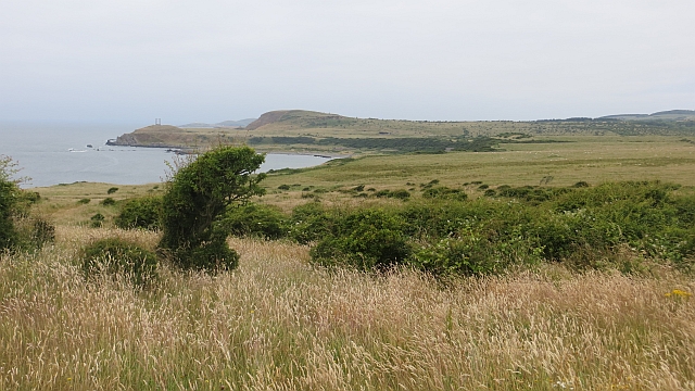
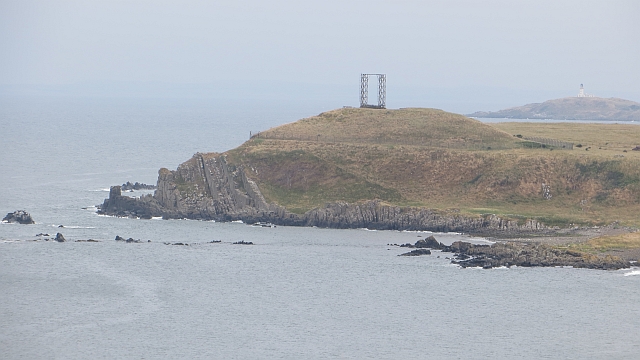
Back Bason is a prominent headland located in Kirkcudbrightshire, Scotland. Situated along the rugged coastline, the headland offers stunning views of the surrounding sea and landscape. The area is known for its rocky cliffs, sandy beaches, and diverse marine life.

Back Bason is a popular spot for birdwatching, with a wide variety of seabirds and shorebirds frequenting the area. Visitors can often spot species such as gannets, puffins, and cormorants soaring above the cliffs or fishing in the waters below.

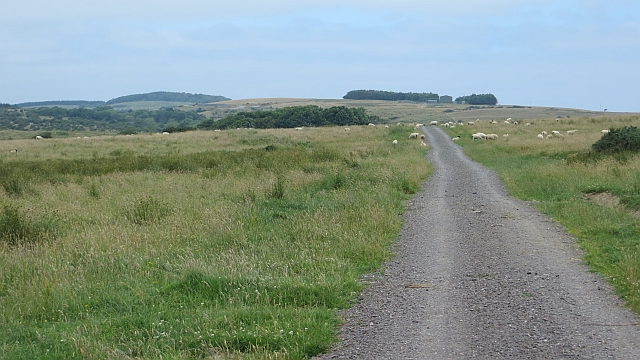
The headland is also a great place for outdoor activities such as hiking, picnicking, and photography. The dramatic coastal scenery and unique rock formations provide plenty of opportunities for exploration and adventure.

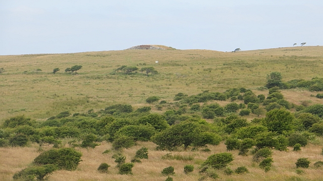
In addition to its natural beauty, Back Bason has a rich history, with evidence of ancient settlements and archaeological sites scattered throughout the area. Visitors can learn about the area's past while taking in the breathtaking views and enjoying the peaceful atmosphere.

Overall, Back Bason is a must-see destination for nature lovers, outdoor enthusiasts, and history buffs alike. Its picturesque setting and diverse wildlife make it a truly special place to visit on the Kirkcudbrightshire coast.

If you have any feedback on the listing, please let us know in the comments section below.
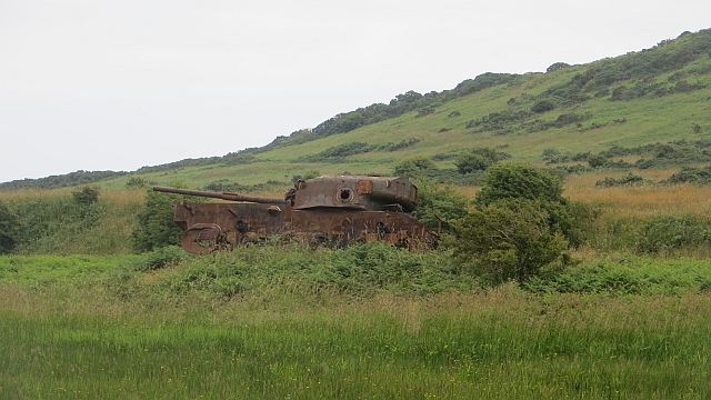
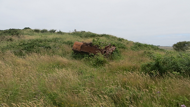
Back Bason Images

Images are sourced within 2km of 54.770389/-4.007342 or Grid Reference NX7043. Thanks to Geograph Open Source API. All images are credited.

Wooden sign, Kirkcudbright Training Area
Churchill Tank The remains of a Churchill tank, that's been used as a target on the Kirkcudbright Ranges for years.
Churchill Tank
The remains of a Churchill tank, that's been used as a target on the Kirkcudbright Ranges for years.
Sherman Tank An old Sherman tank, used for target practice 
on Kirkcudbright Ranges.
Sherman Tank
An old Sherman tank, used for target practice on Kirkcudbright Ranges.
Old Target An old target on Kirkcudbright Ranges.
Old Target
An old target on Kirkcudbright Ranges.
Road near Craigraploch The road runs beside the Controlled Impact Area of the Kirkcudbright Infantry Training Area. It is a waymarked route across the range when the flags are down.
Road near Craigraploch
The road runs beside the Controlled Impact Area of the Kirkcudbright Infantry Training Area. It is a waymarked route across the range when the flags are down.
Kirkcudbright Infantry Training Range The southernmost part of the waymarked route across the range, above Mullock Bay. The view is westward towards Big Raeberry.  The land is still grazed, but has the appearance of ground from which farm animals were once excluded as is the case in the current Controlled Impact Area. There were numerous targets erected here and I suspect that the red flags were back up very soon after this visit.
Kirkcudbright Infantry Training Range
The southernmost part of the waymarked route across the range, above Mullock Bay. The view is westward towards Big Raeberry. The land is still grazed, but has the appearance of ground from which farm animals were once excluded as is the case in the current Controlled Impact Area. There were numerous targets erected here and I suspect that the red flags were back up very soon after this visit.
Road, Mullock The road is not shown on maps from before the land was turned into a training range. It is open when the range is not in use and traverses some now wild and beautiful scenery.  

This part of the range is farmed.
Road, Mullock
The road is not shown on maps from before the land was turned into a training range. It is open when the range is not in use and traverses some now wild and beautiful scenery. This part of the range is farmed.
Kirkcudbright Infantry Training Range Scrub on what was, and what appears to be again farmland on the training range. A real savannah appearance to this place with the dry summer. No wildebeest here, just sheep and clegs.
Kirkcudbright Infantry Training Range
Scrub on what was, and what appears to be again farmland on the training range. A real savannah appearance to this place with the dry summer. No wildebeest here, just sheep and clegs.
Tank,  Kirkcudbright Range A target near the road which crosses the range at Craigraploch. This is the controlled impact area and there has been little or no agricultural activity for many years.
Tank, Kirkcudbright Range
A target near the road which crosses the range at Craigraploch. This is the controlled impact area and there has been little or no agricultural activity for many years.
View towards the Raeberries The coast south of Dundrennan, wild and ill frequented due to the infantry training range.
View towards the Raeberries
The coast south of Dundrennan, wild and ill frequented due to the infantry training range.
Overgrown tank Once a target on the Kirkcudbright ranges, now somewhat overgrown.
Overgrown tank
Once a target on the Kirkcudbright ranges, now somewhat overgrown.
Kirkcudbright Infantry Training Range The road crossing the range which is open to non motorised traffic when the flags are down, passes Mullock Bay.
Kirkcudbright Infantry Training Range
The road crossing the range which is open to non motorised traffic when the flags are down, passes Mullock Bay.
Little Raeberry Headland with near vertical bedding on coast south of Kirkudbright. It is deep within the Kirkcudbright Infantry Training Range which explains the starting frame like structure. 
The Ross Island lighthouse is in the background.
Little Raeberry
Headland with near vertical bedding on coast south of Kirkudbright. It is deep within the Kirkcudbright Infantry Training Range which explains the starting frame like structure. The Ross Island lighthouse is in the background.
Mermaid's Chair Rock formation off Little Raeberry, south of Kirkcudbright.
Mermaid's Chair
Rock formation off Little Raeberry, south of Kirkcudbright.
Military building, Mullock Dug into the Kirkcudbright Infantry Training Range.
Military building, Mullock
Dug into the Kirkcudbright Infantry Training Range.
Camp Hill Wild ground, typical of artillery ranges where agricultural activity has been suspended for many years. Much of the range is still farmed, note the contrast between the foreground slopes and fields on the hill top.
Camp Hill
Wild ground, typical of artillery ranges where agricultural activity has been suspended for many years. Much of the range is still farmed, note the contrast between the foreground slopes and fields on the hill top.
Craigraploch and Camp Hill Contrasting farmed and left wild areas of the Kirkcudbright Infantry Training Range.
Craigraploch and Camp Hill
Contrasting farmed and left wild areas of the Kirkcudbright Infantry Training Range.
Targets, Kirkcudbright Infantry Training Range Only "the enemy" was present over the weekend and the track across the range open. Locals told me that there were a lot of soldiers up at the range, so I presume the flags went up the next day.
Targets, Kirkcudbright Infantry Training Range
Only "the enemy" was present over the weekend and the track across the range open. Locals told me that there were a lot of soldiers up at the range, so I presume the flags went up the next day.
Show me another place!

Back Bason is located at Grid Ref: NX7043 (Lat: 54.770389, Lng: -4.007342)

Unitary Authority: Dumfries and Galloway

Police Authority: Dumfries and Galloway

What 3 Words

///grapevine.rationed.duet. Near Kirkcudbright, Dumfries & Galloway

Related Wikis

Abbey Head

Abbey Head is a headland on the Solway Firth coast of Dumfries and Galloway. == References ==
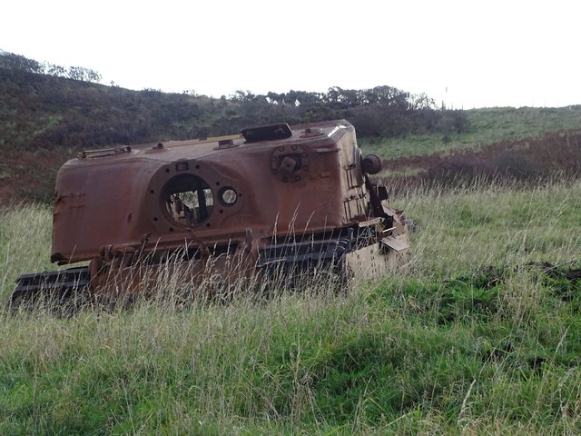
Dundrennan Range

Dundrennan Range is a weapons testing range on the Solway Firth, near Kirkcudbright in Dumfries and Galloway, in south west Scotland, it is part of the...

Kirkcudbright Bay

Kirkcudbright Bay is an inlet of the Irish Sea on the coast of Galloway in southwest Scotland. Its coastline falls entirely within the modern administrative...

Little Ross

Little Ross is a 29-acre (12-hectare) island with a lighthouse on the Solway Coast south of the town of Kirkcudbright in Galloway, Scotland. It is next...

Nearby Amenities

Located within 500m of 54.770389,-4.007342
Source: PGS
Lat/Long: 54.7703924/-4.015024
Source: PGS
Lat/Long: 54.7703547/-4.014438
Source: PGS
Lat/Long: 54.7704285/-4.0139345
Source: PGS
Lat/Long: 54.7705279/-4.012884
Source: PGS
Lat/Long: 54.7704757/-4.0123714
Source: PGS
Lat/Long: 54.7704239/-4.0118052
Source: PGS
Lat/Long: 54.7706488/-4.0110959
Source: PGS
Lat/Long: 54.7707778/-4.0107098
Source: PGS
Lat/Long: 54.7710855/-4.0104928
Source: PGS
Lat/Long: 54.7716145/-4.0104221
Source: PGS
Lat/Long: 54.7716933/-4.0097907
Source: PGS
Lat/Long: 54.771736/-4.0088904
Source: PGS
Lat/Long: 54.7716401/-4.0083233
Source: PGS
Lat/Long: 54.7720055/-4.0071144
Source: PGS
Lat/Long: 54.7719377/-4.0078103
Source: PGS
Lat/Long: 54.7721907/-4.0084212
Source: PGS
Lat/Long: 54.7725431/-4.0084551
Source: PGS
Lat/Long: 54.7730029/-4.0080529
Source: PGS
Lat/Long: 54.7732132/-4.0077504
Source: PGS
Lat/Long: 54.7733833/-4.007421
Source: PGS
Lat/Long: 54.7734561/-4.0068817
Source: PGS
Lat/Long: 54.7737156/-4.0069432
Source: PGS
Lat/Long: 54.7739731/-4.0066685
Source: PGS
Lat/Long: 54.7740389/-4.0070493
Source: PGS
Lat/Long: 54.7742813/-4.0069834
Source: PGS
Lat/Long: 54.7745092/-4.0063367
Source: PGS
Lat/Long: 54.7744876/-4.0057785
Source: PGS
Lat/Long: 54.774217/-4.005651
Source: PGS
Lat/Long: 54.7734781/-4.0038261
Source: PGS
Lat/Long: 54.7733365/-4.0027469
Source: PGS
Lat/Long: 54.7730257/-4.0014786
Source: PGS
Lat/Long: 54.7729438/-4.000978
Mullock Bay
Natural: bay
Source: Popular Edition (Scotland)
Lat/Long: 54.7723128/-4.0054016
The data included in this document is from www.openstreetmap.org. The data is made available under ODbL.

Have you been to Back Bason?

Leave your review of Back Bason below (or comments, questions and feedback).