Castle Rock

Coastal Feature, Headland, Point in Devon North Devon

England

Castle Rock

South West Coast Path The South West Coast Path National Trail - 630 miles of superb coastal walking. From Minehead on the edge of the Exmoor National Park to the shores of Poole Harbour in Dorset. It is the longest of all Britain's National Trails.
Website: <span class="nowrap"><a title="http://www.southwestcoastpath.com/" rel="nofollow ugc noopener" href="http://www.southwestcoastpath.com/">Link</a><img style="margin-left:2px;" alt="External link" title="External link - shift click to open in new window" src="https://s1.geograph.org.uk/img/external.png" width="10" height="10"/></span>
South West Coast Path Credit: Lauren

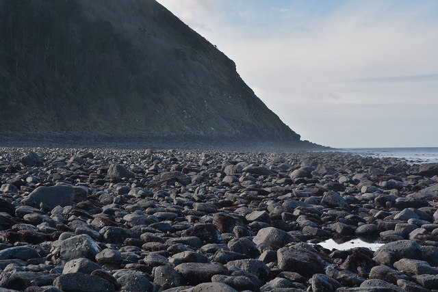
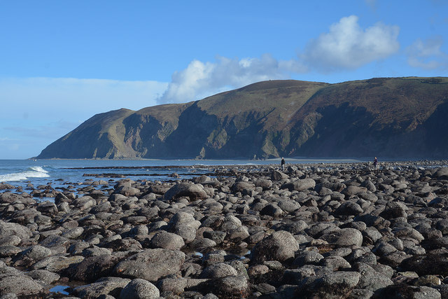
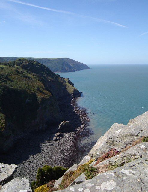
Castle Rock is a prominent coastal feature located in the county of Devon, England. Situated on the southwestern coast, it is classified as a headland or point due to its distinctive geographic characteristics. Rising approximately 20 meters above sea level, Castle Rock offers breathtaking views of the surrounding landscape and the English Channel.

The rock formation gets its name from an ancient castle that once stood on its summit. Although the castle itself no longer remains, its historical significance is evident through the ruins and remnants that can still be observed. These include remnants of the castle walls and foundations, providing a glimpse into the area's rich history.

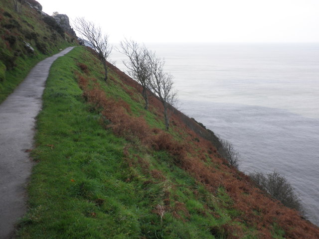
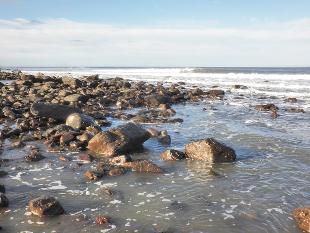
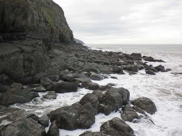
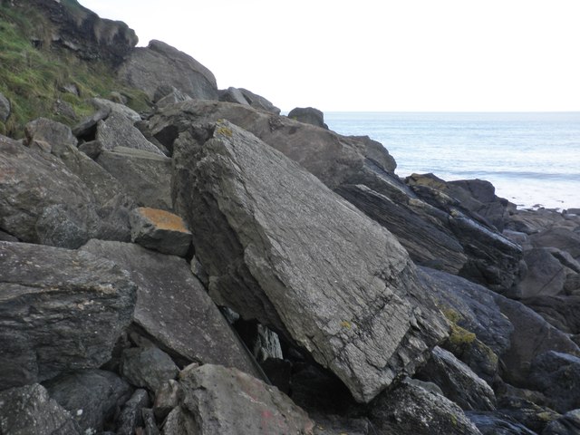
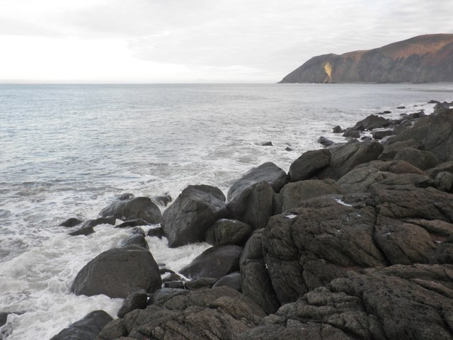
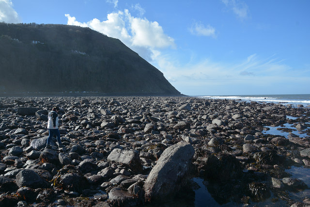
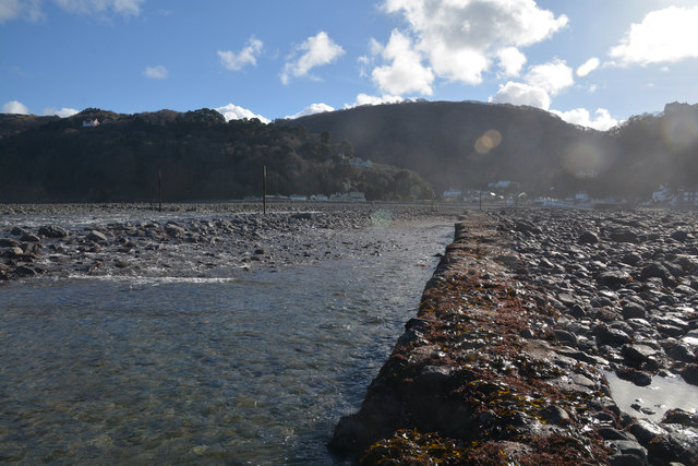
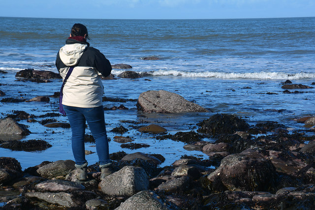
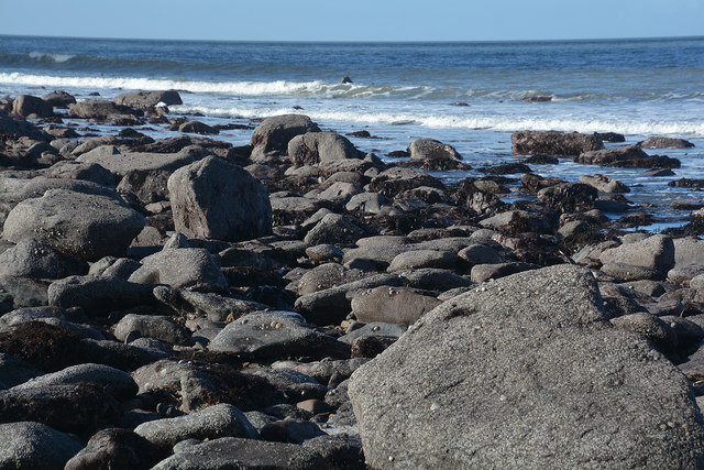
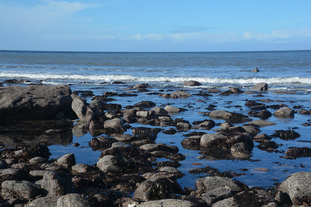
Castle Rock is known for its rugged and dramatic appearance, with sheer cliffs and jagged rocks extending into the sea. It is a popular destination for both locals and tourists, offering opportunities for outdoor activities such as hiking, birdwatching, and photography. The headland serves as a vantage point for spotting various marine wildlife, including seals, dolphins, and seabirds.

Visitors to Castle Rock can access the site via a well-maintained footpath, which winds its way up from the nearby village. The path offers stunning views of the coastline and surrounding countryside, making the climb an enjoyable experience in itself.

Overall, Castle Rock in Devon is a captivating coastal feature that combines natural beauty with historical significance. Its rugged cliffs, ancient ruins, and panoramic views make it a must-visit destination for nature enthusiasts and history buffs alike.

If you have any feedback on the listing, please let us know in the comments section below.

Castle Rock Images

Images are sourced within 2km of 51.231454/-3.8583469 or Grid Reference SS7049. Thanks to Geograph Open Source API. All images are credited.

South West Coast Path The South West Coast Path National Trail - 630 miles of superb coastal walking. From Minehead on the edge of the Exmoor National Park to the shores of Poole Harbour in Dorset. It is the longest of all Britain's National Trails.
Website: <span class="nowrap"><a title="http://www.southwestcoastpath.com/" rel="nofollow ugc noopener" href="http://www.southwestcoastpath.com/">Link</a><img style="margin-left:2px;" alt="External link" title="External link - shift click to open in new window" src="https://s1.geograph.org.uk/img/external.png" width="10" height="10"/></span>
South West Coast Path
The South West Coast Path National Trail - 630 miles of superb coastal walking. From Minehead on the edge of the Exmoor National Park to the shores of Poole Harbour in Dorset. It is the longest of all Britain's National Trails. Website: LinkExternal link
Ruddy Ball Ruddy Ball is part of the cliff face in Lynton North Devon. The photograph was taken close to the foot of the cliff at low tide.
Ruddy Ball
Ruddy Ball is part of the cliff face in Lynton North Devon. The photograph was taken close to the foot of the cliff at low tide.
Cliff path, above Ruddy Ball
Lyn Mouth and the Bristol Channel Looking north east from Lynton, near the upper cliff railway station.
Lyn Mouth and the Bristol Channel
Looking north east from Lynton, near the upper cliff railway station.
Water's edge, Lynmouth
View west, from Ruddy Ball
Rock slabs, Ruddy Ball
Rising tide, Ruddy Ball
Lynmouth : Lyn Mouth At the mouth of the Lyn and you're pretty much in the sea.
Lynmouth : Lyn Mouth
At the mouth of the Lyn and you're pretty much in the sea.
Lynmouth : Western Beach Looking out across the pebble beach.
Lynmouth : Western Beach
Looking out across the pebble beach.
Lynmouth : Western Beach Looking back along the River Lyn and Lynmouth.
Lynmouth : Western Beach
Looking back along the River Lyn and Lynmouth.
Lynmouth : Marker A marker out in the sea.
Lynmouth : Marker
A marker out in the sea.
Lynmouth : Coastal Scenery Looking out to sea from Western Beach.
Lynmouth : Coastal Scenery
Looking out to sea from Western Beach.
Lynmouth : Coastal Scenery Looking out across the coastline from Western Beach.
Lynmouth : Coastal Scenery
Looking out across the coastline from Western Beach.
Lynmouth : Western Beach Looking across the Lynmouth coastline.
Lynmouth : Western Beach
Looking across the Lynmouth coastline.
Lynmouth : Western Beach The coastal scenery at Lynmouth at low tide.
Lynmouth : Western Beach
The coastal scenery at Lynmouth at low tide.
Lynmouth : Western Beach Looking across the coastline with Foreland Point in view.
Lynmouth : Western Beach
Looking across the coastline with Foreland Point in view.
Lynmouth : Coastal Scenery Coastal scenery seen from Western Beach.
Lynmouth : Coastal Scenery
Coastal scenery seen from Western Beach.
Show me another place!

Castle Rock is located at Grid Ref: SS7049 (Lat: 51.231454, Lng: -3.8583469)

Administrative County: Devon

District: North Devon

Police Authority: Devon and Cornwall

What 3 Words

///treetop.turkeys.breeze. Near Lynton, Devon

Related Wikis

Wringcliff Bay

Wringcliff Bay, also known as Wring Cliff Cove, is a bay on the Bristol Channel of northern Devon, England. It lies to the northwest of the village of...

Valley of Rocks

The Valley of Rocks, sometimes called Valley of the Rocks, is a dry valley that runs parallel to the coast in north Devon, England, about 1 kilometre...

Lee Abbey

Lee Abbey, founded in 1946, is an ecumenical Christian community between Woody Bay and Lynmouth in Devon, England. It is a Grade II listed building. The...

Lynton

Lynton is a town on the Exmoor coast in the North Devon district in the county of Devon, England, approximately 17 miles (27 km) north-east of Barnstaple...

Nearby Amenities

Located within 500m of 51.231454,-3.8583469
Source: PGS
Lat/Long: 51.2346547/-3.8540326
Source: PGS
Lat/Long: 51.2345792/-3.8542206
Source: PGS
Lat/Long: 51.2340378/-3.8553648
Source: PGS
Lat/Long: 51.2339053/-3.8557222
Source: PGS
Lat/Long: 51.2336918/-3.8565698
Source: PGS
Lat/Long: 51.2333383/-3.8579016
Source: PGS
Lat/Long: 51.2330717/-3.859218
Source: PGS
Lat/Long: 51.2329862/-3.8594369
Source: PGS
Lat/Long: 51.2324837/-3.8601156
Source: PGS
Lat/Long: 51.2322944/-3.8603534
Source: PGS
Lat/Long: 51.2317259/-3.8611878
Source: PGS
Lat/Long: 51.2316615/-3.8614211
Source: PGS
Lat/Long: 51.2316675/-3.8616996
Source: PGS
Lat/Long: 51.231729/-3.8619245
Source: PGS
Lat/Long: 51.2316714/-3.8623336
Source: PGS
Lat/Long: 51.2316779/-3.8632874
Source: PGS
Lat/Long: 51.2317635/-3.863566
Source: PGS
Lat/Long: 51.2318281/-3.8637052
Source: PGS
Lat/Long: 51.2318221/-3.8638007
Source: PGS
Lat/Long: 51.2317864/-3.863974
Source: PGS
Lat/Long: 51.2318012/-3.8641728
Source: PGS
Lat/Long: 51.2318558/-3.8643086
Source: PGS
Lat/Long: 51.2318706/-3.8644294
Source: PGS
Lat/Long: 51.2318229/-3.8651722
Source: PGS
Lat/Long: 51.231702/-3.8652689
Barrier: cattle_grid
Bicycle: yes
Motorcycle: yes
Lat/Long: 51.2295901/-3.8606582
The Valley of Rocks
Place: locality
Lat/Long: 51.2317547/-3.8544801
Castle Rock
Image: https://archive.org/details/lynmouth-2021-09-07/DSCN4539.JPG
Natural: rock
Lat/Long: 51.2320023/-3.8579499
Wringcliff Bay
Natural: bay
Wikidata: Q16897669
Wikipedia: en:Wringcliff Bay
Lat/Long: 51.2316264/-3.8607293
Tourism: picnic_site
Lat/Long: 51.2323576/-3.8527124
Vending Machine
Image: https://archive.org/details/lynmouth-2021-09-07/DSCN4546.JPG
Operator: North Devon District Council
Vending: parking_tickets
Lat/Long: 51.2323796/-3.8514731
Binoculars
Image: https://archive.org/details/lynmouth-2021-09-07/DSCN4536.JPG
Note: Actually a coin operated telescope as viewed through one eye only, but serves same purpose
Lat/Long: 51.2327464/-3.855359
The data included in this document is from www.openstreetmap.org. The data is made available under ODbL.

Have you been to Castle Rock?

Leave your review of Castle Rock below (or comments, questions and feedback).