Wringcliff Rock

Island in Devon North Devon

England

Wringcliff Rock

South West Coast Path The South West Coast Path National Trail - 630 miles of superb coastal walking. From Minehead on the edge of the Exmoor National Park to the shores of Poole Harbour in Dorset. It is the longest of all Britain's National Trails.
Website: <span class="nowrap"><a title="http://www.southwestcoastpath.com/" rel="nofollow ugc noopener" href="http://www.southwestcoastpath.com/">Link</a><img style="margin-left:2px;" alt="External link" title="External link - shift click to open in new window" src="https://s1.geograph.org.uk/img/external.png" width="10" height="10"/></span>
South West Coast Path Credit: Lauren

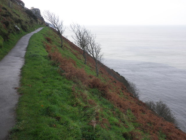
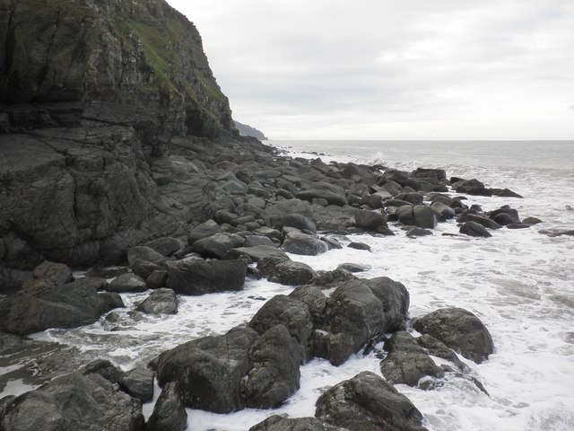
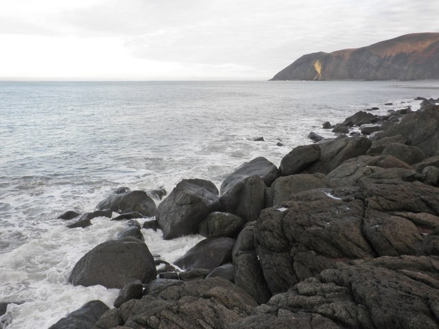
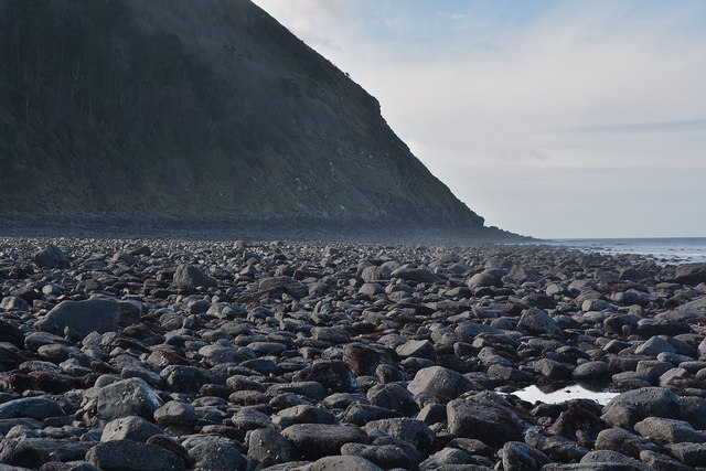
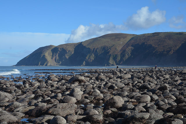
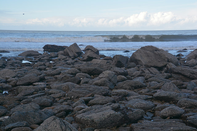
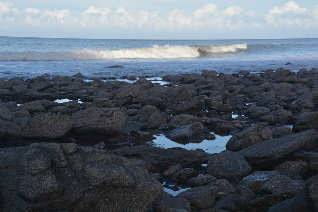
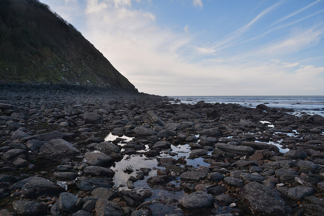
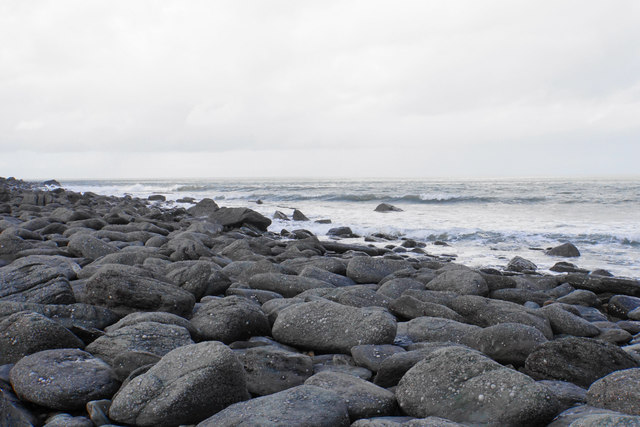
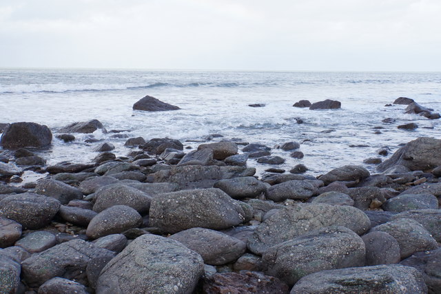
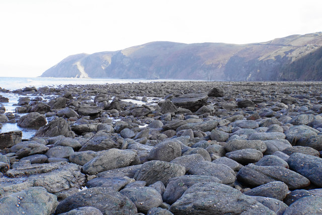
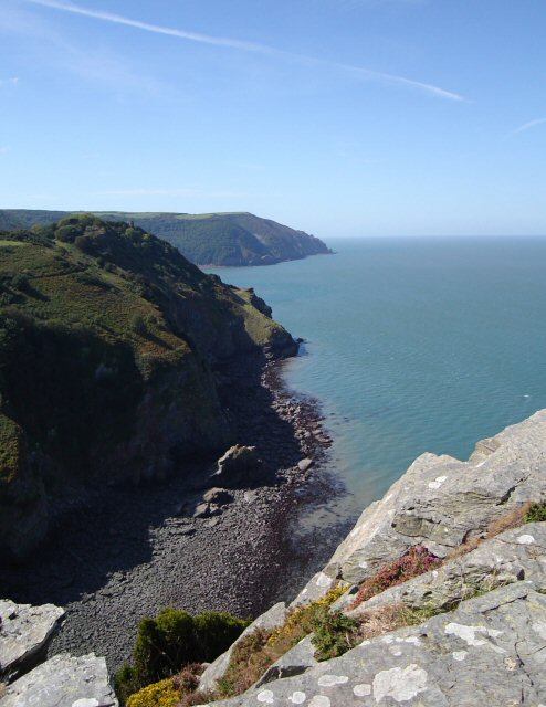
Wringcliff Rock is a prominent geological formation located on the coast of Devon, England. Situated on the northern edge of Exmoor National Park, this distinctive rock formation is known for its rugged beauty and dramatic cliffs that rise over 300 feet from the sea.

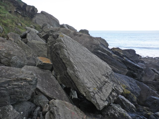
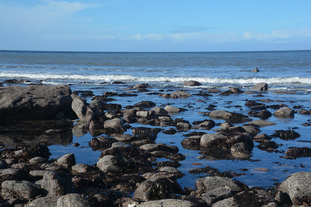
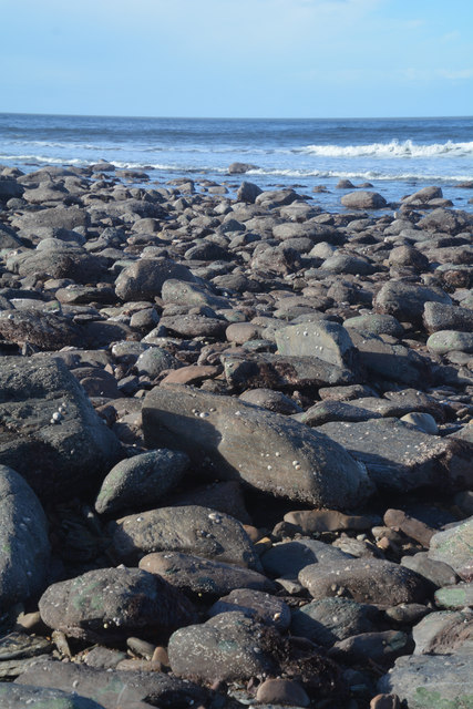
The rock itself is composed of sandstone, formed over millions of years through sedimentation and subsequent compaction. Its unique coloration, ranging from shades of red to orange and yellow, adds to its visual appeal. Wringcliff Rock is part of the larger Lynton Beds, a geological formation renowned for its impressive cliffs and striking coastal scenery.

Visitors to Wringcliff Rock are treated to breathtaking views of the Bristol Channel and the surrounding Exmoor landscapes. The area is home to diverse flora and fauna, including rare plants and bird species, making it a popular spot for nature enthusiasts and birdwatchers.

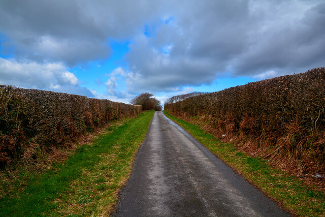
Access to Wringcliff Rock is primarily via the South West Coast Path, a long-distance hiking trail that winds along the coast of Devon and Cornwall. The path allows visitors to fully appreciate the grandeur of the rock formation and explore the surrounding coastal scenery.

Due to its remote location and challenging terrain, Wringcliff Rock is an unspoiled and tranquil area, providing a sense of solitude and peace for those who venture to this natural wonder. With its impressive cliffs, stunning views, and rich biodiversity, Wringcliff Rock is a must-visit destination for nature lovers and adventure seekers alike.

If you have any feedback on the listing, please let us know in the comments section below.

Wringcliff Rock Images

Images are sourced within 2km of 51.232379/-3.8595444 or Grid Reference SS7049. Thanks to Geograph Open Source API. All images are credited.

South West Coast Path The South West Coast Path National Trail - 630 miles of superb coastal walking. From Minehead on the edge of the Exmoor National Park to the shores of Poole Harbour in Dorset. It is the longest of all Britain's National Trails.
Website: <span class="nowrap"><a title="http://www.southwestcoastpath.com/" rel="nofollow ugc noopener" href="http://www.southwestcoastpath.com/">Link</a><img style="margin-left:2px;" alt="External link" title="External link - shift click to open in new window" src="https://s1.geograph.org.uk/img/external.png" width="10" height="10"/></span>
South West Coast Path
The South West Coast Path National Trail - 630 miles of superb coastal walking. From Minehead on the edge of the Exmoor National Park to the shores of Poole Harbour in Dorset. It is the longest of all Britain's National Trails. Website: LinkExternal link
Ruddy Ball Ruddy Ball is part of the cliff face in Lynton North Devon. The photograph was taken close to the foot of the cliff at low tide.
Ruddy Ball
Ruddy Ball is part of the cliff face in Lynton North Devon. The photograph was taken close to the foot of the cliff at low tide.
Cliff path, above Ruddy Ball
Lyn Mouth and the Bristol Channel Looking north east from Lynton, near the upper cliff railway station.
Lyn Mouth and the Bristol Channel
Looking north east from Lynton, near the upper cliff railway station.
View west, from Ruddy Ball
Rock slabs, Ruddy Ball
Rising tide, Ruddy Ball
Lynmouth : Western Beach Looking across the Lynmouth coastline.
Lynmouth : Western Beach
Looking across the Lynmouth coastline.
Lynmouth : Western Beach Looking across the coastline with Foreland Point in view.
Lynmouth : Western Beach
Looking across the coastline with Foreland Point in view.
Lynmouth : Coastal Scenery Coastal scenery seen from Western Beach.
Lynmouth : Coastal Scenery
Coastal scenery seen from Western Beach.
Lynmouth : Coastal Scenery Looking out across the coastline from Western Beach.
Lynmouth : Coastal Scenery
Looking out across the coastline from Western Beach.
Lynmouth : Coastal Scenery The coastline seen at Lynmouth's Western Beach.
Lynmouth : Coastal Scenery
The coastline seen at Lynmouth's Western Beach.
Lynmouth : Western Beach Looking out across the coastline at low tide.
Lynmouth : Western Beach
Looking out across the coastline at low tide.
Lynmouth : Western Beach Looking along the rocky beach off Lynmouth.
Lynmouth : Western Beach
Looking along the rocky beach off Lynmouth.
Rocky beach near Ruddy Ball The only way to get here is to clamber over rocks at low tide, accessed from the end of the car park.
Rocky beach near Ruddy Ball
The only way to get here is to clamber over rocks at low tide, accessed from the end of the car park.
Incoming tide on Western Beach The only way to get here is to clamber over rocks at low tide, accessed from the end of the car park.
Incoming tide on Western Beach
The only way to get here is to clamber over rocks at low tide, accessed from the end of the car park.
Western Beach Looking towards the mouth of the Lyn. The only way to get here is to clamber over rocks at low tide, accessed from the end of the car park.
Western Beach
Looking towards the mouth of the Lyn. The only way to get here is to clamber over rocks at low tide, accessed from the end of the car park.
Lynton : Country Lane A small country lane.
Lynton : Country Lane
A small country lane.
Show me another place!

Wringcliff Rock is located at Grid Ref: SS7049 (Lat: 51.232379, Lng: -3.8595444)

Administrative County: Devon

District: North Devon

Police Authority: Devon and Cornwall

What 3 Words

///zone.client.sonic. Near Lynton, Devon

Related Wikis

Wringcliff Bay

Wringcliff Bay, also known as Wring Cliff Cove, is a bay on the Bristol Channel of northern Devon, England. It lies to the northwest of the village of...

Valley of Rocks

The Valley of Rocks, sometimes called Valley of the Rocks, is a dry valley that runs parallel to the coast in north Devon, England, about 1 kilometre...

Lee Abbey

Lee Abbey, founded in 1946, is an ecumenical Christian community between Woody Bay and Lynmouth in Devon, England. It is a Grade II listed building. The...

Lynton

Lynton is a town on the Exmoor coast in the North Devon district in the county of Devon, England, approximately 17 miles (27 km) north-east of Barnstaple...

Nearby Amenities

Located within 500m of 51.232379,-3.8595444
Source: PGS
Lat/Long: 51.2346547/-3.8540326
Source: PGS
Lat/Long: 51.2345792/-3.8542206
Source: PGS
Lat/Long: 51.2340378/-3.8553648
Source: PGS
Lat/Long: 51.2339053/-3.8557222
Source: PGS
Lat/Long: 51.2336918/-3.8565698
Source: PGS
Lat/Long: 51.2333383/-3.8579016
Source: PGS
Lat/Long: 51.2330717/-3.859218
Source: PGS
Lat/Long: 51.2329862/-3.8594369
Source: PGS
Lat/Long: 51.2324837/-3.8601156
Source: PGS
Lat/Long: 51.2322944/-3.8603534
Source: PGS
Lat/Long: 51.2317259/-3.8611878
Source: PGS
Lat/Long: 51.2316615/-3.8614211
Source: PGS
Lat/Long: 51.2316675/-3.8616996
Source: PGS
Lat/Long: 51.231729/-3.8619245
Source: PGS
Lat/Long: 51.2316714/-3.8623336
Source: PGS
Lat/Long: 51.2316779/-3.8632874
Source: PGS
Lat/Long: 51.2317635/-3.863566
Source: PGS
Lat/Long: 51.2318281/-3.8637052
Source: PGS
Lat/Long: 51.2318221/-3.8638007
Source: PGS
Lat/Long: 51.2317864/-3.863974
Source: PGS
Lat/Long: 51.2318012/-3.8641728
Source: PGS
Lat/Long: 51.2318558/-3.8643086
Source: PGS
Lat/Long: 51.2318706/-3.8644294
Source: PGS
Lat/Long: 51.2318229/-3.8651722
Source: PGS
Lat/Long: 51.231702/-3.8652689
Source: PGS
Lat/Long: 51.2316891/-3.865572
Source: PGS
Lat/Long: 51.2316977/-3.8658701
Barrier: cattle_grid
Bicycle: yes
Motorcycle: yes
Lat/Long: 51.2295901/-3.8606582
The Valley of Rocks
Place: locality
Lat/Long: 51.2317547/-3.8544801
Castle Rock
Image: https://archive.org/details/lynmouth-2021-09-07/DSCN4539.JPG
Natural: rock
Lat/Long: 51.2320023/-3.8579499
Wringcliff Bay
Natural: bay
Wikidata: Q16897669
Wikipedia: en:Wringcliff Bay
Lat/Long: 51.2316264/-3.8607293
Tourism: picnic_site
Lat/Long: 51.2323576/-3.8527124
Binoculars
Image: https://archive.org/details/lynmouth-2021-09-07/DSCN4536.JPG
Note: Actually a coin operated telescope as viewed through one eye only, but serves same purpose
Lat/Long: 51.2327464/-3.855359
The data included in this document is from www.openstreetmap.org. The data is made available under ODbL.

Have you been to Wringcliff Rock?

Leave your review of Wringcliff Rock below (or comments, questions and feedback).