Western King Point

Coastal Feature, Headland, Point in Devon

England

Western King Point

Old Boundary Marker on North Quay, Plymouth Municipal Boundary Marker between buttresses and against a stone wall on the north side of North Quay, behind the buildings on the south side of Millbay Road. Erected by East Stonehouse Local Board of Health.

Milestone Society National ID: DV_ESBS01pb
Old Boundary Marker on North Quay, Plymouth Credit: T Jenkinson

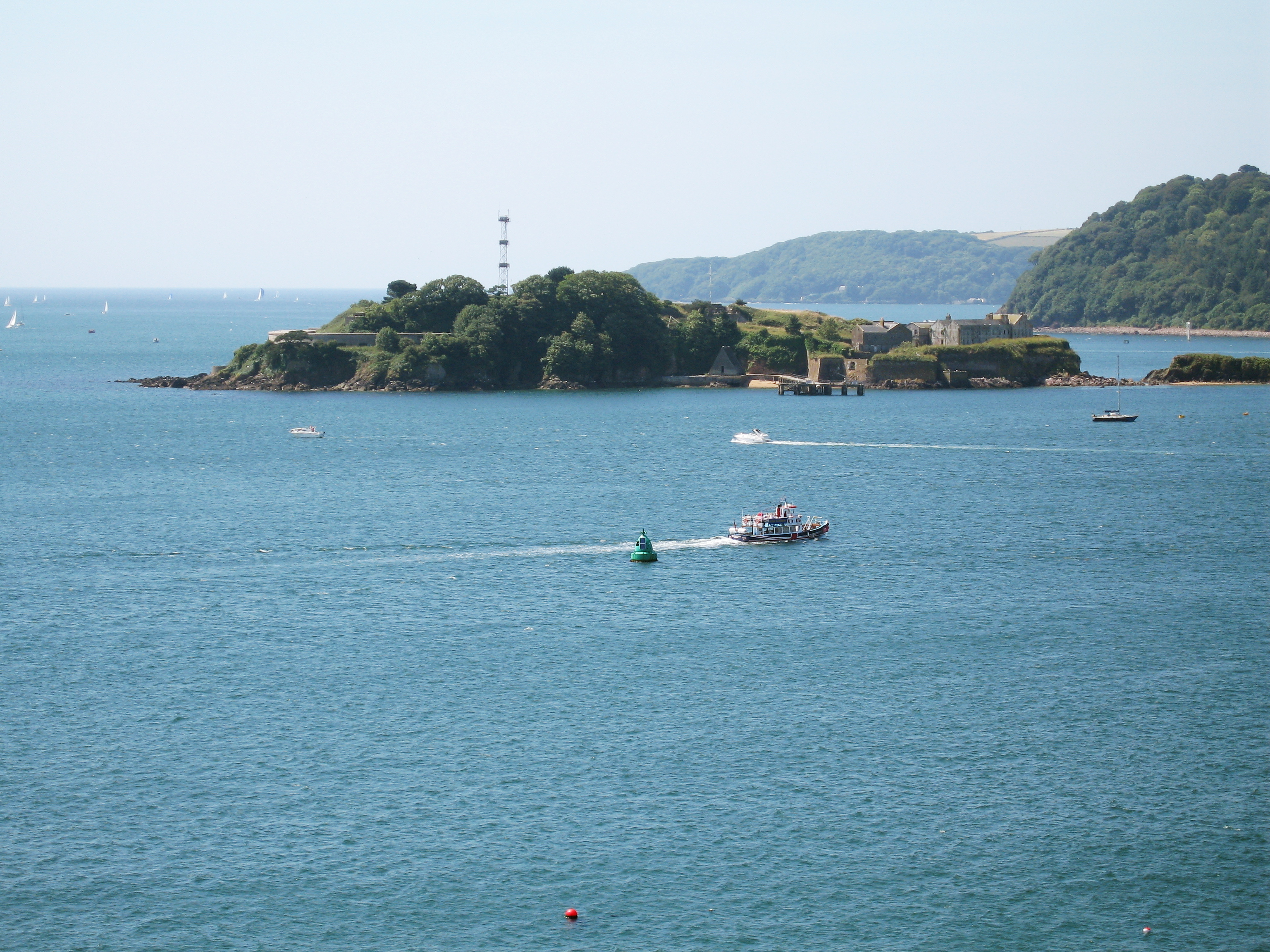
Western King Point is a prominent headland located in Devon, England. Situated along the rugged coastline of the county, this coastal feature is renowned for its stunning natural beauty and dramatic cliffs. The point is positioned on the western side of the region, overlooking the vast expanse of the Bristol Channel.

Rising to an impressive height, Western King Point offers breathtaking panoramic views of the surrounding landscape. The headland is characterized by its steep and jagged cliffs, which are formed from layers of sedimentary rock that have been eroded by the relentless force of the crashing waves over millions of years.

The area surrounding Western King Point is rich in biodiversity, with a variety of plant and animal species making their home here. The headland boasts a diverse range of habitats, including rocky shores, grassy slopes, and coastal heathland. This makes it a haven for numerous bird species, such as gulls, cormorants, and peregrine falcons, as well as a variety of marine life.

In addition to its natural appeal, Western King Point holds historical significance. The headland was once a strategic lookout point during times of conflict, offering views across the Channel. It is said to have been named after a historic event involving a medieval king who was believed to have landed on the point.

Today, Western King Point attracts countless visitors who come to admire its rugged beauty, explore its coastal trails, and take in the awe-inspiring vistas. It stands as a testament to the power and beauty of nature, showcasing the stunning coastal features that make Devon such a popular destination.

If you have any feedback on the listing, please let us know in the comments section below.

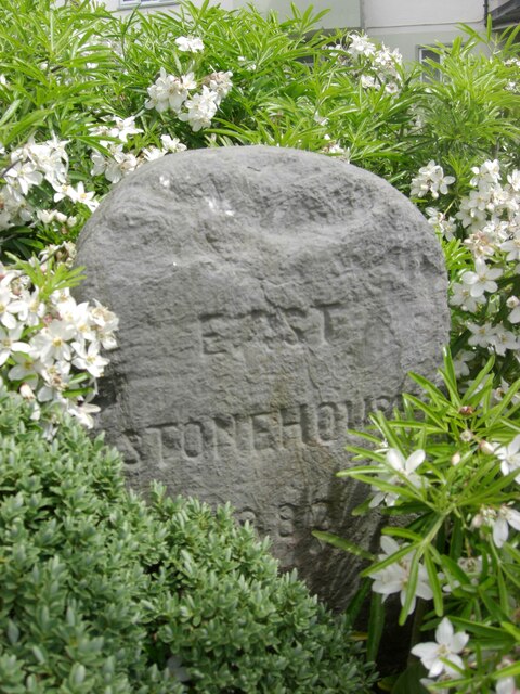
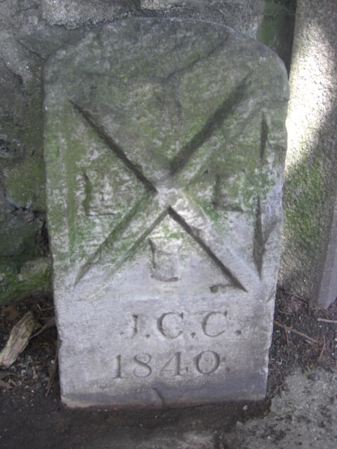
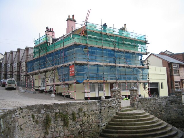
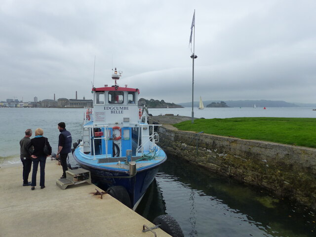
Western King Point Images

Images are sourced within 2km of 50.359429/-4.1633704 or Grid Reference SX4653. Thanks to Geograph Open Source API. All images are credited.

Old Boundary Marker on North Quay, Plymouth Municipal Boundary Marker between buttresses and against a stone wall on the north side of North Quay, behind the buildings on the south side of Millbay Road. Erected by East Stonehouse Local Board of Health.

Milestone Society National ID: DV_ESBS01pb
Old Boundary Marker on North Quay, Plymouth
Municipal Boundary Marker between buttresses and against a stone wall on the north side of North Quay, behind the buildings on the south side of Millbay Road. Erected by East Stonehouse Local Board of Health. Milestone Society National ID: DV_ESBS01pb
Old Boundary Marker on Stoke Road, Plymouth Municipal Boundary Marker inside the railings of Stoke Road flats next to DV_MOS06pb stone, on the north side of a roundabout. Inscribed EAST / STONEHOUSE / 1883 and originally erected by East Stonehouse Local Board of Health.

Milestone Society National ID: DV_ESBS05pb
Old Boundary Marker on Stoke Road, Plymouth
Municipal Boundary Marker inside the railings of Stoke Road flats next to DV_MOS06pb stone, on the north side of a roundabout. Inscribed EAST / STONEHOUSE / 1883 and originally erected by East Stonehouse Local Board of Health. Milestone Society National ID: DV_ESBS05pb
Old Boundary Marker on Stoke Road, Plymouth Parish Boundary Marker inside the railings of Stoke Road flats next to DV_ESB05pb stone, on the north side of a roundabout. Inscribed MANOR / OF / STONEHOUSE.

Milestone Society National ID: DV_MOS06pb
Old Boundary Marker on Stoke Road, Plymouth
Parish Boundary Marker inside the railings of Stoke Road flats next to DV_ESB05pb stone, on the north side of a roundabout. Inscribed MANOR / OF / STONEHOUSE. Milestone Society National ID: DV_MOS06pb
Old Boundary Marker? in Hoe Park, Plymouth Boundary Marker in Hoe Park, Plymouth, set in the path between a tree and a lamp post. The source of much local debate as a point possibly where three marines died or perhaps a boundary stone number 3 in a series. The cross shape is unusual.

Milestone Society National ID: DV_HOEbm
Old Boundary Marker? in Hoe Park, Plymouth
Boundary Marker in Hoe Park, Plymouth, set in the path between a tree and a lamp post. The source of much local debate as a point possibly where three marines died or perhaps a boundary stone number 3 in a series. The cross shape is unusual. Milestone Society National ID: DV_HOEbm
Old Boundary Marker in Victoria Park, Plymouth Municipal Boundary Marker set on a concrete base beside Devonport boundary marker DV_DCBB11pb inside the wall at the northwest entrance to Victoria Park, Plymouth. J.C.C. refers to Joseph C Cookworthy, mayor.

Milestone Society National ID: DV_PCBS12pb
Old Boundary Marker in Victoria Park, Plymouth
Municipal Boundary Marker set on a concrete base beside Devonport boundary marker DV_DCBB11pb inside the wall at the northwest entrance to Victoria Park, Plymouth. J.C.C. refers to Joseph C Cookworthy, mayor. Milestone Society National ID: DV_PCBS12pb
Old Boundary Marker on Hoe Road, Plymouth Municipal Boundary Marker facing north in the stone sea wall on the south side of Hoe Road, Plymouth, opposite West Hoe Park. Inscribed H.J. WARING / 1889 for Henry John Waring, mayor.

Milestone Society National ID: DV_PCBS47pb
Old Boundary Marker on Hoe Road, Plymouth
Municipal Boundary Marker facing north in the stone sea wall on the south side of Hoe Road, Plymouth, opposite West Hoe Park. Inscribed H.J. WARING / 1889 for Henry John Waring, mayor. Milestone Society National ID: DV_PCBS47pb
Old Boundary Marker on Cecil Street, Plymouth Water Boundary Marker on the west side of Cecil Street, Plymouth, against the side wall of "Cornerstone" beside a gate. It is inscribed STONEHOUSE / LEAT / AND BANKS / 1593 but dates from the 1850’s. 

Milestone Society National ID: DV_SLBB03em
Old Boundary Marker on Cecil Street, Plymouth
Water Boundary Marker on the west side of Cecil Street, Plymouth, against the side wall of "Cornerstone" beside a gate. It is inscribed STONEHOUSE / LEAT / AND BANKS / 1593 but dates from the 1850’s. Milestone Society National ID: DV_SLBB03em
Colin Campbell Court Car Park
Entrance to Royal William Yard The Royal William Victualling Yard occupies virtually the whole of the Devil's Point peninsula - about 18 acres - to the south of Stonehouse within the conurbation of Plymouth.
The Yard was given Royal Assent on June 3rd 1824 during the reign of King George IV, but was not completed until 9 years later by which time George had died and his brother William had become King William IV. So the Yard was named after this latter monarch on 3rd December 1833.
The architects of this fine set of buildings (much admired by the architectural historian, Pevsner) were Sir John Rennie the Younger (1794-1874) and Philip Richards, and the contractor was Hugh McIntosh. The cost of the building was estimated at £2,000,000 which in the early C19th was a colossal amount of money, equivalent to billions today.
The original purpose of the Yard, as its name suggests, was to supply victuals - that is food, drink and provisions - for the Royal Navy. With the burgeoning British Empire in the C19th, the Navy grew in size dramatically, and so therefore did its requirement for victuals. This Yard therefore played an important part in "oiling the wheels" of the vast machine that was the Royal Navy. Not only food items but uniforms and all the general paraphernalia required by the Navy's ships (other than munitions etc.)  was stored here. In addition the yard contained a brewery, a slaughterhouse, mill, bakehouse and, essentially, a huge cooperage. Barrels made by the coopers were required in vast quantities to store the provisions on board the ships - not just liquids such as beer, but salted meats etc.
As the character of the Royal Navy changed over the decades, so the Yard had to adapt; and during the C20th, with the decline in Britain's maritime supremacy, the Yard suffered a similar decline. In 1992 the Navy gave up ownership of the land and buildings and they passed into private hands. Since then the Grade I listed buildings have had numerous uses, but are now undergoing major renovations and conversion into apartments, businesses, restaurants and galleries.
Entrance to Royal William Yard
The Royal William Victualling Yard occupies virtually the whole of the Devil's Point peninsula - about 18 acres - to the south of Stonehouse within the conurbation of Plymouth. The Yard was given Royal Assent on June 3rd 1824 during the reign of King George IV, but was not completed until 9 years later by which time George had died and his brother William had become King William IV. So the Yard was named after this latter monarch on 3rd December 1833. The architects of this fine set of buildings (much admired by the architectural historian, Pevsner) were Sir John Rennie the Younger (1794-1874) and Philip Richards, and the contractor was Hugh McIntosh. The cost of the building was estimated at £2,000,000 which in the early C19th was a colossal amount of money, equivalent to billions today. The original purpose of the Yard, as its name suggests, was to supply victuals - that is food, drink and provisions - for the Royal Navy. With the burgeoning British Empire in the C19th, the Navy grew in size dramatically, and so therefore did its requirement for victuals. This Yard therefore played an important part in "oiling the wheels" of the vast machine that was the Royal Navy. Not only food items but uniforms and all the general paraphernalia required by the Navy's ships (other than munitions etc.) was stored here. In addition the yard contained a brewery, a slaughterhouse, mill, bakehouse and, essentially, a huge cooperage. Barrels made by the coopers were required in vast quantities to store the provisions on board the ships - not just liquids such as beer, but salted meats etc. As the character of the Royal Navy changed over the decades, so the Yard had to adapt; and during the C20th, with the decline in Britain's maritime supremacy, the Yard suffered a similar decline. In 1992 the Navy gave up ownership of the land and buildings and they passed into private hands. Since then the Grade I listed buildings have had numerous uses, but are now undergoing major renovations and conversion into apartments, businesses, restaurants and galleries.
Brewhouse at Royal William Yard The Royal William Victualling Yard occupies virtually the whole of the Devil's Point peninsula - about 18 acres - to the south of Stonehouse within the conurbation of Plymouth.
The Yard was given Royal Assent on June 3rd 1824 during the reign of King George IV, but was not completed until 9 years later by which time George had died and his brother William had become King William IV. So the Yard was named after this latter monarch on 3rd December 1833.
The architects of this fine set of buildings (much admired by the architectural historian, Pevsner) were Sir John Rennie the Younger (1794-1874) and Philip Richards, and the contractor was Hugh McIntosh. The cost of the building was estimated at £2,000,000 which in the early C19th was a colossal amount of money, equivalent to billions today.
The original purpose of the Yard, as its name suggests, was to supply victuals - that is food, drink and provisions - for the Royal Navy. With the burgeoning British Empire in the C19th, the Navy grew in size dramatically, and so therefore did its requirement for victuals. This Yard therefore played an important part in "oiling the wheels" of the vast machine that was the Royal Navy. Not only food items but uniforms and all the general paraphernalia required by the Navy's ships (other than munitions etc.)  was stored here. In addition the yard contained a brewery, a slaughterhouse, mill, bakehouse and, essentially, a huge cooperage. Barrels made by the coopers were required in vast quantities to store the provisions on board the ships - not just liquids such as beer, but salted meats etc.
As the character of the Royal Navy changed over the decades, so the Yard had to adapt; and during the C20th, with the decline in Britain's maritime supremacy, the Yard suffered a similar decline. In 1992 the Navy gave up ownership of the land and buildings and they passed into private hands. Since then the Grade I listed buildings have had numerous uses, but are now undergoing major renovations and conversion into apartments, businesses, restaurants and galleries.
Brewhouse at Royal William Yard
The Royal William Victualling Yard occupies virtually the whole of the Devil's Point peninsula - about 18 acres - to the south of Stonehouse within the conurbation of Plymouth. The Yard was given Royal Assent on June 3rd 1824 during the reign of King George IV, but was not completed until 9 years later by which time George had died and his brother William had become King William IV. So the Yard was named after this latter monarch on 3rd December 1833. The architects of this fine set of buildings (much admired by the architectural historian, Pevsner) were Sir John Rennie the Younger (1794-1874) and Philip Richards, and the contractor was Hugh McIntosh. The cost of the building was estimated at £2,000,000 which in the early C19th was a colossal amount of money, equivalent to billions today. The original purpose of the Yard, as its name suggests, was to supply victuals - that is food, drink and provisions - for the Royal Navy. With the burgeoning British Empire in the C19th, the Navy grew in size dramatically, and so therefore did its requirement for victuals. This Yard therefore played an important part in "oiling the wheels" of the vast machine that was the Royal Navy. Not only food items but uniforms and all the general paraphernalia required by the Navy's ships (other than munitions etc.) was stored here. In addition the yard contained a brewery, a slaughterhouse, mill, bakehouse and, essentially, a huge cooperage. Barrels made by the coopers were required in vast quantities to store the provisions on board the ships - not just liquids such as beer, but salted meats etc. As the character of the Royal Navy changed over the decades, so the Yard had to adapt; and during the C20th, with the decline in Britain's maritime supremacy, the Yard suffered a similar decline. In 1992 the Navy gave up ownership of the land and buildings and they passed into private hands. Since then the Grade I listed buildings have had numerous uses, but are now undergoing major renovations and conversion into apartments, businesses, restaurants and galleries.
Plymouth Sound The South West Coast Path National Trail - 630 miles of superb coastal walking. From Minehead on the edge of the Exmoor National Park to the shores of Poole Harbour in Dorset. It is the longest of all Britain's National Trails.
Website: <span class="nowrap"><a title="http://www.southwestcoastpath.com/" rel="nofollow ugc noopener" href="http://www.southwestcoastpath.com/">Link</a><img style="margin-left:2px;" alt="External link" title="External link - shift click to open in new window" src="https://s1.geograph.org.uk/img/external.png" width="10" height="10"/></span>
Plymouth Sound
The South West Coast Path National Trail - 630 miles of superb coastal walking. From Minehead on the edge of the Exmoor National Park to the shores of Poole Harbour in Dorset. It is the longest of all Britain's National Trails. Website: LinkExternal link
Smeaton's Tower Smeaton's Tower was originally built on the Eddystone reef in 1759 and was taken down in the early 1880s. 

Now standing at 72 foot high it offers fantastic views of Plymouth Sound and beyond from its Lantern Room.
Smeaton's Tower
Smeaton's Tower was originally built on the Eddystone reef in 1759 and was taken down in the early 1880s. Now standing at 72 foot high it offers fantastic views of Plymouth Sound and beyond from its Lantern Room.
The Swan Former pub undergoing conversion to housing.
The Swan
Former pub undergoing conversion to housing.
The Cremyll passenger Ferry "Edgcumbe Belle" The ferry takes foot passengers between Cremyll, close to the Mount Edgcumbe Estate, and the city of Plymouth.
The Cremyll passenger Ferry "Edgcumbe Belle"
The ferry takes foot passengers between Cremyll, close to the Mount Edgcumbe Estate, and the city of Plymouth.
The "Edgcumbe Arms" public house, Cremyll, Cornwall
The Orangery, Mount Edgcumbe Country Park The building now houses a cafe.
The Orangery, Mount Edgcumbe Country Park
The building now houses a cafe.
Acer tree beside stairway, Mount Edgcumbe Country Park The stairway can be seen here <a href="https://www.geograph.org.uk/photo/7118860">SX4553 : Formal stairway leading to informal garden, Mount Edgcumbe Country Park</a>.
Acer tree beside stairway, Mount Edgcumbe Country Park
Formal stairway leading to informal garden, Mount Edgcumbe Country Park
Show me another place!

Western King Point is located at Grid Ref: SX4653 (Lat: 50.359429, Lng: -4.1633704)

Unitary Authority: Plymouth

Police Authority: Devon and Cornwall

What 3 Words

///tummy.crab.noisy. Near Plymouth, Devon

Related Wikis

Western King's Redoubt

The Western King's Redoubt is an 18th and 19th-century artillery battery in Plymouth, Devonshire, England, upgraded as a result of the Royal Commission...

River Tamar

The Tamar (; Cornish: Dowr Tamar) is a river in south west England that forms most of the border between Devon (to the east) and Cornwall (to the west...

Devil's Point, Plymouth

Devil's Point (also called Western King Point) is located on the eastern side of the mouth of the River Tamar where it meets the English Channel at Plymouth...

Royal William Victualling Yard

The Royal William Victualling Yard in Stonehouse, a suburb of Plymouth, England, was the major victualling depot of the Royal Navy and an important adjunct...

Brigade Patrol Troop

The Brigade Patrol Troop is a reconnaissance troop of the United Kingdom's Royal Marines and is part of the Surveillance and Reconnaissance Squadron (SRS...

Drake's Island

Drake's Island is a 6.5-acre (2.6-hectare) island lying in Plymouth Sound, the stretch of water south of the city of Plymouth, Devon. The rocks which make...

Stonehouse Barracks

Stonehouse Barracks, or RM Stonehouse, is a military installation at Stonehouse, Plymouth. It is the home of 3 Commando Brigade and referred to by commandos...

Cremyll

Cremyll (pronounced ) is a small coastal village in south-east Cornwall, England, United Kingdom. Cremyll is on the Rame Peninsula facing Plymouth Sound...

Nearby Amenities

Located within 500m of 50.359429,-4.1633704
Source: PGS
Lat/Long: 50.3637598/-4.1630297
Source: PGS
Lat/Long: 50.3637194/-4.1625356
Source: PGS
Lat/Long: 50.3634161/-4.1633369
Source: PGS
Lat/Long: 50.3631674/-4.1632154
Source: PGS
Lat/Long: 50.3629881/-4.16325
Source: PGS
Lat/Long: 50.3623436/-4.1652713
Source: PGS
Lat/Long: 50.3624427/-4.1649057
Source: PGS
Lat/Long: 50.3620077/-4.1645349
Source: PGS
Lat/Long: 50.3616848/-4.1654475
Source: PGS
Lat/Long: 50.3621105/-4.16582
Source: PGS
Lat/Long: 50.362271/-4.1655067
Source: PGS
Lat/Long: 50.3623653/-4.1656263
Source: PGS
Lat/Long: 50.361775/-4.1671659
Source: PGS
Lat/Long: 50.360384/-4.1672985
Source: PGS
Lat/Long: 50.3598222/-4.1674386
Source: PGS
Lat/Long: 50.3597262/-4.1672449
Source: PGS
Lat/Long: 50.3591851/-4.164728
Source: PGS
Lat/Long: 50.3589428/-4.1641442
Bus Stop
Royal William Yard
Bench: yes
Bin: yes
Bus: yes
Lit: yes
Naptan AtcoCode: 1180PLA10081
Naptan Bearing: NW
Naptan CommonName: Royal William Yard
Naptan Indicator: NW-bound
Naptan NaptanCode: plyawdt
Naptan PlusbusZoneRef: PLYMTH
Naptan Street: Cremyll Street
Naptan Verified: no
Public Transport: platform
Shelter: yes
Tactile Paving: no
Lat/Long: 50.3628148/-4.162825
Bus Stop
Royal William Yard
Bench: yes
Bin: yes
Bus: yes
Lit: yes
Naptan AtcoCode: 1180PLA10002
Naptan Bearing: NE
Naptan CommonName: Royal William Yard
Naptan Indicator: NE-bound
Naptan NaptanCode: plyawdm
Naptan PlusbusZoneRef: PLYMTH
Naptan Street: Cremyll Street
Naptan Verified: no
Public Transport: platform
Shelter: yes
Tactile Paving: no
Lat/Long: 50.3630772/-4.1629326
Bus Stop
Durnford Street Square
Bench: no
Bin: yes
Bus: yes
Departures Board: timetable
Lit: yes
Naptan AtcoCode: 1180PLA10080
Naptan Bearing: S
Naptan CommonName: St Paul's Church
Naptan Indicator: S-bound
Naptan NaptanCode: plyawtd
Naptan PlusbusZoneRef: PLYMTH
Naptan Street: Durnford Street
Naptan Verified: no
Public Transport: platform
Shelter: yes
Tactile Paving: no
Lat/Long: 50.3635763/-4.1611346
Seamark Information: Fl.W. 5s shown in fog.Auxiliary light Q.Y.
Seamark Light Character: Q
Seamark Light Colour: green
Seamark Light Height: 5
Seamark Light Range: 3
Seamark Light Reference: A 0174
Seamark Type: light_minor
Source: US NGA Pub. 114. 2011-05-26.
Lat/Long: 50.3597833/-4.1673667
Seamark Information: Auxiliary light Q.Y.
Seamark Light 1 Character: F
Seamark Light 1 Colour: green
Seamark Light 1 Height: 14
Seamark Light 1 Range: 5
Seamark Light 1 Sector End: 266
Seamark Light 1 Sector Start: 264
Seamark Light 2 Character: Al
Seamark Light 2 Colour: green;white
Seamark Light 2 Height: 14
Seamark Light 2 Range: 5
Seamark Light 2 Sector End: 270
Seamark Light 2 Sector Start: 266
Seamark Light 3 Character: F
Seamark Light 3 Colour: white
Seamark Light 3 Height: 14
Seamark Light 3 Range: 13
Seamark Light 3 Sector End: 272
Seamark Light 3 Sector Start: 270
Seamark Light 4 Character: Al
Seamark Light 4 Colour: red;white
Seamark Light 4 Height: 14
Seamark Light 4 Range: 5
Seamark Light 4 Sector End: 276
Seamark Light 4 Sector Start: 272
Seamark Light 5 Character: F
Seamark Light 5 Colour: red
Seamark Light 5 Height: 14
Seamark Light 5 Range: 5
Seamark Light 5 Sector End: 284
Seamark Light 5 Sector Start: 276
Seamark Light Reference: A 0162
Seamark Type: light_minor
Source: US NGA Pub. 114. 2011-05-26.
Lat/Long: 50.3604694/-4.1630023
Restaurant
River Cottage Canteen, Plymouth
Cuisine: regional
Smoking: no
Website: https://www.rivercottage.net/canteens/plymouth/
Lat/Long: 50.3616299/-4.1668463
Restaurant
The Club House
Lat/Long: 50.361709/-4.1657005
Cafe
The Hutong
Addr Housenumber: 160
Addr Postcode: PL1 3RB
Addr Street: Cremyll Street
Contact Facebook: https://www.facebook.com/TheHutongCafe/
Internet Access: wlan
Opening Hours: We-Mo 07:30-17:30
Outdoor Seating: yes
Lat/Long: 50.3624931/-4.1626878
Waste Basket
Lat/Long: 50.3597492/-4.1643129
Bench
Backrest: yes
Lat/Long: 50.3595845/-4.1646535
Bench
Backrest: yes
Lat/Long: 50.3596033/-4.1645064
Ferry Terminal
Ferry: yes
Public Transport: station
Lat/Long: 50.3621038/-4.1651961
Restaurant
Wildwood
Brand: Wildwood
Brand Wikidata: Q85300869
Cuisine: grill;pasta;pizza
Website: https://wildwoodrestaurants.co.uk/restaurant/wildwood-plymouth-royal-william-yard/
Lat/Long: 50.3625122/-4.1633865
Le Vignoble
Shop: wine
Lat/Long: 50.3617025/-4.1638634
Steel Brew Co & Taproom
Addr City: Plymouth
Addr Postcode: PL1 3GD
Brewery: yes
Contact Facebook: https://www.facebook.com/SteelBrewCo
Craft: brewery
Phone: +44 1752 987728
Website: https://www.steelbrew.co/
Lat/Long: 50.3615143/-4.1640713
Building: bunker
Bunker Type: gun_emplacement
Disused Military: bunker
Lat/Long: 50.3597794/-4.1649629
Building: bunker
Bunker Type: gun_emplacement
Disused Military: bunker
Lat/Long: 50.3597721/-4.1651759
Building: bunker
Bunker Type: gun_emplacement
Disused Military: bunker
Lat/Long: 50.3597825/-4.1647544
Building: bunker
Bunker Type: gun_emplacement
Disused Military: bunker
Lat/Long: 50.3598199/-4.1645284
Building: bunker
Bunker Type: gun_emplacement
Disused Military: bunker
Lat/Long: 50.359901/-4.1643557
Building: bunker
Bunker Type: gun_emplacement
Disused Military: bunker
Lat/Long: 50.3599821/-4.1641765
Building: bunker
Bunker Type: gun_emplacement
Disused Military: bunker
Lat/Long: 50.3600729/-4.1640179
Building: bunker
Bunker Type: gun_emplacement
Disused Military: bunker
Lat/Long: 50.3597624/-4.1637789
Building: bunker
Bunker Type: gun_emplacement
Disused Military: bunker
Lat/Long: 50.3594547/-4.1641982
Bench
Backrest: no
Survey Date: 2022-01-08
Lat/Long: 50.3631728/-4.1627702
Bench
Backrest: no
Survey Date: 2022-01-08
Lat/Long: 50.3629769/-4.1629382
Waste Basket
Ref: 933
Survey Date: 2022-01-08
Lat/Long: 50.3629371/-4.1629636
Bench
Backrest: no
Survey Date: 2022-01-08
Lat/Long: 50.3629338/-4.1629232
Life Ring
Emergency: life_ring
Survey Date: 2022-01-08
Lat/Long: 50.3628106/-4.1630447
Bicycle Parking
Bicycle Parking: stands
Capacity: 12
Covered: no
Survey Date: 2022-01-08
Lat/Long: 50.362782/-4.1641406
Bench
Backrest: yes
Survey Date: 2022-01-08
Lat/Long: 50.3625332/-4.1648271
Life Ring
Emergency: life_ring
Survey Date: 2022-01-08
Lat/Long: 50.3624324/-4.16503
Life Ring
Emergency: life_ring
Survey Date: 2022-01-08
Lat/Long: 50.3623641/-4.164777
Bench
Backrest: no
Survey Date: 2022-01-08
Lat/Long: 50.3623446/-4.164714
Bench
Backrest: no
Survey Date: 2022-01-08
Lat/Long: 50.3621056/-4.1645694
Bench
Backrest: yes
Survey Date: 2022-01-08
Lat/Long: 50.3616843/-4.1652322
Life Ring
Emergency: life_ring
Survey Date: 2022-01-08
Lat/Long: 50.3618083/-4.1655905
Life Ring
Emergency: life_ring
Survey Date: 2022-01-08
Lat/Long: 50.3622012/-4.1656843
Waste Basket
Survey Date: 2022-01-08
Lat/Long: 50.3621321/-4.1658809
Bench
Backrest: yes
Survey Date: 2022-01-08
Lat/Long: 50.3622142/-4.1659244
Bench
Backrest: yes
Survey Date: 2022-01-08
Lat/Long: 50.3622492/-4.1658685
Bench
Backrest: yes
Survey Date: 2022-01-08
Lat/Long: 50.3620928/-4.1662588
Bench
Backrest: yes
Survey Date: 2022-01-08
Lat/Long: 50.359457/-4.1641858
Recycling
Recycling Cans: yes
Recycling Glass Bottles: yes
Recycling Paper: yes
Recycling Plastic: yes
Recycling Type: container
Survey Date: 2022-01-08
Lat/Long: 50.3597602/-4.1642893
Recycling
Recycling Cans: yes
Recycling Glass Bottles: yes
Recycling Paper: yes
Recycling Plastic: yes
Recycling Type: container
Survey Date: 2022-01-08
Lat/Long: 50.3601197/-4.1637086
Bench
Backrest: yes
Mapillary: 766578220693360
Source Position: Mapillary 2021-06-20
Survey Date: 2022-01-08
Lat/Long: 50.3636408/-4.1611405
Bench
Backrest: yes
Survey Date: 2022-01-08
Lat/Long: 50.3635217/-4.1633892
Bench
Backrest: no
Survey Date: 2022-01-08
Lat/Long: 50.3631208/-4.1628568
Bench
Backrest: yes
Survey Date: 2022-01-08
Lat/Long: 50.3628088/-4.162736
Bench
Backrest: yes
Survey Date: 2022-01-08
Lat/Long: 50.3629087/-4.1640881
Bicycle Parking
Bicycle Parking: stands
Capacity: 6
Covered: no
Survey Date: 2022-01-08
Lat/Long: 50.3626386/-4.1646188
Bench
Backrest: yes
Survey Date: 2022-01-08
Lat/Long: 50.3625966/-4.1647001
Bench
Backrest: yes
Survey Date: 2022-01-08
Lat/Long: 50.362556/-4.1647904
Bench
Backrest: no
Survey Date: 2022-01-08
Lat/Long: 50.3624146/-4.164763
Life Ring
Emergency: life_ring
Survey Date: 2022-01-08
Lat/Long: 50.3621575/-4.1645834
Waste Basket
Survey Date: 2022-01-08
Lat/Long: 50.3620006/-4.1644979
Life Ring
Emergency: life_ring
Survey Date: 2022-01-08
Lat/Long: 50.3616988/-4.1652909
Bench
Backrest: yes
Survey Date: 2022-01-08
Lat/Long: 50.3621285/-4.1662226
Waste Basket
Survey Date: 2022-01-08
Lat/Long: 50.3611134/-4.1671015
Bench
Backrest: no
Survey Date: 2022-01-08
Lat/Long: 50.3609351/-4.1671349
Life Ring
Emergency: life_ring
Survey Date: 2022-01-08
Lat/Long: 50.3606118/-4.1671699
Bench
Backrest: yes
Survey Date: 2022-01-08
Lat/Long: 50.3595648/-4.1650471
Bench
Backrest: yes
Survey Date: 2022-01-08
Lat/Long: 50.3597877/-4.1640739
Recycling
Recycling Cans: yes
Recycling Glass Bottles: yes
Recycling Paper: yes
Recycling Plastic: yes
Recycling Type: container
Survey Date: 2022-01-08
Lat/Long: 50.3603992/-4.1634247
Waste Basket
Survey Date: 2022-01-08
Lat/Long: 50.3604305/-4.1633707
Bench
Backrest: no
Survey Date: 2022-01-08
Lat/Long: 50.3622309/-4.1611627
Waste Basket
Survey Date: 2022-01-08
Lat/Long: 50.3635034/-4.1611551
Life Ring
Emergency: life_ring
Survey Date: 2022-01-08
Lat/Long: 50.363637/-4.163384
Bench
Backrest: no
Survey Date: 2022-01-08
Lat/Long: 50.3617857/-4.1656138
Life Ring
Emergency: life_ring
Survey Date: 2022-01-08
Lat/Long: 50.3611066/-4.1670551
Bench
Backrest: yes
Survey Date: 2022-01-08
Lat/Long: 50.359564/-4.1648424
Bench
Backrest: yes
Survey Date: 2022-01-08
Lat/Long: 50.3600903/-4.1635706
Bench
Backrest: yes
Survey Date: 2022-01-08
Lat/Long: 50.362883/-4.1641565
Bench
Backrest: no
Survey Date: 2022-01-08
Lat/Long: 50.3621496/-4.1645502
Telephone
Booth: K6
Survey Date: 2022-08-21
Lat/Long: 50.361414/-4.1656717
Life Ring
Emergency: life_ring
Survey Date: 2022-01-08
Lat/Long: 50.3617902/-4.167059
Life Ring
Emergency: life_ring
Survey Date: 2022-01-08
Lat/Long: 50.3615044/-4.1670739
Bench
Backrest: no
Survey Date: 2022-01-08
Lat/Long: 50.3611903/-4.1670742
Life Ring
Emergency: life_ring
Survey Date: 2022-01-08
Lat/Long: 50.3596903/-4.1662186
Bench
Backrest: yes
Survey Date: 2022-01-08
Lat/Long: 50.3602914/-4.1633741
Bench
Backrest: no
Survey Date: 2022-01-08
Lat/Long: 50.3614414/-4.1615135
Defibrillator
Defibrillator Location: On outside corner of toilet building next to Artillery Tower, Durnford Street
Emergency: defibrillator
Indoor: no
Ref GB The Circuit: 35DFB998-9A60-47A4-9CB6-B03600AF16F5
Survey Date: 2022-01-08
Lat/Long: 50.3617216/-4.1616514
Bench
Backrest: no
Survey Date: 2022-01-08
Lat/Long: 50.3621105/-4.1614568
Bench
Backrest: yes
Survey Date: 2022-01-08
Lat/Long: 50.3617114/-4.1651087
Bench
Backrest: no
Survey Date: 2022-01-08
Lat/Long: 50.3612927/-4.1670181
Life Ring
Emergency: life_ring
Survey Date: 2022-01-08
Lat/Long: 50.3608475/-4.167139
Bench
Backrest: no
Survey Date: 2022-01-08
Lat/Long: 50.3608139/-4.1671264
Telephone
Booth: K6
Check Date: 2024-04-26
Covered: booth
Listed Status: Grade II
Lat/Long: 50.3634414/-4.1613895
Waste Basket
Survey Date: 2022-01-08
Lat/Long: 50.3616405/-4.1655024
Bicycle Parking
Bicycle Parking: stands
Capacity: 2
Covered: no
Survey Date: 2022-01-08
Lat/Long: 50.3618236/-4.1669433
Bench
Backrest: no
Survey Date: 2022-01-08
Lat/Long: 50.3610606/-4.1671332
Bench
Backrest: no
Survey Date: 2022-01-08
Lat/Long: 50.3606887/-4.1671605
Bench
Backrest: yes
Survey Date: 2022-01-08
Lat/Long: 50.3599612/-4.1667097
Waste Basket
Survey Date: 2022-01-08
Lat/Long: 50.3600753/-4.1637475
Bench
Backrest: no
Survey Date: 2022-01-08
Lat/Long: 50.361718/-4.1655537
Bench
Backrest: yes
Survey Date: 2022-01-08
Lat/Long: 50.3597838/-4.1663326
Bicycle Parking
Bicycle Parking: stands
Capacity: 8
Covered: no
Lat/Long: 50.3611538/-4.1664502
Man Made: flagpole
Lat/Long: 50.3618192/-4.163534
Street Lamp
Survey Date: 2022-05-05
Lat/Long: 50.3635117/-4.1624273
Street Lamp
Survey Date: 2022-05-05
Lat/Long: 50.3637484/-4.1625173
Man Made: utility_pole
Material: wood
Survey Date: 2022-05-05
Lat/Long: 50.3632316/-4.1616473
Street Lamp
Survey Date: 2022-05-05
Lat/Long: 50.3632178/-4.161289
Man Made: street_cabinet
Survey Date: 2022-05-05
Lat/Long: 50.3633868/-4.1613469
Street Lamp
Survey Date: 2022-05-05
Lat/Long: 50.3637985/-4.16297
Fire Hydrant
Emergency: fire_hydrant
Fire Hydrant Diameter Signed: no
Fire Hydrant Position: sidewalk
Fire Hydrant Type: underground
Survey Date: 2022-05-05
Lat/Long: 50.3635874/-4.1624563
Man Made: utility_pole
Material: wood
Survey Date: 2022-05-05
Lat/Long: 50.3632771/-4.1616312
Information: guidepost
Survey Date: 2022-05-05
Tourism: information
Lat/Long: 50.3632545/-4.1612974
Man Made: utility_pole
Material: wood
Survey Date: 2022-05-05
Lat/Long: 50.3636187/-4.1623267
Street Lamp
Ref: 1
Survey Date: 2022-05-05
Lat/Long: 50.3631281/-4.1623086
Fire Hydrant
Emergency: fire_hydrant
Fire Hydrant Diameter: 100
Fire Hydrant Position: sidewalk
Fire Hydrant Type: underground
Survey Date: 2022-05-05
Lat/Long: 50.3632594/-4.1612073
Street Lamp
Ref: 22
Survey Date: 2022-05-05
Lat/Long: 50.3635987/-4.1613995
Fire Hydrant
Emergency: fire_hydrant
Fire Hydrant Diameter: 150
Fire Hydrant Position: sidewalk
Fire Hydrant Type: underground
Survey Date: 2022-08-21
Lat/Long: 50.3626805/-4.1645592
Fire Hydrant
Emergency: fire_hydrant
Fire Hydrant Diameter: 150
Fire Hydrant Position: sidewalk
Fire Hydrant Type: underground
Survey Date: 2022-08-21
Lat/Long: 50.3623453/-4.1646796
Life Ring
Emergency: life_ring
Survey Date: 2022-08-21
Lat/Long: 50.3619653/-4.1666738
Life Ring
Emergency: life_ring
Survey Date: 2022-08-21
Lat/Long: 50.3614918/-4.1610903
Bench
Backrest: yes
Survey Date: 2022-08-21
Lat/Long: 50.3615531/-4.1609527
Bench
Backrest: yes
Survey Date: 2022-08-21
Lat/Long: 50.3615503/-4.1608982
Bench
Backrest: yes
Survey Date: 2022-08-21
Lat/Long: 50.3615282/-4.1608033
Bench
Backrest: yes
Survey Date: 2022-08-21
Lat/Long: 50.3615281/-4.1607618
Bench
Backrest: yes
Survey Date: 2022-08-21
Lat/Long: 50.36152/-4.1607217
Bench
Backrest: yes
Survey Date: 2022-08-21
Lat/Long: 50.3615131/-4.1606652
Bench
Backrest: yes
Survey Date: 2022-08-21
Lat/Long: 50.3614906/-4.1603862
Bench
Backrest: yes
Survey Date: 2022-08-21
Lat/Long: 50.3614776/-4.1601844
Bench
Backrest: yes
Survey Date: 2022-08-21
Lat/Long: 50.3613372/-4.1593118
Waste Basket
Ref: 926
Survey Date: 2022-08-21
Lat/Long: 50.3612935/-4.1592402
Bench
Backrest: yes
Survey Date: 2022-08-21
Lat/Long: 50.361327/-4.1589409
Fire Hydrant
Emergency: fire_hydrant
Fire Hydrant Diameter: 27"
Fire Hydrant Position: sidewalk
Fire Hydrant Type: underground
Survey Date: 2023-12-27
Lat/Long: 50.3621207/-4.1644953
Bench
Backrest: no
Survey Date: 2022-08-21
Lat/Long: 50.3619446/-4.1645597
Bench
Backrest: no
Survey Date: 2022-08-21
Lat/Long: 50.3618849/-4.1646577
Life Ring
Emergency: life_ring
Survey Date: 2022-08-21
Lat/Long: 50.3620517/-4.166438
Bench
Backrest: yes
Survey Date: 2022-08-21
Lat/Long: 50.3613262/-4.1591148
Bench
Backrest: yes
Survey Date: 2022-08-21
Lat/Long: 50.3613511/-4.1587415
Fire Hydrant
Emergency: fire_hydrant
Fire Hydrant Diameter: 34
Fire Hydrant Position: sidewalk
Fire Hydrant Type: underground
Survey Date: 2022-08-21
Lat/Long: 50.3628475/-4.1641615
Fire Hydrant
Emergency: fire_hydrant
Fire Hydrant Diameter: 27
Fire Hydrant Position: sidewalk
Fire Hydrant Type: underground
Survey Date: 2022-08-21
Lat/Long: 50.3624614/-4.1648341
Fire Hydrant
Emergency: fire_hydrant
Fire Hydrant Type: underground
Survey Date: 2022-08-21
Lat/Long: 50.3625024/-4.1626715
Bench
Backrest: yes
Survey Date: 2022-08-21
Lat/Long: 50.3613275/-4.1591645
Life Ring
Emergency: life_ring
Survey Date: 2022-08-21
Lat/Long: 50.3612845/-4.1588532
Bench
Backrest: yes
Survey Date: 2022-08-21
Lat/Long: 50.3615389/-4.1610091
Bench
Backrest: yes
Survey Date: 2022-08-21
Lat/Long: 50.3615375/-4.1608345
Waste Basket
Ref: 925
Survey Date: 2022-08-21
Lat/Long: 50.3615045/-4.1605832
Bench
Backrest: yes
Survey Date: 2022-08-21
Lat/Long: 50.3613219/-4.1590682
Bench
Backrest: yes
Survey Date: 2022-08-21
Lat/Long: 50.3613205/-4.1589819
Bench
Backrest: yes
Survey Date: 2022-08-21
Lat/Long: 50.3613442/-4.1593449
Tourism: viewpoint
Lat/Long: 50.3593909/-4.1651497
Tourism: viewpoint
Lat/Long: 50.3592816/-4.1648034
Bench
Backrest: yes
Survey Date: 2022-01-08
Lat/Long: 50.3594635/-4.1641682
Bench
Backrest: yes
Survey Date: 2022-01-08
Lat/Long: 50.3594625/-4.1641455
Bench
Backrest: yes
Survey Date: 2022-01-08
Lat/Long: 50.3594563/-4.1641196
Bench
Backrest: yes
Survey Date: 2022-01-08
Lat/Long: 50.3594517/-4.1641075
Bench
Backrest: yes
Survey Date: 2022-01-08
Lat/Long: 50.3594455/-4.164199
Bench
Backrest: yes
Survey Date: 2022-01-08
Lat/Long: 50.3594336/-4.1642071
Bench
Backrest: yes
Survey Date: 2022-01-08
Lat/Long: 50.3594207/-4.1642095
Bench
Backrest: yes
Survey Date: 2022-01-08
Lat/Long: 50.3597692/-4.16371
Bench
Backrest: yes
Survey Date: 2022-01-08
Lat/Long: 50.3597738/-4.1637239
Bench
Backrest: yes
Survey Date: 2022-01-08
Lat/Long: 50.3597777/-4.163743
Bench
Backrest: yes
Survey Date: 2022-01-08
Lat/Long: 50.3597774/-4.1637658
Bench
Backrest: yes
Survey Date: 2022-01-08
Lat/Long: 50.3597725/-4.163789
Bench
Backrest: yes
Survey Date: 2022-01-08
Lat/Long: 50.3597599/-4.1637994
Bench
Backrest: yes
Survey Date: 2022-01-08
Lat/Long: 50.3597441/-4.1638035
Bench
Backrest: yes
Survey Date: 2022-01-08
Lat/Long: 50.3597293/-4.1637973
Bench
Backrest: yes
Survey Date: 2022-09-03
Lat/Long: 50.3600583/-4.1640625
Bench
Backrest: yes
Survey Date: 2022-09-03
Lat/Long: 50.3599867/-4.1641812
Bench
Backrest: yes
Survey Date: 2022-09-03
Lat/Long: 50.3599493/-4.1642076
Bench
Backrest: yes
Survey Date: 2022-09-03
Lat/Long: 50.3598473/-4.1646029
Bench
Backrest: yes
Survey Date: 2022-09-03
Lat/Long: 50.3598753/-4.164383
Defibrillator
Defibrillator Location: On wall at gatehouse entrance to Royal William Yard
Emergency: defibrillator
Indoor: no
Ref GB The Circuit: D893EF00-943C-4ACB-AAC2-AD6500A27203
Survey Date: 2022-09-03
Lat/Long: 50.3625206/-4.1629781
Fire Hydrant
Emergency: fire_hydrant
Fire Hydrant Diameter: 225
Fire Hydrant Position: sidewalk
Fire Hydrant Type: underground
Survey Date: 2022-09-11
Lat/Long: 50.3621413/-4.1638401
Bench
Backrest: yes
Survey Date: 2022-09-11
Lat/Long: 50.362086/-4.1639073
Bench
Backrest: yes
Survey Date: 2022-09-11
Lat/Long: 50.3621951/-4.1635697
Fire Hydrant
Emergency: fire_hydrant
Fire Hydrant Diameter: 30
Fire Hydrant Position: sidewalk
Fire Hydrant Type: underground
Survey Date: 2022-09-11
Lat/Long: 50.3612008/-4.1665419
Fire Hydrant
Emergency: fire_hydrant
Fire Hydrant Diameter: 225
Fire Hydrant Position: sidewalk
Fire Hydrant Type: underground
Survey Date: 2022-09-11
Lat/Long: 50.3621348/-4.1638484
Fire Hydrant
Emergency: fire_hydrant
Fire Hydrant Diameter: 100
Fire Hydrant Position: sidewalk
Fire Hydrant Type: underground
Survey Date: 2022-09-11
Lat/Long: 50.3625901/-4.1607345
Stonehouse Lawn Tennis Club
Club: sport
Sport: tennis
Lat/Long: 50.3618806/-4.1615976
Restaurant
Wagamama
Brand: Wagamama
Brand Wikidata: Q503715
Cuisine: asian
Indoor Seating: yes
Outdoor Seating: yes
Website: https://wagamama.com/restaurants/plymouth/plymouth
Lat/Long: 50.361996/-4.166037
Cafe
South West Sup
Lat/Long: 50.361303/-4.1623545
Yoke
Shop: hairdresser
Lat/Long: 50.3617879/-4.1639851
Ace Swimming
Shop: swimming_pool
Lat/Long: 50.361184/-4.1624901
The Royal William Bakery
Shop: bakery
Lat/Long: 50.3628407/-4.1637713
Restaurant
Pho
Indoor Seating: yes
Outdoor Seating: yes
Lat/Long: 50.3615628/-4.1650371
Bar
Bistrot Pierre
Lat/Long: 50.3615823/-4.1638017
Cafe
Ocean Studios Real Ideas
Opening Hours: Mo-Fr 08:30-17:00; Sa,Su 10:00-17:00
Lat/Long: 50.3612114/-4.1652923
Restaurant
Hook & Line
Cuisine: seafood
Lat/Long: 50.3627358/-4.1636716
Bar
Seco Lounge
Indoor Seating: yes
Outdoor Seating: yes
Lat/Long: 50.3621765/-4.1643764
Domea Favour
Shop: chocolate
Lat/Long: 50.3617977/-4.1665593
Enhance
Shop: beauty
Lat/Long: 50.362155/-4.1631306
Cafe
Block
Indoor Seating: yes
Outdoor Seating: yes
Lat/Long: 50.3617081/-4.1646594
Cafe
The Shack
Lat/Long: 50.3612571/-4.1622793
Make at 140
Opening Hours: We-Sa 10:00-17:00
Shop: craft
Lat/Long: 50.3614115/-4.1654957
Disused Shop: yes
Lat/Long: 50.3624523/-4.1646088
Identity Fashion
Shop: clothes
Lat/Long: 50.3621436/-4.1641592
Restaurant
Hubbox
Brand: Hubbox
Brand Wikidata: Q85297493
Cuisine: burger;american;chicken;barbecue
Indoor Seating: yes
Outdoor Seating: yes
Lat/Long: 50.3617907/-4.1644306
Natural: tree_stump
Lat/Long: 50.3632721/-4.1611816
Addr Housename: The Mount
Addr Housenumber: 170
Addr Street: Durnford Street
Lat/Long: 50.3622122/-4.1615474
Addr Housenumber: 30B
Addr Street: Admiralty Street
Entrance: yes
Lat/Long: 50.3634752/-4.1603517
Addr Housenumber: 133
Addr Street: Durnford Street
Entrance: yes
Lat/Long: 50.3634217/-4.1608248
Fire Hydrant
Emergency: fire_hydrant
Fire Hydrant Diameter: 150
Fire Hydrant Position: lane
Fire Hydrant Type: underground
Survey Date: 2023-05-26
Lat/Long: 50.3616653/-4.1654982
Leisure: pitch
Sport: table_tennis
Lat/Long: 50.3615111/-4.1625156
Leisure: pitch
Sport: table_tennis
Lat/Long: 50.3616003/-4.1626051
Drinking Water
Fountain: bottle_refill
Lat/Long: 50.3617071/-4.1616117
Fire Hydrant
Emergency: fire_hydrant
Fire Hydrant Position: lane
Fire Hydrant Type: underground
Survey Date: 2023-12-27
Lat/Long: 50.3620254/-4.1644265
Bench
Survey Date: 2023-12-27
Lat/Long: 50.360077/-4.1666014
Bench
Survey Date: 2023-12-27
Lat/Long: 50.3600858/-4.1665758
Bench
Survey Date: 2023-12-27
Lat/Long: 50.3600966/-4.1665523
Leisure: picnic_table
Survey Date: 2023-12-27
Lat/Long: 50.3599014/-4.1665916
Fire Hydrant
Emergency: fire_hydrant
Fire Hydrant Diameter: 225
Fire Hydrant Position: lane
Fire Hydrant Type: underground
Survey Date: 2024-04-26
Lat/Long: 50.3617002/-4.1650112
Fire Hydrant
Emergency: fire_hydrant
Fire Hydrant Position: sidewalk
Fire Hydrant Type: underground
Survey Date: 2024-04-26
Lat/Long: 50.3620563/-4.1662535
Fire Hydrant
Emergency: fire_hydrant
Fire Hydrant Position: lane
Fire Hydrant Type: underground
Survey Date: 2024-04-26
Lat/Long: 50.3617046/-4.1649854
The data included in this document is from www.openstreetmap.org. The data is made available under ODbL.

Have you been to Western King Point?

Leave your review of Western King Point below (or comments, questions and feedback).