Trwyn y Crewyn

Coastal Feature, Headland, Point in Anglesey

Wales

Trwyn y Crewyn

Gunnery Range Marker Shelter Seen this structure from a distance previously, lucky enough to get close whilst walking Anglesey Coastal Path.
Gunnery Range Marker Shelter Credit: Arthur C Harris

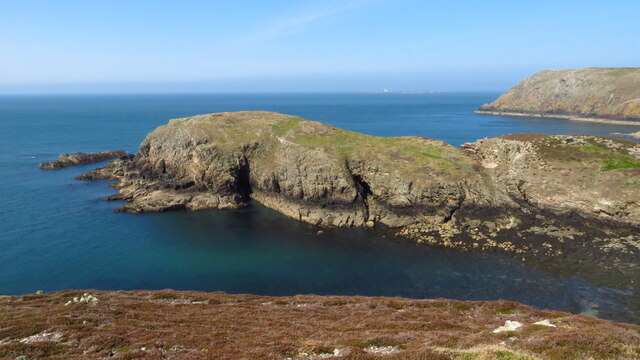
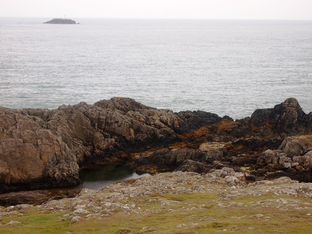
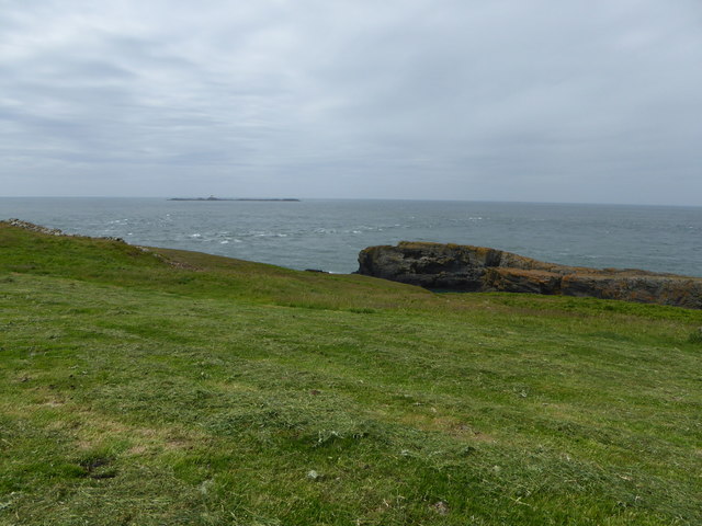
Trwyn y Crewyn is a prominent coastal feature situated on the Isle of Anglesey, Wales. This headland, also known as The Point, is located on the western side of the island, overlooking the Irish Sea. It is positioned approximately 3 miles northwest of the town of Holyhead.

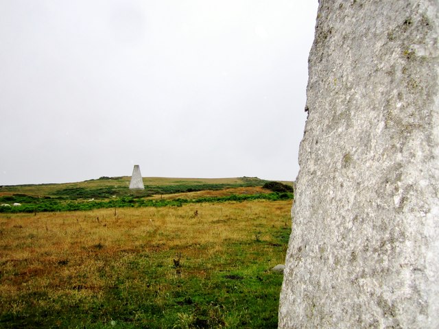
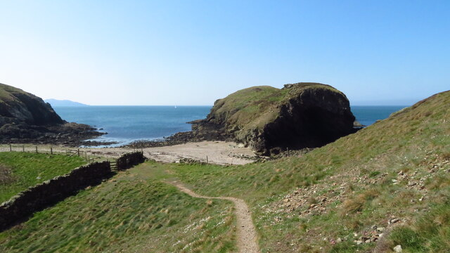
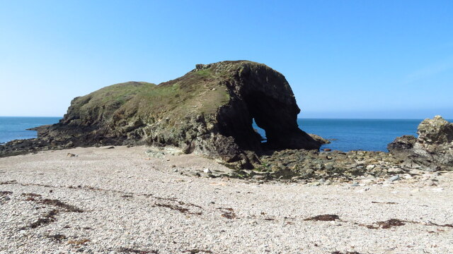
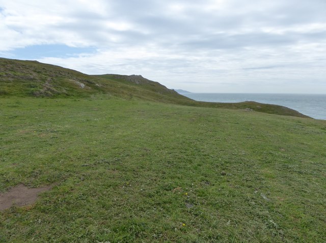
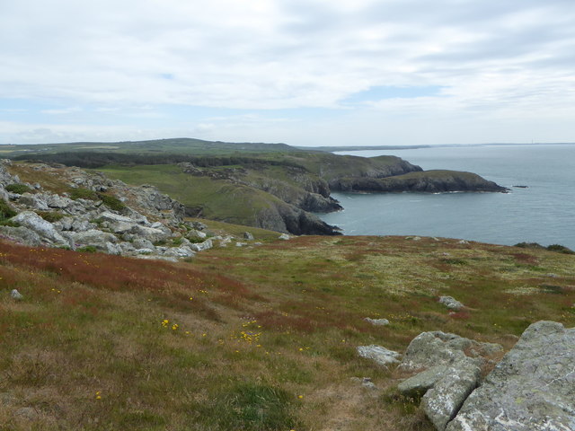
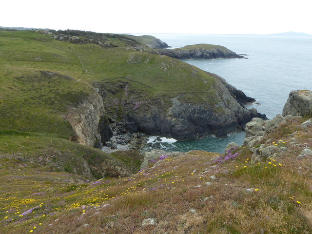
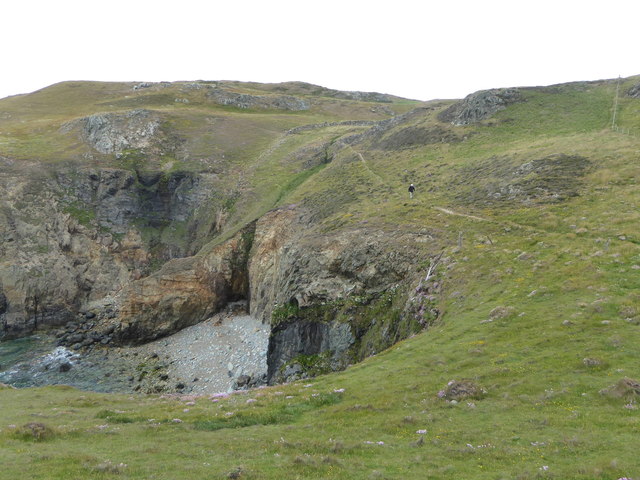
The headland is characterized by its rugged and dramatic landscape, with towering cliffs that offer breathtaking views of the surrounding area. Trwyn y Crewyn is composed mainly of sedimentary rocks, including sandstone and limestone, which have been shaped over thousands of years by the constant pounding of the sea.

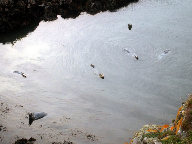
The area is known for its rich biodiversity and is home to a variety of plant and animal species. The cliffs provide nesting sites for seabirds such as guillemots, razorbills, and puffins, while the surrounding waters are inhabited by seals and dolphins.

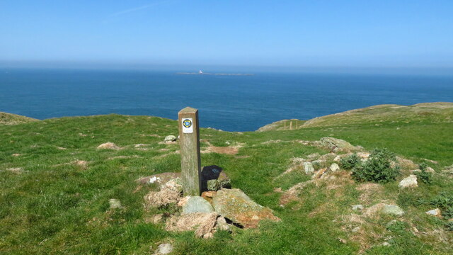
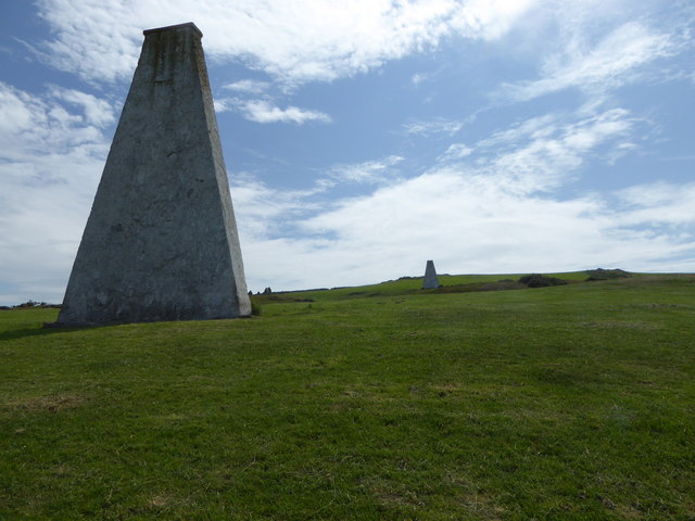
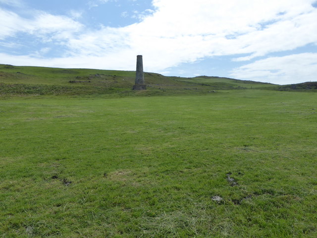
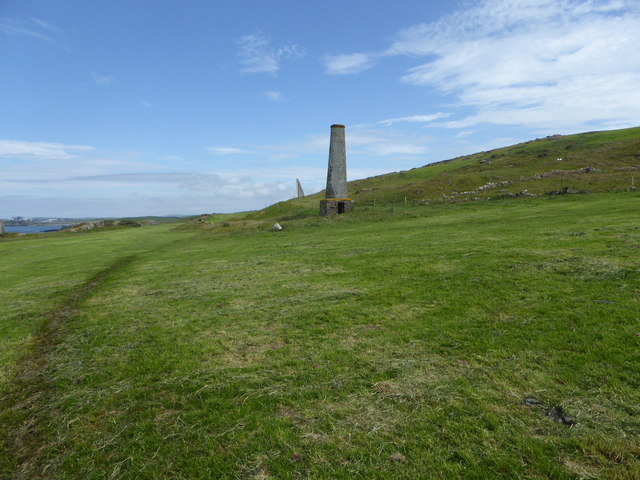
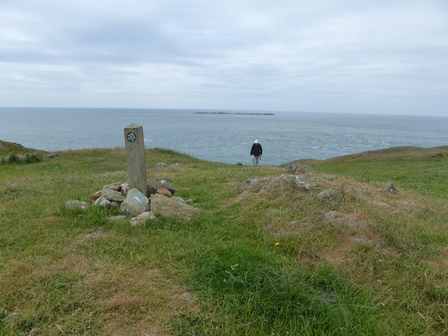
Trwyn y Crewyn is a popular destination for outdoor enthusiasts, offering opportunities for hiking, birdwatching, and photography. The headland is accessible via a footpath that starts from the nearby village of Four Mile Bridge. The path leads visitors along the cliffs, providing stunning panoramic views of the coastline and the nearby Holyhead Mountain.

Overall, Trwyn y Crewyn is a captivating coastal feature that showcases the natural beauty of Anglesey. Its rugged cliffs, diverse wildlife, and picturesque views make it a must-visit destination for nature lovers and those seeking a tranquil escape by the sea.

If you have any feedback on the listing, please let us know in the comments section below.

Trwyn y Crewyn Images

Images are sourced within 2km of 53.39217/-4.571821 or Grid Reference SH2991. Thanks to Geograph Open Source API. All images are credited.

Gunnery Range Marker Shelter Seen this structure from a distance previously, lucky enough to get close whilst walking Anglesey Coastal Path.
Gunnery Range Marker Shelter
Seen this structure from a distance previously, lucky enough to get close whilst walking Anglesey Coastal Path.
Navigation markers The Coal Rock Beacons known locally as the White Ladies.
<span class="nowrap"><a title="http://en.wikipedia.org/wiki/Carmel_Head" rel="nofollow ugc noopener" href="http://en.wikipedia.org/wiki/Carmel_Head">Link</a><img style="margin-left:2px;" alt="External link" title="External link - shift click to open in new window" src="https://s1.geograph.org.uk/img/external.png" width="10" height="10"/></span>
Navigation markers
The Coal Rock Beacons known locally as the White Ladies. LinkExternal link
Anglesey Coast Path at Carmel Head
Ynys y Fydlyn, S of Carmel Head
Coal Rock Pilot Beacons, Carmel Head Also known as the 'White Ladies'.  They were erected by Trinity House in the 1830's as an aid to navigation into the harbour at Holyhead and probably used in conjuction with the marker on West Mouse
Coal Rock Pilot Beacons, Carmel Head
Also known as the 'White Ladies'. They were erected by Trinity House in the 1830's as an aid to navigation into the harbour at Holyhead and probably used in conjuction with the marker on West Mouse
Grey Seals, Porth y Dyfn
Carmel Head
Carmel Head
White Lady beacon The beacons were erected on Carmel Head by Trinity House in the 1830's as an aid to navigation into the harbour at Holyhead and probably used in conjuction with the marker on West Mouse.
White Lady beacon
The beacons were erected on Carmel Head by Trinity House in the 1830's as an aid to navigation into the harbour at Holyhead and probably used in conjuction with the marker on West Mouse.
Chimney on Carmel Head The remains of copper workings on the headland.
Chimney on Carmel Head
The remains of copper workings on the headland.
Chimney, Carmel Head The remains of copper workings on the headland. Just to the left of the chimney is one of the White Ladies, marker to aid navigation at sea.
Chimney, Carmel Head
The remains of copper workings on the headland. Just to the left of the chimney is one of the White Ladies, marker to aid navigation at sea.
Anglesey Coast Path at Carmel Head Out to sea are the Skerries, a group of sparsely vegetated rocky islets lying 3 kilometres offshore from Carmel Head. They are important as a breeding site for seabirds, and they attract divers, who come to visit the numerous shipwrecks. The Skerries Lighthouse sits atop the highest point in the islands.
Anglesey Coast Path at Carmel Head
Out to sea are the Skerries, a group of sparsely vegetated rocky islets lying 3 kilometres offshore from Carmel Head. They are important as a breeding site for seabirds, and they attract divers, who come to visit the numerous shipwrecks. The Skerries Lighthouse sits atop the highest point in the islands.
The western end of Carmel Head The Anglesey Coast Path reaches the westernmost part of its journey along the north coast of Anglesey.
The western end of Carmel Head
The Anglesey Coast Path reaches the westernmost part of its journey along the north coast of Anglesey.
Anglesey Coast Path marker On Carmel Head, where the path turns eastwards. The Skerries are on the horizon.
Anglesey Coast Path marker
On Carmel Head, where the path turns eastwards. The Skerries are on the horizon.
North-west coast of Anglesey
Porth yr Hwch
Porth yr Hwch
Porth yr Hwch From the south. The Anglesey Coast path is quite well defined here.
Porth yr Hwch
From the south. The Anglesey Coast path is quite well defined here.
Show me another place!

Trwyn y Crewyn is located at Grid Ref: SH2991 (Lat: 53.39217, Lng: -4.571821)

Unitary Authority: Isle of Anglesey

Police Authority: North Wales

What 3 Words

///talkative.worth.financial. Near Llanfaethlu, Isle of Anglesey

Related Wikis

Carmel Head

Carmel Head (Welsh: Trwyn y Gadair) is a prominent coastal headland on the northwest tip of the island of Anglesey. It is a designated SSSI because of...

Llanfair-yng-Nghornwy

Llanfair-yng-Nghornwy () is a village in Anglesey, in north-west Wales. == See also == St Mary's Church, Llanfair-yng-Nghornwy == References ==

Clegir Mawr

Clegir Mawr is a Site of Special Scientific Interest (SSSI) in the community of Cylch-y-Garn in the north-west of the island of Anglesey, Wales. It is...

Church Bay, Anglesey

Church Bay (Welsh: Porth Swtan) is a settlement on the north-west coast of Anglesey, Wales, United Kingdom, about a mile and a half north-west of the...

Nearby Amenities

Located within 500m of 53.39217,-4.571821
Source: PGS
Lat/Long: 53.3947705/-4.573247
Source: PGS
Lat/Long: 53.3940536/-4.5731648
Source: PGS
Lat/Long: 53.3940802/-4.5725157
Source: PGS
Lat/Long: 53.3939053/-4.5724514
Source: PGS
Lat/Long: 53.3943566/-4.5715878
Source: PGS
Lat/Long: 53.3944053/-4.5711915
Source: PGS
Lat/Long: 53.3946194/-4.5705882
Source: PGS
Lat/Long: 53.3947105/-4.5704076
Source: PGS
Lat/Long: 53.3947475/-4.5701832
Source: PGS
Lat/Long: 53.3944011/-4.5696796
Source: PGS
Lat/Long: 53.3941957/-4.569626
Source: PGS
Lat/Long: 53.3940405/-4.5700264
Source: PGS
Lat/Long: 53.3938358/-4.5702303
Source: PGS
Lat/Long: 53.3936261/-4.5709682
Source: PGS
Lat/Long: 53.393159/-4.5711853
Source: PGS
Lat/Long: 53.3922451/-4.5716371
Source: PGS
Lat/Long: 53.3919204/-4.5722057
Source: PGS
Lat/Long: 53.3914965/-4.57157
Source: PGS
Lat/Long: 53.3914994/-4.5705176
Source: PGS
Lat/Long: 53.391455/-4.5697971
Source: PGS
Lat/Long: 53.3911622/-4.5680858
Source: PGS
Lat/Long: 53.3911239/-4.5675279
Barrier: kissing_gate
Lat/Long: 53.3948584/-4.5694247
Barrier: kissing_gate
Lat/Long: 53.3904405/-4.5653902
Barrier: kissing_gate
Lat/Long: 53.3938451/-4.5695454
Ynys y Fydlyn
Name En: Fydlyn Island
Tourism: attraction
Lat/Long: 53.3948614/-4.5709243
The data included in this document is from www.openstreetmap.org. The data is made available under ODbL.

Have you been to Trwyn y Crewyn?

Leave your review of Trwyn y Crewyn below (or comments, questions and feedback).