Phillip's Strand

Coastal Feature, Headland, Point in Cornwall

England

Phillip's Strand

Beach House Hotel and Surf School On the dunes north of Widemouth Bay,
Beach House Hotel and Surf School Credit: David Martin

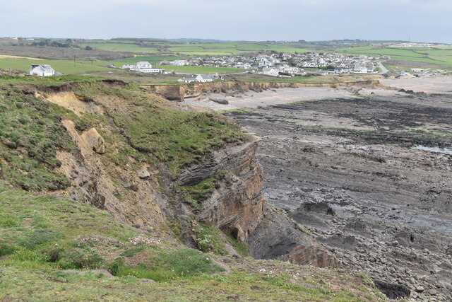
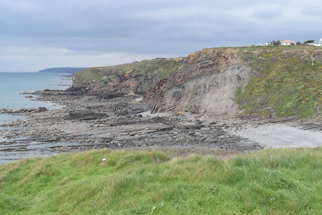
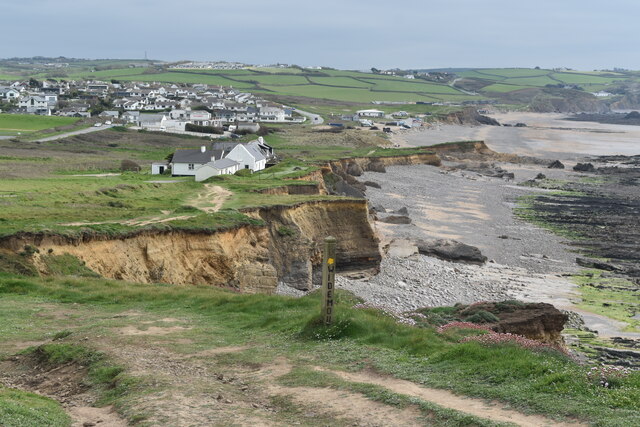
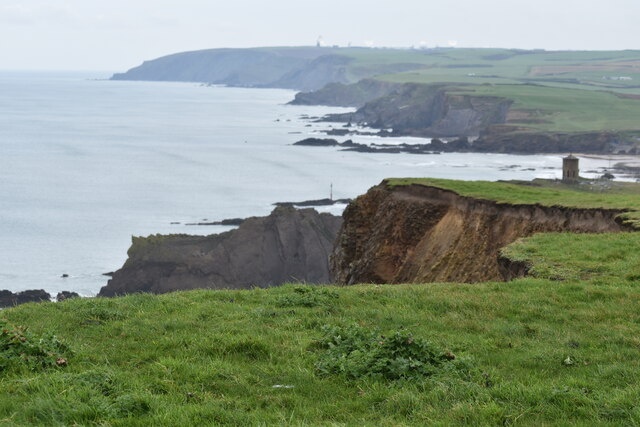
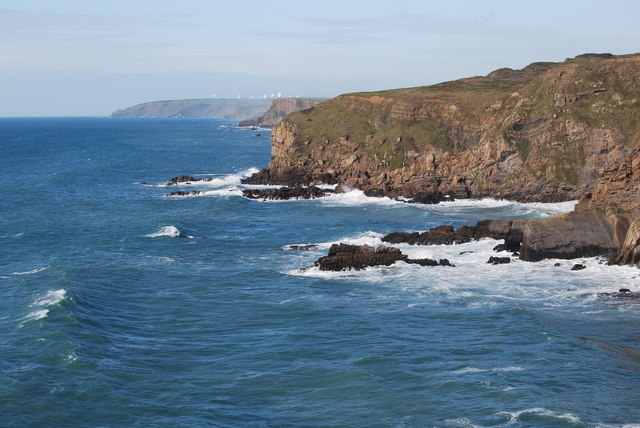
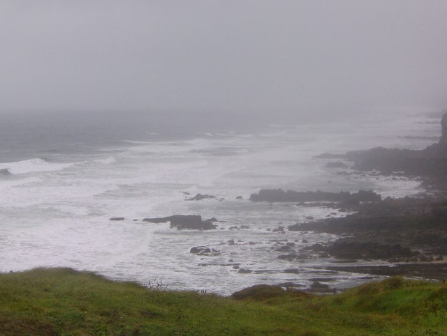
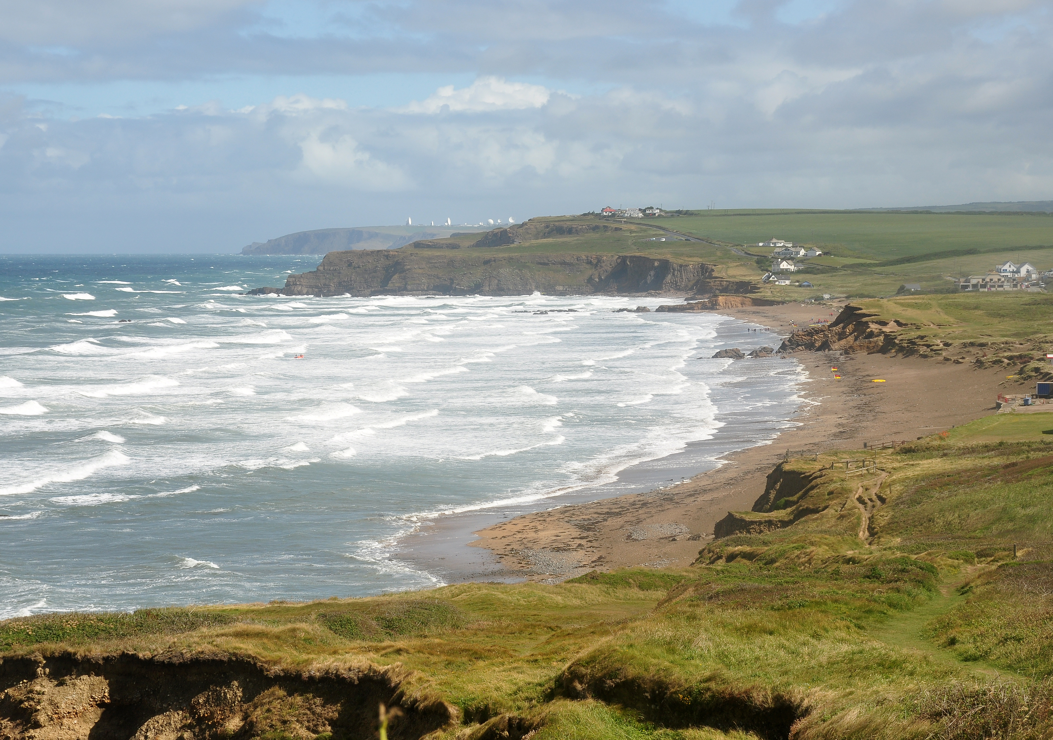
Phillip's Strand is a picturesque coastal feature located in Cornwall, England. This stretch of coastline is characterized by stunning cliffs, sandy beaches, and crystal-clear waters, making it a popular destination for tourists and locals alike.

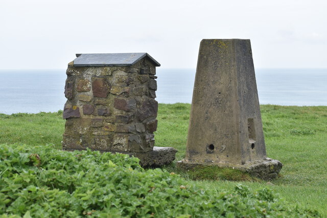
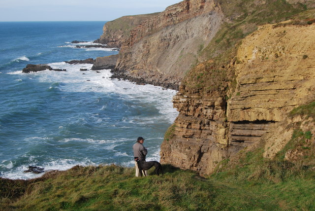
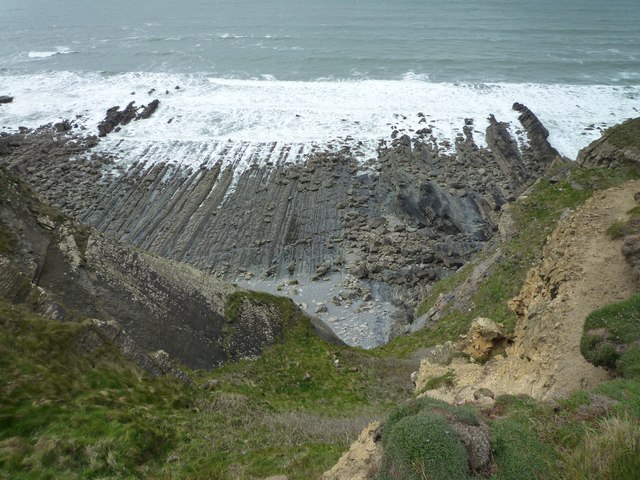
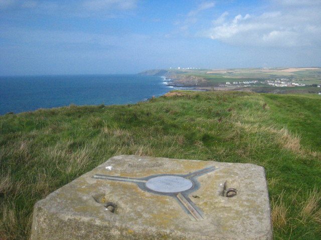
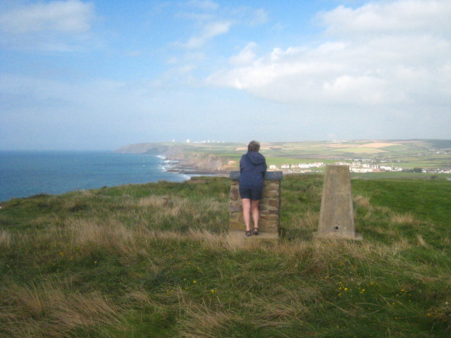
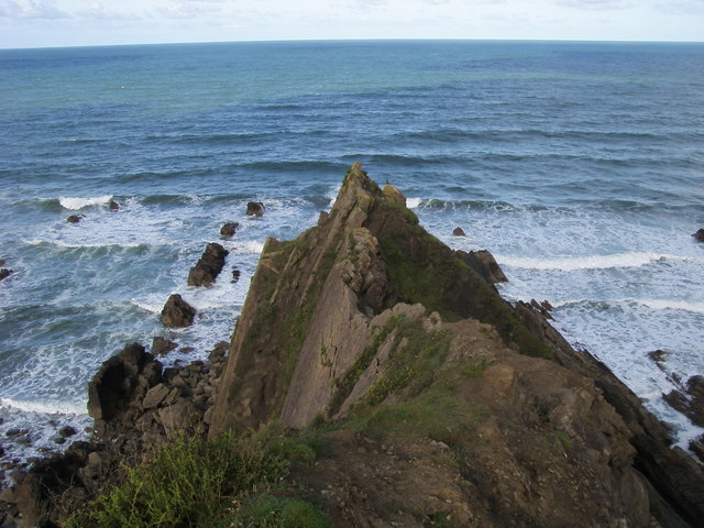
The headland at Phillip's Strand offers breathtaking views of the surrounding landscape, with rugged cliffs jutting out into the sea and providing a dramatic backdrop for visitors to enjoy. The point itself is a prominent landmark along the coastline, offering a vantage point for those looking to take in the beauty of the Cornish coast.

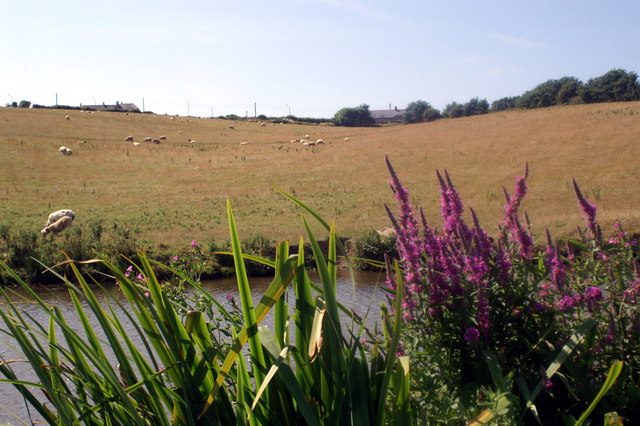
Surrounded by lush greenery and dotted with colorful wildflowers, Phillip's Strand is a haven for wildlife enthusiasts, with a variety of bird species and marine life calling this area home. Visitors can often spot seals basking on the rocks or dolphins playing in the surf, adding to the natural beauty of this coastal gem.

Whether you're looking to relax on the beach, explore the cliffs, or simply take in the stunning views, Phillip's Strand offers a little something for everyone. With its rugged beauty and tranquil atmosphere, this coastal feature is sure to leave a lasting impression on all who visit.

If you have any feedback on the listing, please let us know in the comments section below.

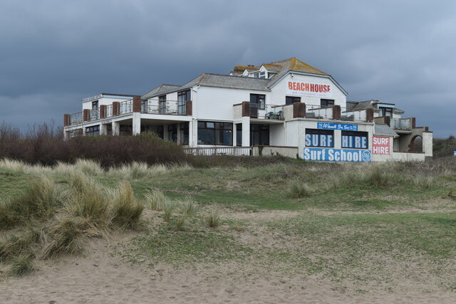
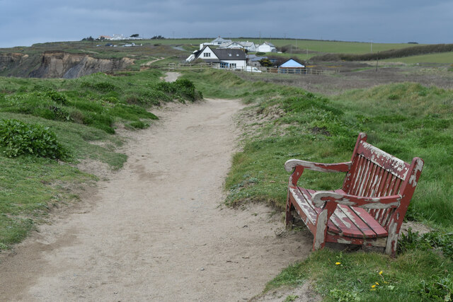
Phillip's Strand Images

Images are sourced within 2km of 50.81176/-4.5583543 or Grid Reference SS1904. Thanks to Geograph Open Source API. All images are credited.

Beach House Hotel and Surf School On the dunes north of Widemouth Bay,
Beach House Hotel and Surf School
On the dunes north of Widemouth Bay,
Seat on the coastal path near Salthouse
Cliff at Lower Longbeak, with view to Widemouth Bay
Cliffs and shore north of Lower Longbeak
Coast at Salthouse, from the coastal path The settlement in the distance is Widemouth Bay.
Coast at Salthouse, from the coastal path
The settlement in the distance is Widemouth Bay.
Clifftop at Efford Beacon The view from the trig point. The monument at Compass Point can be seen on the right.
Clifftop at Efford Beacon
The view from the trig point. The monument at Compass Point can be seen on the right.
Trig point on Efford Beacon The purpose of the second stone plinth is unclear - it may perhaps once have provided information about the view.
Trig point on Efford Beacon
The purpose of the second stone plinth is unclear - it may perhaps once have provided information about the view.
On Lower Longbeak, near Widemouth Bay, looking back up the coast northwards
From Lower Longbeak, looking back up the coast to past Bude and the listening station beyond
Rough sea at Widemouth Bay Climbing to the viewpoint at Lower Longbeak, provided this view of the rocks
looking towards Bude. The wind was running close to a gale, spray rising up and
the waves too messy for surfing, or much else for that matter. Keeping the camera
still proved difficult, keeping oneself still was hard enough. As someone pointed
out, there is nothing to stop the wind between here and New York.
Rough sea at Widemouth Bay
Climbing to the viewpoint at Lower Longbeak, provided this view of the rocks looking towards Bude. The wind was running close to a gale, spray rising up and the waves too messy for surfing, or much else for that matter. Keeping the camera still proved difficult, keeping oneself still was hard enough. As someone pointed out, there is nothing to stop the wind between here and New York.
Coast between Lower Longbeak and Higher Longbeak
Trig point on Efford Beacon With a view along the coast towards the radio dishes at Morwenstow.
Trig point on Efford Beacon
With a view along the coast towards the radio dishes at Morwenstow.
Efford Beacon Showing the trig point and the adjacent topograph, sadly vandalised so that the direction indicators are missing.
Efford Beacon
Showing the trig point and the adjacent topograph, sadly vandalised so that the direction indicators are missing.
The trig point on Efford Down Looking across the down towards Bude town.
The trig point on Efford Down
Looking across the down towards Bude town.
Rocky Foreshore Rocky foreshore below Upton
Rocky Foreshore
Rocky foreshore below Upton
Efford Beacon Efford Beacon trig point looking North along the coast
Efford Beacon
Efford Beacon trig point looking North along the coast
Compass Point Rocky outcrop of Compass Point
Compass Point
Rocky outcrop of Compass Point
Higher Longbeak From Lower Longbeak cliff looking North to Higher Longbeak
Higher Longbeak
From Lower Longbeak cliff looking North to Higher Longbeak
Show me another place!

Phillip's Strand is located at Grid Ref: SS1904 (Lat: 50.81176, Lng: -4.5583543)

Unitary Authority: Cornwall

Police Authority: Devon and Cornwall

What 3 Words

///estuaries.seagull.gulped. Near Bude, Cornwall

Related Wikis

Lower and Higher Longbeak barrows

The Lower and Higher Longbeak barrows (also known as the Widemouth Bay tumulus) are a scheduled monument located north of Widemouth Bay in Cornwall. The...

Lynstone

Lynstone is a hamlet near Bude in north Cornwall, England. At the 2011 census the population at the 2011 census was included in the civil parish of Bude...

St Michael and All Angels Church, Bude

St Michael and All Angels Church is a Grade II listed church in Bude, Cornwall. == History == It was originally built in 1834 by George Wightwick for Sir...

Cornish Way

The Cornish Way is a cycle route which is part of the National Cycle Network that links Bude to Land's End. The route is via Padstow or St Austell and...

Nearby Amenities

Located within 500m of 50.81176,-4.5583543
Post Box
Brand: Royal Mail
Brand Wikidata: Q638098
Brand Wikipedia: en:Royal Mail
Collection Times: Mo-Fr 09:00; Sa 07:00
Drive Through: no
Operator: Royal Mail
Operator Wikidata: Q638098
Post Box Mounting: brick_pillar
Post Box Type: wall
Ref: EX23 68D
Royal Cypher: EIIR
Royal Cypher Wikidata: Q33102113
Source: survey;aerial imagery;streetlevel imagery
Lat/Long: 50.8148296/-4.555087
Bus Stop
Phone Box
Bench: no
Bin: no
Lit: yes
Naptan AtcoCode: 0800COA10067
Naptan Bearing: N
Naptan CommonName: Phone Box
Naptan NaptanCode: cordpdpg
Naptan Street: Unclassified
Naptan Verified: no
Shelter: no
Source: naptan_import
Tactile Paving: no
Lat/Long: 50.8152427/-4.5550428
Bus Stop
Opp Phone Box
Naptan AtcoCode: 0800COA10068
Naptan Bearing: S
Naptan CommonName: Opp Phone Box
Naptan Indicator: Opp
Naptan NaptanCode: cordpdpt
Naptan Street: Unclassified
Naptan Verified: no
Source: naptan_import
Lat/Long: 50.8155231/-4.5547506
Upton
Name Kw: Trewartha
Place: hamlet
Source: OS_OpenData_StreetView
Lat/Long: 50.815125/-4.5541377
Bench
Backrest: yes
Lat/Long: 50.8108937/-4.5558722
Bench
Backrest: yes
Survey Date: 2023-04-01
Lat/Long: 50.8148198/-4.5552567
Information: guidepost
Tourism: information
Lat/Long: 50.814804/-4.5550785
Waste Basket
Survey Date: 2023-04-01
Lat/Long: 50.8148124/-4.5552329
Life Ring
Emergency: life_ring
Survey Date: 2023-04-01
Lat/Long: 50.8144843/-4.5558216
The data included in this document is from www.openstreetmap.org. The data is made available under ODbL.

Have you been to Phillip's Strand?

Leave your review of Phillip's Strand below (or comments, questions and feedback).