Church Races

Coastal Feature, Headland, Point in Cornwall

England

Church Races

On the beach at Widemouth Bay
On the beach at Widemouth Bay Credit: David Martin

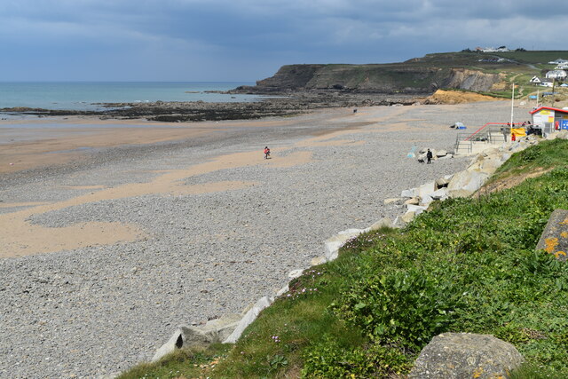
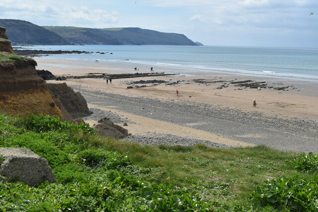
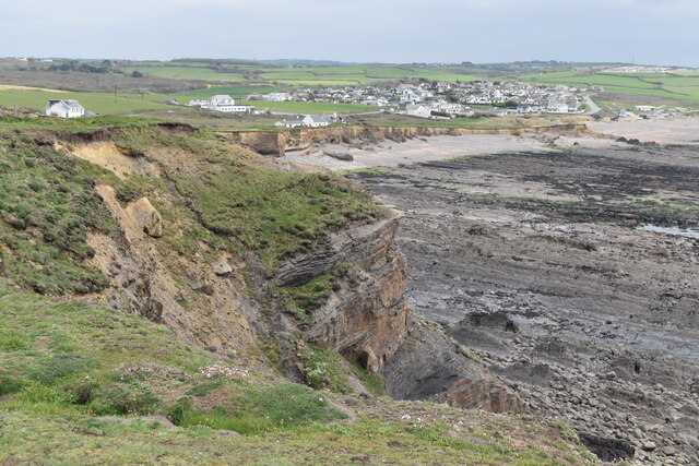
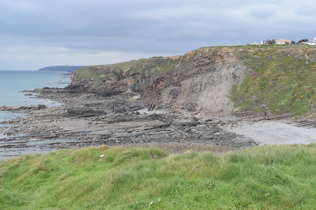
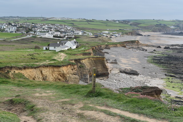
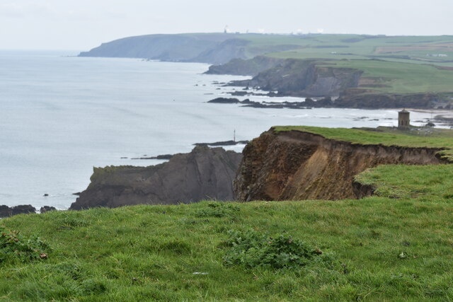
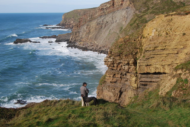
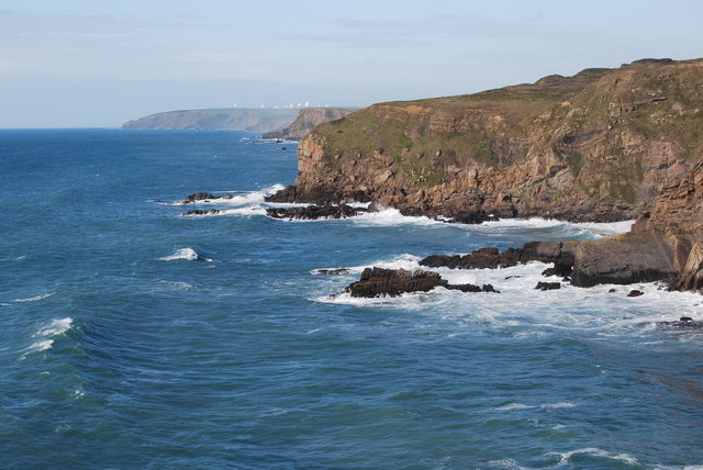
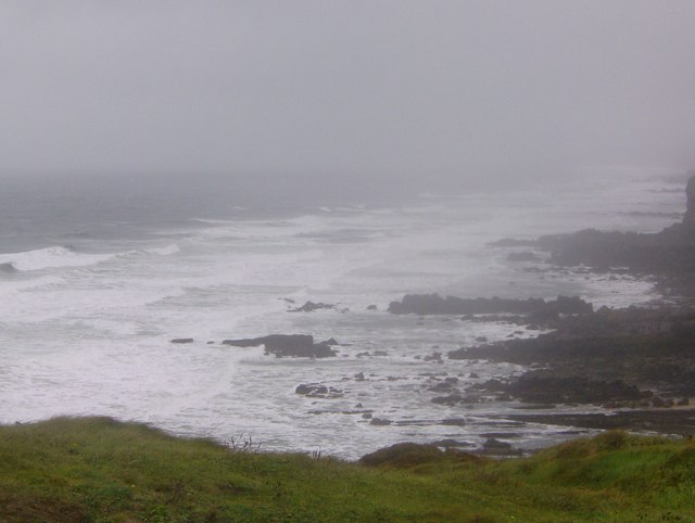
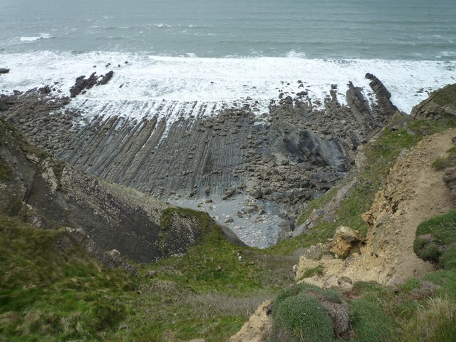
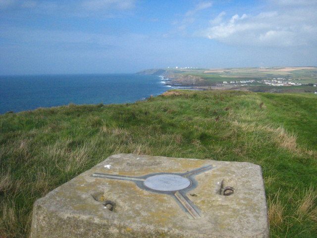
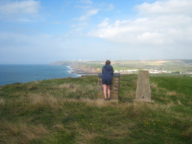
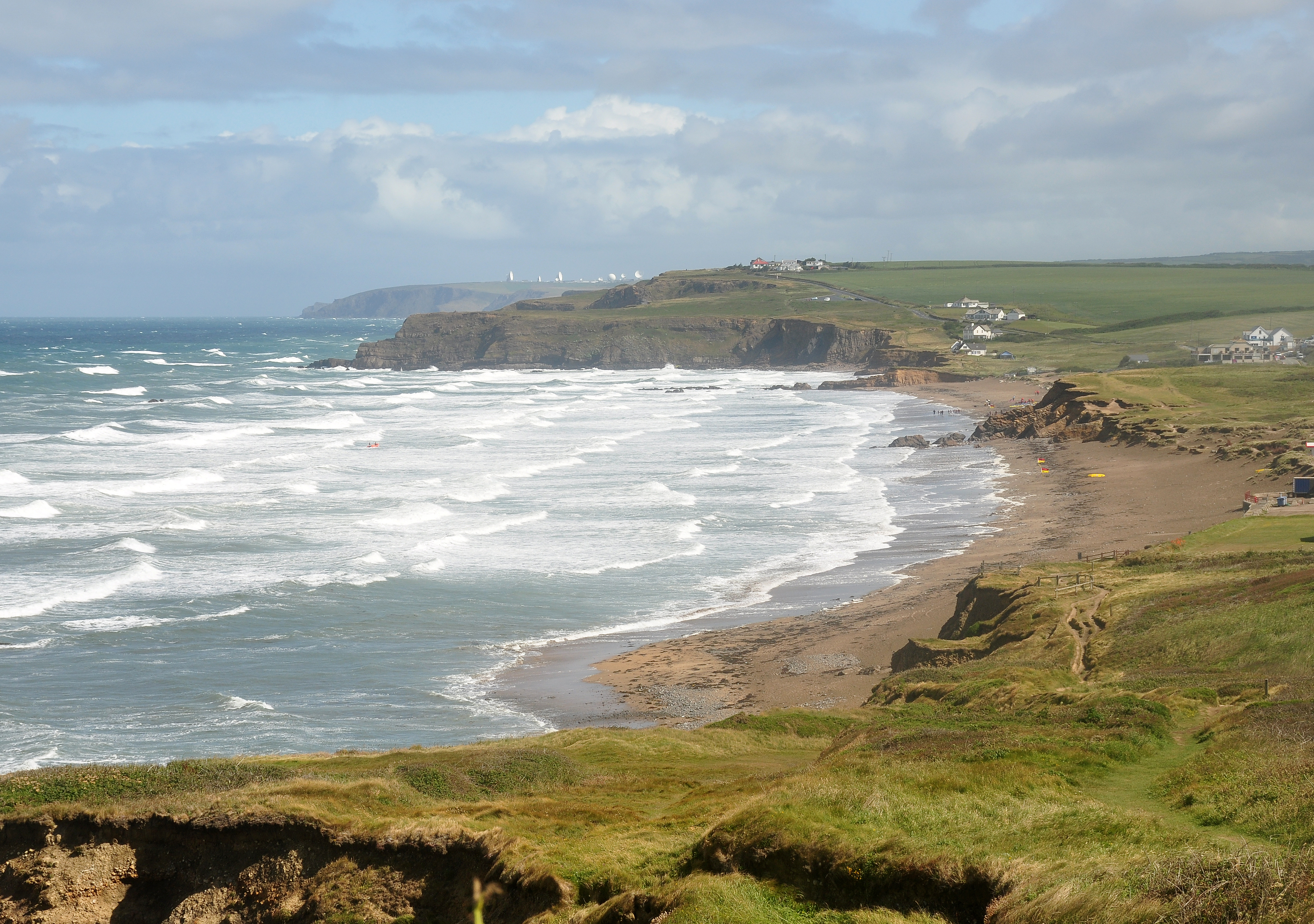
Church Races is a coastal feature located in Cornwall, England. It is a headland that juts out into the sea, forming a point that is known for its rugged beauty and dramatic cliffs. The area is popular with hikers and nature enthusiasts, offering stunning views of the surrounding coastline and the Atlantic Ocean.

Church Races is characterized by its rocky terrain and steep cliffs that drop down to the water below. The name "Church Races" is believed to have originated from the strong currents and swirling waters that are often present around the headland, creating a challenging environment for boats and ships navigating the area.

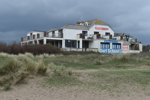
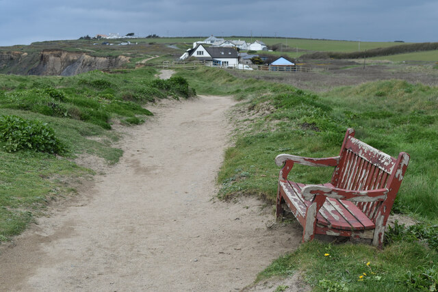
The headland is also home to a variety of wildlife, including seabirds, seals, and dolphins that can often be spotted from the cliffs. Visitors to Church Races can enjoy walking along the coastal path that runs along the edge of the headland, taking in the breathtaking views and enjoying the peaceful surroundings.

Overall, Church Races is a picturesque and rugged coastal feature that offers visitors a chance to experience the natural beauty of Cornwall's coastline in all its glory.

If you have any feedback on the listing, please let us know in the comments section below.
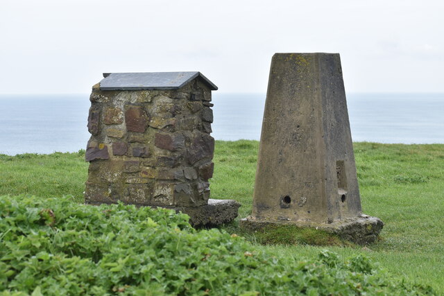
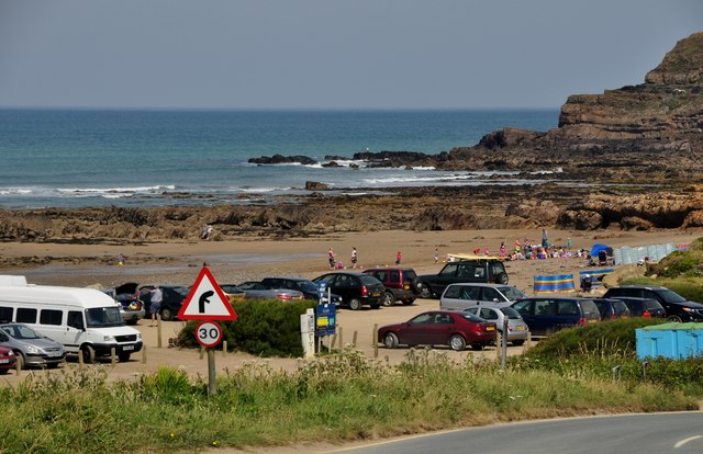
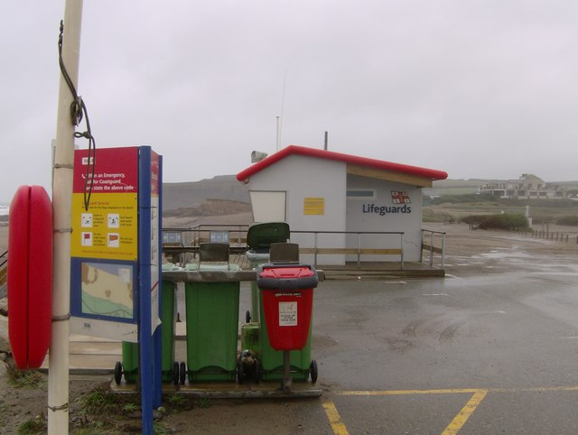
Church Races Images

Images are sourced within 2km of 50.80819/-4.5583153 or Grid Reference SS1904. Thanks to Geograph Open Source API. All images are credited.

On the beach at Widemouth Bay
View over the beach at Widemouth Bay The most distant headland in this view is Cambeak, just south of Crackington Haven.
View over the beach at Widemouth Bay
The most distant headland in this view is Cambeak, just south of Crackington Haven.
Beach House Hotel and Surf School On the dunes north of Widemouth Bay,
Beach House Hotel and Surf School
On the dunes north of Widemouth Bay,
Seat on the coastal path near Salthouse
Cliff at Lower Longbeak, with view to Widemouth Bay
Cliffs and shore north of Lower Longbeak
Coast at Salthouse, from the coastal path The settlement in the distance is Widemouth Bay.
Coast at Salthouse, from the coastal path
The settlement in the distance is Widemouth Bay.
Clifftop at Efford Beacon The view from the trig point. The monument at Compass Point can be seen on the right.
Clifftop at Efford Beacon
The view from the trig point. The monument at Compass Point can be seen on the right.
Trig point on Efford Beacon The purpose of the second stone plinth is unclear - it may perhaps once have provided information about the view.
Trig point on Efford Beacon
The purpose of the second stone plinth is unclear - it may perhaps once have provided information about the view.
Widemouth Bay : Sandy Bay & Car Park A car park beside Widemouth Bay. This stretch of coast is steeped in the smuggling history of times before, and not far south of Widemouth Bay can be found many little inlets and coves.
Widemouth Bay : Sandy Bay & Car Park
A car park beside Widemouth Bay. This stretch of coast is steeped in the smuggling history of times before, and not far south of Widemouth Bay can be found many little inlets and coves.
On Lower Longbeak, near Widemouth Bay, looking back up the coast northwards
From Lower Longbeak, looking back up the coast to past Bude and the listening station beyond
Lifeguard station at Widemouth Bay On a blustery October day, the lifeguard station at Widemouth Bay was not open
for business. The wind was howling in from the sea, a hardy bunch of visitors
was however enjoying this wonderful Cornish beach.
Lifeguard station at Widemouth Bay
On a blustery October day, the lifeguard station at Widemouth Bay was not open for business. The wind was howling in from the sea, a hardy bunch of visitors was however enjoying this wonderful Cornish beach.
Rough sea at Widemouth Bay Climbing to the viewpoint at Lower Longbeak, provided this view of the rocks
looking towards Bude. The wind was running close to a gale, spray rising up and
the waves too messy for surfing, or much else for that matter. Keeping the camera
still proved difficult, keeping oneself still was hard enough. As someone pointed
out, there is nothing to stop the wind between here and New York.
Rough sea at Widemouth Bay
Climbing to the viewpoint at Lower Longbeak, provided this view of the rocks looking towards Bude. The wind was running close to a gale, spray rising up and the waves too messy for surfing, or much else for that matter. Keeping the camera still proved difficult, keeping oneself still was hard enough. As someone pointed out, there is nothing to stop the wind between here and New York.
Coast between Lower Longbeak and Higher Longbeak
Trig point on Efford Beacon With a view along the coast towards the radio dishes at Morwenstow.
Trig point on Efford Beacon
With a view along the coast towards the radio dishes at Morwenstow.
Efford Beacon Showing the trig point and the adjacent topograph, sadly vandalised so that the direction indicators are missing.
Efford Beacon
Showing the trig point and the adjacent topograph, sadly vandalised so that the direction indicators are missing.
The trig point on Efford Down Looking across the down towards Bude town.
The trig point on Efford Down
Looking across the down towards Bude town.
Show me another place!

Church Races is located at Grid Ref: SS1904 (Lat: 50.80819, Lng: -4.5583153)

Unitary Authority: Cornwall

Police Authority: Devon and Cornwall

What 3 Words

///arranger.windows.spooked. Near Bude, Cornwall

Related Wikis

Lower and Higher Longbeak barrows

The Lower and Higher Longbeak barrows (also known as the Widemouth Bay tumulus) are a scheduled monument located north of Widemouth Bay in Cornwall. The...

Lynstone

Lynstone is a hamlet near Bude in north Cornwall, England. At the 2011 census the population at the 2011 census was included in the civil parish of Bude...

Helebridge

Helebridge is a hamlet west of Marhamchurch (where the 2011 census population was included ) in northeast Cornwall, England. == References ==

Widemouth Bay

Widemouth Bay (Cornish: Porth an Men) is a bay, beach and small village on the Atlantic coast of Cornwall, England, UK. It is about 3 miles (5 km) south...

Nearby Amenities

Located within 500m of 50.80819,-4.5583153
Bench
Backrest: yes
Lat/Long: 50.8071009/-4.5564064
Bench
Backrest: yes
Lat/Long: 50.8108937/-4.5558722
Direction: 185
Generator Method: photovoltaic
Generator Output Electricity: yes
Generator Solar Modules: 20
Generator Source: solar
Generator Type: solar_photovoltaic_panel
Location: roof
Power: generator
Lat/Long: 50.8067195/-4.5554336
The data included in this document is from www.openstreetmap.org. The data is made available under ODbL.

Have you been to Church Races?

Leave your review of Church Races below (or comments, questions and feedback).