Pen Diban

Coastal Feature, Headland, Point in Caernarfonshire

Wales

Pen Diban

Landing on Bardsey There was a transfer to a smaller boat for the landing. The crossing was by a larger fast catamaran, similar to the one used for trips out of Crinan  to Jura, Scarab etc.  The boat is heading for the inlet of 
Cafn Enlli where there is a slip.
Landing on Bardsey Credit: Richard Webb

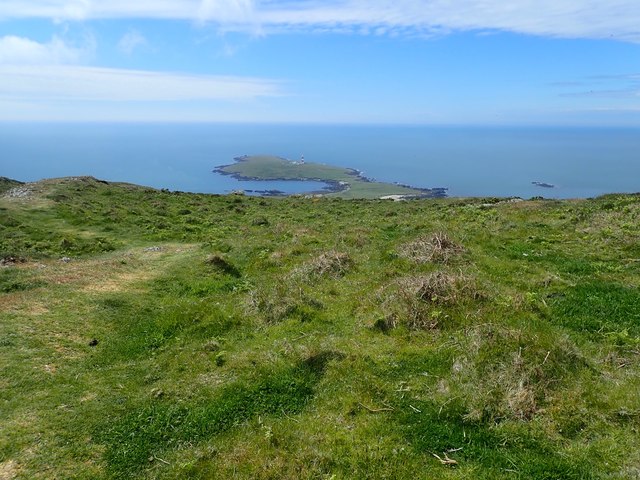
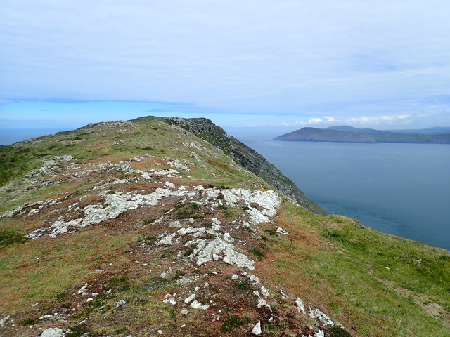
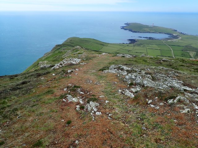
Pen Diban is a prominent headland located on the northern coast of Caernarfonshire, Wales. It is situated near the town of Abersoch and is known for its stunning natural beauty and rugged coastal landscape. The name "Pen Diban" translates to "point with a rounded head" in Welsh, accurately describing the physical characteristics of this coastal feature.

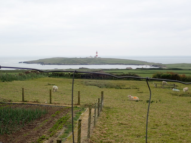
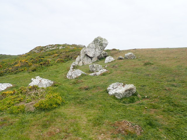
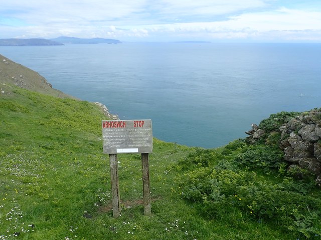
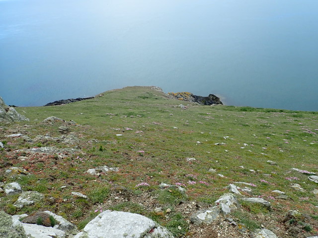
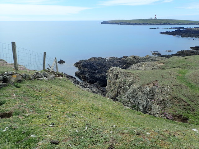
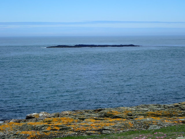
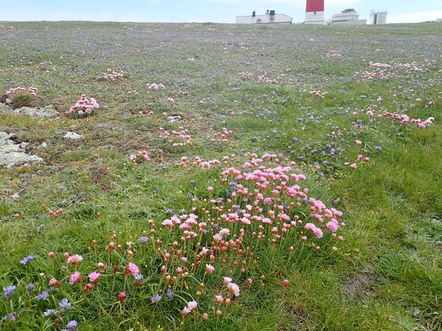
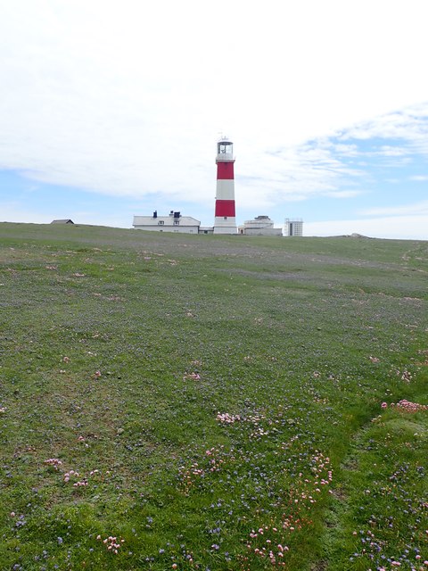
With its towering cliffs and jagged rocks, Pen Diban offers breathtaking views of the Irish Sea and the surrounding coastline. The headland is formed by layers of sedimentary rock, primarily limestone and shale, which have been shaped by years of erosion from the relentless waves.

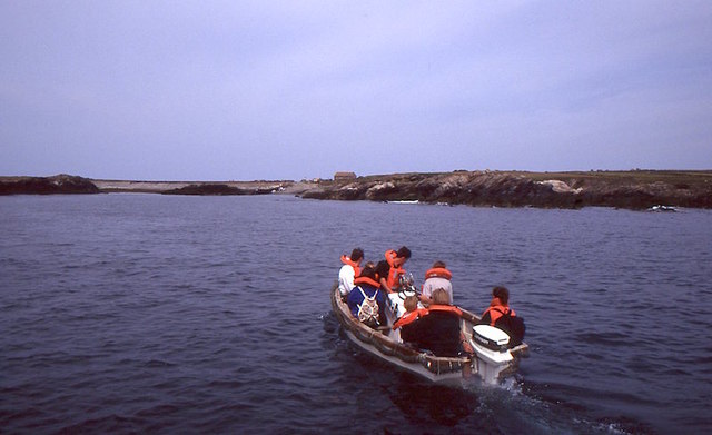
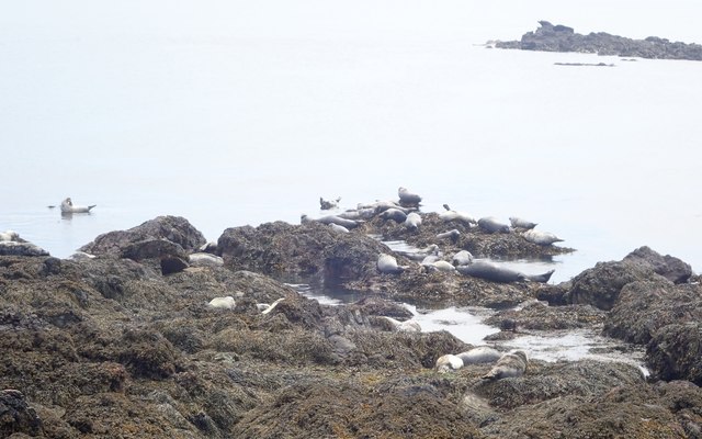
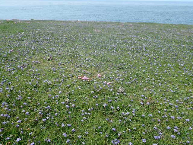
The area surrounding Pen Diban is an ecological hotspot, home to a diverse range of marine and bird life. Seals, dolphins, and porpoises can often be spotted swimming in the waters, while seabirds such as puffins, gannets, and razorbills nest along the cliffs. The headland also supports a variety of plant species, including sea thrift and sea campion, which add vibrant splashes of color to the landscape.

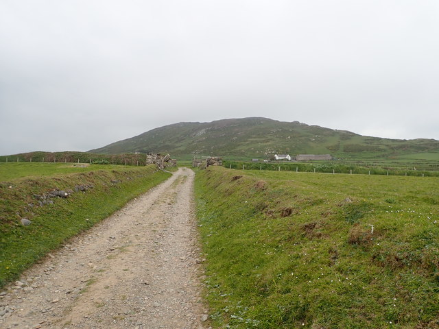
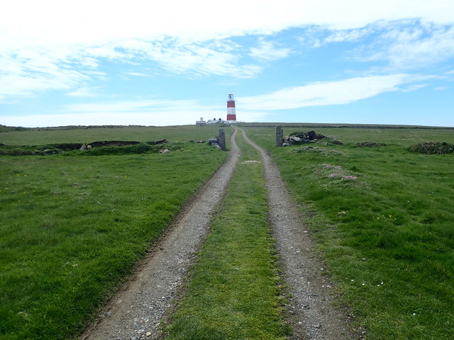
Pen Diban is a popular destination for outdoor enthusiasts and nature lovers. It offers excellent opportunities for hiking and coastal walks, with several well-marked trails that take visitors along the cliff tops and down to secluded coves and sandy beaches. The headland is also a favorite spot for birdwatching, fishing, and photography.

Visitors to Pen Diban should exercise caution, as the cliffs can be unstable and slippery, and the tides can change rapidly. However, with its dramatic scenery and abundant wildlife, Pen Diban is a must-visit for anyone seeking a true coastal adventure in Caernarfonshire.

If you have any feedback on the listing, please let us know in the comments section below.
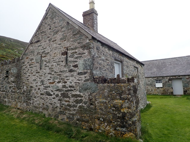
Pen Diban Images

Images are sourced within 2km of 52.746112/-4.7997504 or Grid Reference SH1120. Thanks to Geograph Open Source API. All images are credited.

Landing on Bardsey There was a transfer to a smaller boat for the landing. The crossing was by a larger fast catamaran, similar to the one used for trips out of Crinan  to Jura, Scarab etc.  The boat is heading for the inlet of 
Cafn Enlli where there is a slip.
Landing on Bardsey
There was a transfer to a smaller boat for the landing. The crossing was by a larger fast catamaran, similar to the one used for trips out of Crinan to Jura, Scarab etc. The boat is heading for the inlet of Cafn Enlli where there is a slip.
The main - and only - road on Bardsey Island
Bardsey view From the farm buildings towards the lighthouse
Bardsey view
From the farm buildings towards the lighthouse
The Old School, Bardsey Island The School House was originally the 'old chapel' building for islanders until a more formal school was established in 1875 for the twelve students on the island at the time.
The Old School, Bardsey Island
The School House was originally the 'old chapel' building for islanders until a more formal school was established in 1875 for the twelve students on the island at the time.
Plas Bach, Ynys Enlli These buildings are now used to house the tourists who come to Bardsey Island on vacation
Plas Bach, Ynys Enlli
These buildings are now used to house the tourists who come to Bardsey Island on vacation
Heading south on Bardsey Mountain The little promontory of Pen Diban ahead, with the lighthouse
Heading south on Bardsey Mountain
The little promontory of Pen Diban ahead, with the lighthouse
Summit ridge, Mynydd Enlli Looking north, with the tip of the Lleyn peninsula over Bardsey Sound
Summit ridge, Mynydd Enlli
Looking north, with the tip of the Lleyn peninsula over Bardsey Sound
Mynydd Enlli ridge A patchwork of fields at the farm, the bay between the main island and Pen Dibyn is where the boat comes in, and the lighthouse is on the flat southern end of the island.
Mynydd Enlli ridge
A patchwork of fields at the farm, the bay between the main island and Pen Dibyn is where the boat comes in, and the lighthouse is on the flat southern end of the island.
Limestone boulders on Mynydd Enlli
Arhoswch! Stop! Warning notice to stop people accessing bird nesting sites between March and September. This is at the top of a very steep cliff on the eastern side of Mynydd Enlli.
Arhoswch! Stop!
Warning notice to stop people accessing bird nesting sites between March and September. This is at the top of a very steep cliff on the eastern side of Mynydd Enlli.
Descending the southern slope of Mynydd Enlli to Pen Cristin
Gully on Pen Cristin
Basking seals at Honllwyn There is a large breeding colony of grey seals on Bardsey and are regularly seen basking on the rocks at Honllwyn. Theirs calls can be heard far and wide - even on the top of Mynydd Enlli.
Basking seals at Honllwyn
There is a large breeding colony of grey seals on Bardsey and are regularly seen basking on the rocks at Honllwyn. Theirs calls can be heard far and wide - even on the top of Mynydd Enlli.
Track to the lighthouse on Bardsey Island
Squills as far as the eye can see A beautiful Spring meadow near the lighthouse on Bardsey, Scilla Verna mostly, with the odd tuft of sea pink
Squills as far as the eye can see
A beautiful Spring meadow near the lighthouse on Bardsey, Scilla Verna mostly, with the odd tuft of sea pink
Carreg yr Honwy A skerry, (small rocky island) off the west coast of Bardsey Island.
Carreg yr Honwy
A skerry, (small rocky island) off the west coast of Bardsey Island.
Thrift and Squills  on Pen Diban
Thrift and Squills on Pen Diban
Bardsey Island Lighthouse Built in 1821, this is the tallest square tower lighthouse in the UK. It was automated in 1987 and is now controlled from Trinity House’s Planning Centre in Harwich. It guides shipping past outcrops of sharp rocks which surround Bardsey Island.
Bardsey Island Lighthouse
Built in 1821, this is the tallest square tower lighthouse in the UK. It was automated in 1987 and is now controlled from Trinity House’s Planning Centre in Harwich. It guides shipping past outcrops of sharp rocks which surround Bardsey Island.
Show me another place!

Pen Diban is located at Grid Ref: SH1120 (Lat: 52.746112, Lng: -4.7997504)

Unitary Authority: Gwynedd

Police Authority: North Wales

What 3 Words

///jacuzzi.helpfully.nerves. Near Nefyn, Gwynedd

Related Wikis

Bardsey Lighthouse

Bardsey Lighthouse stands on the southerly tip of Bardsey Island, off the Llŷn Peninsula in Gwynedd, Wales, and guides vessels passing through St George...

Bardsey Bird and Field Observatory

Bardsey Bird and Field Observatory is a bird observatory on Bardsey Island, off the Welsh coast. It was founded in 1953 by a group of ornithologists from...

Bardsey Island

Bardsey Island (Welsh: Ynys Enlli), known as the legendary "Island of 20,000 Saints", is located 1.9 miles (3.1 km) off the Llŷn Peninsula in the Welsh...

St Hywyn's Church, Aberdaron

The Church of St Hywyn, Aberdaron, Gwynedd, Wales, is a parish church dating from the 12th century. Its origins are earlier, as a clas church from the...

Nearby Amenities

Located within 500m of 52.746112,-4.7997504
Source: PGS
Lat/Long: 52.7451687/-4.8017767
Source: PGS
Lat/Long: 52.7459917/-4.8021002
Created By: dmgroom_coastlines
Source: PGS
Lat/Long: 52.74756/-4.798656
Pen Dirban
Place: locality
Source: npe
Lat/Long: 52.7462617/-4.8001451
Ogof Diban
Natural: cave_entrance
Lat/Long: 52.7465379/-4.8002874
Ogof Ysteffwl- Glas
Natural: cave_entrance
Lat/Long: 52.7487152/-4.8002078
Ogof Lladron
Natural: cave_entrance
Lat/Long: 52.7462772/-4.8013657
Pen Diban
Ele: 20
Natural: peak
Source: npe
Lat/Long: 52.7466209/-4.8007882
Seamark Fog Signal Category: horn
Seamark Fog Signal Group: 2
Seamark Fog Signal Period: 45
Seamark Landmark Height: 30
Seamark Light Character: Fl
Seamark Light Colour: white
Seamark Light Group: 5
Seamark Light Height: 39
Seamark Light Period: 15
Seamark Light Range: 26
Seamark Light Reference: A 5234
Seamark Light Sequence: 0.3+(1.1)+0.3+(1.1)+0.3+(1.1)+0.3+(1.1)+0.3+(9.1)
Seamark Name: Bardsey
Seamark Type: light_major
Url: https://www.trinityhouse.co.uk/lighthouses-and-lightvessels/bardsey-lighthouse
Wikidata: Q10580915
Wikipedia: en:Bardsey Lighthouse
Lat/Long: 52.7499215/-4.799751
Maen Du
Place: locality
Lat/Long: 52.7451652/-4.8015817
Aeroway: helipad
Lat/Long: 52.7499734/-4.7990038
The data included in this document is from www.openstreetmap.org. The data is made available under ODbL.

Have you been to Pen Diban?

Leave your review of Pen Diban below (or comments, questions and feedback).