Black Isle

Coastal Feature, Headland, Point in Wigtownshire

Scotland

Black Isle

Portpatrick From the coast path to the north west, the start of the Southern Upland Way to Cockburnspath on the east coast.
Portpatrick Credit: Andy Stephenson

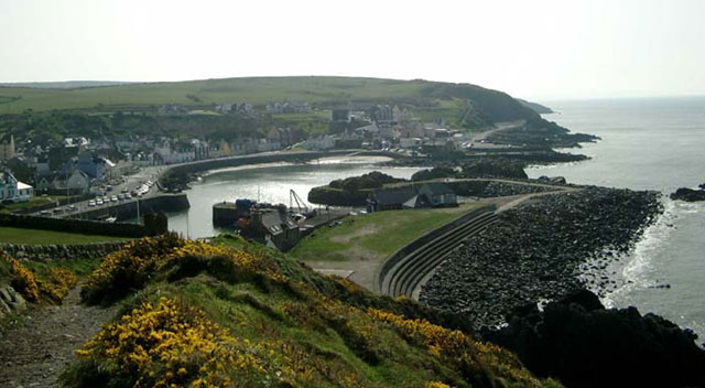
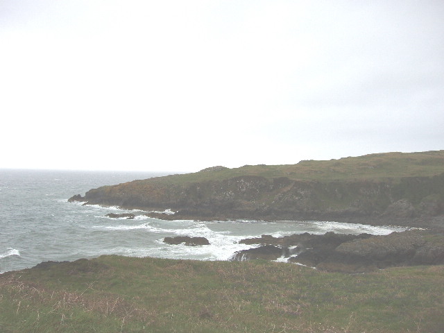
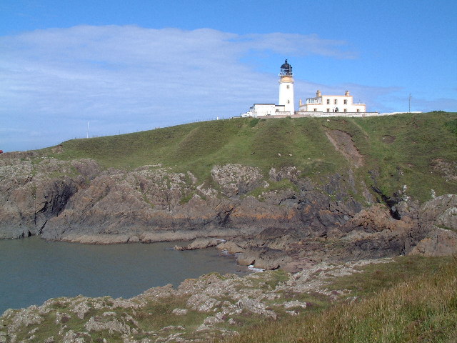
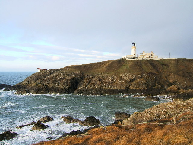
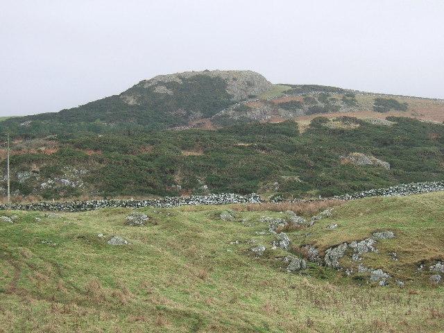
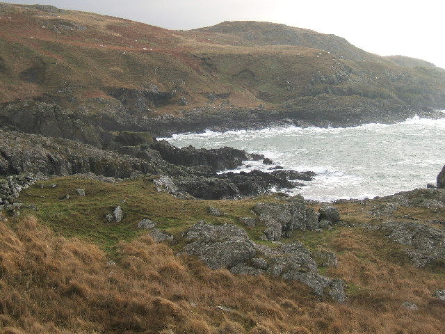
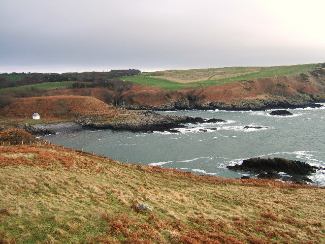
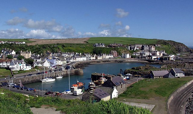
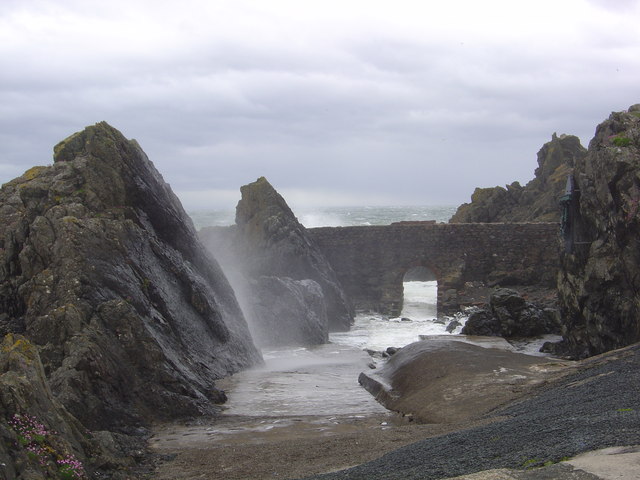
Black Isle is a prominent coastal feature located in Wigtownshire, Scotland. It is a headland that stretches out into the Irish Sea, forming a distinct point along the coastline. The headland is characterized by its rugged cliffs, which rise steeply from the water and provide stunning panoramic views of the surrounding area.

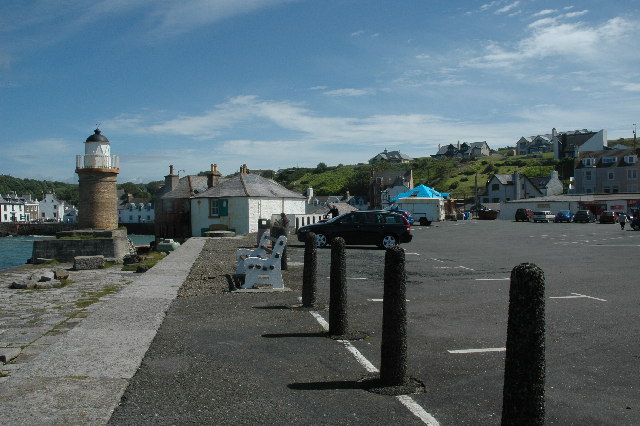
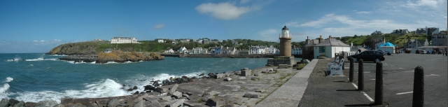
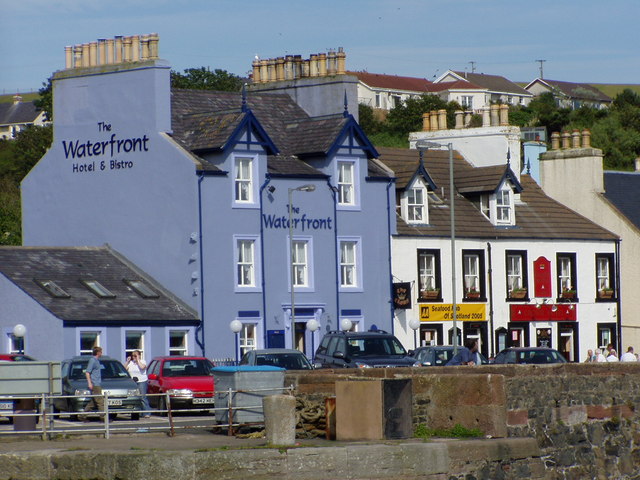
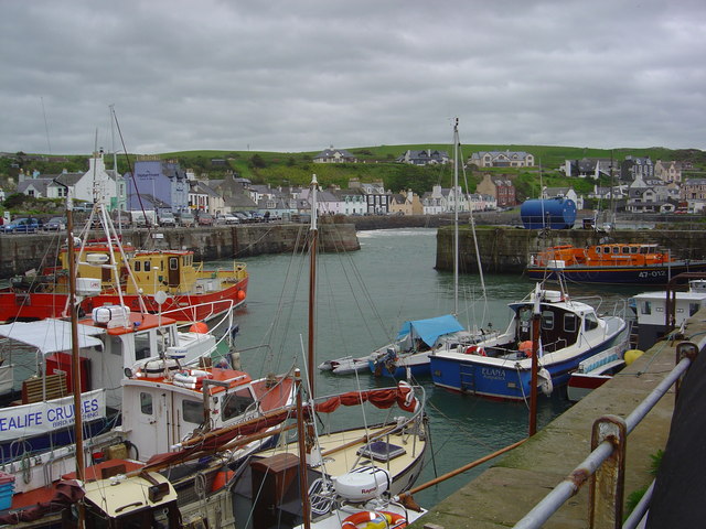
Black Isle is situated near the town of Stranraer and is easily accessible by road, making it a popular destination for locals and tourists alike. The headland is known for its natural beauty and offers a range of activities for outdoor enthusiasts, including hiking, birdwatching, and photography.

The cliffs of Black Isle are made up of various geological formations, including sandstone and shale, which have been shaped by the relentless pounding of the sea over thousands of years. This has resulted in the creation of numerous sea caves and rock formations that add to the allure of the headland.

The area surrounding Black Isle is also home to a diverse range of wildlife. Visitors can spot seabirds such as gannets, fulmars, and guillemots nesting on the cliffs, while seals can often be seen basking on nearby rocks. Dolphins and porpoises are also known to frequent the waters surrounding the headland, providing a unique opportunity for marine wildlife spotting.

Overall, Black Isle in Wigtownshire is a captivating coastal feature that offers breathtaking views, fascinating geological formations, and abundant wildlife. It is a must-visit destination for nature lovers and those seeking a tranquil escape along Scotland's stunning coastline.

If you have any feedback on the listing, please let us know in the comments section below.

Black Isle Images

Images are sourced within 2km of 54.849529/-5.1309132 or Grid Reference NW9955. Thanks to Geograph Open Source API. All images are credited.

Portpatrick From the coast path to the north west, the start of the Southern Upland Way to Cockburnspath on the east coast.
Portpatrick
From the coast path to the north west, the start of the Southern Upland Way to Cockburnspath on the east coast.
Across Port Kale to Catebraid, near Portpatrick The inlet is the bottom of Dunskey Glen. The headland is near the start of the Southern Upland Way.
Across Port Kale to Catebraid, near Portpatrick
The inlet is the bottom of Dunskey Glen. The headland is near the start of the Southern Upland Way.
Dunskey Glen, near Portpatrick
A tribute to the Lifeboatmen of Portpatrick This is in memory of the Lifeboatmen of Portpatrick who, in January 1953, risked their lives to save the passengers and crew of the BR/S Princess Victoria during The Great Storm.
A tribute to the Lifeboatmen of Portpatrick
This is in memory of the Lifeboatmen of Portpatrick who, in January 1953, risked their lives to save the passengers and crew of the BR/S Princess Victoria during The Great Storm.
Car park at south end of Portpatrick Harbour Car park at south end of Portpatrick Harbour.
Car park at south end of Portpatrick Harbour
Car park at south end of Portpatrick Harbour.
Portpatrick This is a panoramic view on Portpatrick. Four pictures were used for this view and were stitched together using Panavue.
Portpatrick
This is a panoramic view on Portpatrick. Four pictures were used for this view and were stitched together using Panavue.
Lighthouse on Black Head, Wigtonshire Seen from the cliff top path of the Southern Upland Way from Portpatrick heading North.
Lighthouse on Black Head, Wigtonshire
Seen from the cliff top path of the Southern Upland Way from Portpatrick heading North.
Killantringan Fell near Portpatrick The small hill Killantringan Fell (464 feet) situated south of the Southern Upland Way road to Killantringan Lighthouse.
Killantringan Fell near Portpatrick
The small hill Killantringan Fell (464 feet) situated south of the Southern Upland Way road to Killantringan Lighthouse.
Killantringan Lighthouse and foghorn, Black Head near Portpatrick This photo is almost the same as the one already submitted, but taken on a stormy winter day. This photo also shows the foghorn. The bay in front of the lighthouse is called Portamaggie where a cargo ship named "Craiganlet" was grounded on rocks and shipwrecked in 1982. The remains can still be seen protruding from the sea.
Killantringan Lighthouse and foghorn, Black Head near Portpatrick
This photo is almost the same as the one already submitted, but taken on a stormy winter day. This photo also shows the foghorn. The bay in front of the lighthouse is called Portamaggie where a cargo ship named "Craiganlet" was grounded on rocks and shipwrecked in 1982. The remains can still be seen protruding from the sea.
Craig Anthony (90 metres) near Killantringan lighthouse. A steep rocky crag named Craig Anthony near Killantringan lighthouse, South West Scotland.
Craig Anthony (90 metres) near Killantringan lighthouse.
A steep rocky crag named Craig Anthony near Killantringan lighthouse, South West Scotland.
Portavaddie Bay South of Killantringan Lighthouse Portavaddie Bay, South of Killantringan lighthouse and passed by on the Southern Upland Way towards Portpatrick.
Portavaddie Bay South of Killantringan Lighthouse
Portavaddie Bay, South of Killantringan lighthouse and passed by on the Southern Upland Way towards Portpatrick.
Port Kale and Port Mora Bays from Catebraid near Portpatrick Port Kale (foreground) and Port Mora (known locally as Sandeel Bay) Bays near Portpatrick. This location covers three ordnance survey squares but I have chosen the furthest away for the location.
Port Kale and Port Mora Bays from Catebraid near Portpatrick
Port Kale (foreground) and Port Mora (known locally as Sandeel Bay) Bays near Portpatrick. This location covers three ordnance survey squares but I have chosen the furthest away for the location.
A waterfall over caves at the end of Sandeel Bay (Port Mora Bay) near Portpatrick.
Port Patrick Hotel Taken from the old Harbour in Portpatrick up towards the hotel
Port Patrick Hotel
Taken from the old Harbour in Portpatrick up towards the hotel
Portpatrick Harbour My yacht 'Makushla' is the large yacht moored against the wall with the smaller one rafted against it.
Portpatrick Harbour
My yacht 'Makushla' is the large yacht moored against the wall with the smaller one rafted against it.
Portpatrick Waterfront Hotel
Portpatrick Harbour
Portpatrick Harbour
View from Portpatrick
Show me another place!

Black Isle is located at Grid Ref: NW9955 (Lat: 54.849529, Lng: -5.1309132)

Unitary Authority: Dumfries and Galloway

Police Authority: Dumfries and Galloway

What 3 Words

///release.wink.detonated. Near Stranraer, Dumfries & Galloway

Related Wikis

Portpatrick

Portpatrick is a village and civil parish in the historical county of Wigtownshire, Dumfries and Galloway, Scotland. It is located on the west coast of...

Portpatrick railway station

Portpatrick railway station was a railway station serving the village of Portpatrick, Dumfries & Galloway, Scotland. Opened in 1862 the station served...

Dunskey

Dunskey Estate (also known as Portree Estate) is north of Portpatrick on the west coast of Scotland. The B-listed mansion dates from the start of the twentieth...

MV Craigantlet

MV Craigantlet was a German-owned, Cyprus-registered container ship operated on time-charter by Cawoods Containers Ltd of Belfast. She ran aground on 26...

Nearby Amenities

Located within 500m of 54.849529,-5.1309132
Created By: dmgroom_coastlines
Source: PGS
Lat/Long: 54.851374/-5.13789
Created By: dmgroom_coastlines
Source: PGS
Lat/Long: 54.850614/-5.137406
Created By: dmgroom_coastlines
Source: PGS
Lat/Long: 54.850489/-5.137176
Created By: dmgroom_coastlines
Source: PGS
Lat/Long: 54.850366/-5.136949
Created By: dmgroom_coastlines
Source: PGS
Lat/Long: 54.850241/-5.136719
Created By: dmgroom_coastlines
Source: PGS
Lat/Long: 54.850118/-5.136491
Created By: dmgroom_coastlines
Source: PGS
Lat/Long: 54.849609/-5.136242
Created By: dmgroom_coastlines
Source: PGS
Lat/Long: 54.849745/-5.135805
Created By: dmgroom_coastlines
Source: PGS
Lat/Long: 54.849897/-5.134481
Created By: dmgroom_coastlines
Source: PGS
Lat/Long: 54.850409/-5.134508
Created By: dmgroom_coastlines
Source: PGS
Lat/Long: 54.850552/-5.133628
Created By: dmgroom_coastlines
Source: PGS
Lat/Long: 54.850684/-5.133413
Created By: dmgroom_coastlines
Source: PGS
Lat/Long: 54.851204/-5.132997
Created By: dmgroom_coastlines
Source: PGS
Lat/Long: 54.851335/-5.132781
Created By: dmgroom_coastlines
Source: PGS
Lat/Long: 54.851487/-5.131457
Created By: dmgroom_coastlines
Source: PGS
Lat/Long: 54.850207/-5.13139
Source: PGS
Lat/Long: 54.8501849/-5.1311567
Source: PGS
Lat/Long: 54.8508072/-5.1300709
Source: PGS
Lat/Long: 54.8514221/-5.1289219
Source: PGS
Lat/Long: 54.8510626/-5.128475
Source: PGS
Lat/Long: 54.8505677/-5.1291806
Golf: pin
Lat/Long: 54.847776/-5.1238443
Golf: pin
Lat/Long: 54.8485586/-5.1252471
Golf: pin
Lat/Long: 54.8497365/-5.127881
Golf: pin
Lat/Long: 54.8509736/-5.1246917
Golf: pin
Lat/Long: 54.8504858/-5.1239132
Maidenhead Bay
Natural: bay
Lat/Long: 54.8481377/-5.1311825
Power: pole
Lat/Long: 54.8530065/-5.1264752
Power: pole
Lat/Long: 54.8526308/-5.1276443
Power: pole
Lat/Long: 54.8522308/-5.1288862
The data included in this document is from www.openstreetmap.org. The data is made available under ODbL.

Have you been to Black Isle?

Leave your review of Black Isle below (or comments, questions and feedback).