An Deargann

Coastal Feature, Headland, Point in Ross-shire

Scotland

An Deargann

Loch na h-Uamhaidh Beag
Loch na h-Uamhaidh Beag Credit: David Brown

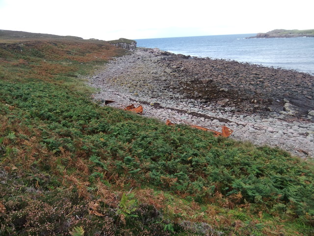
An Deargann is a prominent coastal feature located in Ross-shire, Scotland. It is a headland or point that juts out into the North Atlantic Ocean, offering breathtaking views of the surrounding coastline. The name "An Deargann" translates to "The Red Rock" in the Gaelic language, which accurately reflects the reddish hue of the rock formations found in this area.

The headland is characterized by steep cliffs that rise dramatically from the sea, reaching heights of up to 200 feet in some places. These cliffs are composed of sandstone and conglomerate rock, displaying distinct layers that have been formed over millions of years through geological processes.

An Deargann is also renowned for its diverse wildlife. The headland provides a habitat for various seabirds, including puffins, gannets, and guillemots, which nest on the cliff ledges. Visitors can often spot seals basking on the rocks below, while dolphins and porpoises are occasionally seen swimming in the waters offshore.

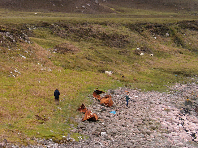
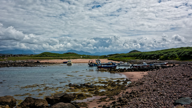
Access to An Deargann is possible via a well-maintained footpath that winds its way along the cliff edge, offering stunning views of the rugged coastline. The headland is a popular destination for hikers and nature enthusiasts who appreciate its unspoiled beauty and tranquil atmosphere.

Overall, An Deargann is a captivating coastal feature that showcases the raw power of nature and provides a haven for a wide range of flora and fauna. Its striking cliffs, vibrant rock formations, and abundant wildlife make it a must-visit location for anyone exploring the Ross-shire region.

If you have any feedback on the listing, please let us know in the comments section below.

An Deargann Images

Images are sourced within 2km of 57.863572/-5.6830597 or Grid Reference NG8191. Thanks to Geograph Open Source API. All images are credited.
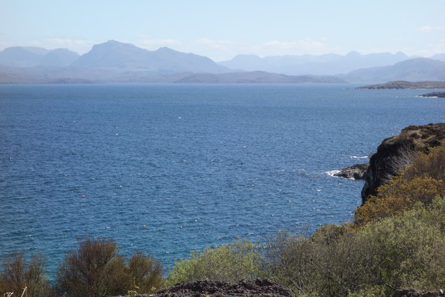
Loch na h-Uamhaidh Beag
The car park at Cove Here there are information boards describing the part Loch Ewe played in the WW2 Arctic Convoys.
The car park at Cove
Here there are information boards describing the part Loch Ewe played in the WW2 Arctic Convoys.
Information board at Rubha nan Sasan, Cove This describes the part Loch Ewe played in the WW2 Arctic Convoys.
Information board at Rubha nan Sasan, Cove
This describes the part Loch Ewe played in the WW2 Arctic Convoys.
New house near Cove
New house near Cove
Beach with rusting lifeboats
Bouldery beach with wrecked lifeboats The beach is at a bay south of Eilean Furadh Mòr near to where, on 26 Feb 1944, the US 'Liberty Ship', William H. Welch foundered and was lost with most of her crew. The rusting remains of several of the ship's lifeboats lie on the beach
Bouldery beach with wrecked lifeboats
The beach is at a bay south of Eilean Furadh Mòr near to where, on 26 Feb 1944, the US 'Liberty Ship', William H. Welch foundered and was lost with most of her crew. The rusting remains of several of the ship's lifeboats lie on the beach
Sgeir Gorma The coastline at Caolas an Fhuraidh with the reef of Sgeir Gorma in the foreground and the islet of Eilean Furadh Beag further out. Along the horizon are an array of diatant mountains, including [l-r] Arkle, Quinag, Suilven, canisp, Stac Pollaidh, Cul Mor and Ben Mor Coigach.
Sgeir Gorma
The coastline at Caolas an Fhuraidh with the reef of Sgeir Gorma in the foreground and the islet of Eilean Furadh Beag further out. Along the horizon are an array of diatant mountains, including [l-r] Arkle, Quinag, Suilven, canisp, Stac Pollaidh, Cul Mor and Ben Mor Coigach.
Lochan on Meall na h-Uamhaidh
Command post at Rubha nan Sasan
Boats at Cove
Boats at Cove
Loch Ewe and the road to Cove
Loch Ewe
Loch Ewe
Light anti-aircraft gun emplacement, Rubha nan Sasan, Ross and Cromarty The gun emplacement lies within the Rubha nan Sasan coastal battery which was part of the Second World War defences of Loch Ewe from where Russian Arctic Convoys sailed.
Light anti-aircraft gun emplacement, Rubha nan Sasan, Ross and Cromarty
The gun emplacement lies within the Rubha nan Sasan coastal battery which was part of the Second World War defences of Loch Ewe from where Russian Arctic Convoys sailed.
Light anti-aircraft gun emplacement, Rubha nan Sasan, Ross and Cromarty The gun emplacement lies within the Rubha nan Sasan coastal battery.
Light anti-aircraft gun emplacement, Rubha nan Sasan, Ross and Cromarty
The gun emplacement lies within the Rubha nan Sasan coastal battery.
Memorial  stone  for  over  3000  men  lost  on  Russian  Convoys Erected on the headland of Rubha nan Sasan by the Russian Arctic Convoy Club. Loch Ewe was the heavily fortified base for the convoys to assemble prior to departure. <span class="nowrap"><a title="www.russianarcticconvoymuseum.org" rel="nofollow ugc noopener" href="http://www.russianarcticconvoymuseum.org">Link</a><img style="margin-left:2px;" alt="External link" title="External link - shift click to open in new window" src="https://s1.geograph.org.uk/img/external.png" width="10" height="10"/></span> is the museum at Aultbea on the A832 which is well worth a visit
Memorial stone for over 3000 men lost on Russian Convoys
Erected on the headland of Rubha nan Sasan by the Russian Arctic Convoy Club. Loch Ewe was the heavily fortified base for the convoys to assemble prior to departure. LinkExternal link is the museum at Aultbea on the A832 which is well worth a visit
WW2   buildings  NW  of  the  Arctic  Convoy  Memorial This whole headland was a military camp covering the entrance into Loch Ewe
WW2 buildings NW of the Arctic Convoy Memorial
This whole headland was a military camp covering the entrance into Loch Ewe
Hydrographic  Survey  Pillar  overlooking  Loch  Ewe On the headland of Rubha nan Sasan which in WW2 was a protective battery covering the entrance to Loch Ewe. This survey pillar was placed here in 1951 by HMS Cook during survey work on the west coast of Scotland
Hydrographic Survey Pillar overlooking Loch Ewe
On the headland of Rubha nan Sasan which in WW2 was a protective battery covering the entrance to Loch Ewe. This survey pillar was placed here in 1951 by HMS Cook during survey work on the west coast of Scotland
Road (B8057) between Stirkhill and Cove Looking north-westward.
Road (B8057) between Stirkhill and Cove
Looking north-westward.
Show me another place!

An Deargann is located at Grid Ref: NG8191 (Lat: 57.863572, Lng: -5.6830597)

Unitary Authority: Highland

Police Authority: Highlands and Islands

What 3 Words

///filed.elbowing.proceeds. Near Gairloch, Highland

Related Wikis

Cove, Highland

Cove is a remote hamlet located on the northwestern shore of the sea loch Loch Ewe, and 8 mi (13 km) northwest of Poolewe in Ross-shire, Scottish Highlands...

Mellon Charles

Mellon Charles (Scottish Gaelic: Meallan Theàrlaich) is a remote crofting village on the north east shore of Loch Ewe near Gairloch in Wester Ross, in...

Ormiscaig

Ormiscaig (Scottish Gaelic: Ormasgaig) is a remote crofting village on the north east shore of Loch Ewe in Achnasheen, Ross-shire, Scottish Highlands and...

Loch Ewe

Loch Ewe (Scottish Gaelic: Loch Iùbh) is a sea loch in the region of Wester Ross in the Northwest Highlands of Scotland. The shores are inhabited by a...

Nearby Amenities

Located within 500m of 57.863572,-5.6830597
Created By: almien_coastlines
Source: PGS
Lat/Long: 57.860132/-5.687086
Source: PGS
Lat/Long: 57.8600748/-5.6867924
Source: PGS
Lat/Long: 57.8602297/-5.6862059
Source: PGS
Lat/Long: 57.8604797/-5.6859585
Source: PGS
Lat/Long: 57.8606378/-5.6856299
Source: PGS
Lat/Long: 57.8617331/-5.6851985
Source: PGS
Lat/Long: 57.8616931/-5.685417
Source: PGS
Lat/Long: 57.8620862/-5.6854633
Source: PGS
Lat/Long: 57.8621359/-5.6852329
Source: PGS
Lat/Long: 57.8623257/-5.6847823
Source: PGS
Lat/Long: 57.8625645/-5.6845641
Source: PGS
Lat/Long: 57.8626249/-5.6845759
Source: PGS
Lat/Long: 57.8628115/-5.6844407
Source: PGS
Lat/Long: 57.8629185/-5.684001
Source: PGS
Lat/Long: 57.863119/-5.6836298
Source: PGS
Lat/Long: 57.8637387/-5.6832069
Source: PGS
Lat/Long: 57.8637997/-5.6831924
Source: PGS
Lat/Long: 57.8640475/-5.6826683
Source: PGS
Lat/Long: 57.8647004/-5.6827179
Source: PGS
Lat/Long: 57.864557/-5.6843194
Source: PGS
Lat/Long: 57.864894/-5.6837202
Source: PGS
Lat/Long: 57.865588/-5.6844093
Source: PGS
Lat/Long: 57.8656617/-5.6854159
Source: PGS
Lat/Long: 57.8653413/-5.6865952
Source: PGS
Lat/Long: 57.8652196/-5.6877776
Source: PGS
Lat/Long: 57.8659935/-5.6872965
Source: PGS
Lat/Long: 57.86658/-5.6886776
Source: PGS
Lat/Long: 57.8666559/-5.6886125
Parking
Lat/Long: 57.8642878/-5.6866181
Arctic Convoy Memorial
Historic: memorial
Source: Bing
Lat/Long: 57.864896/-5.6855543
The data included in this document is from www.openstreetmap.org. The data is made available under ODbL.

Have you been to An Deargann?

Leave your review of An Deargann below (or comments, questions and feedback).