Rubha na Cùilidh

Coastal Feature, Headland, Point in Argyllshire

Scotland

Rubha na Cùilidh

Sound of Jura Point of Knap with Jura in the distance
Sound of Jura Credit: Ceri

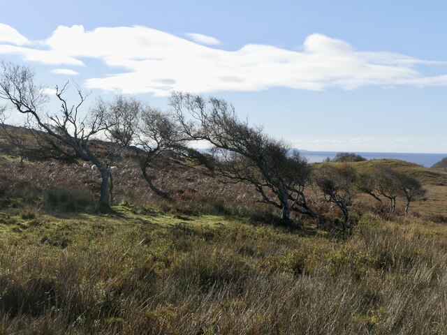
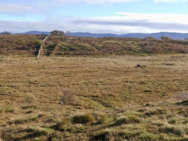
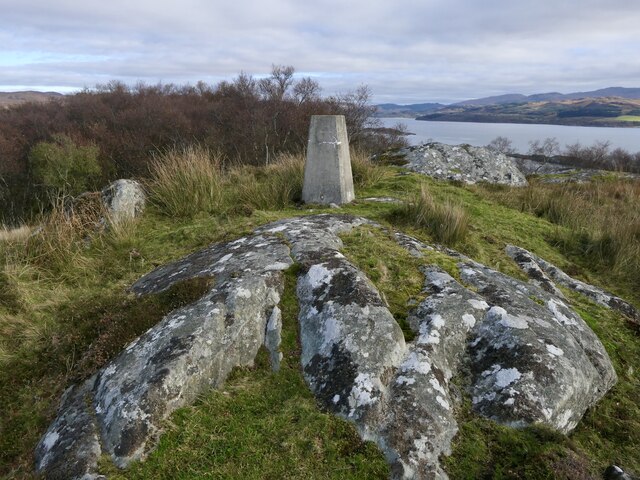
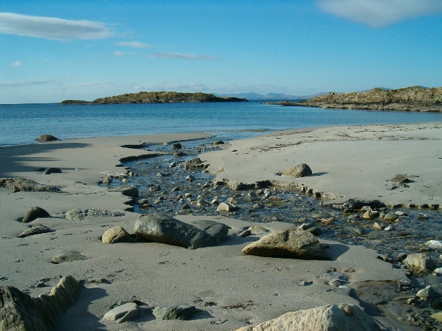
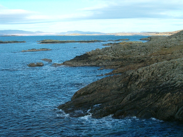
Rubha na Cùilidh, located in Argyllshire, Scotland, is a prominent coastal feature known for its picturesque headland and stunning views. Situated on the western coast of Scotland, Rubha na Cùilidh extends into the North Atlantic Ocean, offering a dramatic landscape where land meets sea.

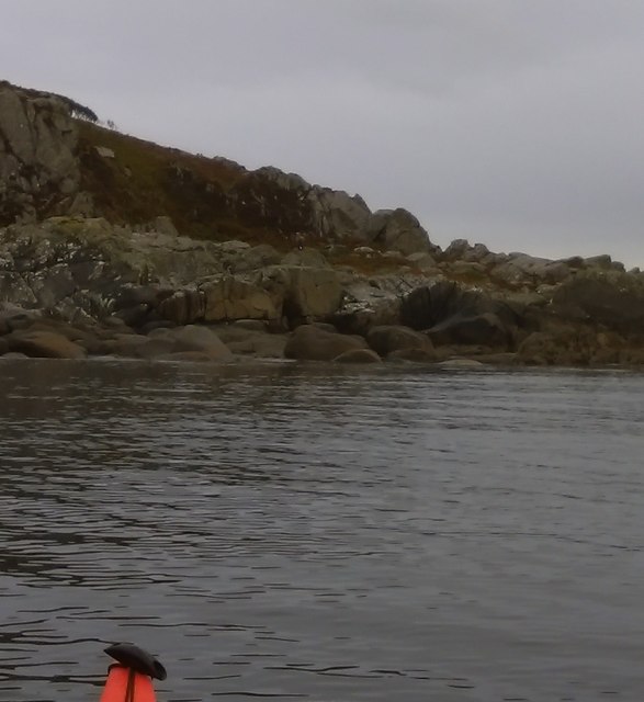
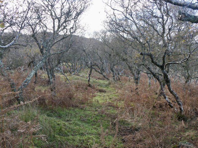
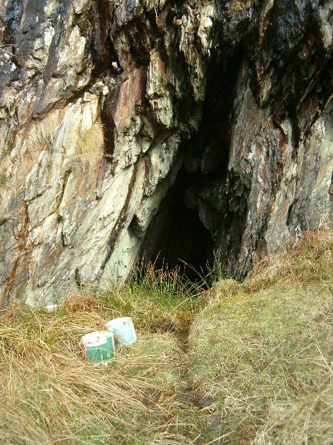
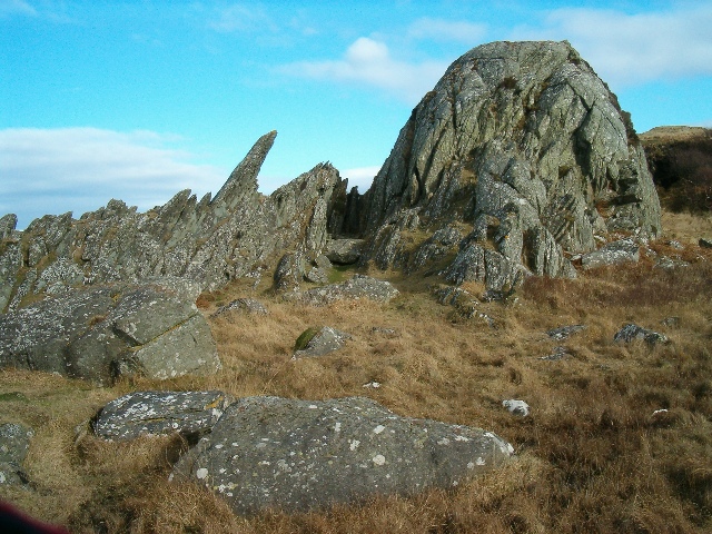
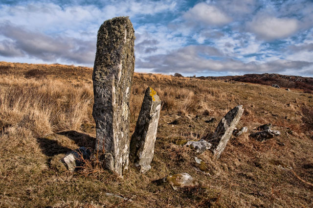
The headland is characterized by its rocky cliffs rising from the water, providing a rugged and dramatic panorama. The cliffs are composed of ancient rock formations, displaying layers of sedimentary rocks that have been shaped by years of erosion from the crashing waves. This natural erosion has created unique formations, including caves and arches, adding to the allure of the area.

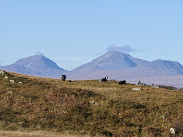
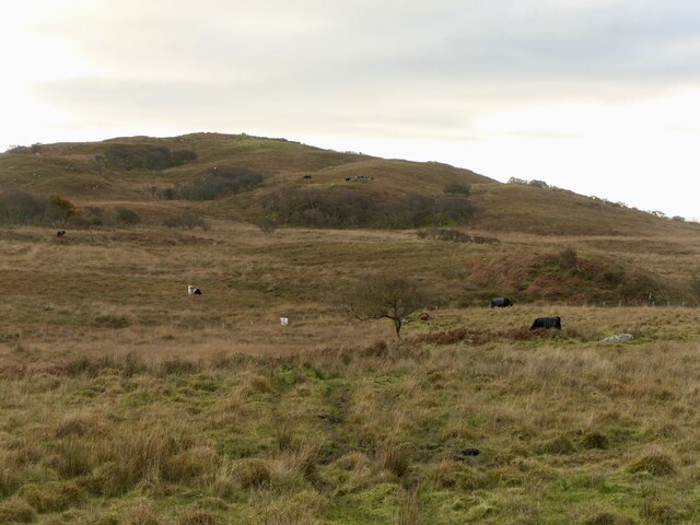
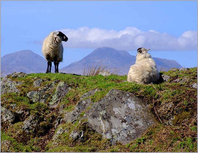
The headland is also home to a variety of wildlife, making it an ideal spot for nature enthusiasts. Seabirds, such as puffins, razorbills, and gannets, can be spotted nesting on the cliffs, while seals and dolphins can often be seen playing in the surrounding waters. The area is also known for its diverse marine life, with an abundance of fish and shellfish thriving in the nutrient-rich waters.

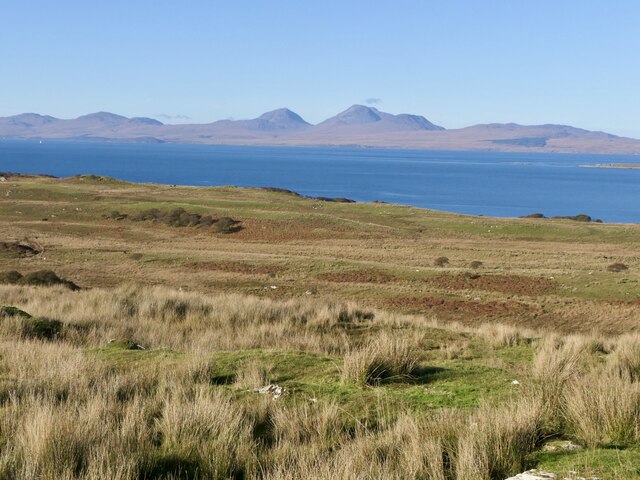
Access to Rubha na Cùilidh is relatively easy, with walking paths and trails leading visitors to the headland. Along the way, visitors can enjoy the stunning coastal views, with the distant mountains of the Scottish Highlands adding to the scenic beauty of the area.

Overall, Rubha na Cùilidh is a captivating coastal feature that offers visitors a glimpse into the wild and rugged beauty of the Scottish coastline. Its stunning cliffs, diverse wildlife, and breathtaking views make it a must-visit destination for nature lovers and those seeking to experience the untamed beauty of Argyllshire.

If you have any feedback on the listing, please let us know in the comments section below.

Rubha na Cùilidh Images

Images are sourced within 2km of 55.887133/-5.6838767 or Grid Reference NR6972. Thanks to Geograph Open Source API. All images are credited.

Sound of Jura Point of Knap with Jura in the distance
Sound of Jura
Point of Knap with Jura in the distance
Camouflaged Sea Eagle at the Point of Knap More used to seeing seagulls on the rocky shoreline on the Point of Knap, I was a bit surprised to see a Sea Eagle perched on a boulder. The birds plumage blending well with its surroundings with only a white tail giving it away (can you spot it?)
Camouflaged Sea Eagle at the Point of Knap
More used to seeing seagulls on the rocky shoreline on the Point of Knap, I was a bit surprised to see a Sea Eagle perched on a boulder. The birds plumage blending well with its surroundings with only a white tail giving it away (can you spot it?)
Small Islets North of the Point of Knap Gigha is seen on the horizon as we paddle through the small Islets inshore of Eilean Naomhachd heading for the Point of Knap.
Small Islets North of the Point of Knap
Gigha is seen on the horizon as we paddle through the small Islets inshore of Eilean Naomhachd heading for the Point of Knap.
Rough grazing land near Balimore
Rough pasture, Balimore Grazed by cattle.
Rough pasture, Balimore
Grazed by cattle.
Cnoc Mòine View along the ridge towards Point of Knap.
Cnoc Mòine
View along the ridge towards Point of Knap.
Wind shaped birches near Point of Knap
Cattle near Balimore Rough grazing with the Paps of Jura beyond. The wisp of cloud is a sign of more humid air, cloud cover appeared not long after this was taken.
Cattle near Balimore
Rough grazing with the Paps of Jura beyond. The wisp of cloud is a sign of more humid air, cloud cover appeared not long after this was taken.
Boggy grassland, Point of Knap Grazed by cattle.
Boggy grassland, Point of Knap
Grazed by cattle.
Birchwood, Point of Knap
Point of Knap Summit with the triangulation pillar beyond.
Point of Knap
Summit with the triangulation pillar beyond.
Rough grazing, Balimore View towards the hill above Point of Knap.
Rough grazing, Balimore
View towards the hill above Point of Knap.
Port an Aomaidh and Glas Eilean The only footprints on this beach this morning were from red deer ...
Port an Aomaidh and Glas Eilean
The only footprints on this beach this morning were from red deer ...
Rocky coastline, looking north towards Jura
Uamh Stocare
Uamh Stocare
Jagged rockscape
Jagged rockscape
Kilmory Knap, looking to Paps of Jura This rugged (knaps) and boggy land is used for sheep and cattle grazing.
Kilmory Knap, looking to Paps of Jura
This rugged (knaps) and boggy land is used for sheep and cattle grazing.
Standing Stones These stones are just north of Uamh Stocaire, a cave recorded in the Canmore database. Are they natural or man made, in ancient times?
Standing Stones
These stones are just north of Uamh Stocaire, a cave recorded in the Canmore database. Are they natural or man made, in ancient times?
Show me another place!

Rubha na Cùilidh is located at Grid Ref: NR6972 (Lat: 55.887133, Lng: -5.6838767)

Unitary Authority: Argyll and Bute

Police Authority: Argyll and West Dunbartonshire

What 3 Words

///weep.clockwork.score. Near Tarbert, Argyll & Bute

Related Wikis

Kilmory, Knapdale

Kilmory (Scottish Gaelic: Cill Mhoire) is a hamlet in the civil parish of South Knapdale, on Knapdale, Argyll and Bute, Scotland. It is situated near the...

Kilmory Knap Chapel

Kilmory Knap Chapel is a 13th-century Christian chapel, located at the tiny hamlet of Kilmory, in Knapdale, Argyll and Bute, on the west coast of Scotland...

Druimdrishaig

Druimdrishaig is a hamlet in Argyll and Bute, Scotland, on the shore of Loch Caolisport. == References ==

Eilean Mòr, MacCormaig Isles

Eilean Mòr ("Big Isle") is one of the MacCormaig Isles situated near the entrance to Loch Sween in the Sound of Jura, Argyll and Bute, Scotland. Eilean...

Nearby Amenities

Located within 500m of 55.887133,-5.6838767
Point of Knap
Natural: cape
Lat/Long: 55.886062/-5.6798405
The data included in this document is from www.openstreetmap.org. The data is made available under ODbL.

Have you been to Rubha na Cùilidh?

Leave your review of Rubha na Cùilidh below (or comments, questions and feedback).