Port an Aomaidh

Sea, Estuary, Creek in Argyllshire

Scotland

Port an Aomaidh

Camouflaged Sea Eagle at the Point of Knap More used to seeing seagulls on the rocky shoreline on the Point of Knap, I was a bit surprised to see a Sea Eagle perched on a boulder. The birds plumage blending well with its surroundings with only a white tail giving it away (can you spot it?)
Camouflaged Sea Eagle at the Point of Knap Credit: Iain James

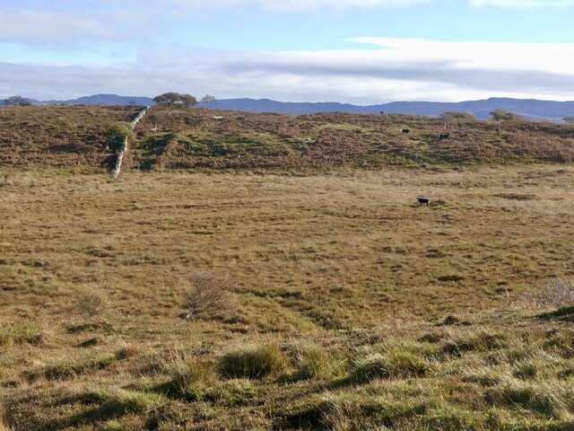
Port an Aomaidh is a small coastal settlement located in Argyllshire, Scotland. Nestled along the western coast, it is renowned for its picturesque natural beauty and serene ambiance. The name "Port an Aomaidh" translates to "port of the creek" in English, aptly describing its geographical features.

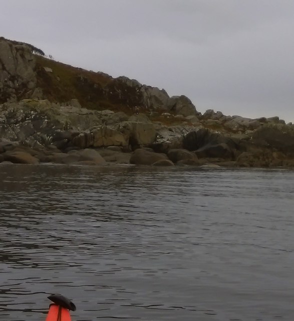
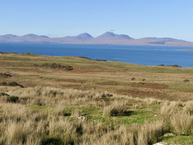
The settlement is primarily characterized by its stunning sea views, with the vast expanse of the Atlantic Ocean stretching out before it. The crystal-clear waters gently lap against the shores, creating a soothing and tranquil atmosphere. The sea is teeming with marine life, making it a popular spot for fishing enthusiasts and wildlife observers.

Port an Aomaidh is also blessed with the presence of an estuary, where a river meets the sea. This estuary not only adds to the scenic charm of the area but also serves as a vital ecosystem for various species of birds, fish, and plants. It provides a haven for migratory birds and is a paradise for birdwatchers.

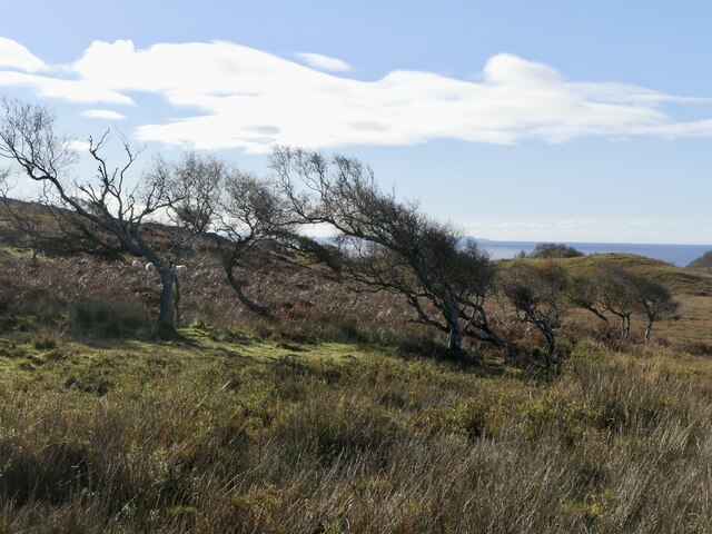
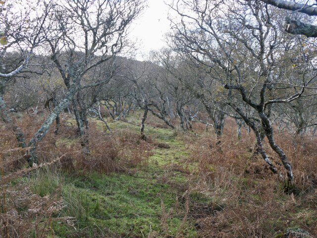
In addition to the sea and estuary, Port an Aomaidh is home to a charming creek that meanders through the settlement. The creek is surrounded by lush greenery and offers a peaceful retreat for locals and visitors alike. Its gentle flow and the sound of trickling water create a calming ambiance that rejuvenates the soul.

Overall, Port an Aomaidh is a hidden gem on the Scottish coast, offering breathtaking sea views, a thriving estuary, and a serene creek. It is a haven for nature lovers seeking tranquility amidst stunning natural surroundings.

If you have any feedback on the listing, please let us know in the comments section below.

Port an Aomaidh Images

Images are sourced within 2km of 55.892002/-5.6852347 or Grid Reference NR6972. Thanks to Geograph Open Source API. All images are credited.

Camouflaged Sea Eagle at the Point of Knap More used to seeing seagulls on the rocky shoreline on the Point of Knap, I was a bit surprised to see a Sea Eagle perched on a boulder. The birds plumage blending well with its surroundings with only a white tail giving it away (can you spot it?)
Camouflaged Sea Eagle at the Point of Knap
More used to seeing seagulls on the rocky shoreline on the Point of Knap, I was a bit surprised to see a Sea Eagle perched on a boulder. The birds plumage blending well with its surroundings with only a white tail giving it away (can you spot it?)
Small Islets North of the Point of Knap Gigha is seen on the horizon as we paddle through the small Islets inshore of Eilean Naomhachd heading for the Point of Knap.
Small Islets North of the Point of Knap
Gigha is seen on the horizon as we paddle through the small Islets inshore of Eilean Naomhachd heading for the Point of Knap.
Sound of Jura Point of Knap with Jura in the distance
Sound of Jura
Point of Knap with Jura in the distance
Hill above Kilmory Bay Looking across Kilmory's lovely beach, Jura in the distance.
Hill above Kilmory Bay
Looking across Kilmory's lovely beach, Jura in the distance.
Minor road near Kilmory
Rough grazing land near Balimore
Ruin, Balimore Balimore was a township at what is now the end of the Kilmory public road. There is now just one modern building.
Ruin, Balimore
Balimore was a township at what is now the end of the Kilmory public road. There is now just one modern building.
Road to Ellary The private section of the road around the north of Knapdale. Taken from the public road end at Balimore.
Road to Ellary
The private section of the road around the north of Knapdale. Taken from the public road end at Balimore.
Waterlogged road, Balimore An old road which served the glen around Muilean Eiteag which is marked as a disused mill on 1890s maps.  The road is very waterlogged with mud and deep puddles.
Waterlogged road, Balimore
An old road which served the glen around Muilean Eiteag which is marked as a disused mill on 1890s maps. The road is very waterlogged with mud and deep puddles.
Track to Muileann Eiteag An old road which served the glen around Muilean Eiteag which is marked as a disused mill on 1890s maps.  The road is very waterlogged with mud and deep puddles.
Track to Muileann Eiteag
An old road which served the glen around Muilean Eiteag which is marked as a disused mill on 1890s maps. The road is very waterlogged with mud and deep puddles.
Cnoc Mòine, summit
Cnoc Mòine, summit
Inland view from Cnoc Mòine A big unforested bit of Knapdale.
Inland view from Cnoc Mòine
A big unforested bit of Knapdale.
Rough pasture, Balimore Grazed by cattle.
Rough pasture, Balimore
Grazed by cattle.
Cnoc Mòine View along the ridge towards Point of Knap.
Cnoc Mòine
View along the ridge towards Point of Knap.
Wind shaped birches near Point of Knap
Cattle near Balimore Rough grazing with the Paps of Jura beyond. The wisp of cloud is a sign of more humid air, cloud cover appeared not long after this was taken.
Cattle near Balimore
Rough grazing with the Paps of Jura beyond. The wisp of cloud is a sign of more humid air, cloud cover appeared not long after this was taken.
Boggy grassland, Point of Knap Grazed by cattle.
Boggy grassland, Point of Knap
Grazed by cattle.
Birchwood, Point of Knap
Show me another place!

Port an Aomaidh is located at Grid Ref: NR6972 (Lat: 55.892002, Lng: -5.6852347)

Unitary Authority: Argyll and Bute

Police Authority: Argyll and West Dunbartonshire

What 3 Words

///deserved.tiles.corrupted. Near Tarbert, Argyll & Bute

Related Wikis

Kilmory, Knapdale

Kilmory (Scottish Gaelic: Cill Mhoire) is a hamlet in the civil parish of South Knapdale, on Knapdale, Argyll and Bute, Scotland. It is situated near the...

Kilmory Knap Chapel

Kilmory Knap Chapel is a 13th-century Christian chapel, located at the tiny hamlet of Kilmory, in Knapdale, Argyll and Bute, on the west coast of Scotland...

Druimdrishaig

Druimdrishaig is a hamlet in Argyll and Bute, Scotland, on the shore of Loch Caolisport. == References ==

Eilean Mòr, MacCormaig Isles

Eilean Mòr ("Big Isle") is one of the MacCormaig Isles situated near the entrance to Loch Sween in the Sound of Jura, Argyll and Bute, Scotland. Eilean...

Baile Boidheach

Baile Boidheach (Scottish Gaelic: Am Baile Bòidheach) is a hamlet in Argyll and Bute, Scotland.

Ormsary

Ormsary (Scottish Gaelic: Ormsaraidh) is a hamlet in Knapdale, Argyll and Bute, Scotland. == References ==

Island of Danna

The Island of Danna or Danna (Scottish Gaelic: Danna), is an inhabited tidal island in Argyll and Bute. == Geography == It is connected to the mainland...

Keills Chapel

Keills Chapel is a small chapel located in the west Highlands, Scotland, near the village of Tayvallich, Knapdale.The chapel dates from the 11th century...

Have you been to Port an Aomaidh?

Leave your review of Port an Aomaidh below (or comments, questions and feedback).