Bealach an Tarabairt

Coastal Feature, Headland, Point in Argyllshire

Scotland

Bealach an Tarabairt

The Garvellachs Seen from around 3,000ft altitude.
The Garvellachs Credit: John Allan

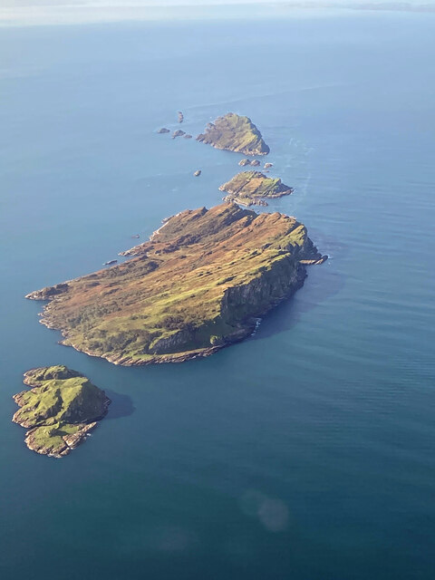
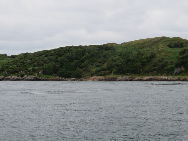
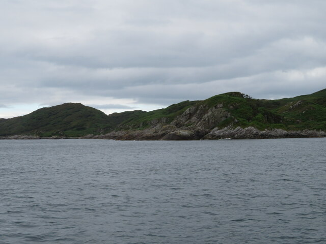
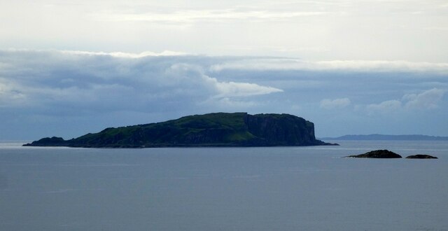
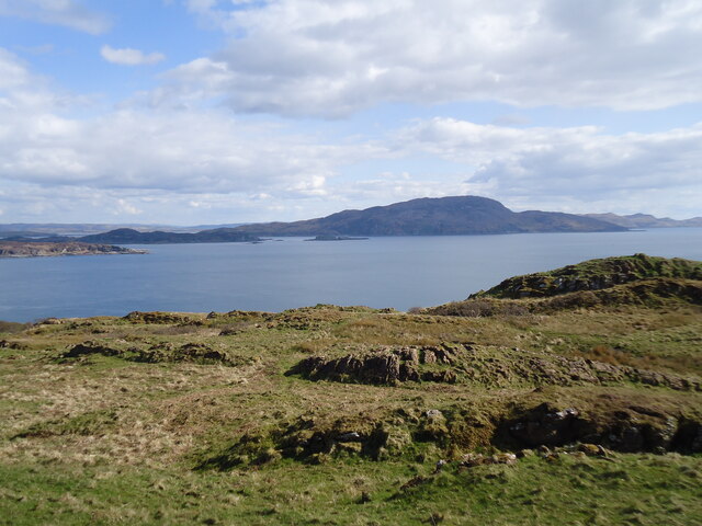
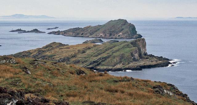
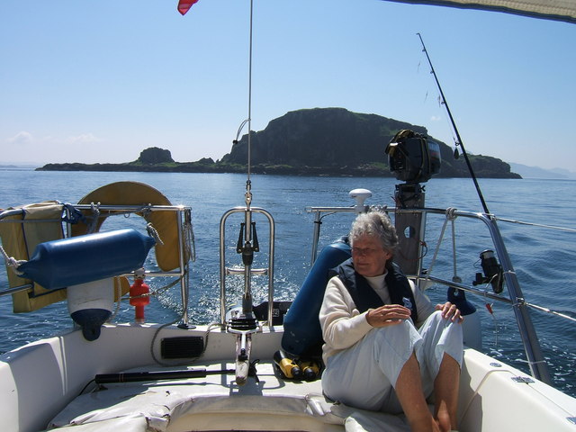
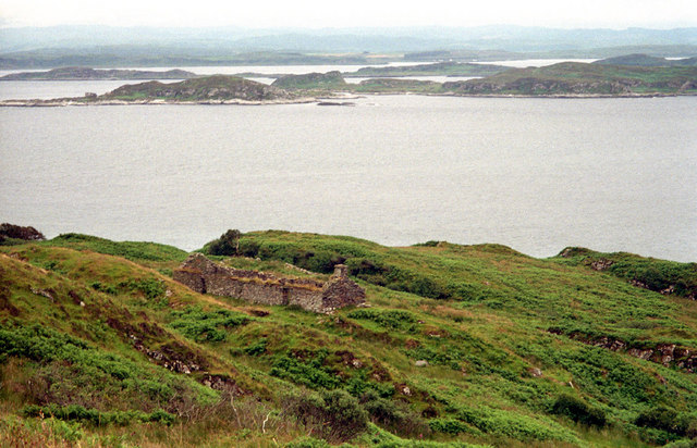
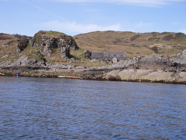
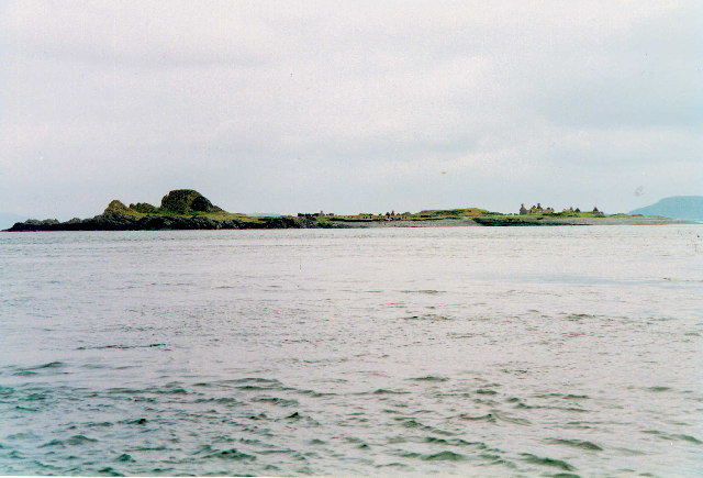
Bealach an Tarabairt is a prominent coastal headland located in Argyllshire, Scotland. Situated on the west coast of Scotland, it extends into the Atlantic Ocean, providing breathtaking views and a strategic position overlooking the surrounding coastline.

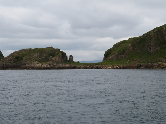
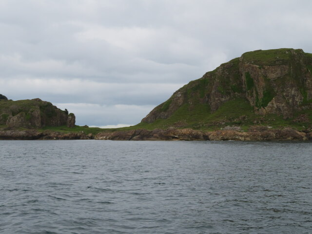
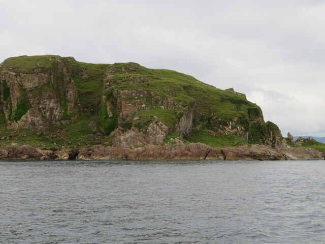
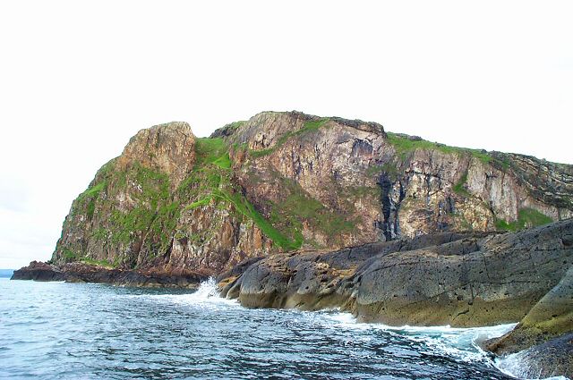
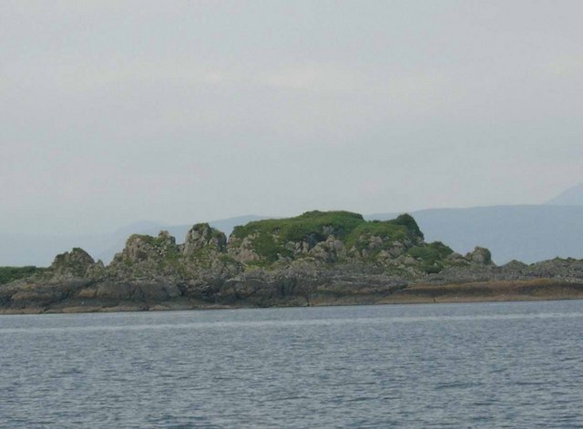
This headland is characterized by its rugged and rocky terrain, which is typical of the Scottish coastline. The cliffs that make up Bealach an Tarabairt rise steeply from the sea, creating a dramatic and picturesque landscape. The headland is composed of various rock types, including sandstone and granite, which have been shaped by the relentless forces of erosion over millennia.

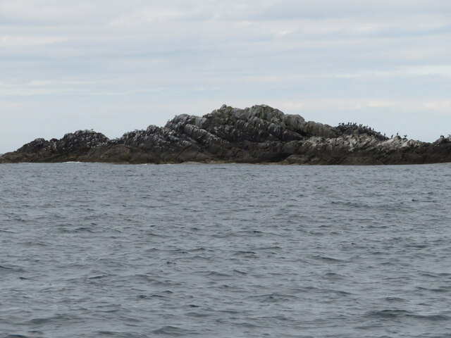
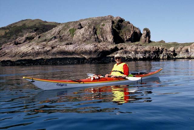
The headland offers a diverse range of habitats, making it a haven for wildlife. Seabirds, such as puffins, guillemots, and razorbills, nest on the cliffs, while seals can often be seen basking on the rocks below. The surrounding waters are also home to a rich variety of marine life, including dolphins, porpoises, and even occasional sightings of whales.

Bealach an Tarabairt is a popular destination for outdoor enthusiasts and nature lovers. The headland offers opportunities for hiking and walking, with several well-marked trails that wind their way along the cliffs, providing stunning panoramic views of the surrounding coastline and the distant islands. The headland is also a favored spot for birdwatching, with many visitors coming to observe the diverse avian species that inhabit the area.

In conclusion, Bealach an Tarabairt is a captivating and ecologically important headland in Argyllshire, Scotland. Its rugged beauty, diverse wildlife, and breathtaking views make it a must-visit destination for anyone exploring the region.

If you have any feedback on the listing, please let us know in the comments section below.

Bealach an Tarabairt Images

Images are sourced within 2km of 56.24523/-5.7689261 or Grid Reference NM6612. Thanks to Geograph Open Source API. All images are credited.

The Garvellachs Seen from around 3,000ft altitude.
The Garvellachs
Seen from around 3,000ft altitude.
Dùn Chonnuill A small island just north of Garbh Eileach, the largest of the Garvellachs.
Dùn Chonnuill
A small island just north of Garbh Eileach, the largest of the Garvellachs.
Dùn Chonnuill Approaching this small island just off Garbh Eileach.
Dùn Chonnuill
Approaching this small island just off Garbh Eileach.
Dùn Chonnuill The northern tip of the Garvellachs.
Dùn Chonnuill
The northern tip of the Garvellachs.
Deciduous woodland on Garbh Eileach A rare patch of woodland on the Garvellachs in the Firth of Lorn.
Deciduous woodland on Garbh Eileach
A rare patch of woodland on the Garvellachs in the Firth of Lorn.
Deciduous woodland on Garbh Eileach A rare patch of woodland on the Garvellachs in the Firth of Lorn.
Deciduous woodland on Garbh Eileach
A rare patch of woodland on the Garvellachs in the Firth of Lorn.
Sgeir nam Marag A skerry, east of Eileach an Naoimh and south of A' Chùli, in the Garvellachs with perching Shags. Its location can be seen in <a href="https://www.geograph.org.uk/photo/4518586">NM6410 : Eileach an Naoimh</a>, the dark skerry at mid-right.
Sgeir nam Marag
A skerry, east of Eileach an Naoimh and south of A' Chùli, in the Garvellachs with perching Shags. Its location can be seen in NM6410 : Eileach an Naoimh, the dark skerry at mid-right.
Garbh Eileach from Easdale The island of Garbh Eileach, the largest of the Garvellachs as seen from the top of the hill on Easdale. The two little rocks to the right of the image are <a href="https://www.geograph.org.uk/photo/7259874">NM7014 : Dubh-fhèith islets from Easdale</a>
Garbh Eileach is a reasonably large island at 142ha (351 acres = 0.55 mile²) its highest point is 110m (361') near the north coast. It is an uninhabited island but the presence of a burial ground attests to its former population.
Garbh Eileach from Easdale
The island of Garbh Eileach, the largest of the Garvellachs as seen from the top of the hill on Easdale. The two little rocks to the right of the image are NM7014 : Dubh-fhèith islets from Easdale Garbh Eileach is a reasonably large island at 142ha (351 acres = 0.55 mile²) its highest point is 110m (361') near the north coast. It is an uninhabited island but the presence of a burial ground attests to its former population.
The summit region of Garbh Eileach Looking just east of south across the Firth of Lorn.

To the left (in shadow) is Lunga, with the small island of Guirasdeal on its right. The large island dominating the photo is Scarba, and part of north Jura can be seen on the right.
The summit region of Garbh Eileach
Looking just east of south across the Firth of Lorn. To the left (in shadow) is Lunga, with the small island of Guirasdeal on its right. The large island dominating the photo is Scarba, and part of north Jura can be seen on the right.
Garvellachs The northern face of this group of islands.
Garvellachs
The northern face of this group of islands.
Garvellachs The islands viewed from the NE. These islands are in the Firth of Lorn that separates Mull from the mainland.
Garvellachs
The islands viewed from the NE. These islands are in the Firth of Lorn that separates Mull from the mainland.
The Garvellachs
The Garvellachs
Garvellachs shepherd's Bothy
Sgeir nam Maraig
Sgeir nam Maraig
Garbh Eileach On the low hill on Garbh Eileach.
Garbh Eileach
On the low hill on Garbh Eileach.
Dun Chonnuill Dun Chonnuill (Connel's Castle) the eastern most island of the Garvellachs
Dun Chonnuill
Dun Chonnuill (Connel's Castle) the eastern most island of the Garvellachs
Dùn Chonnuill Sea kayaking around the Garvellachs.
Dùn Chonnuill
Sea kayaking around the Garvellachs.
Croft House ruin on Garbh Eileach A deserted croft house on the northeast slopes of Garbh Eileach. It has a glorious view out over the Slate Isles. A view now only enjoyed by deer - and the occasional tourist.
Croft House ruin on Garbh Eileach
A deserted croft house on the northeast slopes of Garbh Eileach. It has a glorious view out over the Slate Isles. A view now only enjoyed by deer - and the occasional tourist.
Show me another place!

Bealach an Tarabairt is located at Grid Ref: NM6612 (Lat: 56.24523, Lng: -5.7689261)

Unitary Authority: Argyll and Bute

Police Authority: Argyll and West Dunbartonshire

What 3 Words

///jets.spells.sized. Near Lochbuie, Argyll & Bute

Related Wikis

Garbh Eileach

Garbh Eileach is an uninhabited island in the Inner Hebrides of the west coast of Scotland. It is the largest of the Garvellachs and lies in the Firth...

Dùn Chonnuill

Dùn Chonnuill is a small island in the Garvellachs in the Firth of Lorn, Scotland. Dùn Chonnuill lies north east of Garbh Eileach, the largest of the archipelago...

Garvellachs

The Garvellachs (Scottish Gaelic: Garbh Eileaich) or Isles of the Sea form a small archipelago in the Inner Hebrides of Scotland. Part of the Argyll and...

Eileach an Naoimh

Eileach an Naoimh, also known as Holy Isle, is an uninhabited island in the Inner Hebrides of the west coast of Scotland. It is the southernmost of the...

Eilean Dubh Mòr

Eilean Dubh Mòr (Scottish Gaelic: big black island) is an uninhabited island in the Inner Hebrides of Scotland. It lies at the mouth of the Firth of Lorn...

Belnahua

Belnahua is one of the Slate Islands, in the Firth of Lorn in Scotland, known for its deserted slate quarries. The bedrock that underpins its human history...

Lunga, Firth of Lorn

Lunga is one of the Slate Islands in the Firth of Lorn in Argyll and Bute, Scotland. The "Grey Dog" tidal race, which runs in the sea channel to the south...

Scarba, Lunga and the Garvellachs National Scenic Area

Scarba, Lunga and the Garvellachs is the name of one of the 40 national scenic areas of Scotland. The designated area covers the islands of Scarba, Lunga...

Nearby Amenities

Located within 500m of 56.24523,-5.7689261
Created By: dmgroom_coastlines
Source: PGS
Lat/Long: 56.242448/-5.774851
Created By: dmgroom_coastlines
Source: PGS
Lat/Long: 56.242709/-5.77464
Created By: dmgroom_coastlines
Source: PGS
Lat/Long: 56.243486/-5.774237
Created By: dmgroom_coastlines
Source: PGS
Lat/Long: 56.243752/-5.773796
Created By: dmgroom_coastlines
Source: PGS
Lat/Long: 56.244269/-5.773602
Created By: dmgroom_coastlines
Source: PGS
Lat/Long: 56.244407/-5.773152
Created By: dmgroom_coastlines
Source: PGS
Lat/Long: 56.244673/-5.772711
Created By: dmgroom_coastlines
Source: PGS
Lat/Long: 56.244939/-5.77227
Created By: dmgroom_coastlines
Source: PGS
Lat/Long: 56.245215/-5.77137
Created By: dmgroom_coastlines
Source: PGS
Lat/Long: 56.245481/-5.770929
Created By: dmgroom_coastlines
Source: PGS
Lat/Long: 56.245748/-5.770488
Created By: dmgroom_coastlines
Source: PGS
Lat/Long: 56.246013/-5.770048
Created By: dmgroom_coastlines
Source: PGS
Lat/Long: 56.246162/-5.769138
Created By: dmgroom_coastlines
Source: PGS
Lat/Long: 56.245651/-5.769101
Created By: dmgroom_coastlines
Source: PGS
Lat/Long: 56.245661/-5.768642
Created By: dmgroom_coastlines
Source: PGS
Lat/Long: 56.246173/-5.768679
Created By: dmgroom_coastlines
Source: PGS
Lat/Long: 56.246607/-5.76641
Created By: dmgroom_coastlines
Source: PGS
Lat/Long: 56.246873/-5.765969
Created By: dmgroom_coastlines
Source: PGS
Lat/Long: 56.247139/-5.765528
Created By: dmgroom_coastlines
Source: PGS
Lat/Long: 56.247405/-5.765087
Created By: dmgroom_coastlines
Source: PGS
Lat/Long: 56.247702/-5.763268
The data included in this document is from www.openstreetmap.org. The data is made available under ODbL.

Have you been to Bealach an Tarabairt?

Leave your review of Bealach an Tarabairt below (or comments, questions and feedback).