Garbh Eileach
Island in Argyllshire
Scotland
Garbh Eileach
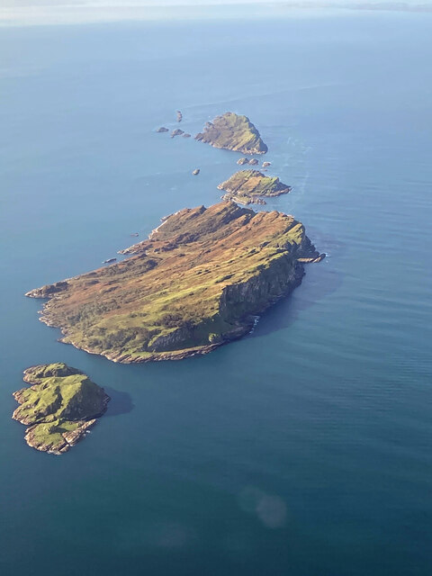
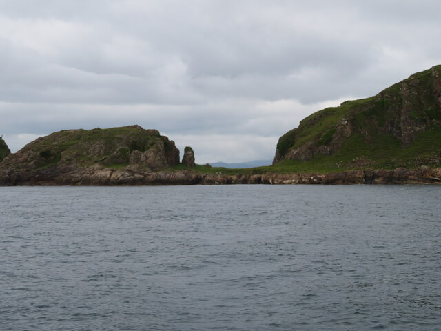
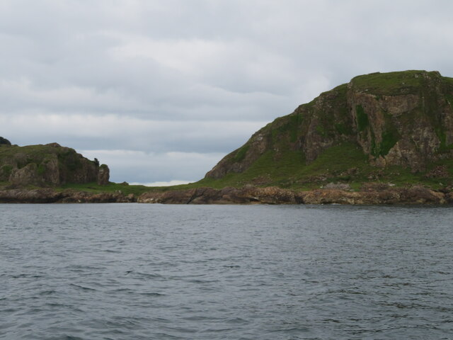
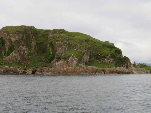
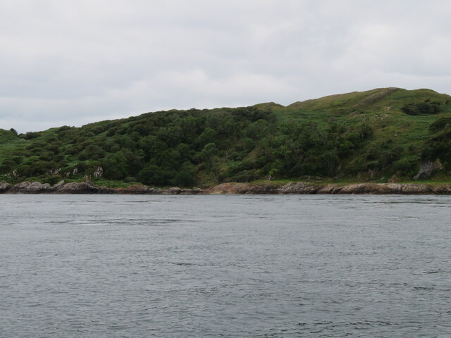
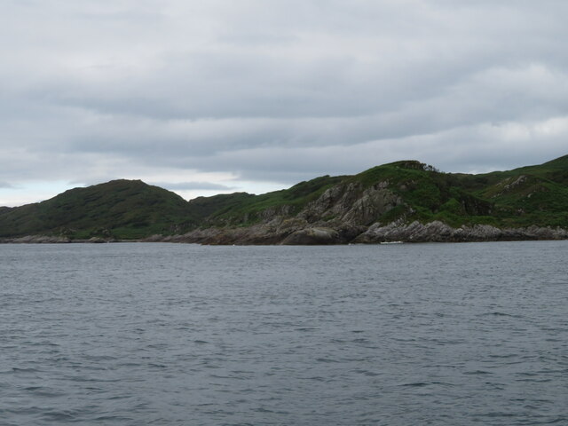
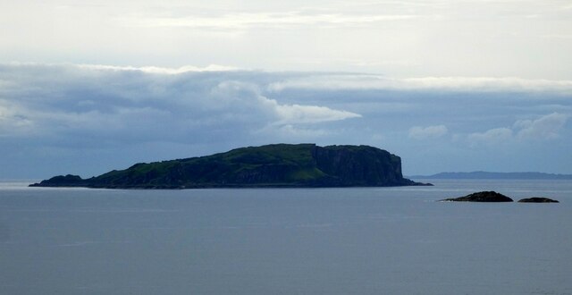
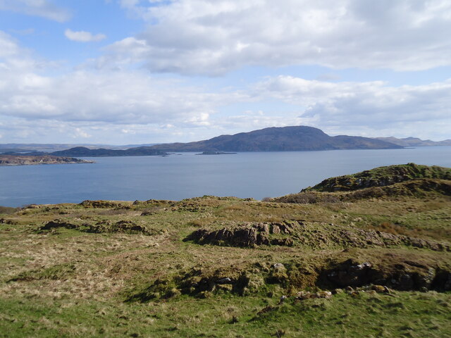
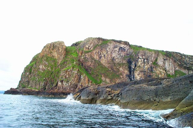
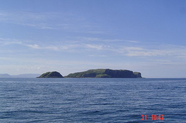
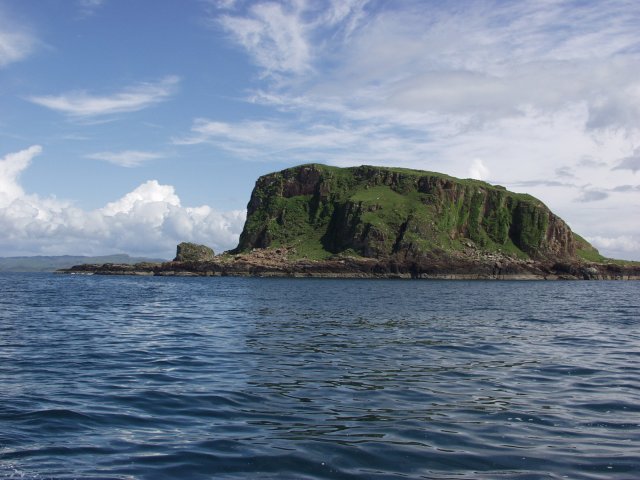
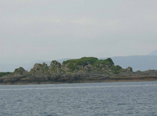
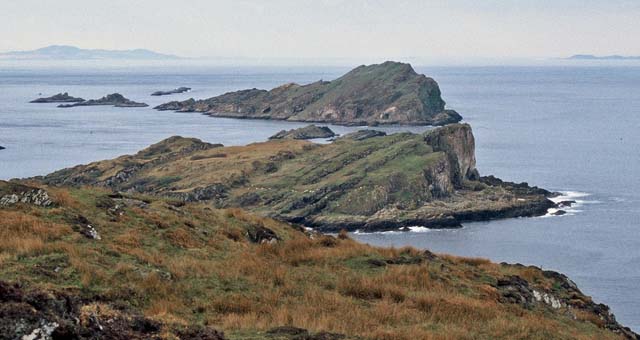
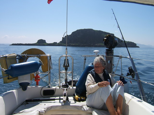
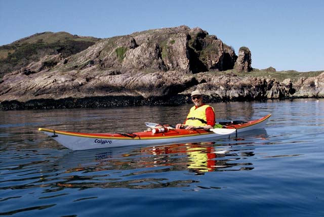
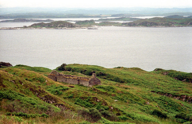
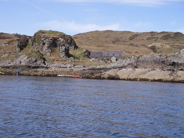
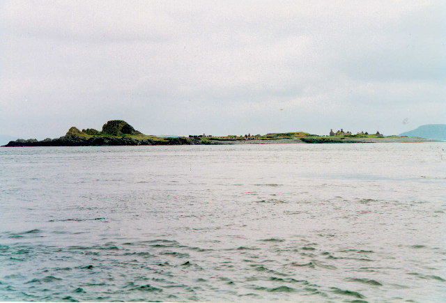
Garbh Eileach, located in Argyllshire, is a small uninhabited island situated off the west coast of Scotland. It forms part of the Garvellachs archipelago and is known for its rugged beauty and rich historical significance. With an area of about 60 acres, Garbh Eileach is characterized by its steep cliffs, rocky terrain, and lush vegetation.
The island boasts a fascinating history dating back to prehistoric times. It is home to the ruins of a medieval monastery, believed to have been founded by St. Brendan in the 6th century. The remains of a chapel, graveyard, and other structures can still be seen, offering visitors a glimpse into the island's spiritual past. Additionally, there are numerous ancient carved stones scattered across the island, further adding to its historical allure.
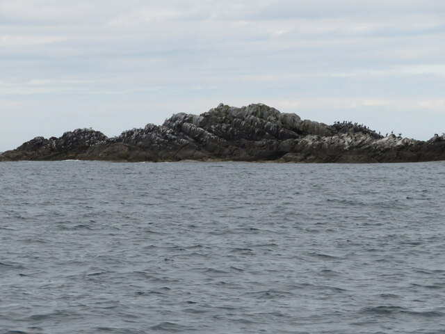
Nature enthusiasts will find Garbh Eileach a haven for wildlife and flora. Its cliffs provide nesting sites for seabirds like puffins, razorbills, and guillemots, while grey seals can often be spotted basking on the rocks. The island's vegetation consists of heather, grasses, and wildflowers, creating a picturesque landscape.
Due to its remote location, Garbh Eileach can only be accessed by boat, adding to its untouched charm. The island offers a sense of tranquility and solitude, making it a popular destination for those seeking a peaceful getaway or avid photographers looking to capture its natural beauty.
Overall, Garbh Eileach is a captivating island that combines history, nature, and serenity in one unique package. Its rugged landscapes, ancient ruins, and abundant wildlife make it a must-visit destination for anyone exploring the Scottish coastline.
If you have any feedback on the listing, please let us know in the comments section below.
Garbh Eileach Images
Images are sourced within 2km of 56.243336/-5.7638306 or Grid Reference NM6612. Thanks to Geograph Open Source API. All images are credited.

Garbh Eileach is located at Grid Ref: NM6612 (Lat: 56.243336, Lng: -5.7638306)
Unitary Authority: Argyll and Bute
Police Authority: Argyll and West Dunbartonshire
What 3 Words
///flank.shelter.interviewer. Near Lochbuie, Argyll & Bute
Nearby Locations
Related Wikis
Garbh Eileach
Garbh Eileach is an uninhabited island in the Inner Hebrides of the west coast of Scotland. It is the largest of the Garvellachs and lies in the Firth...

Dùn Chonnuill
Dùn Chonnuill is a small island in the Garvellachs in the Firth of Lorn, Scotland. Dùn Chonnuill lies north east of Garbh Eileach, the largest of the archipelago...
Garvellachs
The Garvellachs (Scottish Gaelic: Garbh Eileaich) or Isles of the Sea form a small archipelago in the Inner Hebrides of Scotland. Part of the Argyll and...

Eilean Dubh Mòr
Eilean Dubh Mòr (Scottish Gaelic: big black island) is an uninhabited island in the Inner Hebrides of Scotland. It lies at the mouth of the Firth of Lorn...

Eileach an Naoimh
Eileach an Naoimh, also known as Holy Isle, is an uninhabited island in the Inner Hebrides of the west coast of Scotland. It is the southernmost of the...
Belnahua
Belnahua is one of the Slate Islands, in the Firth of Lorn in Scotland, known for its deserted slate quarries. The bedrock that underpins its human history...
Lunga, Firth of Lorn
Lunga is one of the Slate Islands in the Firth of Lorn in Argyll and Bute, Scotland. The "Grey Dog" tidal race, which runs in the sea channel to the south...

Scarba, Lunga and the Garvellachs National Scenic Area
Scarba, Lunga and the Garvellachs is the name of one of the 40 national scenic areas of Scotland. The designated area covers the islands of Scarba, Lunga...
Related Videos
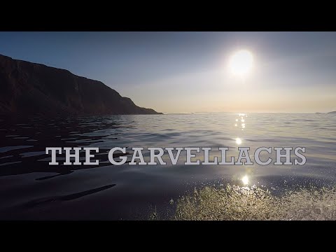
Garvellachs Part 1
It was almost the end of September ..and the forecast indicated a few days on "Indian Summer" so I took the boat back to the Oban ...
Garvellachs Part 2
In this Video I travel to Loch Buie on Mull before returning to the Garvallach Islands then explore the Black Islands and the Slate ...
Nearby Amenities
Located within 500m of 56.243336,-5.7638306Have you been to Garbh Eileach?
Leave your review of Garbh Eileach below (or comments, questions and feedback).