An Liath-chreag

Coastal Feature, Headland, Point in Inverness-shire

Scotland

An Liath-chreag

Forest at Egnaig
Forest at Egnaig Credit: Rick Adam

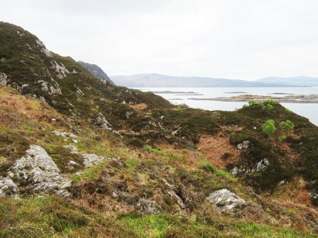
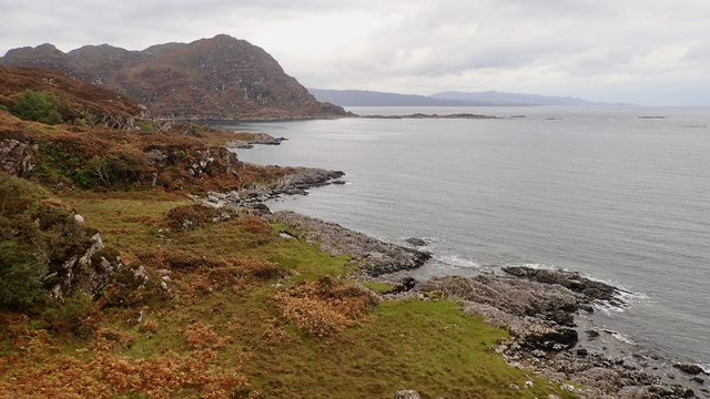
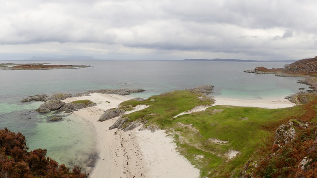
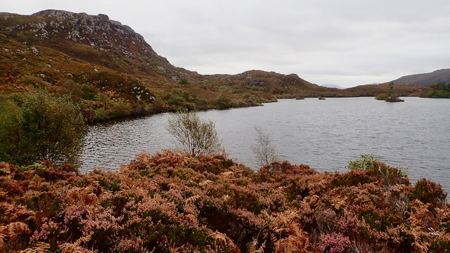
An Liath-chreag is a prominent coastal feature located in Inverness-shire, Scotland. Situated on the western coast, it is a stunning headland that extends into the North Atlantic Ocean, forming a distinct point jutting out into the sea. The name "An Liath-chreag" is derived from Scottish Gaelic, meaning "the grey rock," which aptly describes the rugged and weathered appearance of the headland.

The headland is characterized by its towering cliffs that reach heights of up to 100 meters, offering breathtaking panoramic views of the surrounding landscape. These cliffs are composed of ancient rock formations, showcasing layers of sedimentary rocks that date back millions of years, providing valuable insights into the region's geological history.

An Liath-chreag is also known for its diverse wildlife. The surrounding waters are home to numerous marine species, including seals, dolphins, and various seabirds, making it a popular spot for wildlife enthusiasts and birdwatchers. In addition, the headland's vegetation is rich and varied, with hardy plants and grasses clinging to the cliffs, adding to the area's natural beauty.

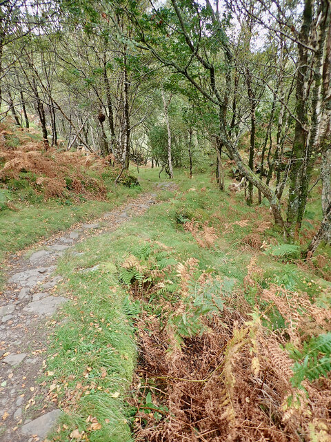
Visitors to An Liath-chreag can explore the headland via several walking trails that wind along its edges, offering stunning views of the dramatic coastline. It is advisable to exercise caution when venturing close to the cliff edges, as they can be perilous due to their sheer drop-offs.

Overall, An Liath-chreag is a captivating coastal feature in Inverness-shire, offering a combination of breathtaking scenery, geological significance, and abundant wildlife. Whether it is for its natural beauty or scientific value, this headland is a must-visit destination for nature lovers and outdoor enthusiasts alike.

If you have any feedback on the listing, please let us know in the comments section below.

An Liath-chreag Images

Images are sourced within 2km of 56.809081/-5.8541809 or Grid Reference NM6475. Thanks to Geograph Open Source API. All images are credited.

Forest at Egnaig
Forest at Egnaig
Ruin at Egnaig
Ruin at Egnaig
White Sands Beach The beautiful, remote beach reached from the small township of Smirisary.
White Sands Beach
The beautiful, remote beach reached from the small township of Smirisary.
Smirisary path A rocky section of the footpath between Smirisary and the remote sandy beach at Eilean Coille. It is actually one of the easier sections, as the extremely wet ground means the 'grassy path' has become braided bog. A rewarding walk with stunning views of the Small Isles.
Smirisary path
A rocky section of the footpath between Smirisary and the remote sandy beach at Eilean Coille. It is actually one of the easier sections, as the extremely wet ground means the 'grassy path' has become braided bog. A rewarding walk with stunning views of the Small Isles.
Ruin at Smirisary There are several roofed and habitable cottages here, but also a few ruins where crofters once lived.
Ruin at Smirisary
There are several roofed and habitable cottages here, but also a few ruins where crofters once lived.
Cottage at Smirisary A croft cottage in a good state of repair, this one being nearest to the shoreline in the remote little community of Smirisary.
Cottage at Smirisary
A croft cottage in a good state of repair, this one being nearest to the shoreline in the remote little community of Smirisary.
This way to the beach? I note that other contributors, more intrepid than me, have made their way to the white sand beach to the south of Smirisary, but this was about as far as I got having decided that boots full of water and peat were not really an option. The path is certainly challenging in places, mainly due to poor drainage.
This way to the beach?
I note that other contributors, more intrepid than me, have made their way to the white sand beach to the south of Smirisary, but this was about as far as I got having decided that boots full of water and peat were not really an option. The path is certainly challenging in places, mainly due to poor drainage.
Eilean Shona A very attractive tidal island seen from the South Channel of Loch Moidart. Taken before returning along the shore of Shona Beag (same island, different estate) to avoid the fast tidal stream between here and Riska on the ebb.
Eilean Shona
A very attractive tidal island seen from the South Channel of Loch Moidart. Taken before returning along the shore of Shona Beag (same island, different estate) to avoid the fast tidal stream between here and Riska on the ebb.
Old path descending woods from Shona Beag Old 6-inch maps show a path crossing Shona Beag. Mostly not obvious on the ground,  but it is visible and helpful for much of the steep slope to Eilean Shona.
Old path descending woods from Shona Beag
Old 6-inch maps show a path crossing Shona Beag. Mostly not obvious on the ground, but it is visible and helpful for much of the steep slope to Eilean Shona.
Eilean Coille
Eilean Coille
Rubha nan Clach Dearga
Port Achadh an Aonaich
Walled enclosure, Port Achadh an Aonaich
Ruined boathouse, Loch na Bairness
Loch na Bairness
Loch na Bairness
Smirisary
Smirisary
Path to Smirisary
Path to Smirisary
Port na Pollaig
Port na Pollaig
Show me another place!

An Liath-chreag is located at Grid Ref: NM6475 (Lat: 56.809081, Lng: -5.8541809)

Unitary Authority: Highland

Police Authority: Highlands and Islands

What 3 Words

///shine.taller.rewarding. Near Arisaig, Highland

Related Wikis

Eilean Shona

Eilean Shona (Scottish Gaelic: Eilean Seòna) is a tidal island in Loch Moidart, Scotland. The modern name may be from the Old Norse for "sea island". The...

Castle Tioram

Castle Tioram (; Scottish Gaelic: Caisteal Tioram, meaning "dry castle") is a ruined castle that sits on the tidal island Eilean Tioram in Loch Moidart...

Glenuig

Glenuig ( glen-OO-ig, Scottish Gaelic: Ghlìnn-Ùige) is a small village in Moidart, Lochaber, Highland, on the west coast of Scotland. It is around 30 miles...

Loch Moidart

Loch Moidart is a sea loch (sea inlet) in the district of Moidart in Highland, Scotland. It is on the west coast of Scotland, and runs about 8 km (5 miles...

Nearby Amenities

Located within 500m of 56.809081,-5.8541809
Created By: dmgroom_coastlines
Source: PGS
Lat/Long: 56.806144/-5.859819
Created By: dmgroom_coastlines
Source: PGS
Lat/Long: 56.806661/-5.859625
Source: PGS
Lat/Long: 56.8071595/-5.8590156
Source: PGS
Lat/Long: 56.8076295/-5.8583485
Created By: dmgroom_coastlines
Source: PGS
Lat/Long: 56.807732/-5.857605
Source: PGS
Lat/Long: 56.8080226/-5.8575471
Created By: dmgroom_coastlines
Source: PGS
Lat/Long: 56.80982/-5.8615
Created By: dmgroom_coastlines
Source: PGS
Lat/Long: 56.809698/-5.861258
Source: PGS
Lat/Long: 56.8094978/-5.8609904
Source: PGS
Lat/Long: 56.8093308/-5.8604739
Source: PGS
Lat/Long: 56.8093067/-5.8602406
Created By: dmgroom_coastlines
Source: PGS
Lat/Long: 56.809096/-5.859577
Created By: dmgroom_coastlines
Source: PGS
Lat/Long: 56.808872/-5.858159
Created By: dmgroom_coastlines
Source: PGS
Lat/Long: 56.808659/-5.856274
Created By: dmgroom_coastlines
Source: PGS
Lat/Long: 56.808537/-5.856033
Created By: dmgroom_coastlines
Source: PGS
Lat/Long: 56.808414/-5.855789
Source: PGS
Lat/Long: 56.8080789/-5.8535951
Source: PGS
Lat/Long: 56.8081508/-5.8526652
Source: PGS
Lat/Long: 56.8079861/-5.8522076
Source: PGS
Lat/Long: 56.8078197/-5.8518977
Source: PGS
Lat/Long: 56.8076038/-5.8517172
Source: PGS
Lat/Long: 56.8074894/-5.8513763
Source: PGS
Lat/Long: 56.8073989/-5.8510421
Source: PGS
Lat/Long: 56.8070817/-5.8502287
Source: PGS
Lat/Long: 56.8070463/-5.8500687
Source: PGS
Lat/Long: 56.8070075/-5.8498232
Source: PGS
Lat/Long: 56.8069405/-5.8496179
Source: PGS
Lat/Long: 56.8067016/-5.8489146
The data included in this document is from www.openstreetmap.org. The data is made available under ODbL.

Have you been to An Liath-chreag?

Leave your review of An Liath-chreag below (or comments, questions and feedback).