Rubha nan Clach Dearga

Coastal Feature, Headland, Point in Inverness-shire

Scotland

Rubha nan Clach Dearga

The path to Smirisary
The path to Smirisary Credit: Gordon Brown

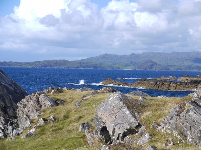
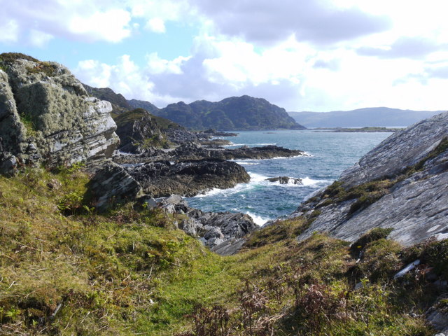
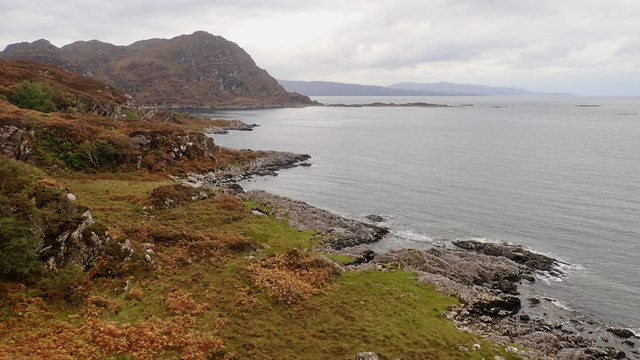
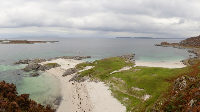
Rubha nan Clach Dearga is a prominent coastal feature located in Inverness-shire, Scotland. It is a headland that extends into the North Atlantic Ocean, forming a distinctive point along the rugged coastline. The name "Rubha nan Clach Dearga" translates to "Headland of the Red Rocks" in Scottish Gaelic, which accurately describes its characteristic red-colored rock formations.

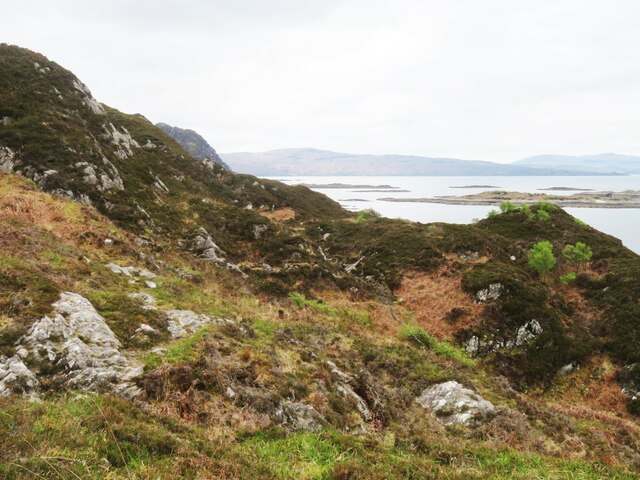
The headland is situated within the larger geographical area known as Inverness-shire, which is renowned for its picturesque landscapes and stunning coastal scenery. Rubha nan Clach Dearga offers breathtaking views of the surrounding sea and the nearby mountains, making it a popular destination for nature enthusiasts and photographers.

The red rocks that give the headland its name are made of sandstone and have been shaped by centuries of erosion from the crashing waves and strong coastal winds. They create a striking contrast against the deep blue waters of the Atlantic Ocean, adding to the area's natural beauty.

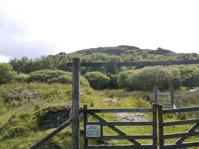
Access to Rubha nan Clach Dearga is relatively easy, with a well-maintained footpath leading visitors to the headland. The path meanders through heathland and grassy slopes, offering glimpses of wildflowers and native wildlife along the way. Once at the headland, visitors can explore the rugged cliffs, take in the panoramic views, and perhaps even spot seals or seabirds that frequent the area.

Overall, Rubha nan Clach Dearga is a captivating coastal feature in Inverness-shire, offering visitors a chance to experience the rugged beauty of Scotland's coastline and immerse themselves in its rich natural heritage.

If you have any feedback on the listing, please let us know in the comments section below.

Rubha nan Clach Dearga Images

Images are sourced within 2km of 56.812116/-5.8661979 or Grid Reference NM6475. Thanks to Geograph Open Source API. All images are credited.

The path to Smirisary
The coast at Smirisary
Rocky shore at Smirisary Over the sea, the island of Eigg (with its Sgurr) and Rum behind.
Rocky shore at Smirisary
Over the sea, the island of Eigg (with its Sgurr) and Rum behind.
Control your dog! Warning notice on the gate approaching the remote hamlet of Smirisary.
Control your dog!
Warning notice on the gate approaching the remote hamlet of Smirisary.
White Sands Beach The beautiful, remote beach reached from the small township of Smirisary.
White Sands Beach
The beautiful, remote beach reached from the small township of Smirisary.
Smirisary path A rocky section of the footpath between Smirisary and the remote sandy beach at Eilean Coille. It is actually one of the easier sections, as the extremely wet ground means the 'grassy path' has become braided bog. A rewarding walk with stunning views of the Small Isles.
Smirisary path
A rocky section of the footpath between Smirisary and the remote sandy beach at Eilean Coille. It is actually one of the easier sections, as the extremely wet ground means the 'grassy path' has become braided bog. A rewarding walk with stunning views of the Small Isles.
Ruin at Smirisary There are several roofed and habitable cottages here, but also a few ruins where crofters once lived.
Ruin at Smirisary
There are several roofed and habitable cottages here, but also a few ruins where crofters once lived.
Cottage at Smirisary A croft cottage in a good state of repair, this one being nearest to the shoreline in the remote little community of Smirisary.
Cottage at Smirisary
A croft cottage in a good state of repair, this one being nearest to the shoreline in the remote little community of Smirisary.
Smirisary A view across the lower part of this isolated former crofting settlement. A beautifully written book by Margaret Leigh ['Spade Among the Rushes'] tells of life here in the 1940's. Margaret lived in the white house in the foreground, where the present owner has proved that you can grow plants and vegetables in your garden if you can keep the deer out. A small wind turbine and solar panels help to supply power, but it is still a lengthy trek to the Glenuig shop or pub. Much of the land here was once cultivated, but has gradually returned to nature with rushes and bog taking over land that could be drained. The path to the settlement divides near the top of the hill [edge of grid square] and although the left hand path looks the more obvious, that to the right is better and leads down to this cottage.
Smirisary
A view across the lower part of this isolated former crofting settlement. A beautifully written book by Margaret Leigh ['Spade Among the Rushes'] tells of life here in the 1940's. Margaret lived in the white house in the foreground, where the present owner has proved that you can grow plants and vegetables in your garden if you can keep the deer out. A small wind turbine and solar panels help to supply power, but it is still a lengthy trek to the Glenuig shop or pub. Much of the land here was once cultivated, but has gradually returned to nature with rushes and bog taking over land that could be drained. The path to the settlement divides near the top of the hill [edge of grid square] and although the left hand path looks the more obvious, that to the right is better and leads down to this cottage.
This way to the beach? I note that other contributors, more intrepid than me, have made their way to the white sand beach to the south of Smirisary, but this was about as far as I got having decided that boots full of water and peat were not really an option. The path is certainly challenging in places, mainly due to poor drainage.
This way to the beach?
I note that other contributors, more intrepid than me, have made their way to the white sand beach to the south of Smirisary, but this was about as far as I got having decided that boots full of water and peat were not really an option. The path is certainly challenging in places, mainly due to poor drainage.
Eilean Coille
Eilean Coille
Rubha nan Clach Dearga
Port Achadh an Aonaich
Walled enclosure, Port Achadh an Aonaich
Ruined boathouse, Loch na Bairness
Loch na Bairness
Loch na Bairness
Show me another place!

Rubha nan Clach Dearga is located at Grid Ref: NM6475 (Lat: 56.812116, Lng: -5.8661979)

Unitary Authority: Highland

Police Authority: Highlands and Islands

What 3 Words

///domain.lunged.spilled. Near Arisaig, Highland

Related Wikis

Eilean Shona

Eilean Shona (Scottish Gaelic: Eilean Seòna) is a tidal island in Loch Moidart, Scotland. The modern name may be from the Old Norse for "sea island". The...

Glenuig

Glenuig ( glen-OO-ig, Scottish Gaelic: Ghlìnn-Ùige) is a small village in Moidart, Lochaber, Highland, on the west coast of Scotland. It is around 30 miles...

Castle Tioram

Castle Tioram (; Scottish Gaelic: Caisteal Tioram, meaning "dry castle") is a ruined castle that sits on the tidal island Eilean Tioram in Loch Moidart...

Sound of Arisaig

The Sound of Arisaig Lochaber, Scotland, separates the Arisaig peninsula to the north from the Moidart peninsula to the south. At the eastern, landward...

Nearby Amenities

Located within 500m of 56.812116,-5.8661979
Source: PGS
Lat/Long: 56.8086623/-5.8714579
Source: PGS
Lat/Long: 56.8078799/-5.8680998
Created By: dmgroom_coastlines
Source: PGS
Lat/Long: 56.816527/-5.865048
Source: PGS
Lat/Long: 56.8161604/-5.8644503
Created By: dmgroom_coastlines
Source: PGS
Lat/Long: 56.815504/-5.86497
Created By: dmgroom_coastlines
Source: PGS
Lat/Long: 56.814993/-5.864931
Created By: dmgroom_coastlines
Source: PGS
Lat/Long: 56.81422/-5.865105
Source: PGS
Lat/Long: 56.814105/-5.8654362
Source: PGS
Lat/Long: 56.8138433/-5.8654856
Created By: dmgroom_coastlines
Source: PGS
Lat/Long: 56.813437/-5.865747
Created By: dmgroom_coastlines
Source: PGS
Lat/Long: 56.813171/-5.866193
Created By: dmgroom_coastlines
Source: PGS
Lat/Long: 56.812904/-5.86664
Created By: dmgroom_coastlines
Source: PGS
Lat/Long: 56.812643/-5.866853
Source: PGS
Lat/Long: 56.8123401/-5.8670769
Rubha nan Clach Dearga
Natural: cape
Source: PGS
Lat/Long: 56.8120774/-5.8671897
Source: PGS
Lat/Long: 56.8114882/-5.8667959
Source: PGS
Lat/Long: 56.8113065/-5.8664446
Source: PGS
Lat/Long: 56.8111727/-5.8661597
Source: PGS
Lat/Long: 56.8109546/-5.8655688
Source: PGS
Lat/Long: 56.8106907/-5.8651317
Source: PGS
Lat/Long: 56.8105372/-5.8640571
Source: PGS
Lat/Long: 56.8103501/-5.8629334
Created By: dmgroom_coastlines
Source: PGS
Lat/Long: 56.80982/-5.8615
Created By: dmgroom_coastlines
Source: PGS
Lat/Long: 56.809698/-5.861258
Source: PGS
Lat/Long: 56.8094978/-5.8609904
Source: PGS
Lat/Long: 56.8093308/-5.8604739
Source: PGS
Lat/Long: 56.8093067/-5.8602406
The data included in this document is from www.openstreetmap.org. The data is made available under ODbL.

Have you been to Rubha nan Clach Dearga?

Leave your review of Rubha nan Clach Dearga below (or comments, questions and feedback).