Sgiath Mhòr

Coastal Feature, Headland, Point in Argyllshire

Scotland

Sgiath Mhòr

Rocks and Seaweed at Aros The remains of Aros Castle are on the headland.
Wikipedia says this about it. "Aros Castle, also known as Dounarwyse Castle, is a ruined 13th-century castle near Salen on the Isle of Mull, Scotland. The castle overlooks the Sound of Mull. The castle was initially a stronghold of the Clan MacDougall."
Rocks and Seaweed at Aros Credit: Des Blenkinsopp

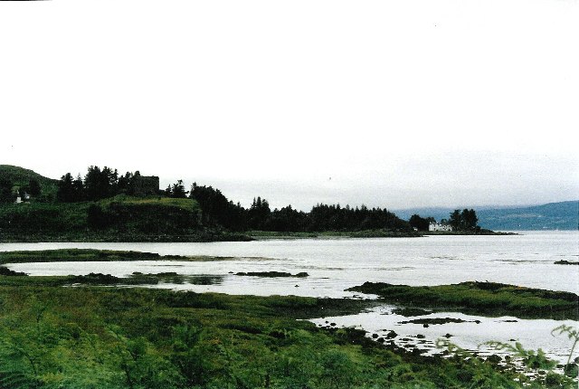
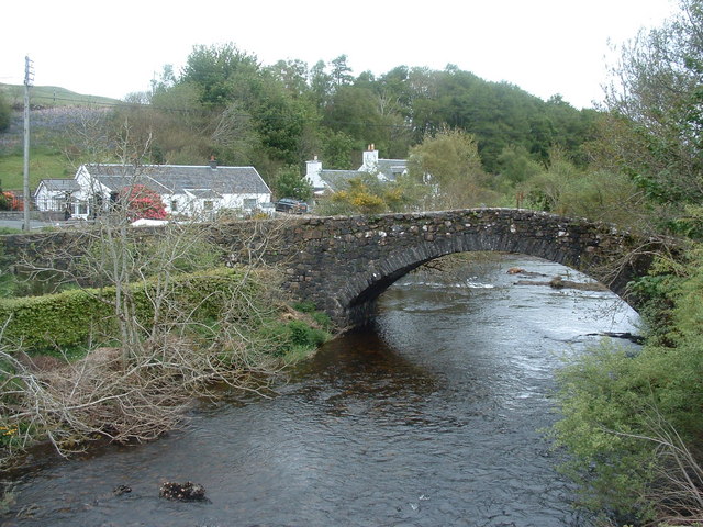
Sgiath Mhòr is a prominent headland located in Argyllshire, a historic county on the western coast of Scotland. It is situated on the western side of Loch Melfort, near the village of Kilmelford. This coastal feature is a picturesque point that juts out into the sea, offering stunning views of the surrounding landscape.

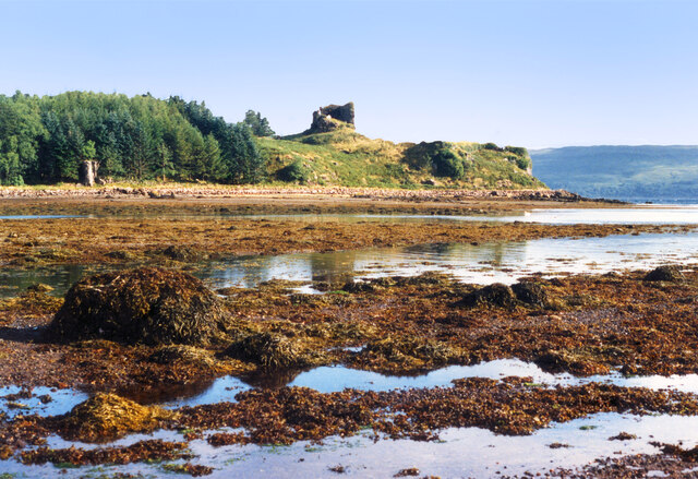
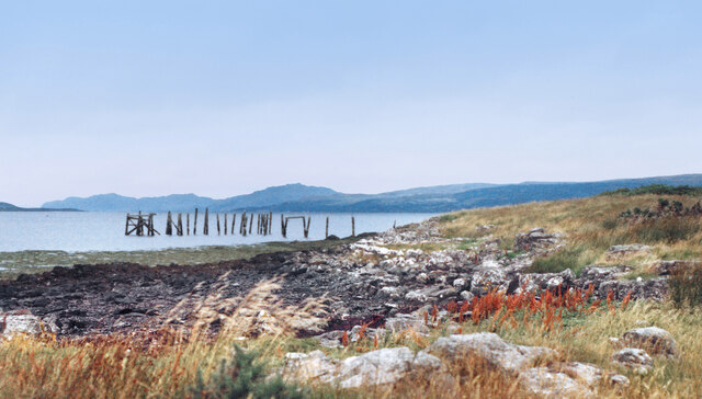
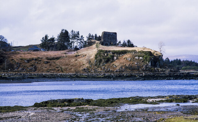
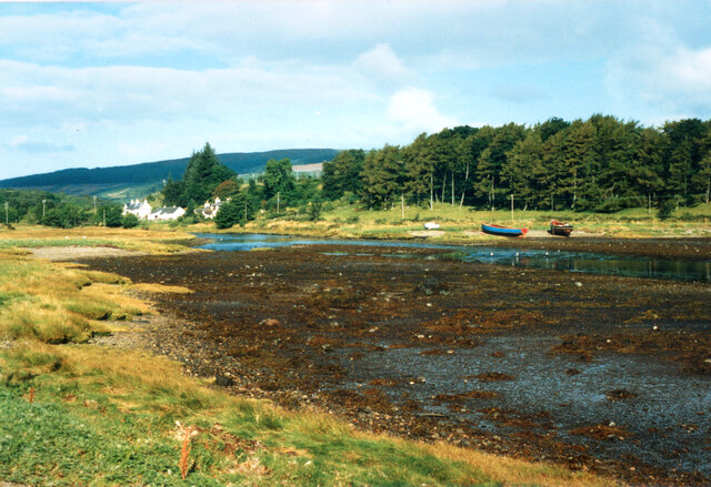
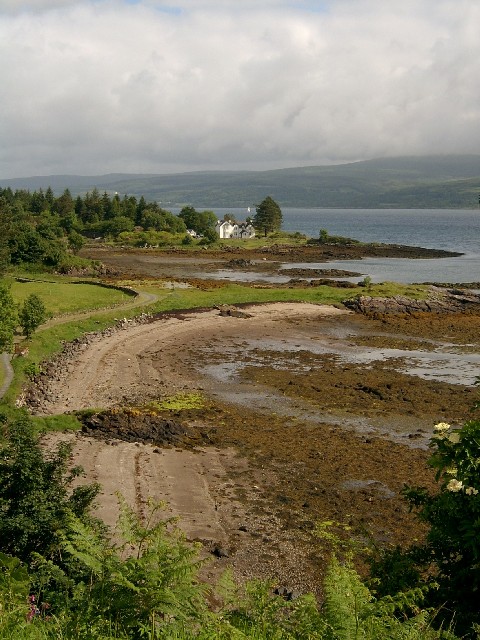
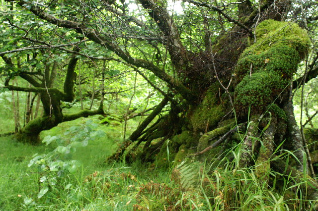
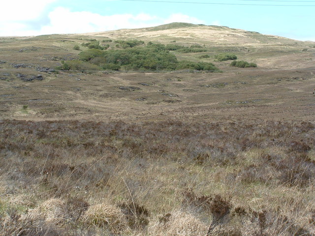
Sgiath Mhòr is characterized by its rugged and rocky terrain, with cliffs that rise steeply from the water's edge. The headland is covered in a blanket of lush green vegetation, including heather and grasses, adding to its natural beauty. This coastal area is also home to a variety of wildlife, including seabirds, seals, and occasionally dolphins, making it a popular spot among nature enthusiasts and birdwatchers.

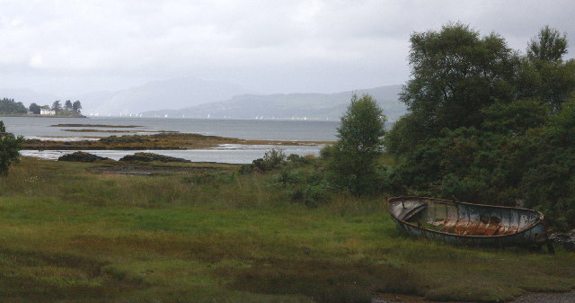
Visitors to Sgiath Mhòr can take advantage of several walking trails that traverse the headland, providing opportunities to explore its unique terrain and enjoy the breathtaking vistas. Along these paths, there are also several vantage points where visitors can pause and take in the panoramic views of the surrounding coastline and Loch Melfort.

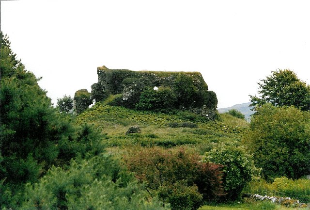
In addition to its natural beauty, Sgiath Mhòr also has historical significance. The headland is believed to have been a defensive site in ancient times, with remnants of an Iron Age fort still visible. This adds an element of intrigue and fascination for those interested in Scotland's rich history.

Overall, Sgiath Mhòr is a captivating coastal feature that offers visitors the chance to immerse themselves in stunning natural scenery, witness diverse wildlife, and explore the remnants of Scotland's ancient past.

If you have any feedback on the listing, please let us know in the comments section below.
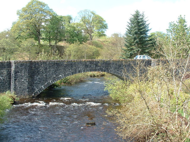
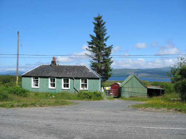
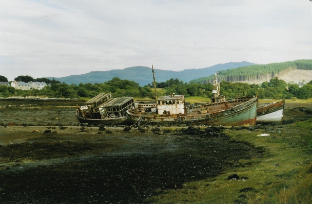
Sgiath Mhòr Images

Images are sourced within 2km of 56.525127/-5.9551219 or Grid Reference NM5644. Thanks to Geograph Open Source API. All images are credited.

Rocks and Seaweed at Aros The remains of Aros Castle are on the headland.
Wikipedia says this about it. "Aros Castle, also known as Dounarwyse Castle, is a ruined 13th-century castle near Salen on the Isle of Mull, Scotland. The castle overlooks the Sound of Mull. The castle was initially a stronghold of the Clan MacDougall."
Rocks and Seaweed at Aros
The remains of Aros Castle are on the headland. Wikipedia says this about it. "Aros Castle, also known as Dounarwyse Castle, is a ruined 13th-century castle near Salen on the Isle of Mull, Scotland. The castle overlooks the Sound of Mull. The castle was initially a stronghold of the Clan MacDougall."
Old Pier at Salen An old picture from the 1980s showing a few bits more structure than in more recent shots.
Old Pier at Salen
An old picture from the 1980s showing a few bits more structure than in more recent shots.
Aros Castle The ruin of Aros Castle seen across the inlet through which the Aros River reaches the Sound of Mull.
Aros Castle
The ruin of Aros Castle seen across the inlet through which the Aros River reaches the Sound of Mull.
Low Tide at Aros The short estuary of the Aros River.
From a print.
Low Tide at Aros
The short estuary of the Aros River. From a print.
Girl Claire and Pavonia The fishing boats have been here since the 1970s.
Girl Claire and Pavonia
The fishing boats have been here since the 1970s.
The Salen Wrecks Compare with earlier versions to see the rate of deterioration!
The Salen Wrecks
Compare with earlier versions to see the rate of deterioration!
Aros Castle & the White House of Aros Seen from the roadside towards the southern edge of the square, these 2 landmarks mark the bottom of Glen Aros as it meets the Tobermory road.
Aros Castle & the White House of Aros
Seen from the roadside towards the southern edge of the square, these 2 landmarks mark the bottom of Glen Aros as it meets the Tobermory road.
Aros Castle The castle seen from behind, on the small road through Aros Mains.  Picture taken at the southern edge of the square, looking south-east.
Aros Castle
The castle seen from behind, on the small road through Aros Mains. Picture taken at the southern edge of the square, looking south-east.
The White House of Aros On Mull's east coast, taken from the ruined Aros Castle just outside the square.
The White House of Aros
On Mull's east coast, taken from the ruined Aros Castle just outside the square.
Sound of Mull From Salen The area in the foreground floods on High water springs. The view is to the North west towards Tobermory up the Sound of Mull. On the left is Aros point. A yacht race is taking place out of Tobermory Harbour.
Sound of Mull From Salen
The area in the foreground floods on High water springs. The view is to the North west towards Tobermory up the Sound of Mull. On the left is Aros point. A yacht race is taking place out of Tobermory Harbour.
Trees in the wood above Salen
Old bridge at Aros As seen from new bridge
Old bridge at Aros
As seen from new bridge
Woodland on Braigh a' choire Mhor
Hospital at Salen As far as I am aware, the building in the photo is the only NHS hospital for Mull, housing the casualty, out patients and x-ray departments for all of the island. It is also an old people's home.
Hospital at Salen
As far as I am aware, the building in the photo is the only NHS hospital for Mull, housing the casualty, out patients and x-ray departments for all of the island. It is also an old people's home.
The new bridge at Aros As seen from the old bridge
The new bridge at Aros
As seen from the old bridge
Old House near Salen
Boats at the old pier, Salen These three fishing boats have been tied up here at the disused pier to rot away. Odd how they look so attractive, when dumped cars and the like look so ugly.
Boats at the old pier, Salen
These three fishing boats have been tied up here at the disused pier to rot away. Odd how they look so attractive, when dumped cars and the like look so ugly.
Wrecks at Salen Familiar to any visitor who's travelled up or down this road, these have been here for years and are immortalised on a local postcard too (a better picture than mine!).
Wrecks at Salen
Familiar to any visitor who's travelled up or down this road, these have been here for years and are immortalised on a local postcard too (a better picture than mine!).
Show me another place!

Sgiath Mhòr is located at Grid Ref: NM5644 (Lat: 56.525127, Lng: -5.9551219)

Unitary Authority: Argyll and Bute

Police Authority: Argyll and West Dunbartonshire

What 3 Words

///siesta.united.situates. Near Salen, Argyll & Bute

Related Wikis

Aros Castle

Aros Castle, also known as Dounarwyse Castle, is a ruined 13th-century castle near Salen on the Isle of Mull, Scotland. The castle overlooks the Sound...

Salen, Mull

Salen (Scottish Gaelic: An t-Sàilean) is a settlement on the Isle of Mull, Scotland. It is on the east coast of the island, on the Sound of Mull, approximately...

Great Mull Air Mystery

The Great Mull Air Mystery is the name given by the media to the disappearance of pilot Peter Gibbs on 24 December 1975 after he took an unscheduled solo...

SS Rondo

SS Rondo was a steam cargo ship. She was built by Tampa Shipbuilding & Drydock Company of Florida for the British government under the name War Wonder...

Nearby Amenities

Located within 500m of 56.525127,-5.9551219
Source: PGS
Lat/Long: 56.5280665/-5.9610678
Source: PGS
Lat/Long: 56.5276126/-5.9607709
Source: PGS
Lat/Long: 56.5272306/-5.9604636
Source: PGS
Lat/Long: 56.526929/-5.9599689
Source: PGS
Lat/Long: 56.5267394/-5.9593804
Source: PGS
Lat/Long: 56.5266475/-5.9588804
Source: PGS
Lat/Long: 56.5263775/-5.95862
Source: PGS
Lat/Long: 56.5258633/-5.9590106
Source: PGS
Lat/Long: 56.5253061/-5.9581305
Created By: dmgroom_coastlines
Source: PGS
Lat/Long: 56.525133/-5.957951
Source: PGS
Lat/Long: 56.5242403/-5.958068
Source: PGS
Lat/Long: 56.5232608/-5.9572243
Source: PGS
Lat/Long: 56.5228155/-5.9565681
Source: PGS
Lat/Long: 56.5227322/-5.9561671
Source: PGS
Lat/Long: 56.522557/-5.9558859
Source: PGS
Lat/Long: 56.5223013/-5.955839
Created By: dmgroom_coastlines
Source: PGS
Lat/Long: 56.522114/-5.955629
Source: PGS
Lat/Long: 56.521856/-5.9552245
Source: PGS
Lat/Long: 56.5216894/-5.9548339
Source: PGS
Lat/Long: 56.5214939/-5.9546174
Source: PGS
Lat/Long: 56.5210756/-5.9541466
Power: pole
Lat/Long: 56.5263467/-5.9628237
Power: pole
Lat/Long: 56.5255576/-5.9621687
Power: pole
Lat/Long: 56.5246174/-5.9613713
Power: pole
Lat/Long: 56.523724/-5.9606368
Power: pole
Lat/Long: 56.5229002/-5.9599928
Power: pole
Lat/Long: 56.5220778/-5.959557
Power: pole
Lat/Long: 56.5213083/-5.9591733
The data included in this document is from www.openstreetmap.org. The data is made available under ODbL.

Have you been to Sgiath Mhòr?

Leave your review of Sgiath Mhòr below (or comments, questions and feedback).