Long Acre

Settlement in Durham

England

Long Acre

Angel Of The North, Gateshead With Me for Scale :) I am 6ft 3. I had to sprint up the hill as only had 10 seconds. 

The steel sculpture is 20 metres (66 ft) tall, with wings measuring 54 metres (177 ft) across. Sculpted by Antony Gormley and was installed on 15 February 1998

<span class="nowrap"><a title="https://en.wikipedia.org/wiki/Angel_of_the_North" rel="nofollow ugc noopener" href="https://en.wikipedia.org/wiki/Angel_of_the_North">Link</a><img style="margin-left:2px;" alt="External link" title="External link - shift click to open in new window" src="https://s1.geograph.org.uk/img/external.png" width="10" height="10"/></span>
Angel Of The North, Gateshead Credit: Brian Deegan

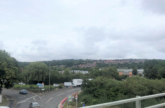
Long Acre is a charming village located in County Durham, England. Situated approximately 6 miles north of the historic city of Durham, it is nestled amidst picturesque countryside and offers a peaceful and idyllic setting for residents and visitors alike.

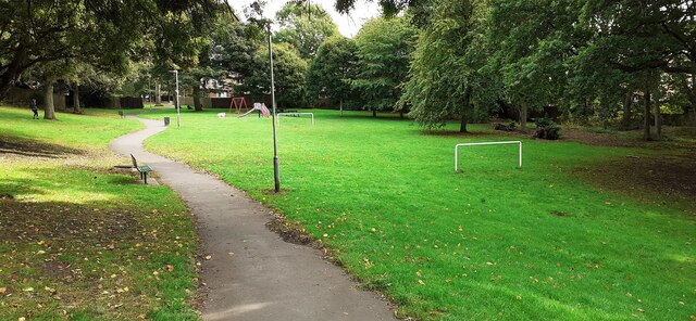
The village is characterized by its stunning natural beauty, with rolling hills, lush green fields, and meandering country lanes. Long Acre is home to a small yet close-knit community, where residents take pride in maintaining the area's rural charm and heritage.

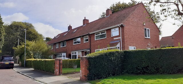
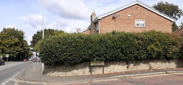
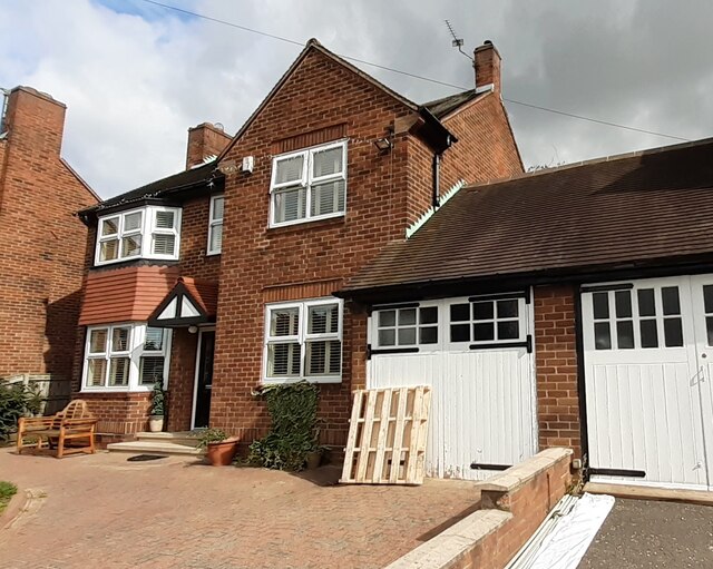
Housing in Long Acre consists primarily of traditional stone cottages and farmhouses, adding to the village's quaint and timeless appeal. The local architecture reflects the historical significance of the area, with some buildings dating back several centuries.

Long Acre benefits from its proximity to the city of Durham, providing residents with convenient access to a range of amenities and services. The city offers a wide variety of shops, restaurants, and entertainment options, ensuring that residents have everything they need within a short distance.

The village is also surrounded by numerous outdoor recreational opportunities. The nearby countryside offers ample opportunities for walking, cycling, and exploring the beautiful landscapes. The River Wear, which runs close to Long Acre, provides a tranquil setting for fishing or boating enthusiasts.

Overall, Long Acre is a charming and peaceful village that offers a perfect balance between rural serenity and convenient access to urban amenities.

If you have any feedback on the listing, please let us know in the comments section below.
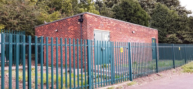
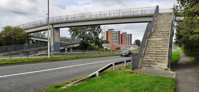
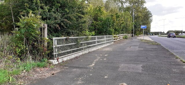
Long Acre Images

Images are sourced within 2km of 54.911556/-1.59519 or Grid Reference NZ2657. Thanks to Geograph Open Source API. All images are credited.

Angel Of The North, Gateshead With Me for Scale :) I am 6ft 3. I had to sprint up the hill as only had 10 seconds. 

The steel sculpture is 20 metres (66 ft) tall, with wings measuring 54 metres (177 ft) across. Sculpted by Antony Gormley and was installed on 15 February 1998

<span class="nowrap"><a title="https://en.wikipedia.org/wiki/Angel_of_the_North" rel="nofollow ugc noopener" href="https://en.wikipedia.org/wiki/Angel_of_the_North">Link</a><img style="margin-left:2px;" alt="External link" title="External link - shift click to open in new window" src="https://s1.geograph.org.uk/img/external.png" width="10" height="10"/></span>
Angel Of The North, Gateshead
With Me for Scale :) I am 6ft 3. I had to sprint up the hill as only had 10 seconds. The steel sculpture is 20 metres (66 ft) tall, with wings measuring 54 metres (177 ft) across. Sculpted by Antony Gormley and was installed on 15 February 1998 LinkExternal link
The Angel of the North, Gateshead
Road junctions below the A1 The roundabout for access to the A1 and the road on the left into Team Valley
Road junctions below the A1
The roundabout for access to the A1 and the road on the left into Team Valley
The Angel of the North A contemporary sculpture by Antony Gormley, it is believed to be the largest sculpture of an angel in the world. Despite considerable opposition during its design and construction phases, it is now widely recognised as an iconic example of public art and as a symbol of Gateshead. It can withstand wind speeds over 100 mph.
The Angel of the North
A contemporary sculpture by Antony Gormley, it is believed to be the largest sculpture of an angel in the world. Despite considerable opposition during its design and construction phases, it is now widely recognised as an iconic example of public art and as a symbol of Gateshead. It can withstand wind speeds over 100 mph.
Prayers and wishes Just south of the Angel of the North, people have left tributes and mementos of lost loved ones hanging on the trees and bushes.
Prayers and wishes
Just south of the Angel of the North, people have left tributes and mementos of lost loved ones hanging on the trees and bushes.
Up close to the Angel of the North Missing half its wingspan of 175 ft when so close
Up close to the Angel of the North
Missing half its wingspan of 175 ft when so close
Information Board - Angel of the North An information board relating the birth of the concept, its construction and various facts.
Information Board - Angel of the North
An information board relating the birth of the concept, its construction and various facts.
Angel of the North A contemporary sculpture by Antony Gormley, it is believed to be the largest sculpture of an angel in the world. Despite considerable opposition during its design and construction phases, it is now widely recognised as an iconic example of public art and as a symbol of Gateshead. It can withstand wind speeds over 100 mph.
Angel of the North
A contemporary sculpture by Antony Gormley, it is believed to be the largest sculpture of an angel in the world. Despite considerable opposition during its design and construction phases, it is now widely recognised as an iconic example of public art and as a symbol of Gateshead. It can withstand wind speeds over 100 mph.
Angel of the North In silhouette
Angel of the North
In silhouette
St Ninian's Church on NW side of Ivy Lane
Nos 1-4 Cedars Green
Junction of Ivy Lane and Durham Road Ordnance Survey documents describe a benchmark levelled at 88.800m above Newlyn Datum on a wall at this location
Junction of Ivy Lane and Durham Road
Ordnance Survey documents describe a benchmark levelled at 88.800m above Newlyn Datum on a wall at this location
#771 Durham Road Ordnance Survey documents indicate that a benchmark was levelled at 76.023m above Newlyn Datum on the far corner of the house
#771 Durham Road
Ordnance Survey documents indicate that a benchmark was levelled at 76.023m above Newlyn Datum on the far corner of the house
Play area and goalposts in Calderwood Park
Esso filling station on east side of A167
Betty Pit electricity substation on east side of A167
Footbridge over Durham Road (A167)
Parapet of bridge taking A167 over track of dismantled railway The track is now a footpath. Ordnance Survey records indicate that a benchmark was levelled at 88.115m above Newlyn Datum on the near end of a parapet of a bridge here
Parapet of bridge taking A167 over track of dismantled railway
The track is now a footpath. Ordnance Survey records indicate that a benchmark was levelled at 88.115m above Newlyn Datum on the near end of a parapet of a bridge here
Show me another place!

Long Acre is located at Grid Ref: NZ2657 (Lat: 54.911556, Lng: -1.59519)

Unitary Authority: Gateshead

Police Authority: Northumbria

What 3 Words

///revamping.achieving.probably. Near Lamesley, Tyne & Wear

Related Wikis

Tyne Yard

Tyne Yard (TY) is a railway yard in Birtley, England, on the East Coast Main Line, operated by DB Cargo UK. The yard is the major freight yard of the North...
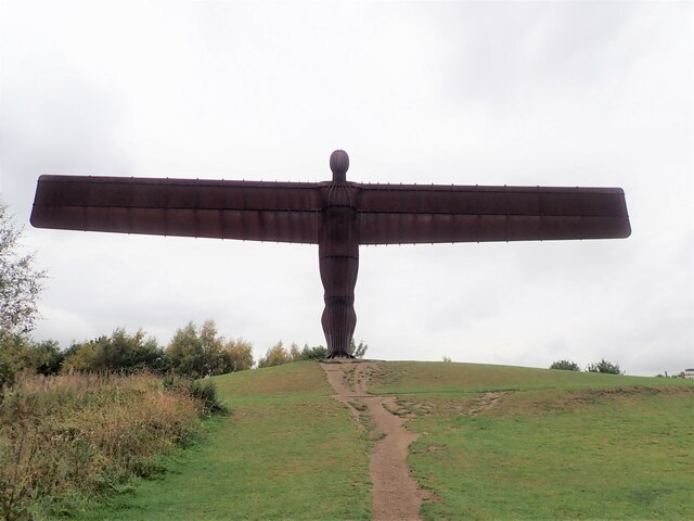
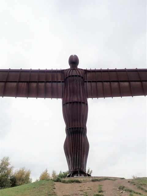
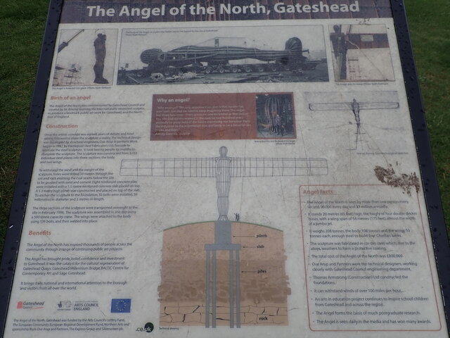
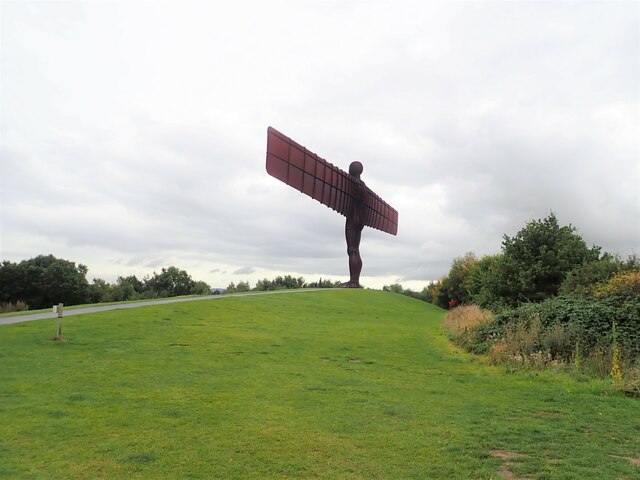
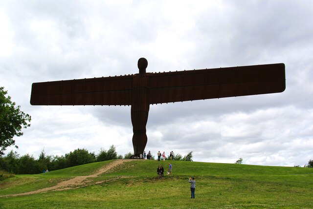
Angel of the North

The Angel of the North is a contemporary sculpture by Antony Gormley, located in Gateshead, Tyne and Wear, England. Completed in 1998, it is believed to...

Team Colliery

Team Colliery is a hamlet and estate in the Metropolitan Borough of Gateshead, Tyne and Wear, England. The estate is made up of 23 private and rented houses...

Lamesley railway station

Lamesley railway station served the village of Lamesley, Tyne and Wear, England from 1868 to 1959 on the East Coast Main Line. == History == The station...

Nearby Amenities

Located within 500m of 54.911556,-1.59519
Motorway Junction
Angel of the North
Name Etymology Wikidata: Q1325290
Ref: 66
Lat/Long: 54.9144453/-1.5932342
Bus Stop
FEATHERBED LANE NORTH-S/B
Local Ref: S
Naptan AtcoCode: 410000022214
Naptan Bearing: S
Naptan CommonName: FEATHERBED LANE NORTH-S/B
Naptan Indicator: S
Naptan Landmark: OPPOSITE MOOR MILL FARM
Naptan NaptanCode: twrdtapd
Naptan Street: FEATHERBED LANE
Naptan Verified: no
Source: naptan_import
Lat/Long: 54.909242/-1.6006254
Bus Stop
Featherbed Lane
Bench: no
Bin: no
Bus: yes
Lit: yes
Local Ref: N
Naptan AtcoCode: 410000022215
Naptan Bearing: N
Naptan CommonName: FEATHERBED LANE NORTH-N/B
Naptan Indicator: N
Naptan Landmark: OUTSIDE MOOR MILL FARM
Naptan NaptanCode: twrdtapg
Naptan Street: FEATHERERBED LANE
Naptan Verified: no
Public Transport: platform
Shelter: no
Source: naptan_import
Tactile Paving: no
Lat/Long: 54.9099635/-1.6014138
Power: tower
Lat/Long: 54.9089581/-1.5953785
Railway: switch
Lat/Long: 54.9108742/-1.5976404
Railway: switch
Lat/Long: 54.9119836/-1.5994029
Railway: switch
Lat/Long: 54.9120042/-1.6015418
Railway: buffer_stop
Lat/Long: 54.9134423/-1.6010249
Railway: railway_crossing
Lat/Long: 54.9135563/-1.6016661
Railway: switch
Lat/Long: 54.913345/-1.600463
Railway: switch
Lat/Long: 54.912639/-1.6000251
Railway: buffer_stop
Lat/Long: 54.9077391/-1.5985356
Railway: switch
Lat/Long: 54.9122056/-1.6017668
Railway: switch
Lat/Long: 54.9134535/-1.6000671
Railway: switch
Lat/Long: 54.9102519/-1.5971331
Railway: switch
Lat/Long: 54.9115079/-1.5982383
Railway: switch
Lat/Long: 54.9132043/-1.6014686
Railway: switch
Lat/Long: 54.913967/-1.6002143
Railway: switch
Lat/Long: 54.9106062/-1.5974226
Railway: buffer_stop
Lat/Long: 54.9127869/-1.6003187
Railway: switch
Lat/Long: 54.9126762/-1.6006745
Railway: switch
Lat/Long: 54.9130816/-1.6011968
Railway: switch
Lat/Long: 54.9129292/-1.6012692
Railway: buffer_stop
Lat/Long: 54.9083736/-1.5972302
Railway: switch
Lat/Long: 54.9128645/-1.6009089
Railway: switch
Lat/Long: 54.9126727/-1.601888
Railway: switch
Lat/Long: 54.9122443/-1.6001159
Railway: switch
Lat/Long: 54.9115295/-1.6010935
Railway: switch
Lat/Long: 54.9126005/-1.6008473
Railway: switch
Lat/Long: 54.9122077/-1.6002204
Railway: buffer_stop
Lat/Long: 54.9080403/-1.597526
Railway: switch
Lat/Long: 54.9126871/-1.6008103
Railway: buffer_stop
Lat/Long: 54.9089515/-1.5986828
Railway: switch
Lat/Long: 54.9085679/-1.5978881
Railway: switch
Lat/Long: 54.908695/-1.597441
Railway: buffer_stop
Lat/Long: 54.908782/-1.5979059
Power: pole
Lat/Long: 54.9072025/-1.5939652
Power: pole
Lat/Long: 54.9072403/-1.5937245
Man Made: tower
Tower Type: communication
Lat/Long: 54.9074873/-1.5955598
Power: pole
Lat/Long: 54.9078236/-1.5941488
Power: pole
Lat/Long: 54.9078655/-1.5943853
Power: pole
Lat/Long: 54.9084689/-1.5948623
Power: pole
Lat/Long: 54.9085208/-1.5946402
Power: tower
Lat/Long: 54.9085513/-1.5949231
Power: tower
Lat/Long: 54.9085863/-1.5948097
Power: tower
Lat/Long: 54.9086167/-1.5946747
Power: tower
Lat/Long: 54.9086249/-1.5949734
Power: tower
Lat/Long: 54.9086453/-1.5947016
Power: tower
Lat/Long: 54.9086579/-1.5948501
Power: tower
Lat/Long: 54.9086902/-1.5947339
Power: tower
Lat/Long: 54.9087572/-1.595064
Power: transformer
Lat/Long: 54.9088173/-1.5951112
Power: tower
Lat/Long: 54.9088883/-1.5951571
Power: tower
Lat/Long: 54.9089378/-1.5949121
Power: tower
Lat/Long: 54.9090877/-1.59541
Power: transformer
Lat/Long: 54.9091059/-1.5953381
Power: tower
Lat/Long: 54.9091275/-1.5952281
Power: tower
Lat/Long: 54.909144/-1.5951354
Power: pole
Lat/Long: 54.9092168/-1.5950064
Power: pole
Lat/Long: 54.9093073/-1.595455
Power: tower
Lat/Long: 54.909765/-1.5907471
Power: pole
Lat/Long: 54.9098849/-1.5957866
Power: pole
Lat/Long: 54.9101964/-1.5937725
Power: pole
Lat/Long: 54.910633/-1.5963857
Power: pole
Lat/Long: 54.9111639/-1.5925459
Power: pole
Lat/Long: 54.9114558/-1.5970329
Power: pole
Lat/Long: 54.9116713/-1.5926634
Power: pole
Lat/Long: 54.9121303/-1.5975464
Power: pole
Lat/Long: 54.9124196/-1.5939069
Power: pole
Lat/Long: 54.9129369/-1.598178
Power: pole
Lat/Long: 54.9131643/-1.5950609
Power: pole
Lat/Long: 54.9136081/-1.5986872
Power: pole
Lat/Long: 54.913886/-1.5962028
Power: pole
Lat/Long: 54.9144235/-1.5990467
Power: pole
Lat/Long: 54.9145823/-1.5968579
Power: pole
Lat/Long: 54.9152212/-1.5993933
Power: pole
Lat/Long: 54.915281/-1.5975336
Power: tower
Lat/Long: 54.9084924/-1.6007017
Man Made: tower
Source: Bing;local_knowledge
Tower Type: lighting
Lat/Long: 54.9086496/-1.5964712
Man Made: tower
Source: Bing;local_knowledge
Tower Type: lighting
Lat/Long: 54.9088383/-1.5992954
Man Made: tower
Source: Bing;local_knowledge
Tower Type: lighting
Lat/Long: 54.9122637/-1.5995932
Railway: switch
Lat/Long: 54.9133723/-1.6015859
Railway: switch
Lat/Long: 54.9137369/-1.601851
Railway: switch
Lat/Long: 54.9124549/-1.602049
Railway: switch
Lat/Long: 54.9130108/-1.601958
Railway: switch
Lat/Long: 54.9128493/-1.6017824
Railway: buffer_stop
Lat/Long: 54.9122683/-1.601357
Railway: switch
Lat/Long: 54.9129856/-1.6011235
Railway: switch
Lat/Long: 54.9124362/-1.6004486
Railway: buffer_stop
Lat/Long: 54.9126287/-1.599724
Railway: switch
Lat/Long: 54.9141589/-1.600401
Railway: switch
Lat/Long: 54.9117706/-1.5984787
Railway: switch
Lat/Long: 54.9112527/-1.5979991
Railway: switch
Lat/Long: 54.911225/-1.5978785
Railway: buffer_stop
Lat/Long: 54.91214/-1.6022273
Railway: buffer_stop
Lat/Long: 54.9121759/-1.6013578
Railway: buffer_stop
Lat/Long: 54.9123149/-1.6013305
Railway: switch
Lat/Long: 54.9124247/-1.6017243
Railway: buffer_stop
Lat/Long: 54.9118442/-1.6012759
Railway: buffer_stop
Lat/Long: 54.9117455/-1.6012603
Railway: buffer_stop
Lat/Long: 54.9134586/-1.6013272
Railway: buffer_stop
Lat/Long: 54.9132642/-1.6007635
Railway: switch
Lat/Long: 54.9130563/-1.6005075
Railway: buffer_stop
Lat/Long: 54.9132517/-1.600538
Railway: buffer_stop
Lat/Long: 54.9132617/-1.6004816
Railway: switch
Lat/Long: 54.9132069/-1.6003125
Railway: buffer_stop
Lat/Long: 54.9126086/-1.5997791
Railway: switch
Lat/Long: 54.9115313/-1.5980341
Railway: switch
Lat/Long: 54.9127087/-1.6011145
Railway: buffer_stop
Lat/Long: 54.9091473/-1.5985971
Railway: buffer_stop
Lat/Long: 54.9091673/-1.5984496
Railway: buffer_stop
Lat/Long: 54.9091057/-1.5982618
Railway: switch
Lat/Long: 54.912489/-1.6006116
Railway: buffer_stop
Lat/Long: 54.9087695/-1.5979534
Railway: buffer_stop
Lat/Long: 54.9087711/-1.5978381
Railway: buffer_stop
Lat/Long: 54.9087294/-1.5977442
Railway: switch
Lat/Long: 54.9087377/-1.5974822
Railway: signal
Railway Signal Direction: forward
Railway Signal Main: GB-NR:main
Railway Signal Main Design: individual
Railway Signal Main Form: light
Railway Signal Main Height: normal
Railway Signal Main States: red;green;yellow;flashing_yellow;double_yellow;flashing_double_yellow
Railway Signal Operator: Network Rail
Railway Signal Position: left
Ref: T 185
Lat/Long: 54.9092094/-1.595975
Railway: signal
Railway Signal Direction: forward
Railway Signal Main: GB-NR:main
Railway Signal Main Design: individual
Railway Signal Main Form: light
Railway Signal Main Height: normal
Railway Signal Main States: red;green;yellow;flashing_yellow
Railway Signal Operator: Network Rail
Railway Signal Position: left
Ref: T 183
Lat/Long: 54.9091874/-1.5960522
Tyne Yard
Railway: yard
Lat/Long: 54.9140742/-1.6006328
Tyne Yard
Operator: DB Cargo UK
Railway: yard
Ref: TY
Wikidata: Q7860500
Wikipedia: en:Tyne Yard
Lat/Long: 54.9128465/-1.6005951
The data included in this document is from www.openstreetmap.org. The data is made available under ODbL.

Have you been to Long Acre?

Leave your review of Long Acre below (or comments, questions and feedback).