Carn Ding Dong

Coastal Feature, Headland, Point in Cornwall

England

Carn Ding Dong

Carn Gloose Trig Point Flush Bracket S8141
Carn Gloose Trig Point Flush Bracket S8141 Credit: thejackrustles

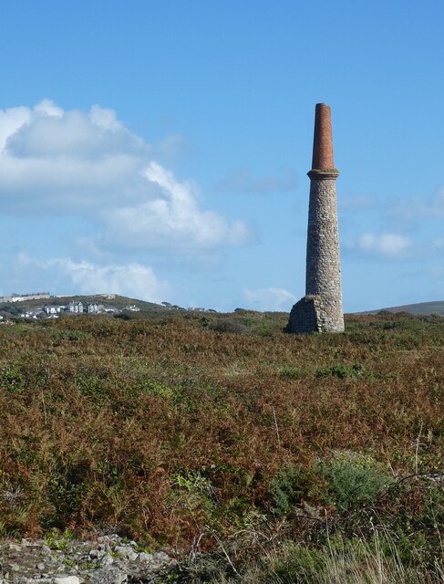
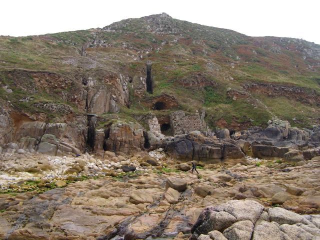
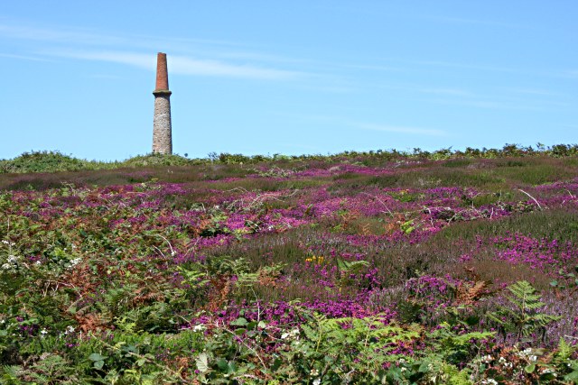
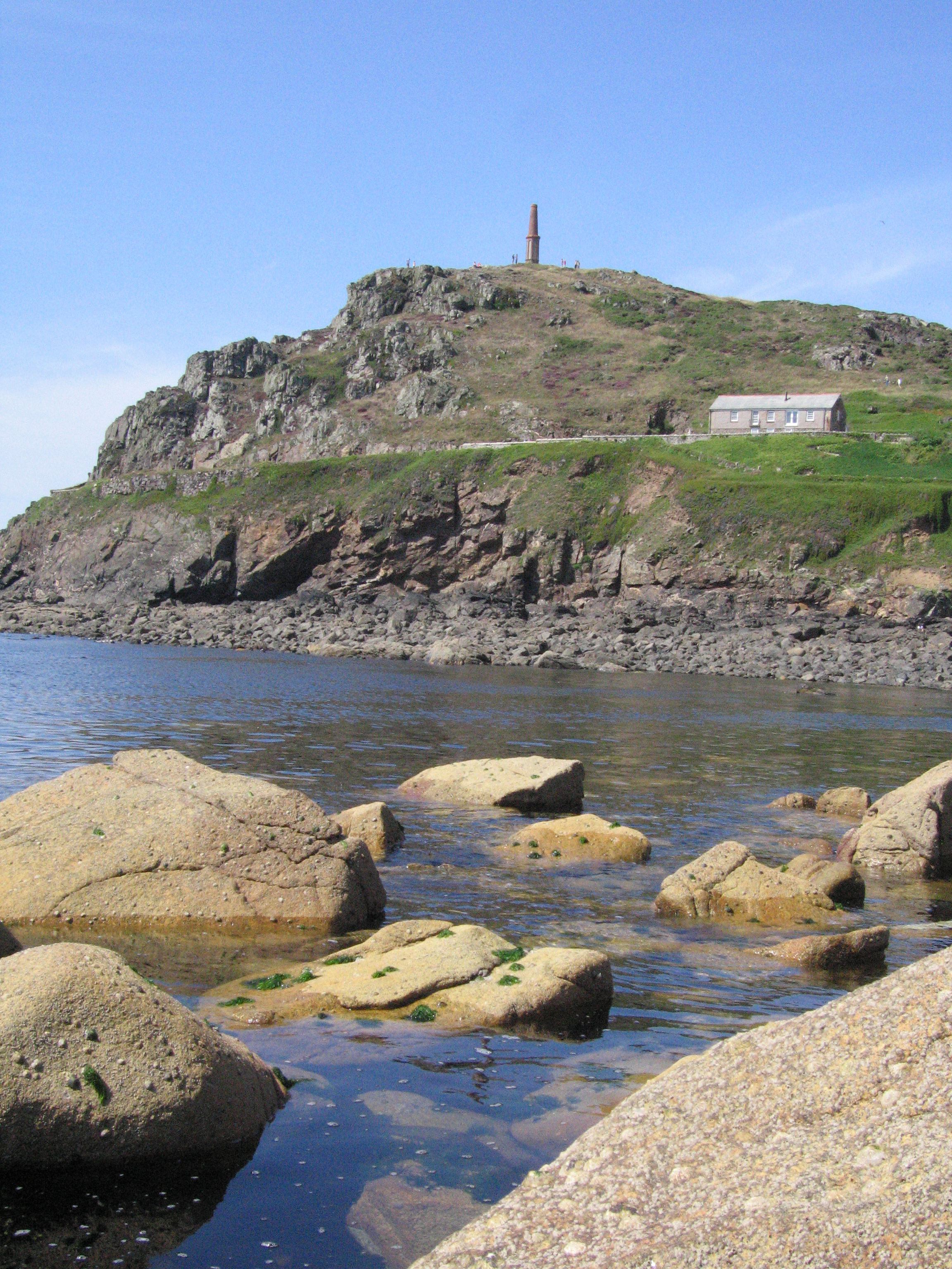
Carn Ding Dong is a prominent coastal feature located in Cornwall, England. Situated on the southwestern tip of the county, it is a headland that juts out into the Atlantic Ocean. The name "Carn Ding Dong" is derived from Cornish language, with "carn" meaning a rocky outcrop or hill, and "ding dong" referring to the sound of waves crashing against the rocks.

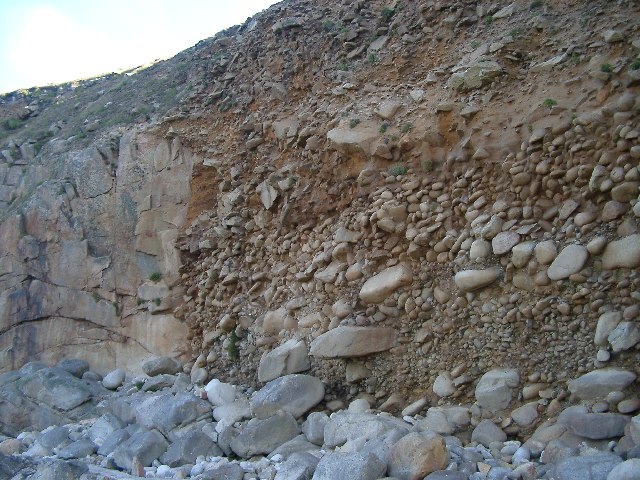
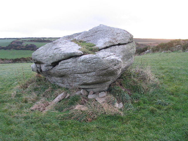
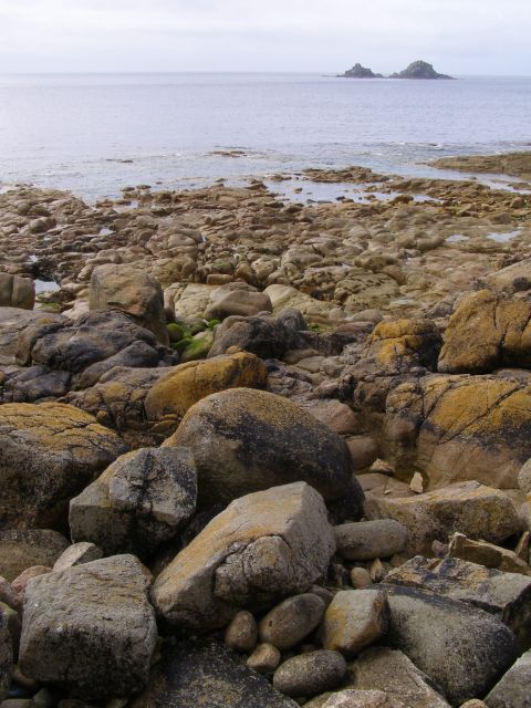
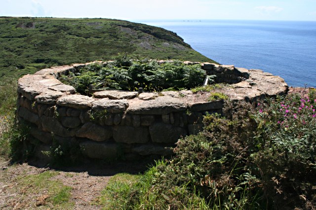
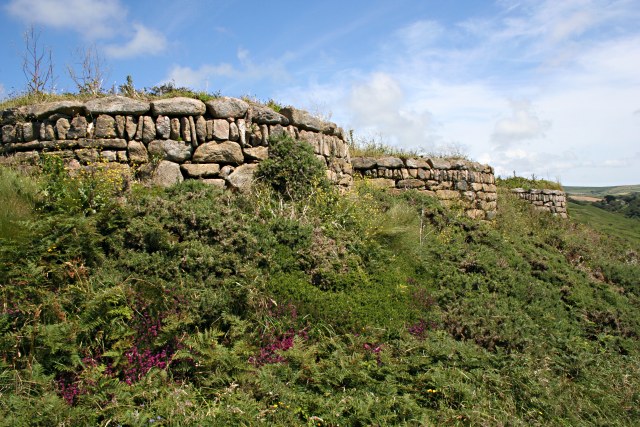
This picturesque headland offers breathtaking views of the rugged coastline and the vast expanse of the Atlantic Ocean. Its rocky cliffs rise dramatically from the sea, providing a natural barrier against the crashing waves. The headland is formed by layers of sedimentary rocks, including sandstone and shale, which have been eroded over time by the relentless force of the ocean.

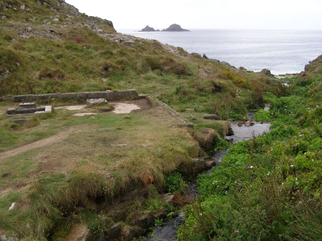
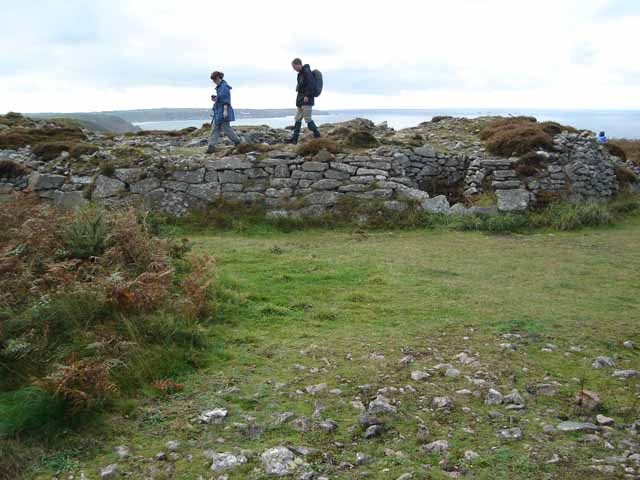
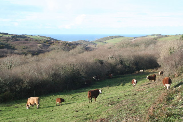
Carn Ding Dong is a popular destination for outdoor enthusiasts and nature lovers. It offers ample opportunities for hiking, birdwatching, and photography. The headland is home to a diverse range of flora and fauna, including various seabirds, coastal plants, and marine life. Visitors can often spot nesting colonies of gulls and cormorants, as well as seals basking on the rocks below.

The headland is also significant from a geological standpoint, as it showcases the unique rock formations and geological processes that have shaped Cornwall's coastline over millions of years. It is not only a natural landmark but also a site of scientific interest.

Overall, Carn Ding Dong is a captivating coastal feature that offers a blend of natural beauty, geological significance, and recreational opportunities.

If you have any feedback on the listing, please let us know in the comments section below.

Carn Ding Dong Images

Images are sourced within 2km of 50.106739/-5.6975976 or Grid Reference SW3529. Thanks to Geograph Open Source API. All images are credited.

Carn Gloose Trig Point Flush Bracket S8141
Ballowall Barrow This Bronze Age barrow was excavated (and radically altered) in 1878 by Cornish antiquarian William Borlase. The internal walls were rebuilt by him which has unfortunately affected the way it is perceived. It is however an evocative site in a stunning location.
See <span class="nowrap"><a title="https://www.english-heritage.org.uk/visit/places/ballowall-barrow" rel="nofollow ugc noopener" href="https://www.english-heritage.org.uk/visit/places/ballowall-barrow">Link</a><img style="margin-left:2px;" alt="External link" title="External link - shift click to open in new window" src="https://s1.geograph.org.uk/img/external.png" width="10" height="10"/></span>
Ballowall Barrow
This Bronze Age barrow was excavated (and radically altered) in 1878 by Cornish antiquarian William Borlase. The internal walls were rebuilt by him which has unfortunately affected the way it is perceived. It is however an evocative site in a stunning location. See LinkExternal link
The stream from Cot Valley discharging onto the beach at Porth Nanven
Eroded rocks on the beach at Porth Nanven Worn away by the stream in the Cot Valley, which discharges onto the beach here.
Eroded rocks on the beach at Porth Nanven
Worn away by the stream in the Cot Valley, which discharges onto the beach here.
Emergency call point at Porth Nanven
Chimney of former mine at Ballowall Situated a few dozen metres southeast of <a href="https://www.geograph.org.uk/photo/6982138">SW3531 : Ballowall Barrow</a> this chimney is all that is left of a former mine. It is one of many mining remnants in the area, which collectively form the Cornwall and West Devon Mining Landscape UNESCO World Heritage site - see
UNESCO: <span class="nowrap"><a title="https://whc.unesco.org/en/list/1215" rel="nofollow ugc noopener" href="https://whc.unesco.org/en/list/1215">Link</a><img style="margin-left:2px;" alt="External link" title="External link - shift click to open in new window" src="https://s1.geograph.org.uk/img/external.png" width="10" height="10"/></span>
English Heritage: <span class="nowrap"><a title="https://historicengland.org.uk/listing/the-list/list-entry/1000105?section=official-list-entry" rel="nofollow ugc noopener" href="https://historicengland.org.uk/listing/the-list/list-entry/1000105?section=official-list-entry">Link</a><img style="margin-left:2px;" alt="External link" title="External link - shift click to open in new window" src="https://s1.geograph.org.uk/img/external.png" width="10" height="10"/></span>
Chimney of former mine at Ballowall
Situated a few dozen metres southeast of SW3531 : Ballowall Barrow this chimney is all that is left of a former mine. It is one of many mining remnants in the area, which collectively form the Cornwall and West Devon Mining Landscape UNESCO World Heritage site - see UNESCO: LinkExternal link English Heritage: LinkExternal link
Climate history revealed! Bottom: current beach - rounded rocks
Middle: raised beach (rounded pebbles but above current sea level) from warm period 120000 years ago (Mediterranean Climate in south Britain)
Top: head deposits (angular - broken by ice action) from 100000-20000 years ago when area was tundra and ice covered much of Britain.
Climate history revealed!
Bottom: current beach - rounded rocks Middle: raised beach (rounded pebbles but above current sea level) from warm period 120000 years ago (Mediterranean Climate in south Britain) Top: head deposits (angular - broken by ice action) from 100000-20000 years ago when area was tundra and ice covered much of Britain.
Tom Thumb rock St. Just-in-Penwith
Beach and cliffs at Nanven Looking inland towards the cliff at low tide, with the rocky beach exposed. The dark vertical gashes in the cliff are the remains of mine workings which followed the seams of minerals. The cliff around the lower entrance is supported by a wall. Look closely and you can just make out a figure making their way across the rocks - they had been snorkelling and were returning to their kit.
Beach and cliffs at Nanven
Looking inland towards the cliff at low tide, with the rocky beach exposed. The dark vertical gashes in the cliff are the remains of mine workings which followed the seams of minerals. The cliff around the lower entrance is supported by a wall. Look closely and you can just make out a figure making their way across the rocks - they had been snorkelling and were returning to their kit.
Rocky beach at Nanven Looking out to sea at low tide from the rocky beach at Nanven, with boulders that have been weathered into smooth shapes by the action of the sea. On the horizon: The Brisons.
Rocky beach at Nanven
Looking out to sea at low tide from the rocky beach at Nanven, with boulders that have been weathered into smooth shapes by the action of the sea. On the horizon: The Brisons.
Geologically interesting beach at Porth Nanven At the end of the Cot Valley is this National Trust owned beach, shown here in the traditional Cornish drizzle at low tide. The geology of the brown cliff on the left is explained in more detail in this geograph: <a href="https://www.geograph.org.uk/photo/71736">SW3530 : Climate history revealed!</a>! A cagouled human figure is supplied in the foreground for scale (crouched down looking into a rockpool). According to the National Trust interpretation board (at the head of the slipway, to the right of the brown cliff) it is an offence to remove stones from this beach.
Geologically interesting beach at Porth Nanven
At the end of the Cot Valley is this National Trust owned beach, shown here in the traditional Cornish drizzle at low tide. The geology of the brown cliff on the left is explained in more detail in this geograph: SW3530 : Climate history revealed!! A cagouled human figure is supplied in the foreground for scale (crouched down looking into a rockpool). According to the National Trust interpretation board (at the head of the slipway, to the right of the brown cliff) it is an offence to remove stones from this beach.
Ruined mine workings in the Cot Valley The stream in this photo runs along the Cot Valley and joins the sea below at Porth Nanven. On the left (and behind the photographer) are the remains of mine workings that accompanied the various shafts in the surrounding cliffs and hills. The rocky islands out to sea are The Brisons, with a profile perhaps unkindly likened to General de Gaulle lying on his back.
Ruined mine workings in the Cot Valley
The stream in this photo runs along the Cot Valley and joins the sea below at Porth Nanven. On the left (and behind the photographer) are the remains of mine workings that accompanied the various shafts in the surrounding cliffs and hills. The rocky islands out to sea are The Brisons, with a profile perhaps unkindly likened to General de Gaulle lying on his back.
Ballowall Barrow A magnificent example of a chambered cairn, otherwise known as Carn Gluze. <span class="nowrap"><a title="http://www.themodernantiquarian.com/site/232" rel="nofollow ugc noopener" href="http://www.themodernantiquarian.com/site/232">Link</a><img style="margin-left:2px;" alt="External link" title="External link - shift click to open in new window" src="https://s1.geograph.org.uk/img/external.png" width="10" height="10"/></span>
Ballowall Barrow
A magnificent example of a chambered cairn, otherwise known as Carn Gluze. LinkExternal link
Trig Point near Carn Gloose Heathland vegetation covers the flat hilltop to the south of Cape Cornwall.
Trig Point near Carn Gloose
Heathland vegetation covers the flat hilltop to the south of Cape Cornwall.
Chimney on Carn Gloose There has been extensive mine workings in the past on this download and many mineshafts have been left behind but this chimney is the only building left standing.
Chimney on Carn Gloose
There has been extensive mine workings in the past on this download and many mineshafts have been left behind but this chimney is the only building left standing.
Disused Mine Shaft on Carn Gloose Overlooking Porth Naven.
Disused Mine Shaft on Carn Gloose
Overlooking Porth Naven.
Row of Disused Mine Shafts On the top of the valley slope at Porth Nanven.
Row of Disused Mine Shafts
On the top of the valley slope at Porth Nanven.
The Coast Path in the Cot Valley The path descends from Carn Gloose then takes the valley road down towards Porth Nanven.
The Coast Path in the Cot Valley
The path descends from Carn Gloose then takes the valley road down towards Porth Nanven.
Show me another place!

Carn Ding Dong is located at Grid Ref: SW3529 (Lat: 50.106739, Lng: -5.6975976)

Unitary Authority: Cornwall

Police Authority: Devon and Cornwall

What 3 Words

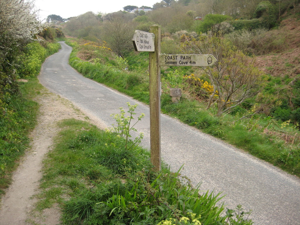
///trend.maddening.sounding. Near St Just, Cornwall

Related Wikis

Nanquidno

Nanquidno is a hamlet near St Just in Penwith in west Cornwall, England. It is about half a mile southwest of Kelynack. == References ==

Porth Nanven

Porth Nanven (grid reference SW355307; most well known as Cot Valley and occasionally known as Penanwell) is a beach in the far west of Cornwall, England...

Cot Valley

Cot Valley is located half-a-mile south of St Just in west Cornwall, United Kingdom. It has a very mild microclimate.The stream which runs down the valley...

Kelynack

Kelynack (from Cornish: Kelynek is a settlement in west Cornwall, England, UK. == Geography == Kelynack is on the Penwith peninsula approximately four...

Ballowall Barrow

Ballowall Barrow (Cornish: Krug Karrekloos) is a prehistoric funerary cairn (chambered tomb) which Ashbee (1982) and Hencken (1902–81) state contains...

Land's End Airport

Land's End Airport (IATA: LEQ, ICAO: EGHC), situated near St Just in Penwith, 5 NM (9.3 km; 5.8 mi) west of Penzance, in Cornwall, is the most south westerly...

Priest Cove

Priest Cove (Cornish: Porth Ust, meaning St Just's Cove) or Priest's Cove is a small cove one mile (1.6 km) west of St Just, Cornwall, UK. The name is...

Cape Cornwall School

Cape Cornwall School is a coeducational secondary school located in St Just in Penwith, Cornwall, England. As of January 2022, the school had 270 pupils...

Related Videos

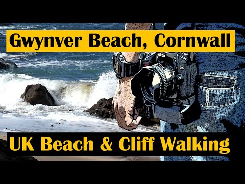
Travel & Walking Cornwall Part 8 Gwynver White Sand Bay

Another two part day where first we explore Gwynver Beach in Cornwall and look over towards the Lands End lighthouse in this ...

Trendrine Hill to Trevalgan Hill - Walk in Cornwall

A video walk on the Penwith Moors of West Cornwall from Trendrine Hill to Trevalgan Hill via Towednack Church and Rosewall ...

200km on the South West Coastal Path

In May 2021, we walked 200km of the path with our q9kilos backpack. camping along the way.

South West Coastal Path | Ringstead to Durdle Door Walk

Abbie heads out to explore some of the most dramatic coastal scenery in the UK, passing the famed UNESCO World Heritage Site ...

Nearby Amenities

Located within 500m of 50.106739,-5.6975976
Source: PGS
Lat/Long: 50.1054232/-5.6982355
Barrier: kissing_gate
Foot: yes
Lat/Long: 50.1109478/-5.6963216
Barrier: kissing_gate
Lat/Long: 50.1066874/-5.696784
Adit
Historic: ruins
Note: The tunnel has collapsed and its course can be seen in the hillside
Lat/Long: 50.1053627/-5.6953845
Waterwheel pits
Historic: ruins
Note: Remains of pits where water wheels were once used, probably in conjunction with the mine workings
Lat/Long: 50.1055696/-5.6952709
Generator Method: photovoltaic
Generator Output Electricity: yes
Generator Source: solar
Generator Type: solar_photovoltaic_panel
Location: roof
Power: generator
Lat/Long: 50.1058016/-5.6931743
Power: pole
Transformer: distribution
Lat/Long: 50.1065875/-5.6932247
Power: pole
Lat/Long: 50.1068025/-5.691677
The data included in this document is from www.openstreetmap.org. The data is made available under ODbL.

Have you been to Carn Ding Dong?

Leave your review of Carn Ding Dong below (or comments, questions and feedback).